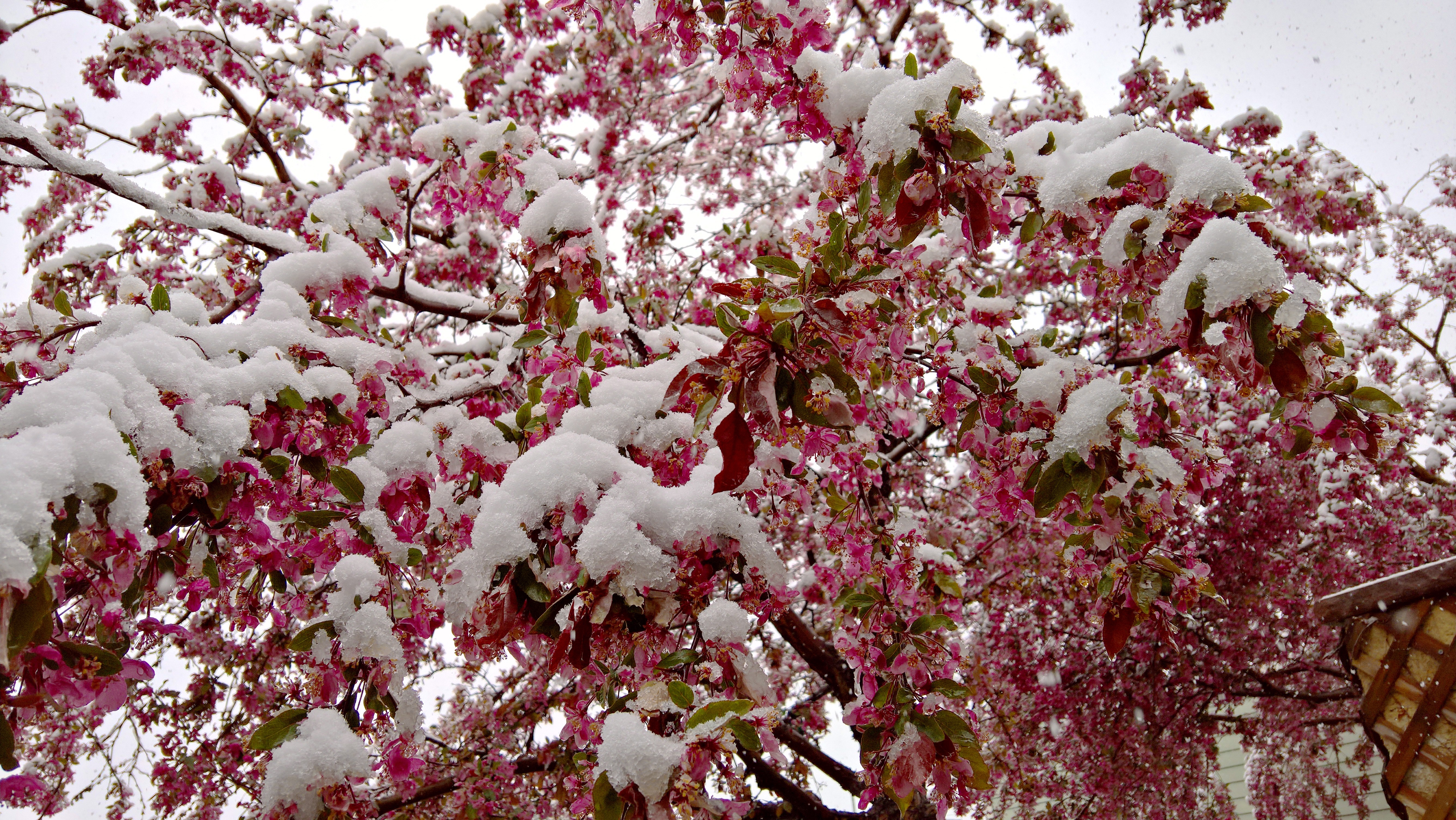
After much hype, Mother Nature delivered a mid-April wallop of snow to northeast Colorado this weekend. Some of us fared (much) better than others, but just about everyone got in on the action. We review the good and bad of our forecast and check in on the health of our mountain snow pack.
It’s April in Colorado… Prepare for all seasons!
April began warm and dry for northeast Colorado. In Boulder, only two of the first fourteen days had below normal temperatures. By the middle of the month, the weather was primed to take a drastic turn, something we warned about two weeks ago in our April outlook.
The culprit was a powerful storm system dropping down from the Pacific Northwest into the Four Corners region on Saturday, which stalled and provided moisture and instability to our region for two full days.
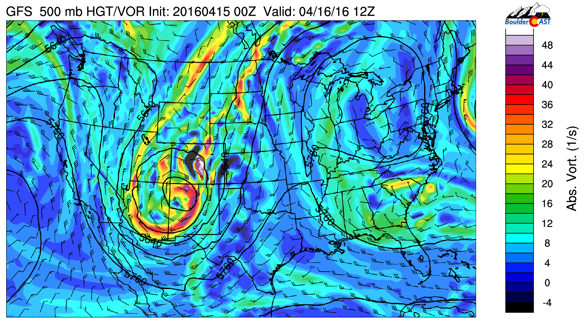
GFS 500 mb vorticity map showing the location of the upper-level storm Saturday morning over the Four Corners
In the days leading up to the storm, models slowly came into agreement that there would be enough cold air to support snow for the lower elevations during the bulk of the event (they were pointing towards all rain about five days out). Combining the slow movement and a healthy influx of Gulf of Mexico moisture with that cold air, the threat of a mid-spring snowstorm was real!
We see a big change in temperature over the course of just two days in the time series below from the BoulderCAST weather station. On the afternoon of April 14th, Boulder was near 80 degrees. By the morning of April 16th, temperatures were situated in the 30’s behind a cold front!
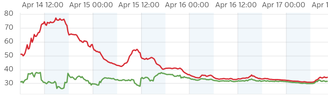
Temperature (red) and dew point (green) time series for BoulderCAST weather station from April 14-17. A big change from 70’s to snow in just over 24 hours!
Our final forecast issued Friday afternoon called for 10-20″ in the lower Foothills, the city of Boulder, and the western suburbs of Denver, with 8-15″ elsewhere in the Denver Metro. In the higher Foothills, where the air would be colder and the upslope stronger, we were forecasting monster totals, 18-36″ with up to 48″ possible in favored locales. Snow was set to begin Friday afternoon in the higher elevations, with rain changing to snow Friday night for the Plains.
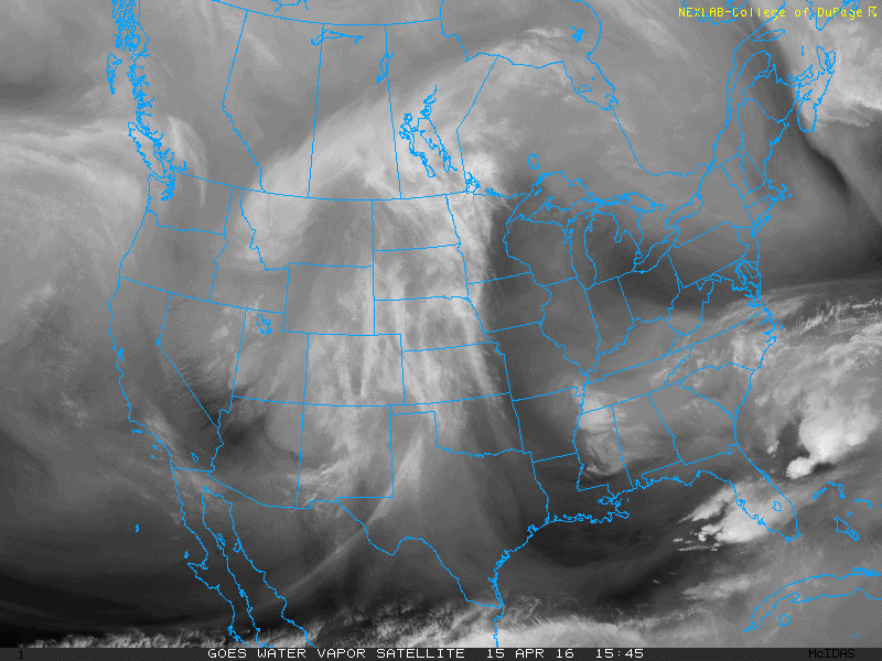
Water vapor satellite image of the storm swirling across the Four Corners
Rain took its good ole’ time changing to snow for the northern Front Range Saturday morning. Strong northerly winds wrapping around the low pushed into the Boulder area. On their way, they rushed downhill from the Cheyenne Ridge, actually producing a few degrees of downslope warming. This actually occurs a lot of the time with due-north winds coming out of Wyoming. However, with temperature such a vital component to this spring storm, it was just enough to prolong the rain in Boulder, Longmont and Greeley. You can see this localized area of warming below, circled in red. This map is from 9AM Saturday.
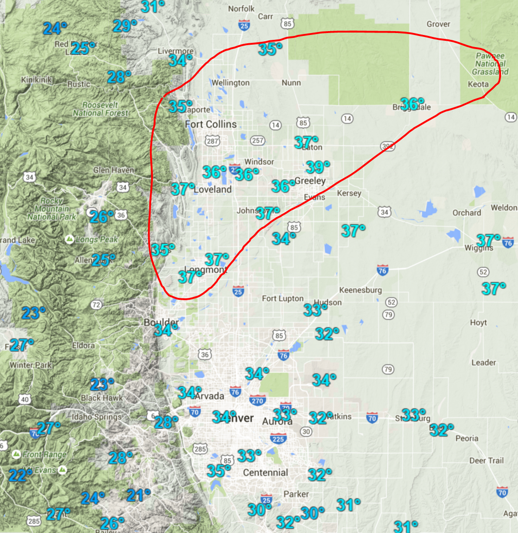
Regional temperature map from ~9AM Saturday, showing a “warm” pocket of air northeast of Boulder (circled in red). This area changed over to snow later and had a tough time accumulating snow
This “warm” pocket lingered through much of the day in some form. With a couple degrees of warming added from the high-angle April sun, snow changed back to rain in many of these areas. In the places that remained all snow, like Boulder, the white stuff had a tough time sticking with temperatures in the 33 to 36 degree range.
After getting off to a slow start in areas north of Denver, we were hopeful the storm would deliver on it’s promise of moderate snow lingering into Sunday morning in and along the Foothills, as most of the models were indicating, a result of 50+ mph upslope at 700 mb progged for the region. We were also counting on the dry slot, seen below straddling the eastern Colorado border at 3AM Sunday, to stay to our east. It did!
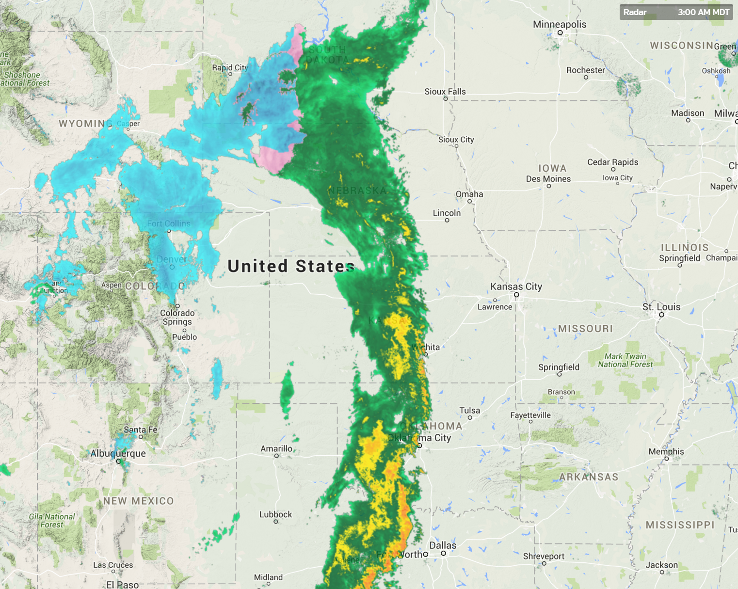
Radar image showing the storm at 3AM Sunday during a period of heavy snow in Boulder area. Notice the dry slot across far eastern Colorado
Things came together in Boulder perfectly as the sun set Saturday night. A heavy band parked itself across much of Boulder County through the night. Mid-level cooling allowed big puffy dendrites to form, producing snowfall rates of 2 to 3″ per hour at times between 11PM and 4AM (see radar image below).
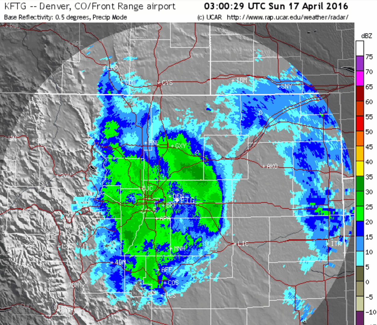
Composite radar loop from 9PM Saturday to 9AM Sunday, showing the development of heavy snow along and in the Front Range Foothills
Light to moderate snow lingered through Sunday morning, which in the end, capped off 30+ hours of continuous snowfall.
Storm totals for the ages
Boulder officially recorded 18.3″ of snow throughout the event. The storm was split across two calendar days, both of which set daily snowfall records! We’re up to 18.2″ at BoulderCAST in North Boulder. Denver officially recorded 12.1″ of snow from the event.
Staggering totals we’re expected for the Foothills, and that is exactly what we got. Almost everywhere breached the 2 to 4 foot range! Some locations even exceeded 50″!
Shown below is our original forecast map created Friday morning. The observed storm totals per location are contained in boxes. Green ones indicate that the observed snowfall was within one inch of the given forecast range, while red was outside the scope of our forecast.
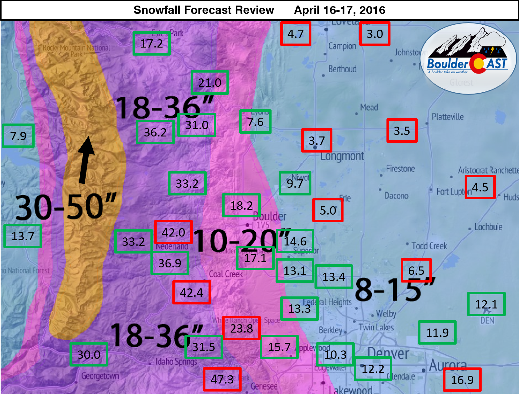
Great forecast overall, but there are two take-aways:
- Warmer temperatures north and east of Denver limited total snow accumulation (due to rain and extreme melting). Therefore, these locations ended up below our forecast range of 8-15″
- While we mentioned that some Foothills locations could approach 4 feet, totals in excess of 36″ were a little more widespread than we were expecting. Our forecast map should have really read 18-36+” for the higher Foothills.
The snow-to-liquid ratio was a little higher for the overnight snow, 10 or even 12:1 (meaning it wasn’t as heavy and dense as it could have been). This likely contributed to the minimal impact the snow had on trees/power lines around town.
We’ve all been spoiled this winter with four storms having exceeded 11″ in Boulder. As forecasters, it’s been great fun battling Mother Nature on each and every one of them. It’s wasn’t easy. Of course, it never is. She got the best of us on storms #1 and #3, but we had her number on #2 and #4 (this storm). Would it be too much to ask for a rubber match at this point?
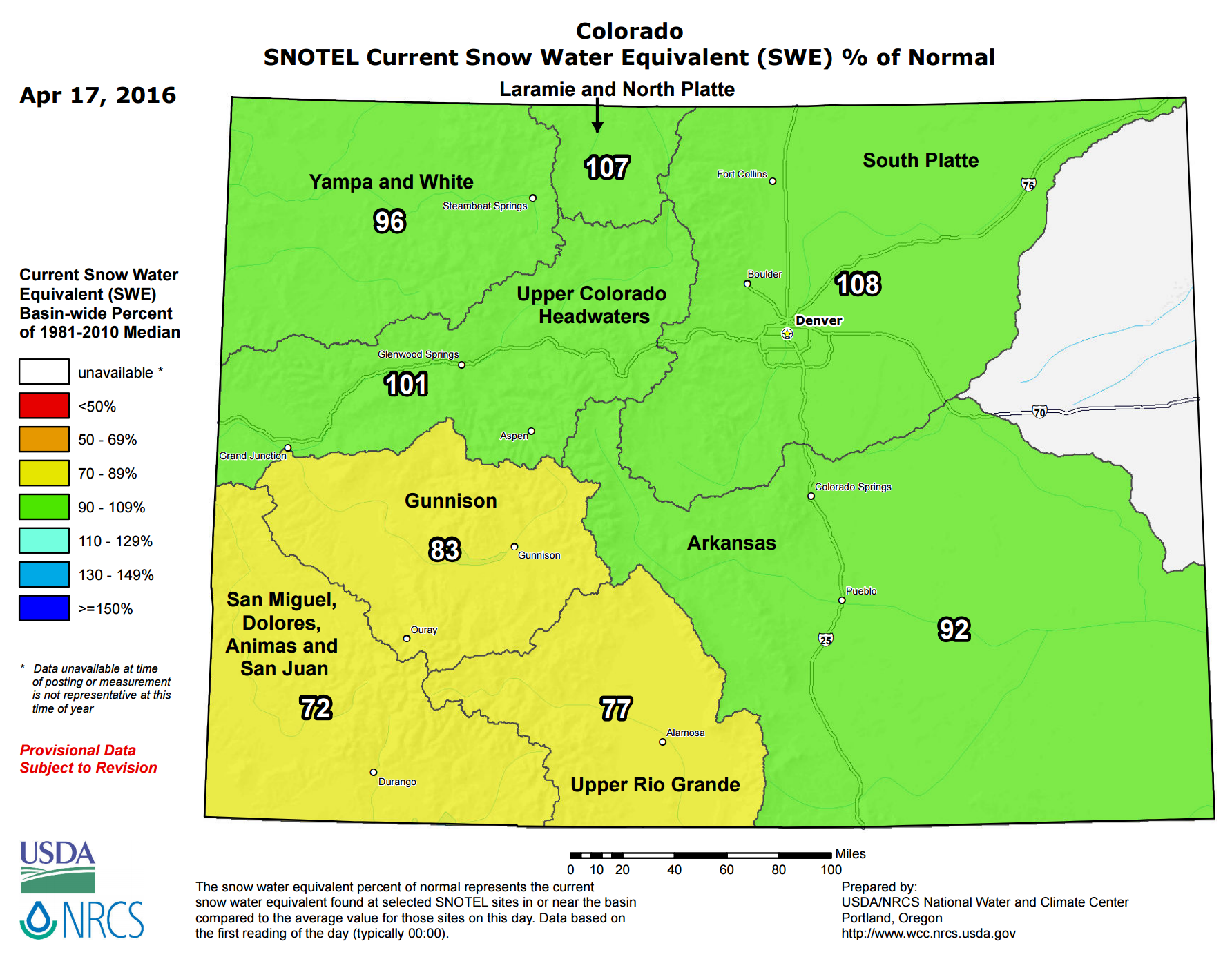
Snowpack on track
This storm brings Boulder’s seasonal snow total to 110″, good enough to crack the top 15 for snowiest winters in Boulder’s historical record. The Front Range has benefited greatly from numerous “big storms” this winter embedded within otherwise lengthy periods of dry and warm weather. For this reason, our mountain snow pack is only slightly above normal.
Checking ahead, the storm track will likely remain relatively active through the end of the month. Whether we’re able to squeeze out anymore sizable snow remains to be seen. That door is closing rapidly!


