This week’s snowstorm has definitely lived up to the hype. Despite a few wrenches thrown in to the mix, our forecast turned out quite well, thanks in part to last night’s ferocious snow band. We recap the storm, explain why the heavy snow formed last night, and check in on our forecast. Read on for all the details.
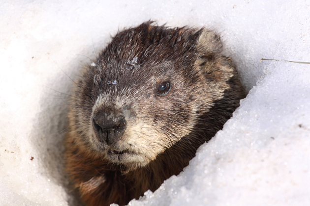
22″ of snow fell in Boulder on Groundhog Day 2012. Fast-forward four years to this morning, and once again, Boulder (and Denver) awoke to yet another school/business-closing dump of snowfall. Luckily, Punxsutawney Phil resides in Pennsylvania, and not Colorado. Otherwise he wouldn’t have even made it out of his hole! Hooray for an early spring!
The devil is in the details
We first alerted you to the possibility of a big winter storm for eastern Colorado on last Wednesday. We cautioned that models were in good agreement that the hardest hit areas would be south of Denver. By Sunday, this southern track remained the most probable. Regardless, the slow-moving nature of the storm was enough for us to project that all of the Denver Metro area would pick up more than 6″ of snow.
Our forecast did verify, but not exactly in the manner that we had planned. Anyone that exclaims this was a simple forecast, or evolved just how they expected, doesn’t understand accountability, or weather.
We expected two waves of snowfall to hit the region. One Sunday evening into Monday morning, and another (bigger one) Monday afternoon into Tuesday morning. In total, we forecasted 10-16″ for the Boulder area, 15-24″ in the Foothills, and 6-12″ in the rest of the Denver Metro.
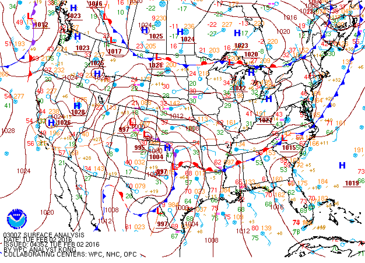
Surface map from Monday evening, showing the position of the low in SE Colorado. This is more or less the track that was expected.
The first wave produced about 2-5″ from Boulder westward, and about 1″ or less around Denver.
Monday morning, after only light snow totals during the night, a rather lengthy lull in the action took place. This initially gave the impression that forecast snow amounts may have been too high. The NWS even took to reducing their forecast from 6-14″ to 6-10″ Monday afternoon. Nonetheless, upslope kicked in as the low intensified in SE Colorado, just a little later than expected, bringing the second round of snow to the Front Range. Through 5pm Monday, most of the Plains were in the 3 to 5″ range for snow already on the ground.
High-resolution models were indicating that a heavy band of snow would form parallel and adjacent to the Foothills Monday evening (see below). Some saving light at the end of the tunnel, maybe.

HRRR forecast reflectivity for Monday evening. The model picked up on a heavy band of precipitation right along the Foothills many hours in advance. Focus on the area just west of Denver during the loop.
When the band verified later that night, it dumped about 6-12″ of snow in just a few hours in eastern Larimer, Boulder, and Jefferson counties.
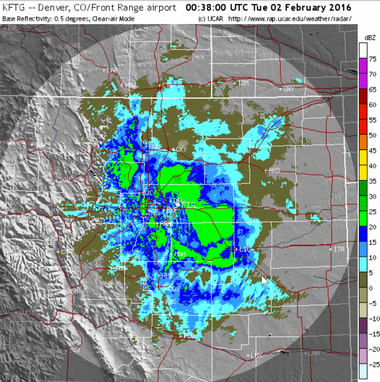
Composite radar image showing the heavy band of snow that set-up over Boulder and remained stationary for several hours, before heading east towards Denver.
While it appeared to be related to strong upslope initially, this was only partially the case. The heavy band of snow was actually the line of demarcation between strong easterly flow (tied to the surface low in SE Colorado) and WNW downslope flow coming over the Continental Divide. Where these two winds converged and produced an area of strong lift, similar to the diagram below. This lift was an extremely efficient way to squeeze the moisture out of the atmosphere as heavy snow.
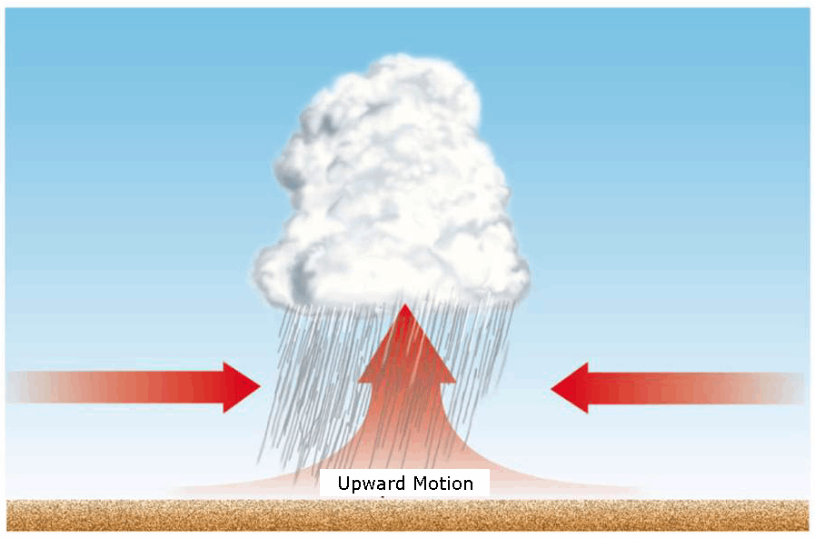
Diagram showing how low-level convergence leads to lift
The westerly wind essentially balanced the easterly wind, such that the convergence line remained stationary for several hours. As the surface low pulled away into Kansas, easterly flow weakened and heavy band slid eastward across the northern Denver Metro area, before dying just east of DIA.
The convergence line is somewhat visible from surface observations below. Notice the NW wind barb in Boulder (left side within red circle) meeting strong easterly flow present across all of NE Colorado. Not the best evidence, but there isn’t a good observation source for this, since the best convergence likely originated from slightly above the surface.
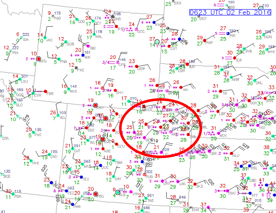
We do see wind observations from Boulder Airport turn from east to north to northwest as the heavy snow band sat over the city.
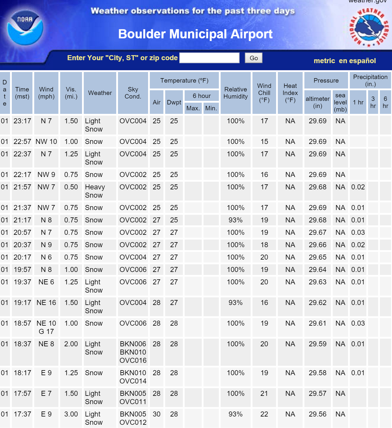
This band was remarkable to see on radar and to experience in person. Rates at times were in excess of 3″ per hour at BoulderCAST, which was right at the epicenter of heaviest snow. We hope you made it outside to experience it! That type of snowfall doesn’t happen all that often around here. We wouldn’t have been surprised to see few lightning strikes in the core of the band. It was that intense!
While the high-resolution models shine at predicting these type of small-scale features, operational forecast models like the GFS, NAM, and Euro cannot pick up on them, at least not well or reliably. They are just too small. For that reason, there was no way to truly predict that which transpired, outside of trusting the HRRR or RAP models a few hours in advance.
The numbers are in
February is off to a fast start for snow. Officially, Boulder picked up 16.6″, while we measured 18.6″ at the BoulderCAST location in North Boulder. In general, Boulder picked up 15-18″, with the Foothills west of town in the 17-24″ range. Denver locations mostly fell between 8 and 12″. Just about everywhere landed within or slightly above our forecast! No complains about that, we reckon.
The snow that fell at BoulderCAST amounted to 1.05″ of liquid equivalent (melted snow), equating to a snow-to-liquid ratio of nearly 18:1, which is quite high. We mentioned in our initial forecast that high ratios would boost our overall snow totals. The observed ratio was right on par with what our algorithm was spitting out.
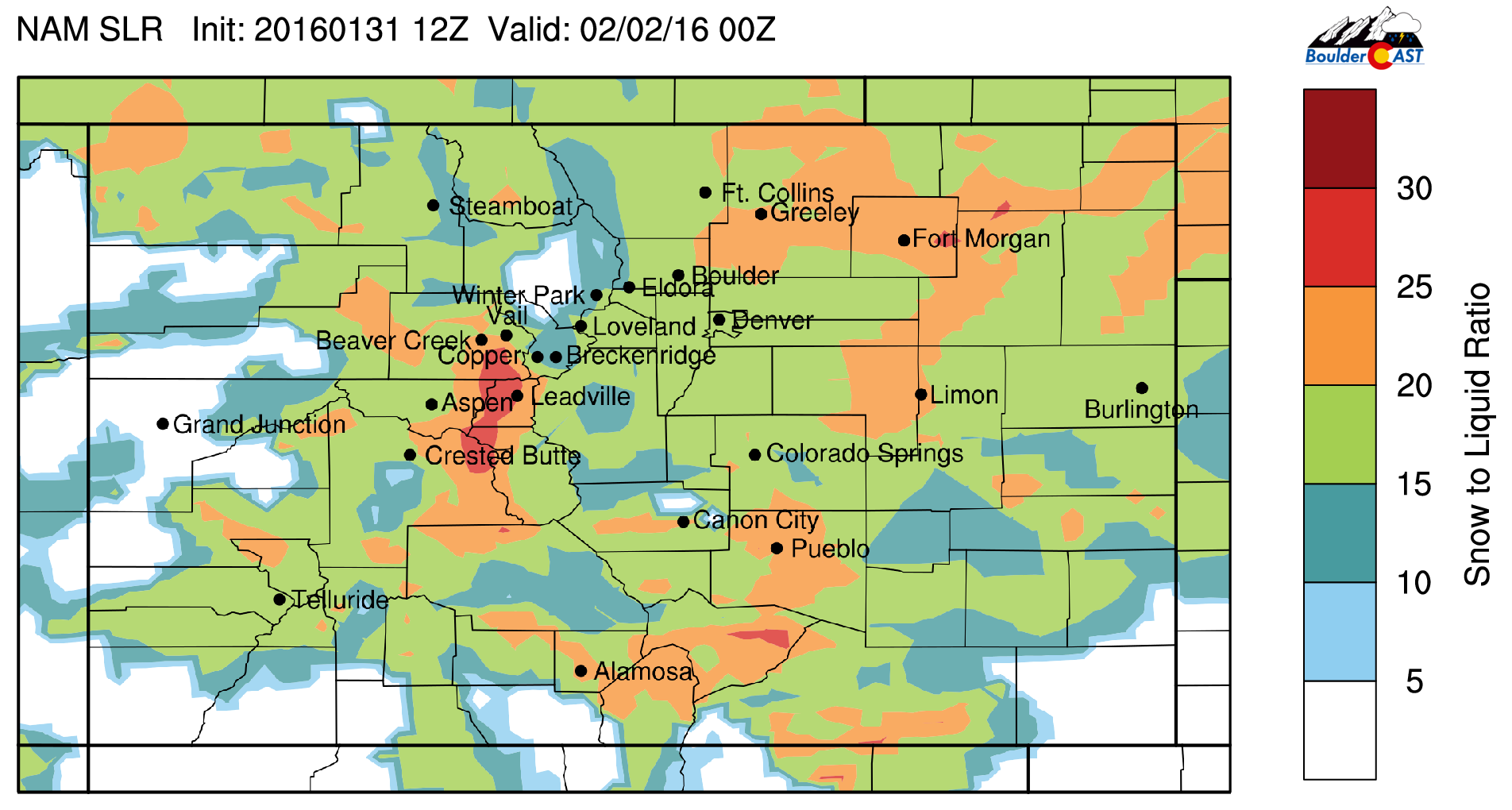
BoulderCAST snow-to-liquid ratio forecast for Monday evening, derived from NAM model output
For the record, one day in, we already have surpassed the month of February’s normal snowfall and precipitation. Take that Phil!
Shown below is our original forecast snow total map (issued Sunday morning), with the observed storm totals per location contained in boxes. Green ones indicate that the observed snowfall was within one inch of the given forecast range, while red was outside the scope of our forecast. NOTE: These are mostly totals through 7am Tuesday. Some locations will have picked up another inch or so before the storm concluded.

Without the aforementioned heavy band Monday evening, snow totals would have been much lower, likely 8-10″ in Boulder, 5-8″ in most of Denver, and 8-13″ in the Foothills. Our biggest, and probably only “bust” location was the higher Foothills southwest of town, with Nederland and Idaho Springs not even exceeding a foot. This area represents what could have happened to the rest of the area, as they just missed out on the added snow from the heavy band.
Bring on the next big one!
All in all, we are happy the way this very dynamic system played out. There were a lot of moving parts, so things are bound to go astray, at least a little . It’s safe to say no one can complain the weathermen got it wrong this time! 😛
Thanks for following along with us! It has been a great past seven days forecasting this storm and interacting with you all through Facebook, Twitter, and our Live Blog. We hope you enjoyed it as much as we have. Have a great snow day and rest of the week!


Great site. I found this just before this last storm came through. Thanks for the updates and keep up the good work!
Appreciate the kind words. Sounds like you found us just in time, Michael. Cheers.