We are currently tracking the potential for a significant winter storm to impact the the Denver Metro area early next week. Read on for full details.
In our post on Monday, we alerted you to the potential for some interesting weather to begin the month of February. With models remaining somewhat consistent over the last three or four days, we are now comfortable at least mentioning the possibility of a major winter storm impacting eastern Colorado Monday into Tuesday.
The models continue to show a deep, 500 mb trough digging into the Four Corners region late Sunday night. This we are fairly certain of.
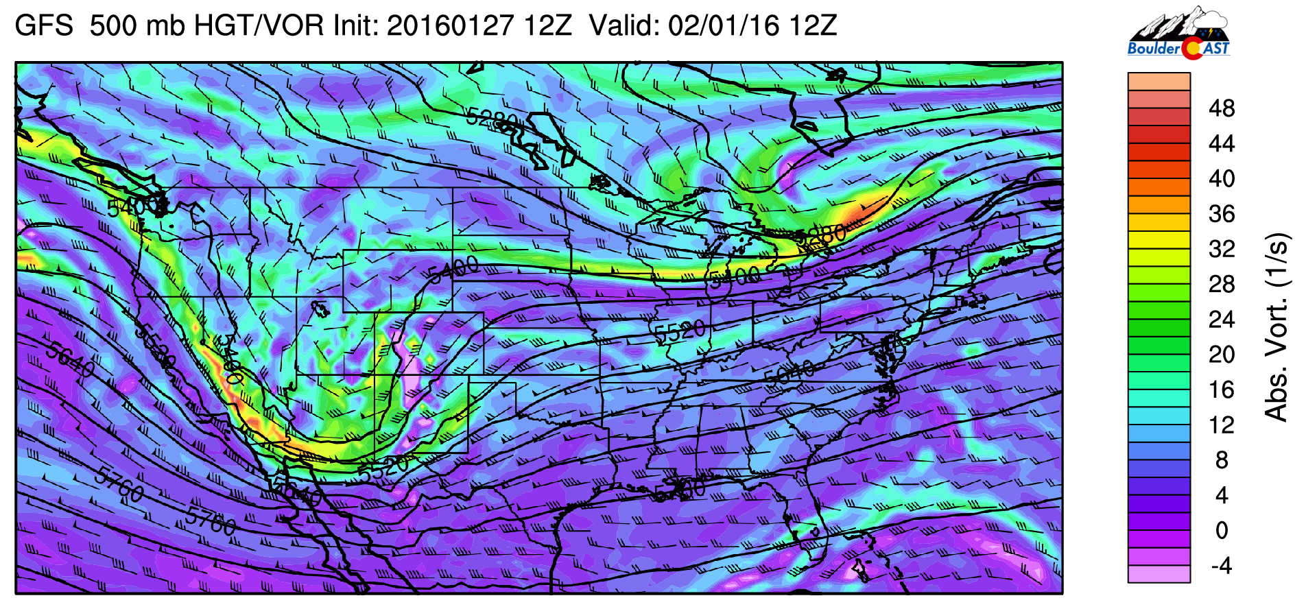
500 mb vorticity map valid Monday morning, showing the upper-level system centered in northern Arizona.
However, as with every Front Range snowstorm, track will be everything. At this point, it is a little too early to say for sure. Models (GFS/Euro/Canadian) generally have been keeping the heaviest snow within our state’s borders. Admittedly, the last several runs have the bulls-eye south and east of Denver, but this can definitely change. The map below from the GFS ensembles shows the uncertainty in how far that trough may end up digging southward.
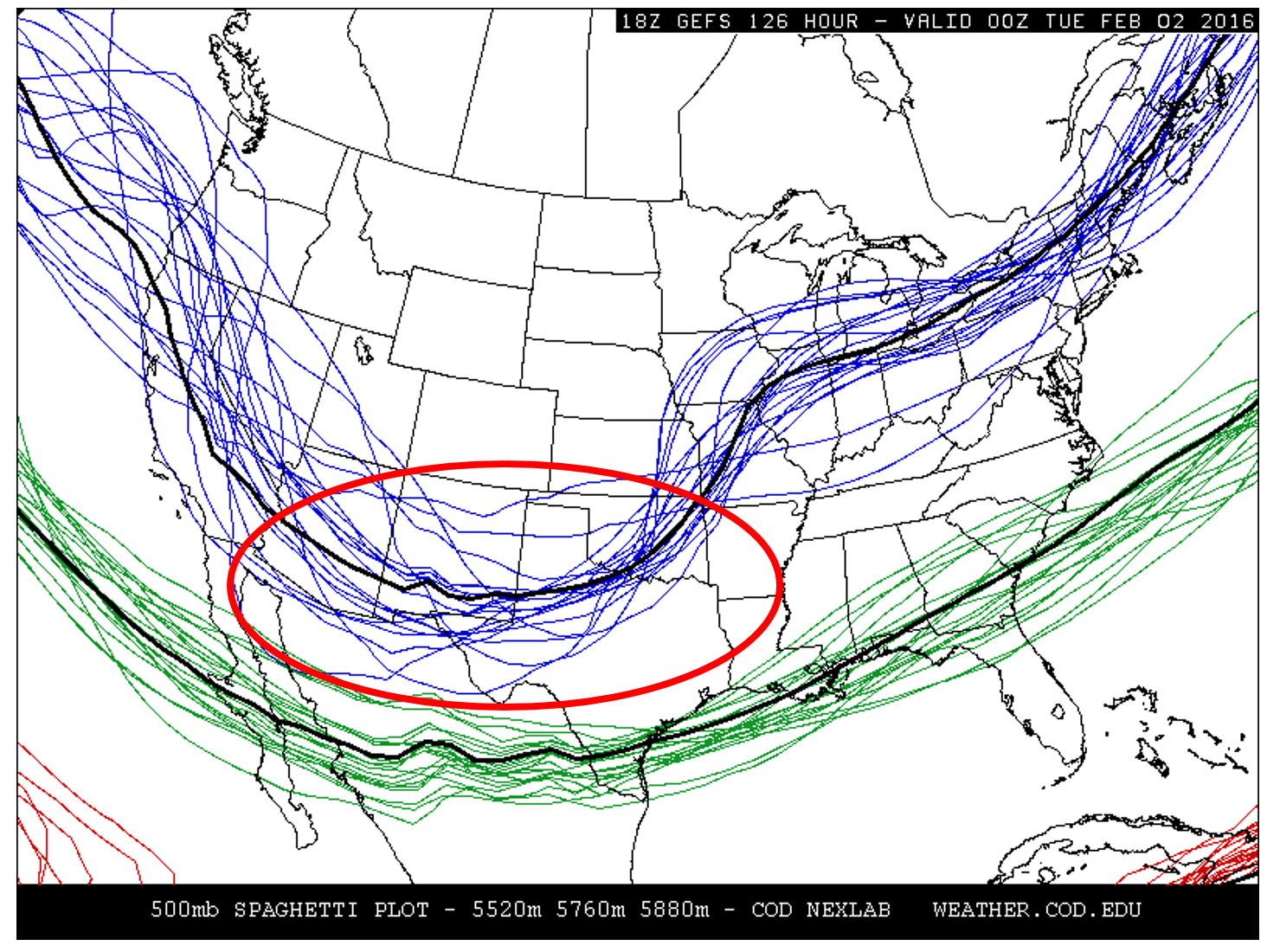
500 mb spaghetti plot showing the spread in possible strength and location of the trough developing this weekend. It’s exact position will be crucial to the eventual track of the storm.
We look at these “spaghetti” plots, as they are called, to gauge model uncertainty, particularly when making forecasts several days out. In the red circle, notice the large spread in the model solutions for the blue lines (the digging trough). Though not equivalent to the storm’s track, the positioning of the trough as it moves across Colorado will play a huge role in where the storm system goes and where the bulls-eye of heavy snow will be. The model ensemble members (blue lines) are skewed slightly south from the mean (thick black line), but in general, are clustered within about 150 miles in the north south direction. For this reason (among others), we can’t pin location of heaviest snow down precisely, only to within about a 150-mile swath, for now.
We think this trough will spawn a potent surface low somewhere in SE Colorado/NW New Mexico Sunday evening, which is shown in the GFS surface map below. This positioning will bring upslope and precipitation to most of eastern Colorado.
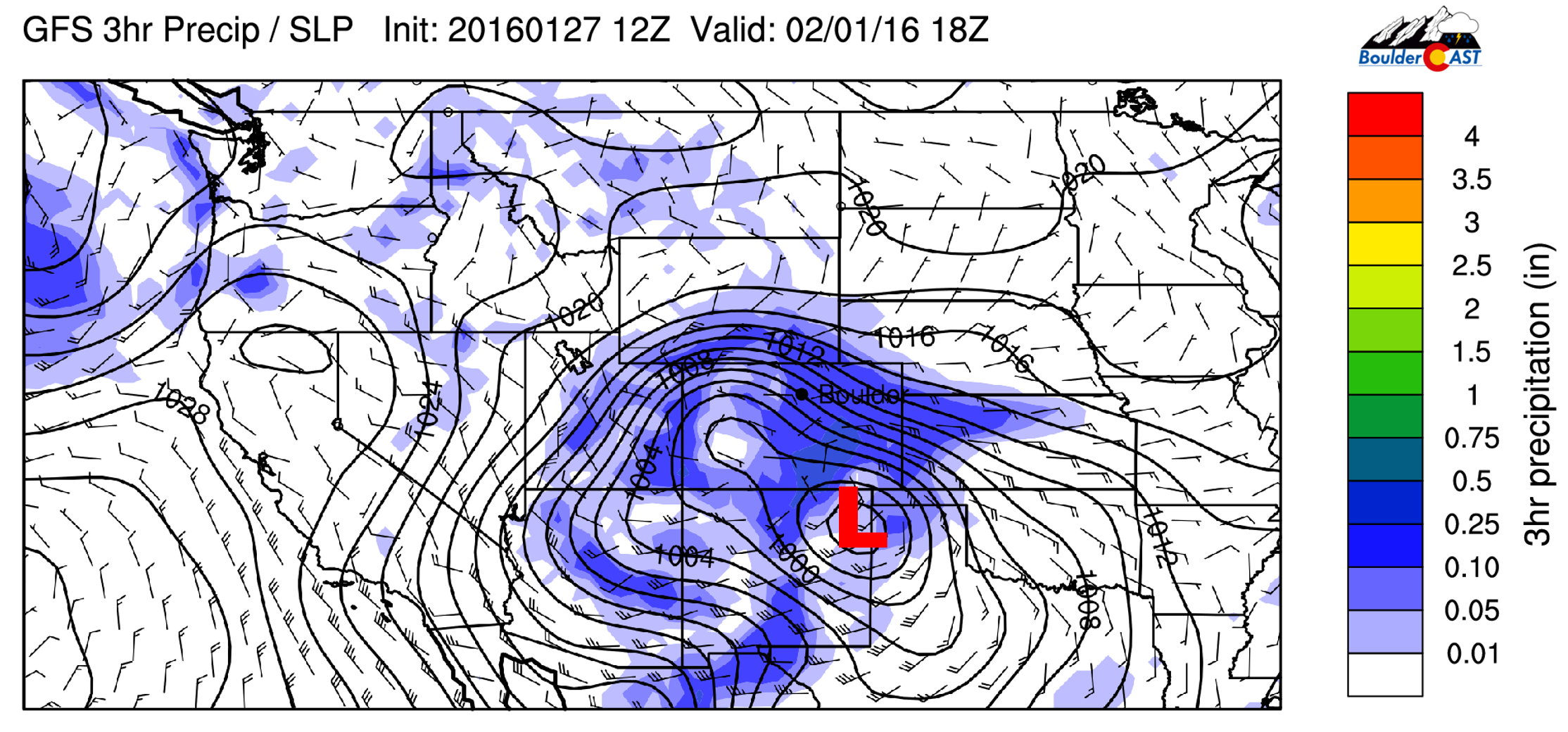
GFS surface map valid at 11am Monday, showing the developing surface low over SE Colorado and accompanying precipitation
It could be a slow-mover…
Despite the uncertain track, the one thing this storm does have going for it is slow progression. Models continue to show that it will take it’s good ole’ time moving through the area. The lack of much blocking (like a ridge) in the eastern USA makes us a little skeptical of this projected storm speed. However, if it does pan out, excellent moisture, decent upper-level divergence (from the jet), and deep upslope will be present from Monday morning into early Tuesday morning. This equates to 24 hours (or more) of continuous snow for the region.
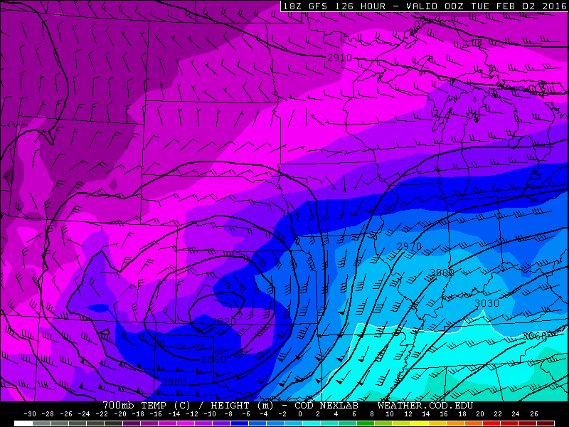
GFS 700 mb temperature and wind field for Monday evening. Shown is a 700mb low in SW Kansas, with northeasterly upslope across most of NE Colorado
When it comes to snow storms, slow movement can make up for other lacking ingredients. As such, even with a less-than-favorable track for snow in Boulder, the shear duration of the event could still drop significant snow. It is a few days too early to make any definite forecasts, but at this point, models are in relatively close agreement (and have been for days).
Blizzard conditions from Denver and east may also be a concern, as strong winds will accompany the core of the system near the Kansas border. Though, we shouldn’t have to worry about that in Boulder, thankfully.
In summary:
After a long wait, the southern storm track looks to finally produce a strong storm that will likely bring significant snow to parts of Colorado early next week. Right now, snow looks to begin Monday morning, persisting into late Monday night/early Tuesday. Be aware that the timing will likely change slightly before the storm arrives.
The exact track is too uncertain right now, but the potential for 6″ of snow or more exists across all of Colorado. Our initial thoughts for the storm are shown below:

Our initial thoughts on which areas may see snowfall exceeding 6 inches with the storm.
Stay tuned for more information over the next few days, as we will be tracking this storm closely! We’ll certainly have more confidence in model solutions by the weekend. For now, just expect a good chance of snow and colder conditions early next week.


You must be logged in to post a comment.