We review the light snow and freezing drizzle that fell on Martin Luther King Junior Day across the Metro area and detail when we will see our next round of snow.
Jet streak led to the snow, but with limitations
The main atmospheric forcing for the snowfall yesterday came from a 145 mph jet streak sliding south through Nebraska and Kansas. Look closely at the animation below and you will notice eastern Colorado in the right entrance region of the jet.
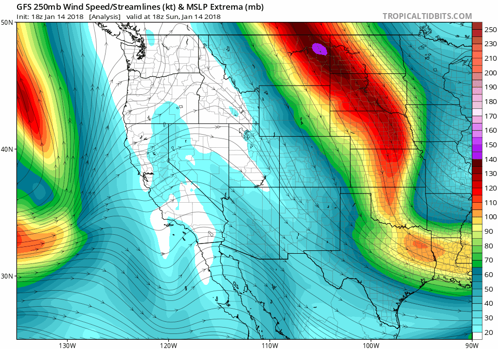
Animation showing the jet streak core that moved southward through Nebraska and Kansas on Monday.
The radar animation from the event clearly shows the northwest-to-southeast oriented snowfall bands produced by the overhead jet.

Radar animation covering the MLK Day 2018 storm in eastern Colorado. The time covered is roughly 4:00 AM to 4:00 PM.
The jet streak made like a sloth as it slowly sagged across the region. It could have produced a lot more snow if things came together better. Snowfall rates within the bands only peaked at about 3/4″ per hour Monday morning. As we have seen in the past, we all know jet-forced bands are capable of dumping 3 to 4″ of snow per hour under ideal conditions. The limiting factor preventing this yesterday was an elevated layer of dry air (shown in the model sounding below boxed in purple). This drier air unfortunately overlapped perfectly with the dendritic growth zone (DGZ). The DGZ is the layer in the atmosphere where temperatures are between -10 and -18°C. This temperature range is ideal for fluffy dendrites to grow rapidly. Yesterday morning, this layer was at about 650 mb to 500 mb (denoted by dashed red lines in the diagram below). The lack of moisture in the DGZ definitely cut into our snow totals. If you were outside in one of these bands, you would have noticed most of the snowflakes were rather small. Very few fluffy dendrites were coming down. We mentioned this lack of moisture in our forecast and actually expected the jet bands to be rather tame and isolated this time around. No surprises for us here.
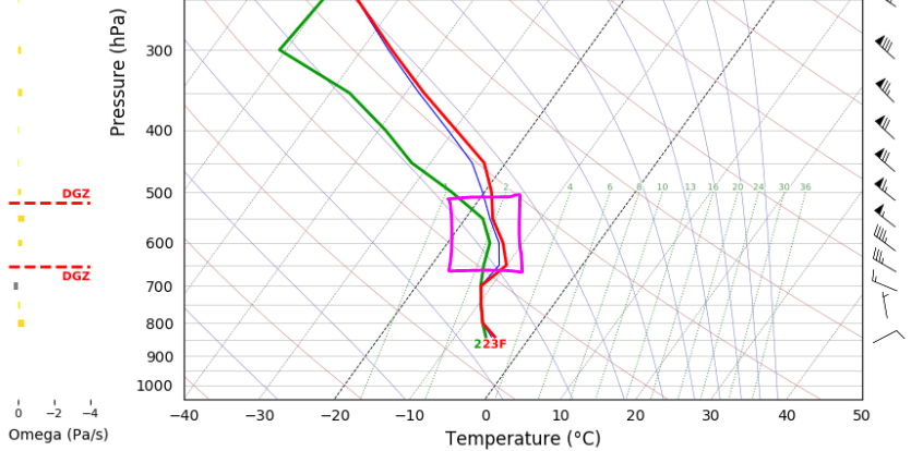
GFS model sounding from mid-morning Monday showing the elevated dry layer that overlapped the Dendritic Growth Zone (DGZ).
Were you caught off-guard by freezing drizzle?
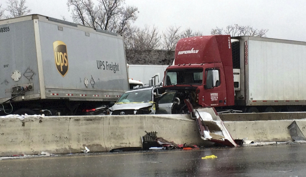
The one facet of the storm that was a surprise to many was the freezing drizzle the occurred around sunrise Monday morning. Small ice accumulations made for dangerous driving (and walking!) conditions early Monday morning. The combination of unexpected ice and the holiday meant road crews were far from prepared. During my commute to the office yesterday at around 8:00 AM, there were no signs of snow plows (or de-icing trucks). However, there were several multi-car accidents and closed intersections.
As we have discussed before, if shallow and weak Arctic upslope is the only forcing, freezing fog and drizzle can happen in Denver and Boulder under the right circumstances (see the “Related Post” below). In the days leading up to the storm, we cautioned our Premium members that there might be some freezing drizzle involved. It wasn’t until the final 36 hours or so that models pulled away from this solution, lending towards a snow-only event. The reason for the shift to all-snow was more favorable jet dynamics. The added lift and turbulence from the jet is enough to disrupt the stratified fog and mist layer near the surface, turning freezing drizzle into snowflakes.
In retrospect, we probably should have at least noted the possibility of freezing drizzle in our final forecast. We did mention that the frontal passage would precede the jet-forcing by around six hours. However, we presumed this delayed time-frame would have sub-saturated air near the surface as models were indicating. As you can guess, bonus moisture in the lower levels of the atmosphere allowed the freezing fog and drizzle to form ahead of the jet-forcing, continuing for several hours. The National Weather Service issued a Winter Weather Advisory for the freezing drizzle as it was happening (around 7:00 AM). It was a little late at this point, but needed nonetheless. There isn’t much else that could have been done. Very subtle differences between observed and modeled moisture in the lowest 2,000 feet of the atmosphere led to impactful differences in our weather. It was a rare occasion where even the high-resolution HRRR model was out to lunch as well. We’ve learned to accept these subtleties at BoulderCAST….sometimes you just can’t get everything 100% right.
Barely a dent in our snow deficit
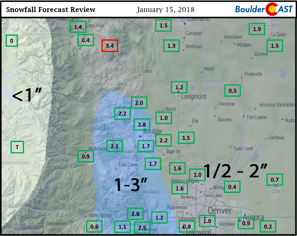
Boulder’s official snow total was 1.7″, while Denver only recorded 0.7″. This brings our seasonal totals to 24.0″ in Boulder and 7.5″ in Denver, well below average for this time of year.
Shown below is our original forecast map created Sunday morning. The observed storm totals per location are contained in boxes. Green ones indicate that the observed snowfall was within one inch of the given forecast range, while red was outside the scope of our forecast. Overall, good results. It was a well-forecasted small storm with equally small totals. As we expected, the highest snow amounts were observed in the Foothills between 6,000 and 8,000 feet elevation.
Now that our first snow event of 2018 is out of the way, we can move on to bigger and better ones in the weeks and months to come!
More snow on the way! Stay in the loop with BoulderCAST Premium
The next storm we are tracking is shaping-up to arrive Saturday evening. It’s a southern track system that models are in fairly good and consistent agreement on. The latest GFS model-derived snowfall forecast brings 3-8″ to the Metro area Saturday night as a strong closed upper-level low tracks across southern Colorado. With four days to go, things can still change, but confidence is growing. We’ll be providing updates through the week to our Premium members. There is no better time to sign up with our Spring snow season on the way. Oh. and we just launched a promotion for you to save 30% on annual memberships of BoulderCAST Premium (new members only, see code below).
LIMITED TIME PROMOTION: Use the promo code “WEATHER-2018” on or before January 24th to save 30% on a BoulderCAST Premium annual subscriptions –> Sign up now!
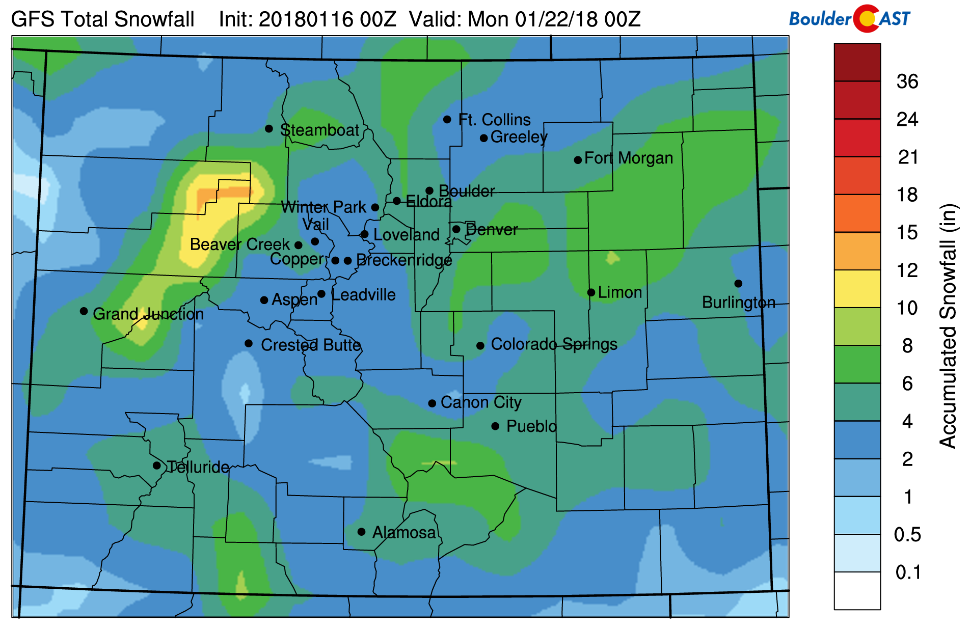
Latest GFS snowfall forecast for this weekend’s storm. Uncertainty remains, but it could be our biggest snow so far this winter.
.
BASIC
PREMIUM
.
.
Give us a shout-out…Share this interesting weather analysis:


You must be logged in to post a comment.