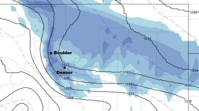
Though the Front Range has been feeling warmer of late, the Arctic air has never been far away. This boundary has remained just across the border in Nebraska and Kansas for the last few days. This changes tonight as the cold front pushes back south and west along with some moisture to bring light snow to everyone. Read on to find out the exact timing and snowfall amounts.
A weather system moving into the Great Lakes tonight will provide just enough “oomph” to back the Arctic cold front into eastern Colorado after midnight tonight.
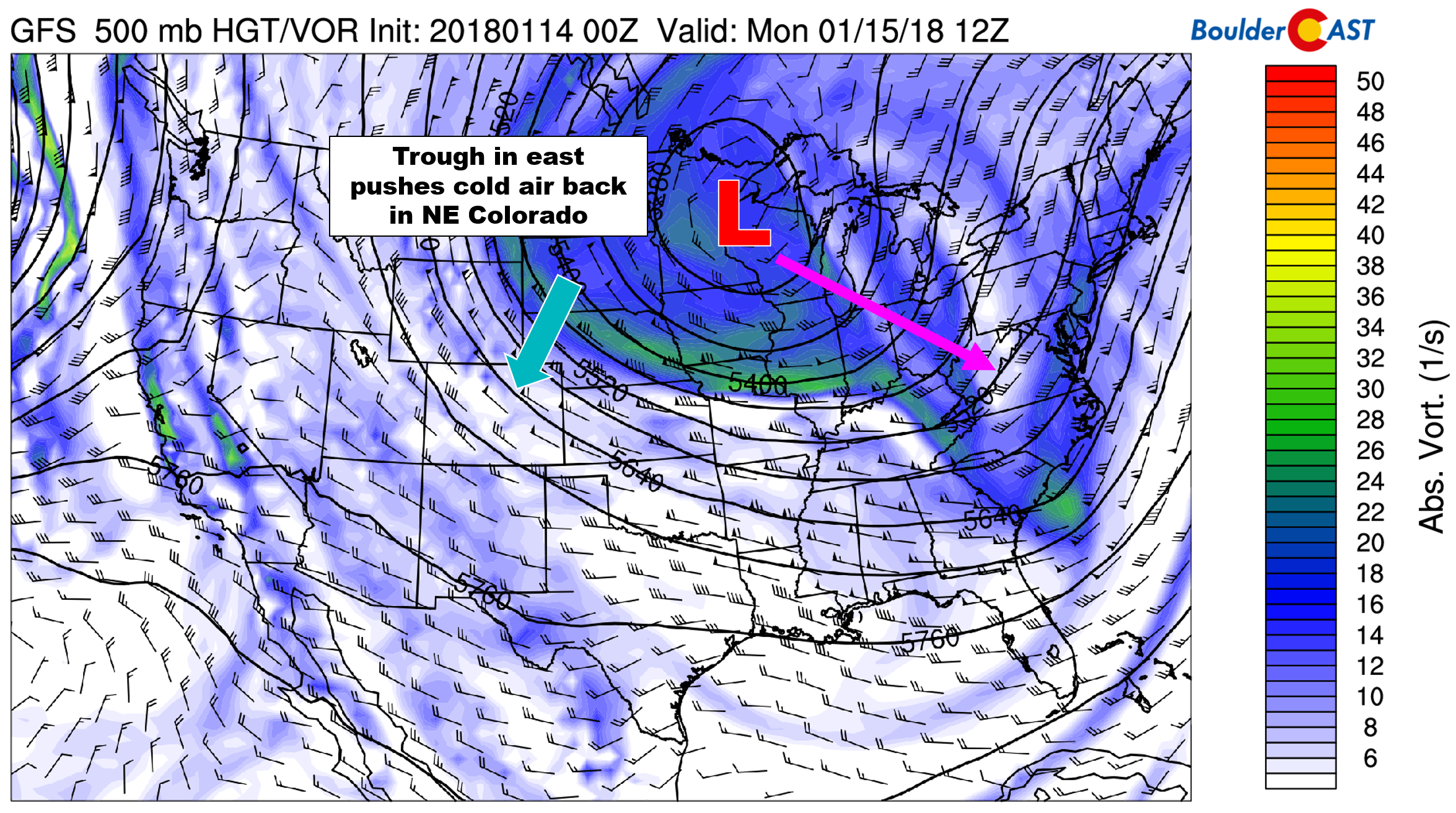
GFS 500 mb vorticity map for Monday morning. A trough across the Great Lakes will help filter colder air in Colorado
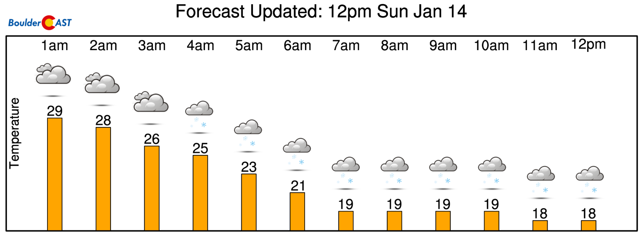
In the meantime, before the front arrives, we’ll see pleasant weather on Sunday across the region with sunshine and temperatures in the lower 50’s. As mentioned, the cold front will swing through around midnight tonight or slightly after.
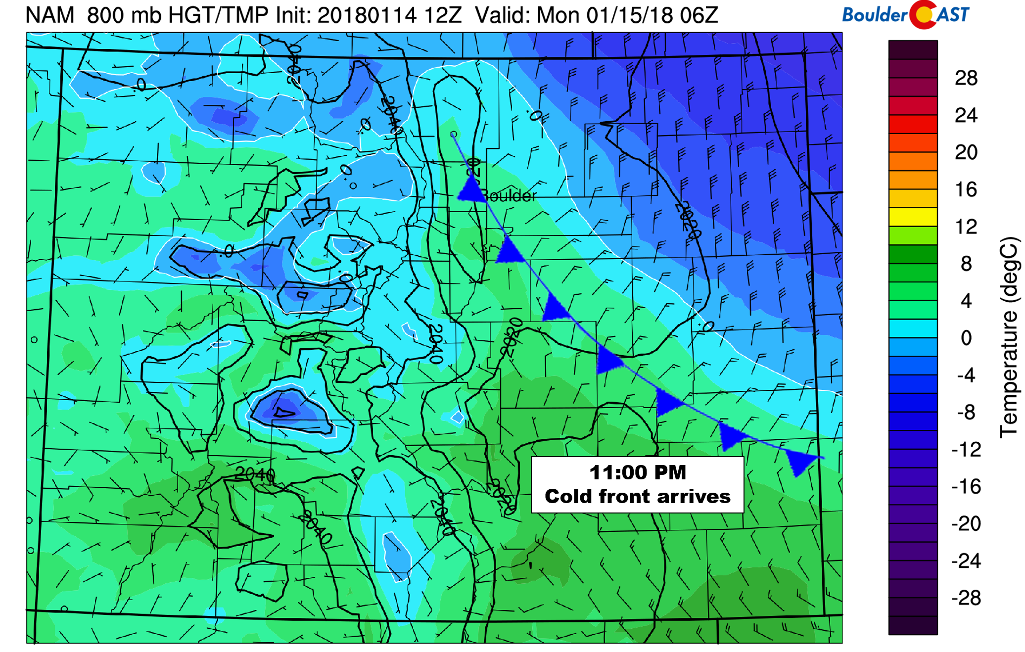
NAM 800 mb temperature and wind forecast for Sunday night at 11:00 PM. The cold front will be pushing through the Metro area around this time.
It will take a few hours for the lower levels of the atmosphere to moisten up, but we expect light snow to begin falling for most of us before sunrise Monday morning, alongside temperatures falling towards 20 degrees where they will remain through the day.
The main factors producing the snow are:
- Right-entrance region of the jet: Northeast Colorado will be in the right-entrance region of the jet Monday morning, roughly from 6:00 AM to Noon. During this time, we could see a few moderate snowfall bands across the region. These should be isolated due to limited moisture however, with most snow remaining light (1/4″ per hour rates).
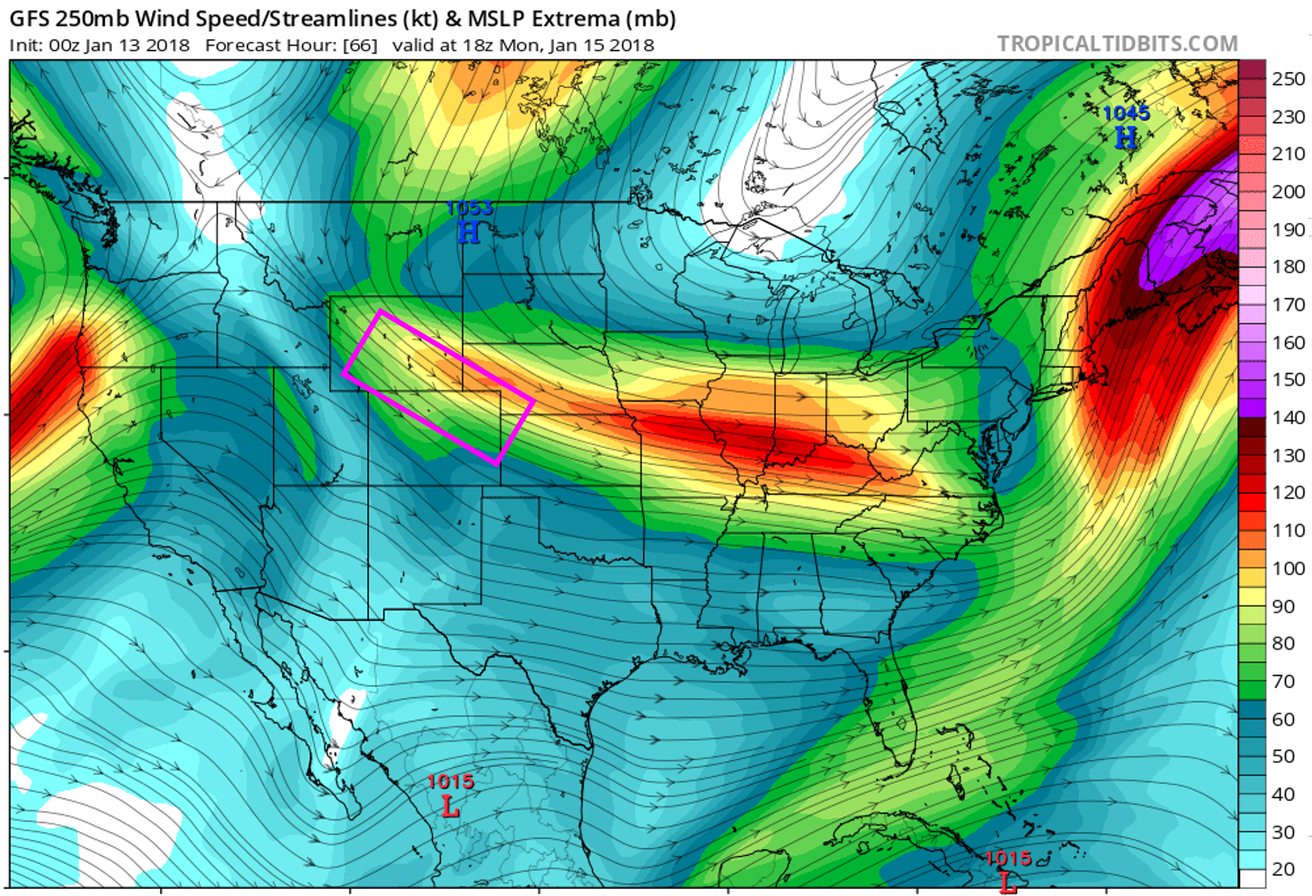
GFS 250 mb wind forecast for Monday morning. NE Colorado will be in the right-entrance region of the jet streak.
- Frontal lift: Areas along the Arctic boundary will briefly see snowfall enhanced due to frontogenesis. The best timing for this will be around sunrise, plus or minus two hours.
- Upslope: Upslope will be shallow and minimal, but it will be the longest lasting producer of snowfall across the Denver Metro area. Upslope will commence with the frontal passage around midnight tonight, and then continue into Monday afternoon. For this reason, we should see light snow or flurries linger into the afternoon hours, especially near the base of the Foothills and Palmer Divide.
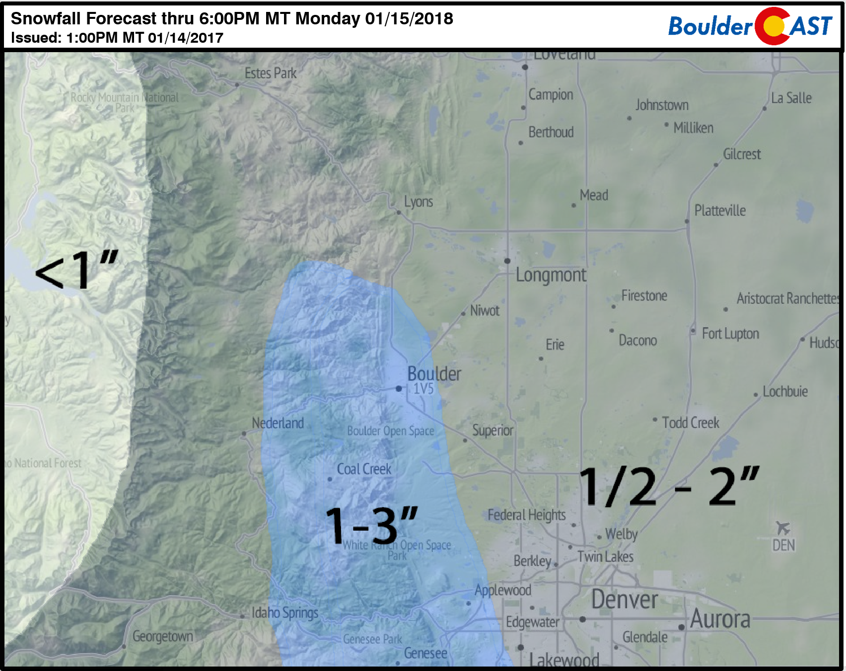
Overall, we’re looking at 1 to 2″ of fluffy snow for most of the area, including the higher elevations. Due to the shallow nature of moisture and upslope, areas above 8,000 feet elevation may end-up with less accumulation than the Plains. The highest storm totals will likely be in the Foothills between 6,000 and 8,000 elevation west of Boulder and Denver.
Nothing to get overly concerned about, but with the very cold temperatures, expect to find slick roadways for the Monday morning commute. Fortunately, the holiday should lighten the traffic load significantly.
The cold airmass will linger through Tuesday, but we have significantly warmer weather returning for the rest of the week. More on this in our weekly outlook tomorrow.
Stay warm and enjoy the good ole’ fashioned snow day!


You must be logged in to post a comment.