The week ahead starts off feeling like autumn thanks to yesterday’s cold frontal passage. We are rather quiet for the most part with only a slight chance of storms late in the week as temperatures moderate back into the 80’s. More details can be found within, including when we expect the wildfire smoke to exit the region.
We also provide thoughts on Category 5 Hurricane Irma which could be making landfall in Florida this weekend.
Toasty this past Sunday
As we eluded to in our Labor Day Weekend forecast, Sunday was very HOT across the Front Range. Temperatures in Boulder and Denver soared to 97 degrees, a new daily record in Boulder and a tie for the monthly record in Denver. This was the second warmest September day in Boulder’s history and was our warmest day since July 19th. Since mid-July, we’ve really had a fairly cool summer.
Cold frontal passage brings autumn-like temperatures today and tomorrow
Thanks to a trough over the Great Lakes, northerly winds have pushed in a colder airmass just in time for the first full week of September. Below shows the mid-level pattern, with arrows denoting the northerly winds around the base of the trough which is tied to an area of low pressure in southeastern Canada.
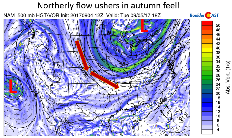
NAM 500 mb absolute vorticity this afternoon
Unfortunately, the northerly winds have advected thick wildfire smoke back onto the Plains and Front Range. Below shows our webcam from yesterday evening. A great degree of haze was present, banked up against the Foothills. Some of you maybe could even smell the smoke…quite amazing! While harmful to breathe, it makes for a unique sunset!
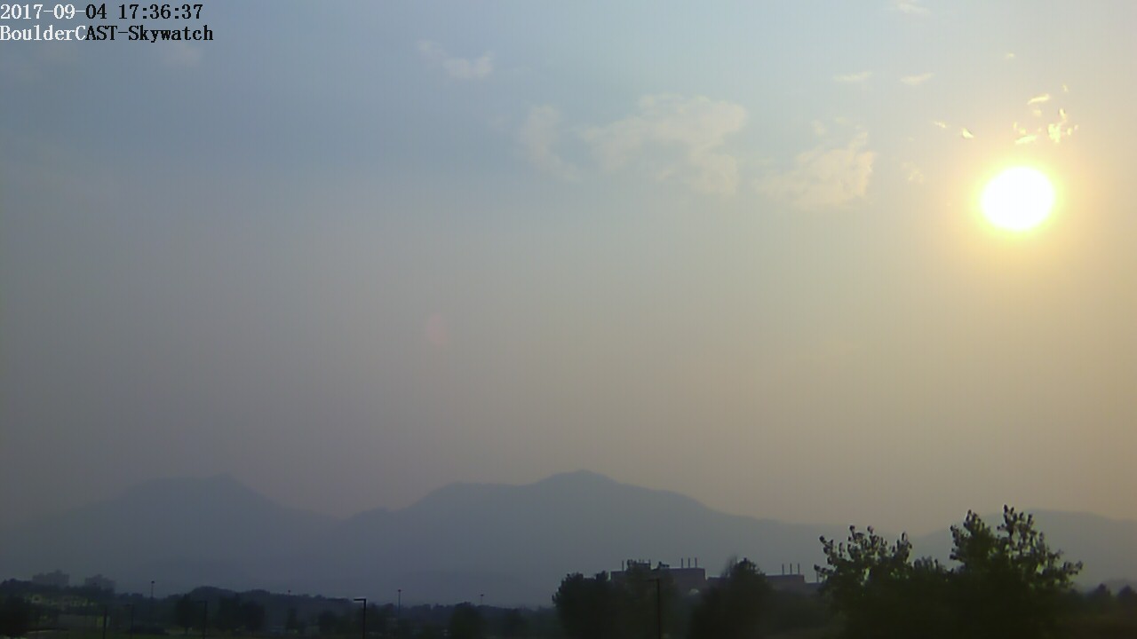
BoulderCAST webcam showing the smoke over Boulder yesterday evening
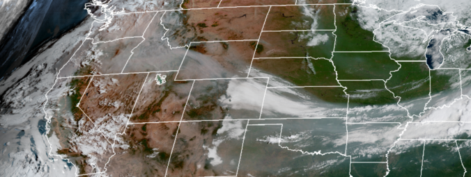
This smoke is also evident in visible satellite imagery. The image below, taken from yesterday evening, shows a large region of smoke across much of the Midwest and western U.S., enclosed in orange. Also denoted is the cold frontal position, showing how the advection of the northerly winds brought down the smoke.
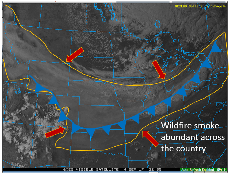
GOES visible satellite imagery from Monday evening showing the abundant wildfire smoke (in orange) across the nation. Blue denotes the cold frontal boundary position.
With northeasterly flow today from the frontal passage yesterday (let’s call it a smoke front!), we are expecting visibility to be low once again with the smoke in place, as shown in the HRRR experimental smoke forecast below.
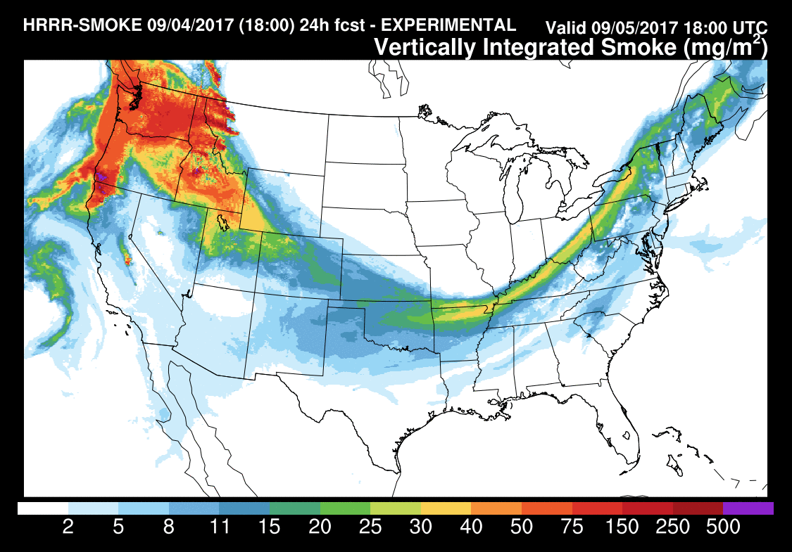
HRRR experimental wildfire smoke forecast for today from NOAA/GSD in Boulder
In addition to the haze, we can expect a little more cloud cover at least to start the day, given high relative humidity in the low-levels of the atmosphere. Sunshine should take over by mid-afternoon. Temperature wise, we are thinking highs in the upper 60’s on the Plains and some upper 50’s in the Foothills, a big change from Sunday and Labor Day!
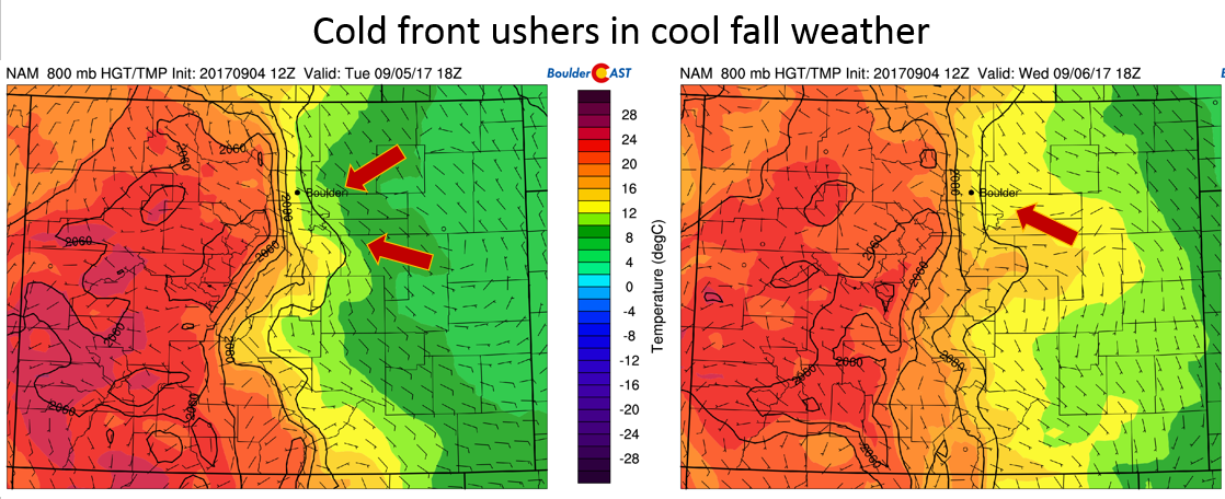
NAM model 800 mb temperature and winds for today (left) and tomorrow (right). Expect temperatures to warm back up for your Wednesday
Wednesday and Thursday quiet…
On Wednesday, the mid-level flow remains north-northwesterly across Colorado (see below), as the trough in the Great Lakes, slowly pushes east-southeast. At the same time, high pressure over eastern Utah will produce fair weather and lots of sunshine once again. We think the haze from wildfire smoke will alleviate somewhat on Wednesday, but still be present thanks to persistent east-southeast flow at the surface keeping the pollutants banked up against the Foothills.
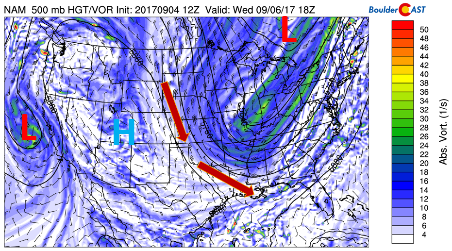
NAM 500 mb absolute vorticity for Wednesday
On Thursday, the mid and upper-level pattern becomes more westerly (see below). That will aid downslope flow and warming temperatures likely into the middle 80’s across much of the Plains. The downslope surface flow combined with the westerly upper-level flow should help greatly improve visibility and remove a large part of the wildfire smoke. The improved visibility should continue into Friday with persistent westerly flow.
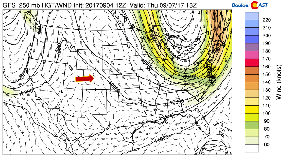
GFS 250 mb winds and jet stream for Thursday
A few of the forecast models are hinting at a chance of isolated storms on Thursday. A weak disturbance in the westerly flow is evident in the vorticity plot below, indicating a little lift for storm activity. However, instability is limited, although moisture does increase compated to earlier in the week. We think most areas will remain dry at this point, with about a 10% chance of storms.
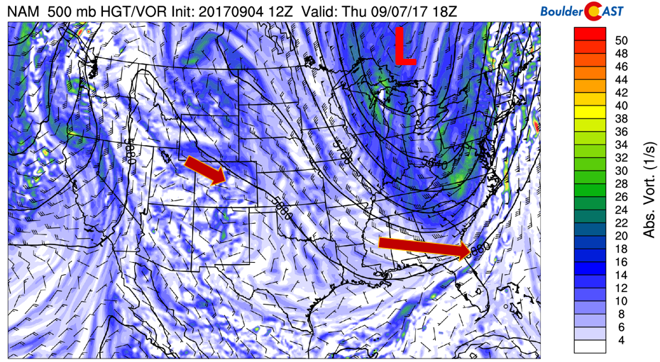
NAM 500 mb absolute vorticity for Thursday
Friday warm with slight storm chances
By Friday, much of the same pattern will exist. Of note will be focusing on a weak disturbance across Colorado on Friday, as predicted by the GFS model (below figure). This may increase lift, and combined with slightly elevated instability, should increase the chance of storms across the area to around 20%. This feature is subtle and it’s hard to say if it will actually happen on Friday or not. This will likely get refined once we get closer to the end of the week. Temperatures should top out Friday in the middle 80’s with more cloud cover from the disturbance.
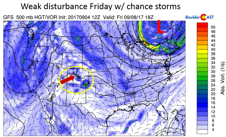
GFS 500 mb absolute vorticity for Friday
A brief look at Hurricane Irma
Although Harvey will have a lasting effect on Houston, it is long gone. The attention now turns to Hurricane Irma, currently packing 185 mph winds at its core!! The official National Hurricane Center forecast of Irma points to the tropical cyclone moving west-northwest north of Puerto Rico by Thursday, and potentially into Cuba come early Saturday in the upcoming weekend.
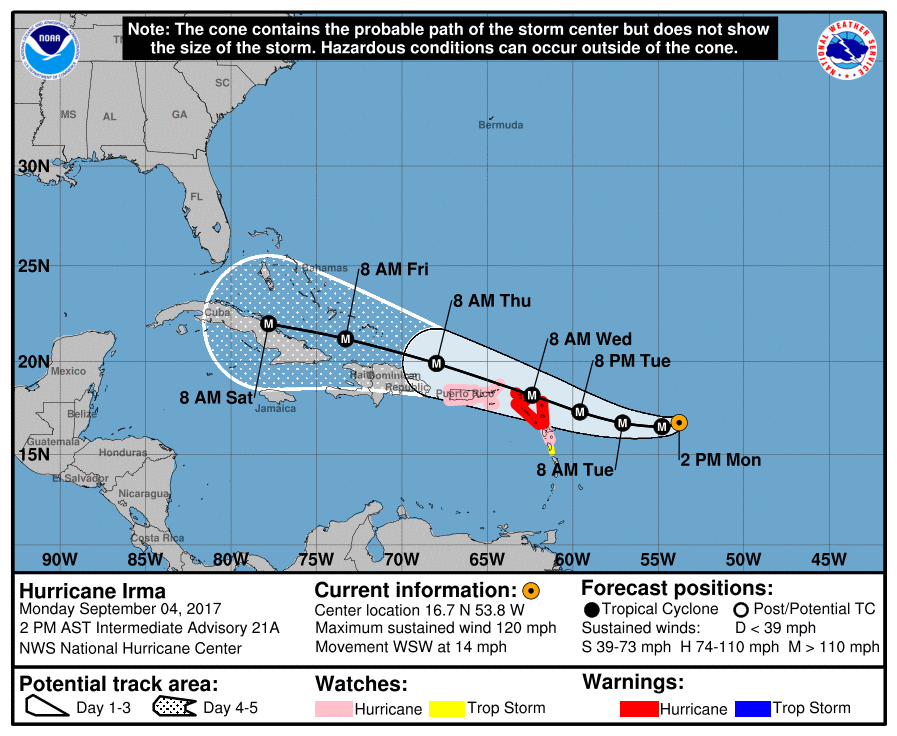
Hurricane Irma forecast from the National Hurricane Center
As far as the longer-range forecast track of Irma, below shows individual ensemble forecast tracks out to 240 hours (early next week). It is evident that there is a great degree of uncertainty in the track of Irma, regarding its predicted landfall into the U.S. The mean track shows it moving north of Cuba and making landfall in the southern tip of Florida. However, other tracks show it going into the Gulf of Mexico, as well as potentially riding up the coast of eastern Florida and into South Carolina. All eyes will be on the storm by the end of this week. The eventual track depends strongly on the mid-level atmospheric flow and its potential interaction with the trough over the Eastern U.S. late this week, so time will tell on its eventual path, but current trends are not boding well for the Florida coast.
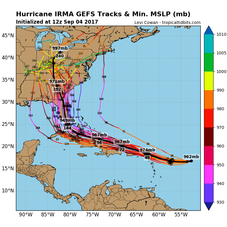
GEFS forecast tracks of Hurricane Irma
Enjoy the short work week!
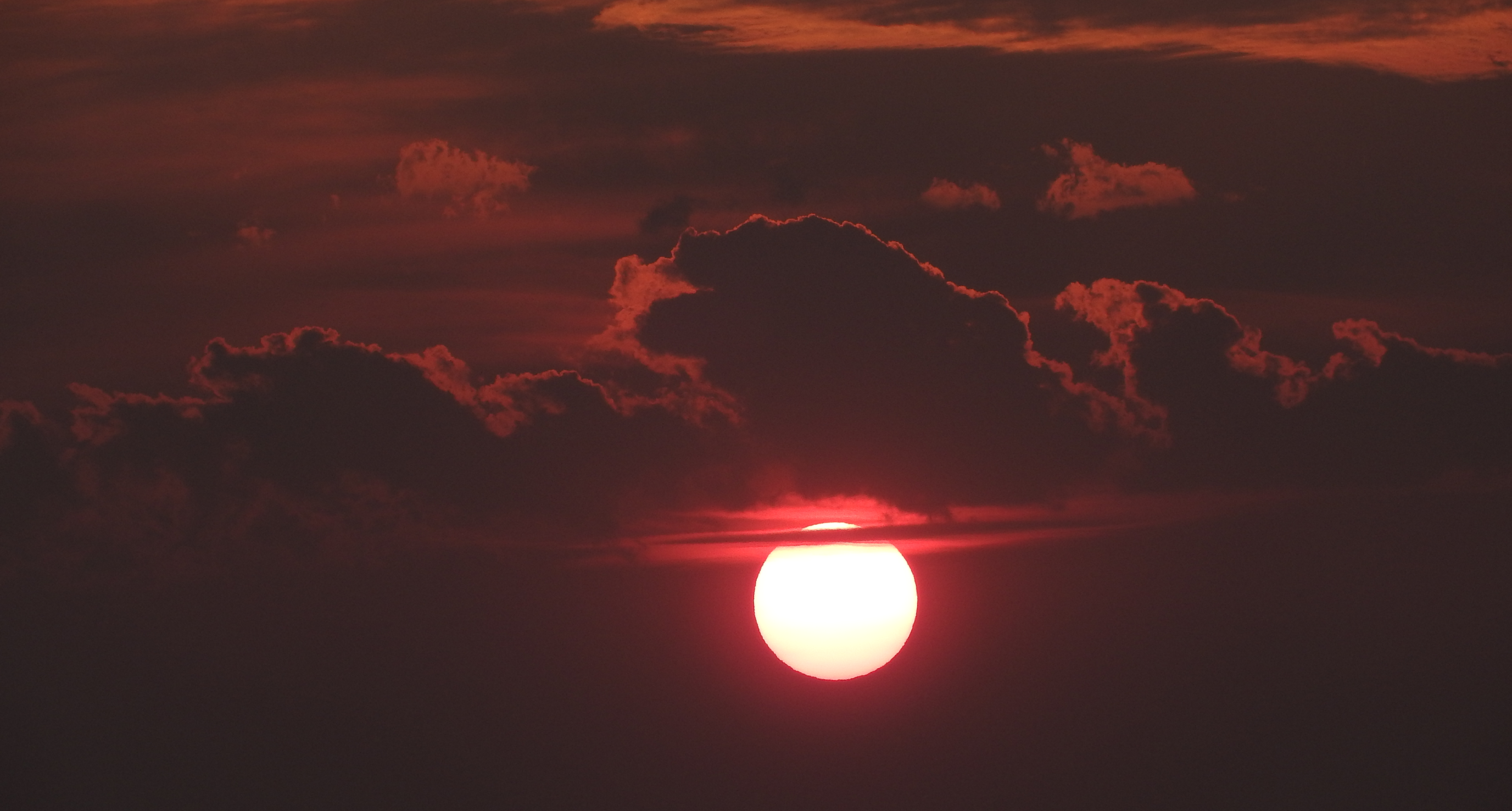
Smoky sunset taken near Bozeman, Montana two weeks ago. It’s this smoky every day there!
Forecast Specifics:
Tuesday: Overcast through the morning with haze, then becoming sunny in the mid to late afternoon. Highs will be autumn-like in the upper 60’s on the Plains, with upper 50’s in the Foothills. Visibility will be low from wildfire smoke.
Wednesday: Mostly sunny skies with haze decreasing by late afternoon. Highs warmer but still pleasant in the upper 70’s across the Plains, with middle 60’s in the Foothills.
Thursday: Mostly sunny skies giving way to increasing clouds in the afternoon. Visibility improves dramatically thanks to westerly flow. Some isolated storms by early evening possible but most areas to remain dry. Temperatures warmer in the middle to upper 80’s across the Plains and middle 70’s in the Foothills.
Friday: Partly cloudy skies becoming mostly cloudy with isolated thunderstorms possible. This is probably our day with the best chance of rain. Expect highs to be in the middle 80’s on the Plains and low 70’s in the Foothills.
High Country: Overall we’re expecting a fairly quiet week in the higher elevations. We do anticipate a mostly dry day today across the higher terrain. On Wednesday and Thursday, however, storm activity returns, thanks to elevated instability and a few disturbances moving in from the south and west. It appears Thursday and Friday will be the best days for rain and storm activity across the High Country. Even then, chances are not all that great. More details over at SummitCAST.
DISCLAIMER: This weekly outlook forecast is created late Monday or Tuesday morning and covers the entire upcoming work-week. Accuracy will decrease as the week progresses as this post is NOT updated. To receive daily updated forecasts, subscribe to BoulderCAST Premium.

Share our forecast:
Tue
Wed
Thu
Fri


Temperature
69
79
86
85


Precip Chc (Plains)
0%
0%
10%(pm)
20%(pm)


You must be logged in to post a comment.