It’s been nearly two weeks in Boulder since our last measurable rainfall. Labor Day weekend will continue this trend with generally dry and at times, hot conditions prevailing across the state of Colorado. We provide our forecast of the entire holiday weekend for the Metro area and the Mountains.
The main reason we are expecting relatively tranquil weather for the upcoming weekend is the presence of a broad ridge that will increase in strength through the weekend (see below). The ridge has been creating record warmth across Pacific coast for many days now, and also was one of the factors that contributed to the epic flooding of Harvey.
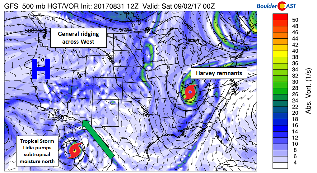
GFS 500 mb vorticity map for Friday evening showing the large scale features of note to impact the holiday weekend
One wildcard is Tropical Storm Lidia, currently located near Cabo San Lucas in Mexico. It will be moving northward over the next few days. While the storm is not expected to reach hurricane status, it has a big footprint already (much larger than Harvey). Lidia’s southerly flow will be advecting moisture northward into the Southwest USA. This has a potential to feed into our weather NEXT week. Luckily, things will remain relatively benign through our holiday weekend.
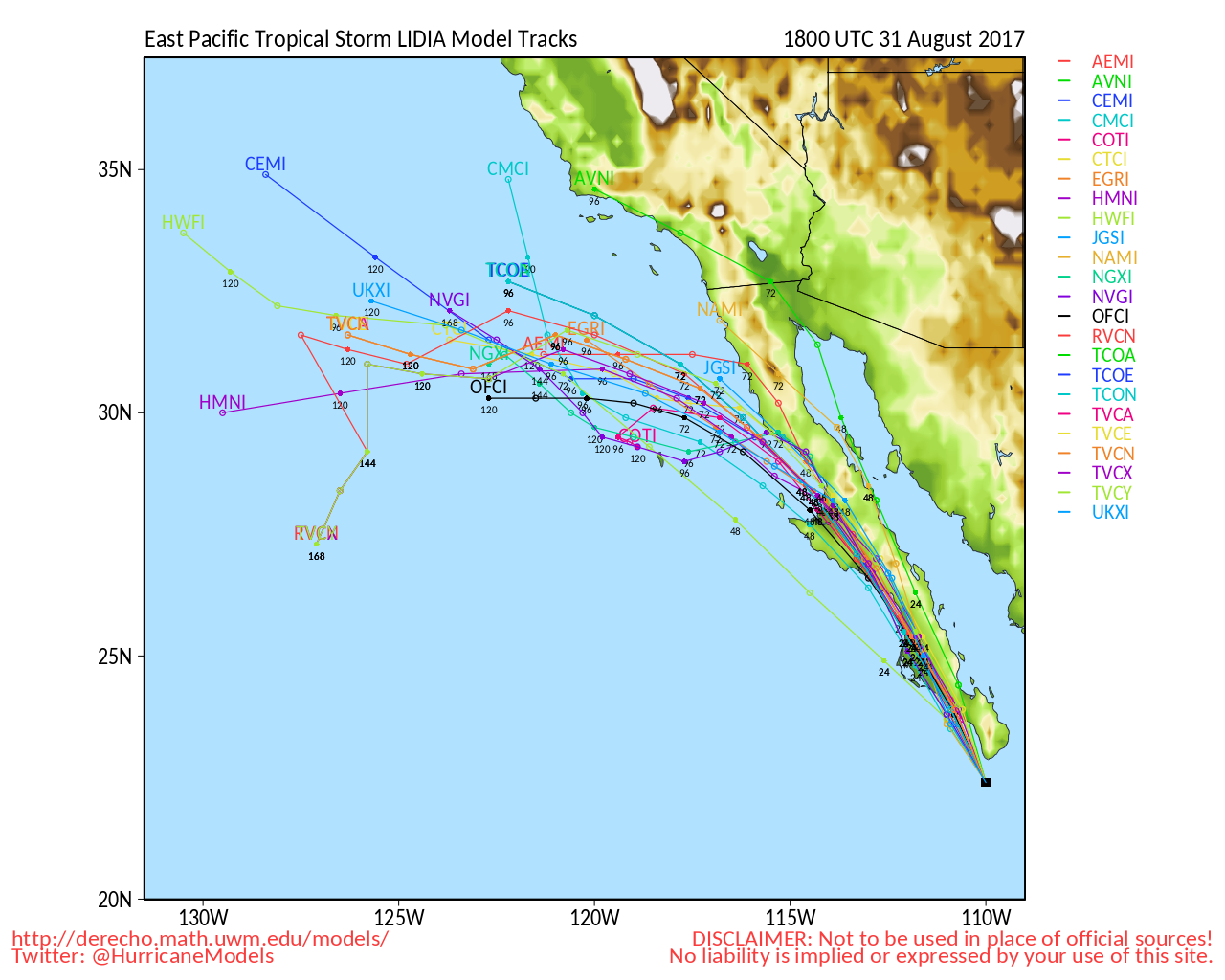
Model forecast tracks for Tropical Storm Lidia.
There will be hints of residual moisture trapped beneath the ridge through the weekend, especially in southwestern Colorado. Afternoon solar heating will provide the energy for spotty thunderstorms each and every day, mostly between 1PM and 8PM. Saturday and Sunday will be the days with the lowest chances of storms, and if you’re heading out to the mountains in the northern half of the state, these days have good odds of being totally dry and sunny.
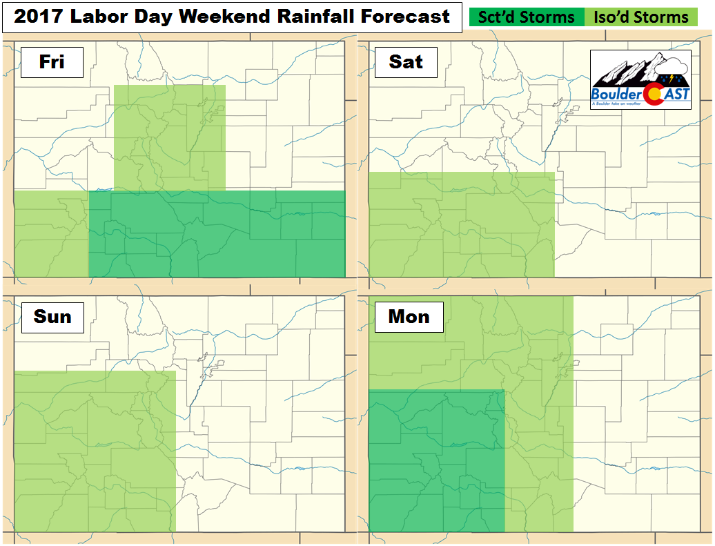
In Boulder and Denver, expect about 10% chance of storms both Friday and Monday. We will assuredly be dry on Saturday and Sunday, though the heat will be turned up a notch. Our forecast highs in Boulder and Denver for the weekend are shown below…
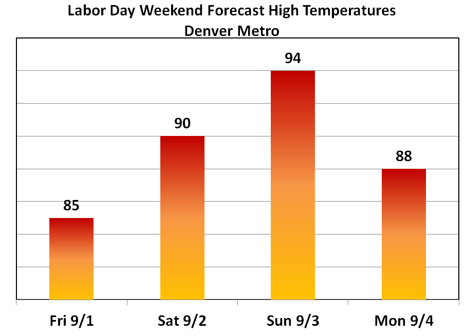
On Sunday, the warmth will be approaching record levels for many locations in northeast Colorado. Boulder’s record high temperature for September 3rd is 94 degrees.
Overall, the Front Range area will offer the best weather for outdoor activities this weekend. Generally anywhere north of Interstate 70 should be in the clear. However, you can’t really go too wrong statewide this weekend. The ridge will serve us all quite well.
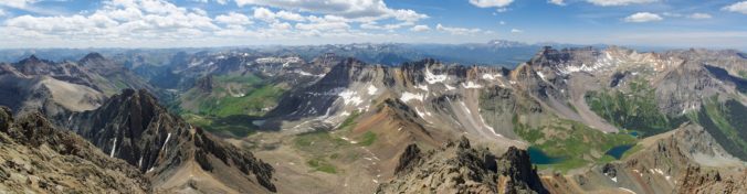
If you plan to peak-bag any 14ers or 13ers this weekend, be sure to check our SummitCAST page for the latest localized forecasts.
![]()
Have a great holiday weekend….Autumn is just three weeks away!


You must be logged in to post a comment.