
This week we discuss what caused the heatwave over the long weekend and what will end it abruptly on Tuesday. We also take a look at our daily chances for thunderstorms the rest of the week.
DISCLAIMER: This weekly outlook forecast was created Tuesday morning and covers the entire upcoming week. Accuracy will decrease as the week progresses as this post is NOT updated. To receive daily updated forecasts from our team, subscribe to BoulderCAST Premium.

T
he weather story for the Front Range written over the long weekend clearly had a theme of very hot temperatures. Both Boulder and Denver reached a scorching 100 degrees Monday afternoon…this comes after hitting 98 degrees on Sunday. By touching the century mark, Monday tied or broke the all-time temperature record for the month of September in both cities. In fact, this was the hottest day in Boulder all summer long (actually, the hottest since 07/19/2017). Many cities throughout eastern Colorado set new daily temperature records on Monday. In most cases, they didn’t just break the daily temperature record; they obliterated it by more than five degrees.
- Lamar (105)
- Pueblo (102)
- Greeley (102)
- Denver (100)
- Boulder (100)
- Akron (99)
- Colorado Springs (96)
- Alamosa (86)
The extreme heatwave over the weekend was brought on by a very strong ridge of high pressure that migrated northward and situated itself directly over Colorado Saturday evening. This large-scale ridge led to prime conditions for extreme heat across our area, including very dry air, sinking motion, and an anomalously hot overall airmass. Even in an ideal scenario, the key factor that often determines whether or not we bust record highs in Boulder is how much afternoon cloud cover rolls off the Foothills. This weekend, skies managed to remain mostly sunny with only a few spotty cumulus clouds moving overhead. This allowed for nearly maximum solar heating to occur, which is critical for early September as we continue to lose the sun’s energy. It really was a perfect set-up for historic heat!
Same story Tuesday, but thankfully cooler
We begin the shortened work-week with essentially the same atmospheric set-up as we had over the weekend. The very strong ridge of high pressure remains centered over Colorado on Tuesday.
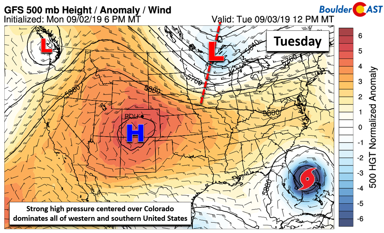
GFS 500 mb height anomaly forecast for Tuesday.
The strength and reach of the high pressure over Colorado is actually what has thrown the weather models for a loop in forecasting where and when Hurricane Dorian may make landfall on the Southeast Coast. For now, it appears that our high has rescued Florida from what was shaping up to be a major catastrophe, potentially even preventing a U.S. landfall entirely.
.
Despite the weather set-up largely remaining the same today, there is one important exception: a weak disturbance is moving across the northern Great Plains and it has a trailing cold front! This front will bring an entirely new, much cooler airmass to the area on Tuesday.
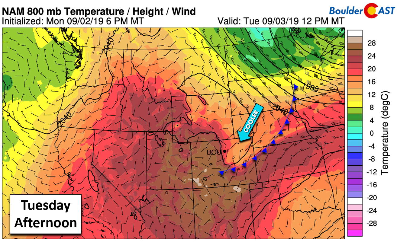
NAM 800 mb temperature and wind forecast for Tuesday afternoon. Hey, there’s a cold front!
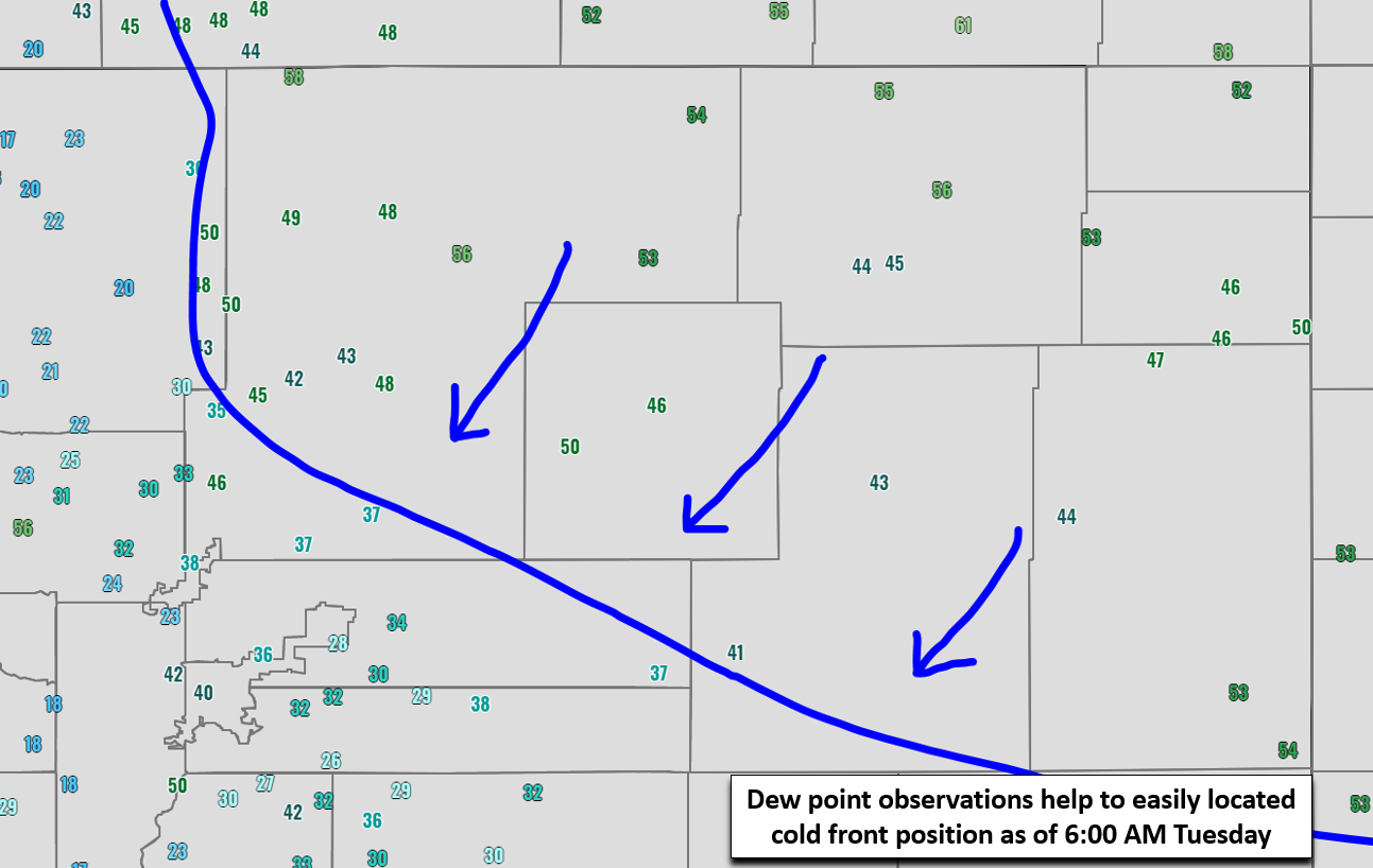
This front is already pushing through the Denver Metro area now. It’s easy to locate by looking at surface dew point observations. North of the front, dew points are in the 40’s and 50’s. South of the front, dew points are significantly drier in the 20’s and 30’s. This front will thankfully bring an end to the heatwave with highs Tuesday some 15 to 20 degrees cooler in the lower 80’s which is right around normal for this time of year.
The change in airmass should provide enough moisture to develop a few isolated thunderstorms Tuesday afternoon and evening. The focus will be across the higher terrain, with the lower elevations largely remaining stable due to the surface cooling and very warm air aloft. However, a weak shower or storm could briefly impact the area before quickly falling apart as it moves eastward…about a 5 to 10% chance.
Warmer with isolated storms Wed & Thu
As easterly flow relaxes, the surface boundary that brought the big cool-down will migrate eastward with shades of the hot airmass creeping back into eastern Colorado from the west. This will allow temperatures to push back towards 90 degrees for Wednesday and Thursday. At the same time, deeper moisture will pump northward into much of the western United States. Precipitable water will reach back near 0.75 to 1.0″ around Denver during this time.
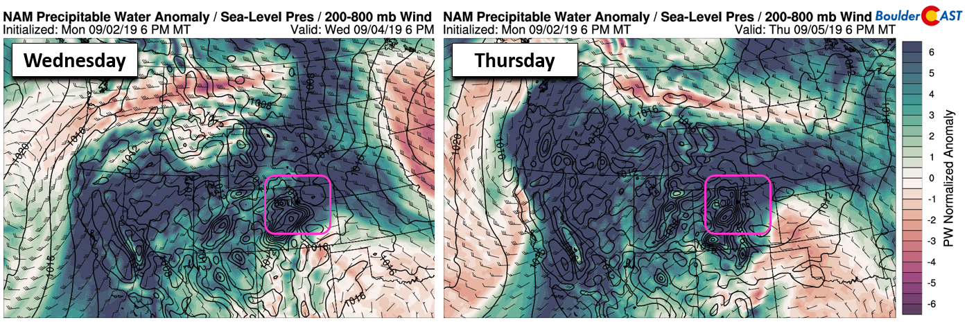
NAM moisture anomaly forecast for Wednesday (left) and Thursday (right).
However, despite the rather high moisture availability, storms will be hard to come by these days across the Denver Metro area. Let’s not forget that a historically strong high pressure will remain directly overhead. This high isn’t in a hurry to go anywhere, though it is slowly shifting eastward. Models are consistently trying to develop isolated to scattered storms across the Mountains Wednesday and Thursday. Some of these will likely push eastward across the area both days, but overall coverage should be fairly spotty with storms mainly bringing just brief light rain and a few rumbles of thunder.
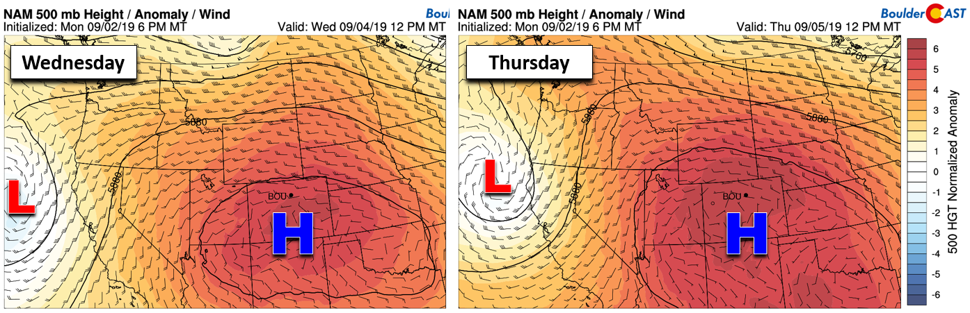
NAM 500 mb height anomaly forecast for Wednesday (left) and Thursday (right). Look at that high pressure!
Late-week cold front
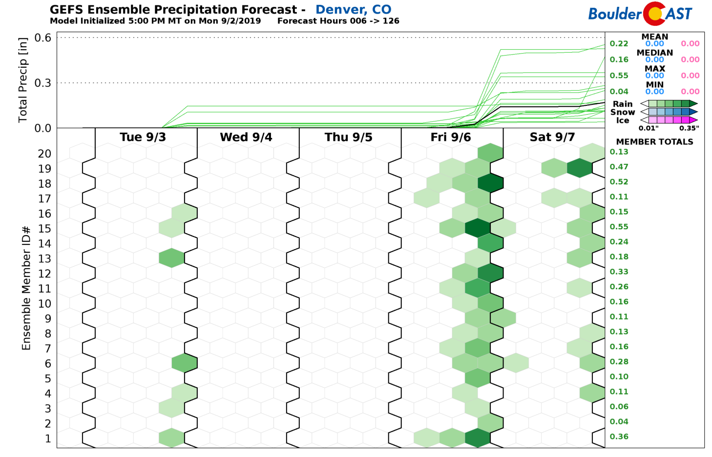
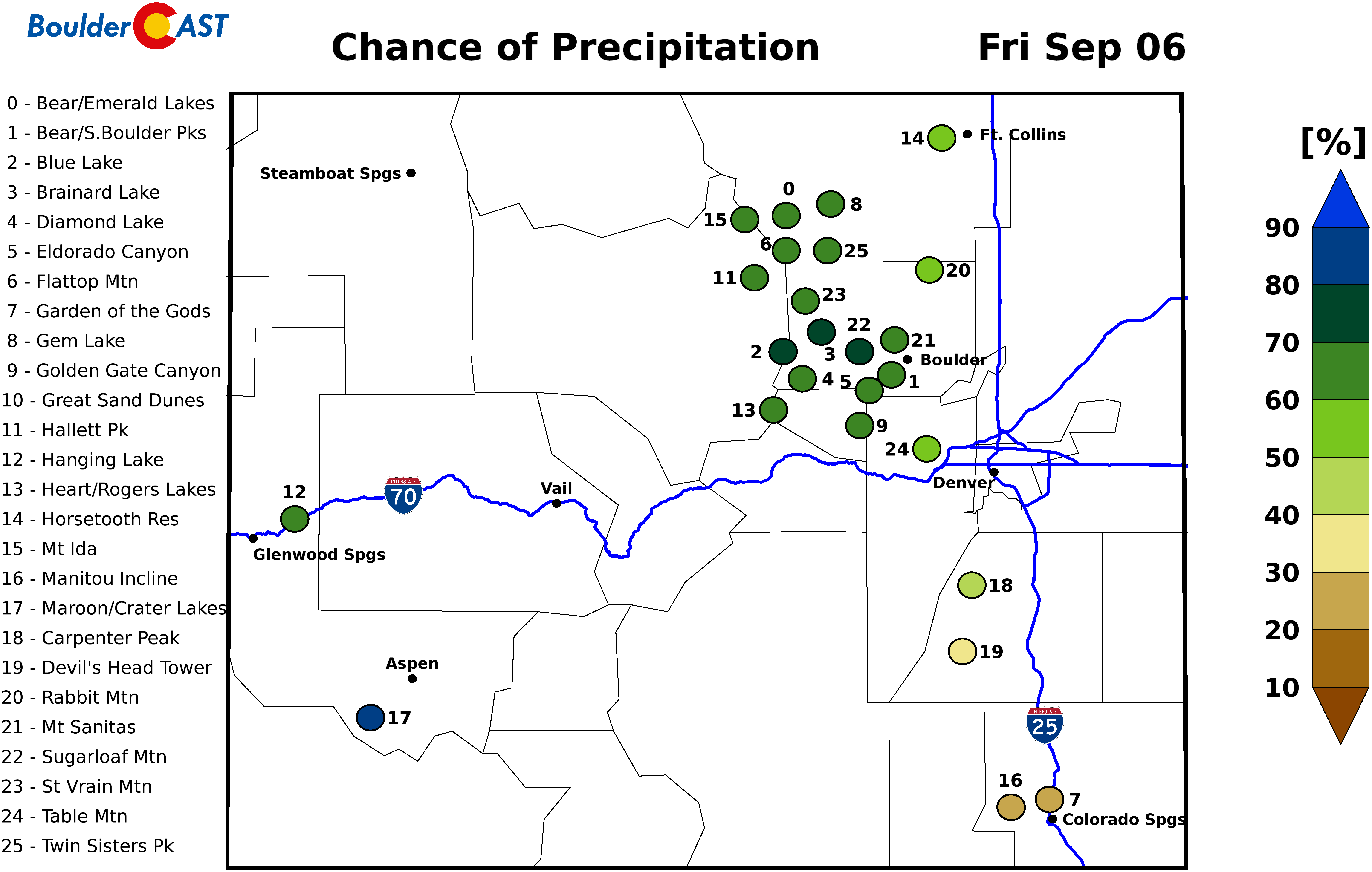
We’re currently tracking the potential for yet another cold front late in the week. The latest timing appears to be Thursday evening or night, with a stronger push of moisture and even a possible mid-level shortwave following suit. This will likely translate into our best chance of rain coming Friday afternoon and evening alongside cooler temperatures. At the very least, storms that do form shouldn’t have any trouble moving out across the Plains, with even heavy downpours on the table. High temperatures will drop back near 80 degrees on Friday. A similar chance of rain and temperature is in our forecast for Saturday as well when another weak cold front could impact the area.
Forecast Specifics:
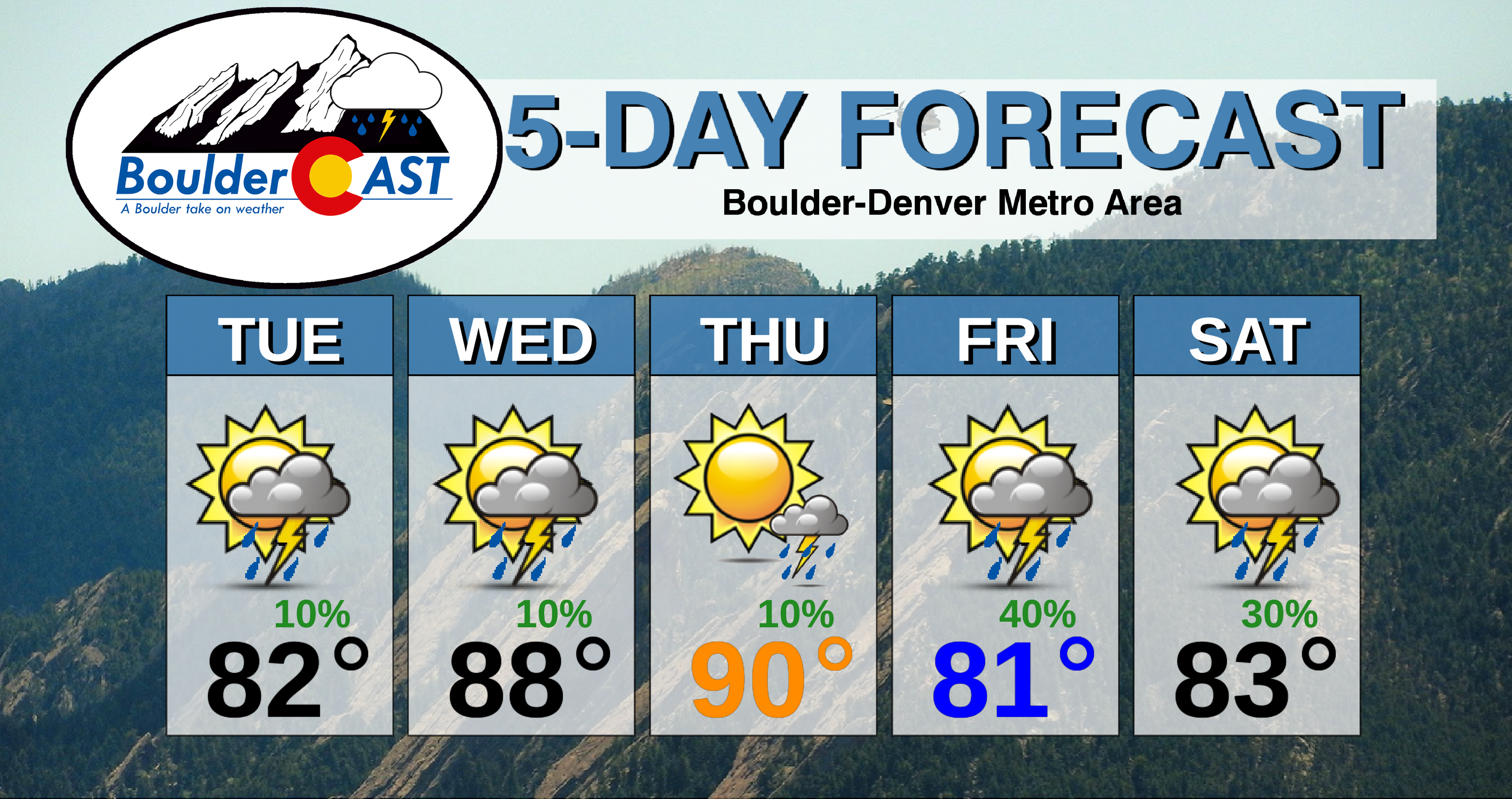
Tuesday: Partly cloudy and much cooler with isolated afternoon and evening storms, mainly across the higher elevations. Highs in the lower 80’s for the Plains and in the middle 70’s in the Foothills.
Wednesday: Warmer with partly to mostly cloudy skies. Isolated afternoon and evening storms are possible. Highs in the upper 80’s on the Plains and middle 70’s for the Foothills.
Thursday: Increasing clouds with isolated afternoon and evening storms. High temperatures near 90 degrees on the Plains with upper 70’s in the Foothills.
Friday: Partly to mostly cloudy with scattered late-day storms. Cooler with highs in the upper 70’s to lower 80’s on the Plains and lower 70’s in the Foothills
Saturday: A mix of clouds and sun with scattered afternoon and evening storms. Highs in the upper 70’s to lower 80’s on the Plains and lower 70’s in the Foothills.
High Country: Despite the anomalously strong high overhead, deeper moisture will work back into the state of Colorado this week leading to isolated to scattered storms developing across the Mountain each day this week. Visit our SummitCAST page for updated forecasts for more than 120 Colorado mountain destinations, including all of our state’s majestic 14ers.
.
Spread the word, share our forecast!
.


You must be logged in to post a comment.