
Our cool and wet prediction for the month of August has held true thus far. The city of Boulder is currently riding a streak of 17 consecutive days of below normal temperatures. Furthermore, the last 90-degree afternoon was nearly three weeks ago. Will the upcoming week continue the trend? Read on to find out!
The active pattern of late will largely continue for the week ahead with several weak disturbances skirting across Colorado. While moisture will remain elevated, it’s NOT monsoonal in nature. The persistently perturbed atmospheric flow is more akin to autumn than it is of summer. Temperatures will remain at or slightly below normal through the week.
Active first half of the week
Early in the week, Colorado will be in the middle-grounds between a weak ridge across the central Great Plains and a trough digging into Nevada and Idaho. The result can be seen below…a continued influx of moist southwesterly flow.
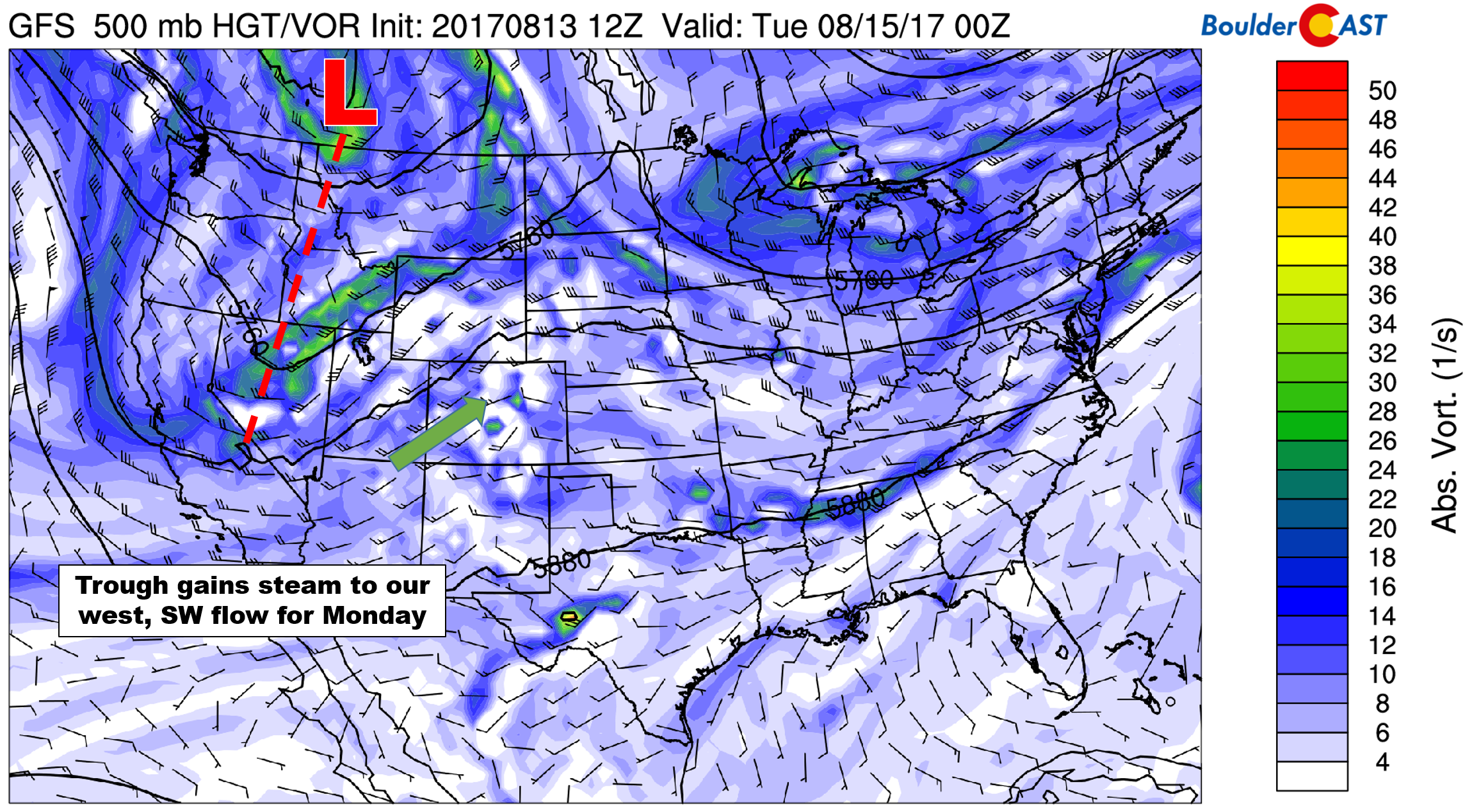
GFS 500 mb vorticity forecast map for Monday evening
On Monday, before the trough’s influence is fully realized, this moisture will equate to afternoon clouds and widely scattered storms rolling off the higher terrain. At this time, instability isn’t overwhelming, so we’re not expecting severe storms. A few cells did turn severe this past weekend dropping ~1″ sized hail on parts of the Denver Metro area. Highs Monday will be right around average in the middle 80’s.
Our best chance of rain for the week will likely come Tuesday evening and night as the trough axis moves through the Denver Metro area. While the nighttime passage is less than ideal for thunderstorms (no solar heating!), it should provide enough additional lift to produce scattered showers and a few storms for the region.
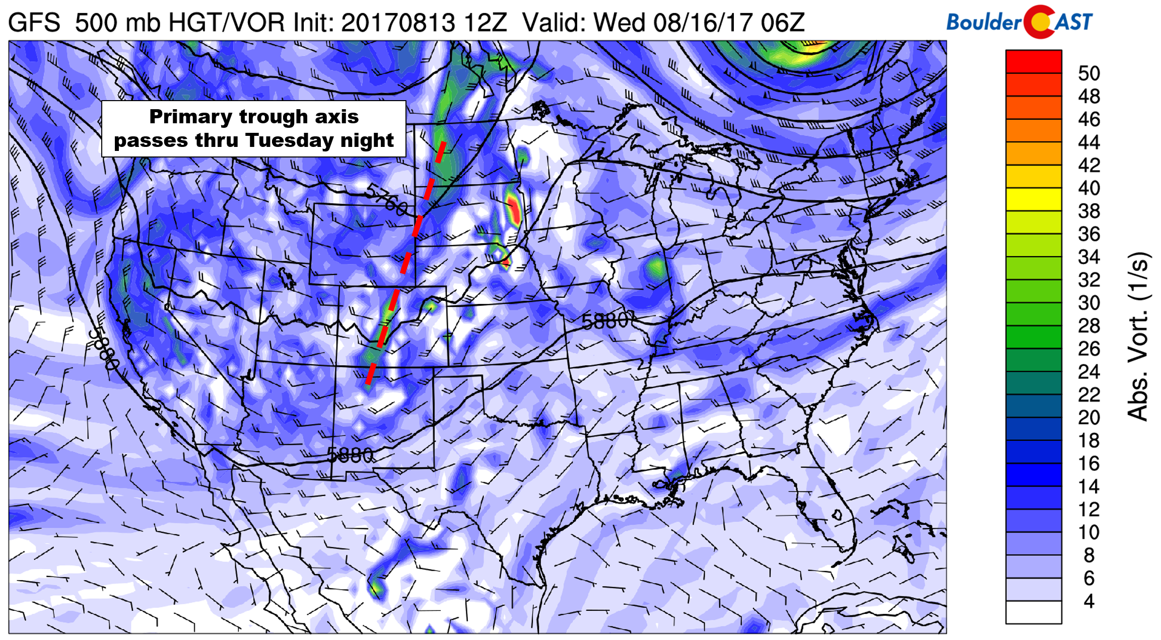
GFS 500 mb vorticity forecast map for Tuesday night
At the surface, a weak cold front will accompany this trough and act to enhance storm activity Tuesday after sunset. The shallow front’s positioning Wednesday morning, banked up against the Foothills, is shown below. This influx of low-level moisture and upslope could produce some low clouds, fog, and drizzle Wednesday morning.
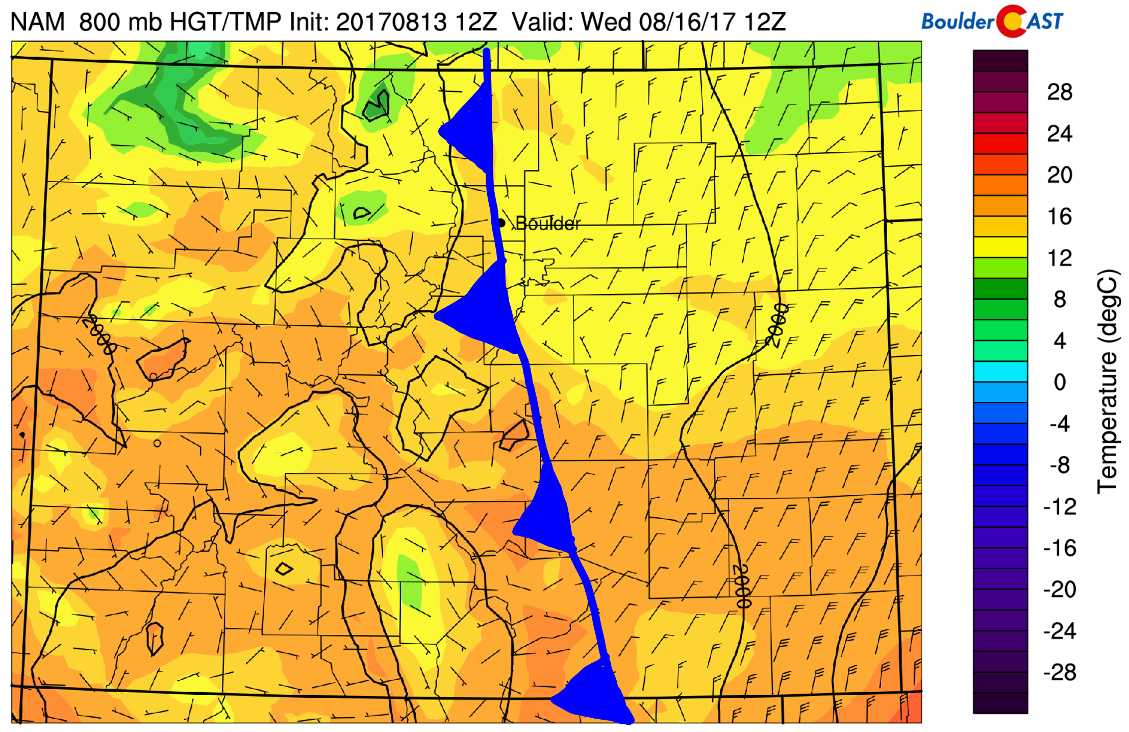
NAM 800 mb temperature and wind forecast for Wednesday morning showing the “cool” front across eastern Colorado
This front won’t be nearly as strong as the one a week ago, but it will cool things down slightly for most of eastern Colorado. After highs reach into the middle 80’s on Tuesday, post-frontal warming should top out in the upper 70’s on Wednesday.
A relatively stable post-frontal airmass will be in place Wednesday afternoon across the lower elevations. This should prevent most storm activity, but a few isolated cells popping up across the High Country is not out of the question.
Late week maybe stormy, too.
Despite model disagreement for the latter part of the week, it appears a slightly calmer pattern will carry us into the weekend. Both Thursday and Friday should see west-northwest flow in the mid-levels of the atmosphere (see below)…a drier one at that. The uncertainty lies in the potential passage of two shortwave troughs…one Thursday night and one Friday night. Some model runs are showing these features, which could help to enhance storm chances both days. While we can’t rule out isolated storms both days for northern Colorado, there is a fair to good chance most locations will remain dry both days. Temperatures each day will be in the low to middle 80’s.
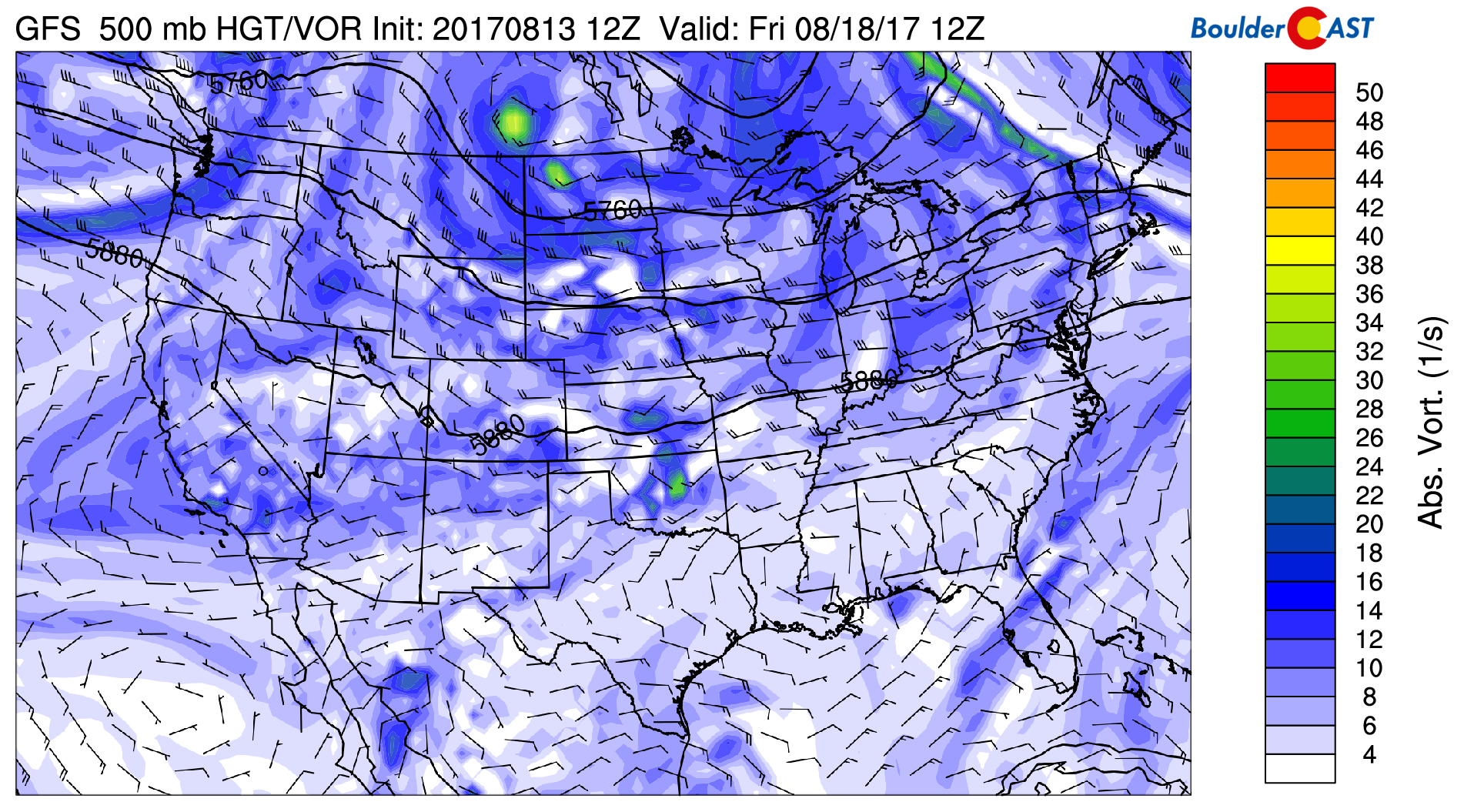
GFS 500 mb vorticity forecast map for Friday morning
Not much looks to change for the upcoming weekend as weak systems and generally westerly flow dominate our pattern. Expect a 10-30% chance of storms and temperatures in the 80’s for both Saturday and Sunday.
Forecast Specifics:
Monday: Morning sunshine with increasing clouds and widely scattered scattered afternoon and evening thunderstorms. Highs will climb into the mid 80’s on the Plains, with mid 70’s in the Foothills.
Tuesday: Some sun early, then mostly cloudy skies by late afternoon. Expect widely scattered storms through the evening, with storms lingering into the overnight hours. Highs in the mid 80’s across the Plains, with mid 70’s in the Foothills.
Wednesday: Mostly cloudy in the morning with the potential for low clouds, fog, and drizzle. Skies should become partly cloudy in the afternoon with extremely isolated thundershowers possible, mostly across the higher terrain. Temperatures cooler in the upper 70’s across the Plains and near 70 in the Foothills.
Thursday: Lots of morning sunshine giving way to partly cloudy afternoon skies and a few isolated thunderstorms. Highs to warm up back into the low 80’s on the Plains and low 70’s in the Foothills.
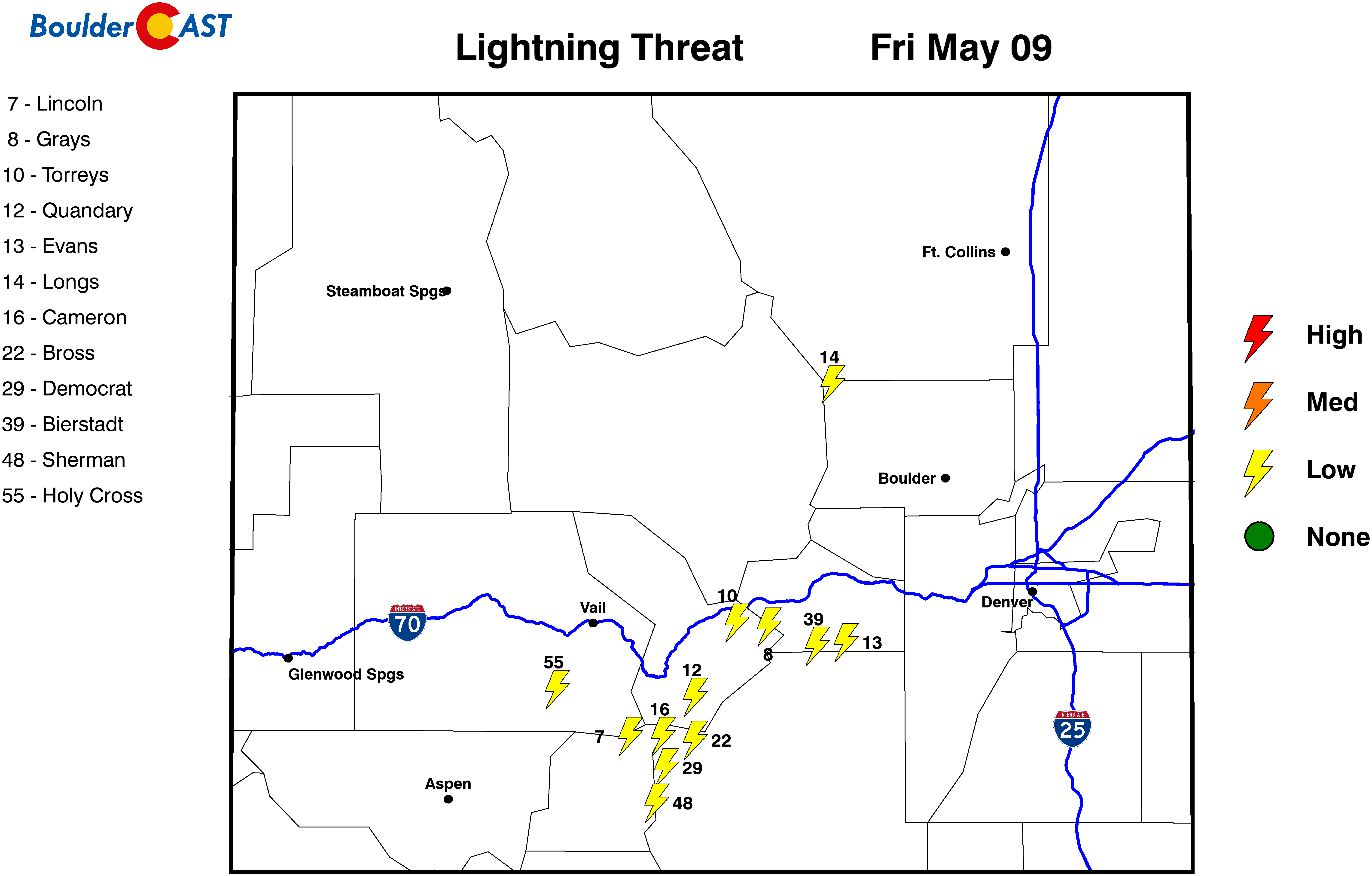
Friday: Mostly sunny with isolated afternoon and evening thundershowers. Highs will likely be in the low to middle 80’s for the Plains, with low 70’s in the Foothills.
High Country: A great weather-week is shaping up for the Mountains. Monday and Tuesday will have the biggest threat for storms due to elevated moisture, probably just scattered in nature though. While we can’t rule out storm activity Wednesday through Friday, storms should generally be isolated these days with most areas remaining high and dry.
Find the best days to hit the mountains with our SummitCAST page. The first 2 days are always free. Upgrade to BoulderCAST Premium to unlock all 6 days.
| Day: | Parameter: |
|---|

Share our forecast:
Mon
Tue
Wed
Thu
Fri


Temperature
87
83
79
83
82


Precip Chc (Plains)
20%(pm)
30%(pm)
10%
10%(pm)
20%(pm)


