After a somewhat surprising urban flood scenario in Boulder on Sunday, smoky air and a heatwave will again be the forecast headlines this week for the Front Range as a strong ridge of high pressure develops just to our north and east. High temperatures will remain in the 90’s through Friday with just meager late-week rain chances. With a staggering number of large wildfires burning upstream, smoke will stay the course this week as well. Read on for our complete forecast of the week ahead.
This week’s highlights include:
- Heavy, flooding rains were observed in portions of Boulder Sunday evening producing more than 2″ of rain in spots
- A potent ridge develops across northeast Colorado leading to hot weather for much of the country through the week, including the Denver Metro area
- The monsoon remains redirected to the west with mostly dry conditions expected in the Front Range this week
- A series of weak cold fronts will supply moisture late in the week into the weekend allowing for some storm chances
- Unfortunately, smoke remains elevated through the week with many large fires burning across the Pacific Northwest and northern Rockies
DISCLAIMER: This weekly outlook forecast is created Monday morning and covers the entire upcoming week. Accuracy will decrease as the week progresses as this post is NOT updated. To receive daily updated forecasts from our team, subscribe to BoulderCAST Premium.

The heaviest rainfall since the 2013 flood!
We begin this week’s weather discussion with a look back at the flooding rains that occurred Sunday evening. If you’re wondering to yourself “What on earth? It didn’t rain on Sunday?”, you likely don’t live in western or southern Boulder. Almost out of the blue, a slow-moving, strong thunderstorm developed directly over Boulder Sunday evening around 6:15 PM and lasted for more than an hour in spots. The radar animation from the evening, shown below, tells the story and indicates that this torrential thunderstorm was triggered by an outflow boundary colliding with an existing weak thunderstorm in the lower Foothills west of Boulder. The outflow originated about 70 miles to the southeast in Limon and took nearly four hours to reach the Boulder area! Talk about a perfect storm!
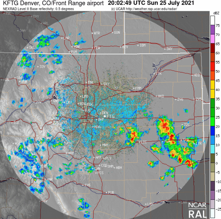
Radar animation from Sunday evening showing the outflow boundary and resulting strong thunderstorm that popped over Boulder
Heavy, persistent rainfall with this storm caused urban street flooding west of Broadway. This was the view from 9th & Balsam after the storm.
Massive flooding at 9th/Balsam in Boulder. Avoid the area. #boulder pic.twitter.com/BhRgELGUPs
— Julie Pearl (@juliebpearl) July 26, 2021
Radar estimates and cooperative observations indicate that more than 2″ of rain fell in west-central Boulder in around 60 minutes! This may be the heaviest rain the area has seen since the 2013 Flood.
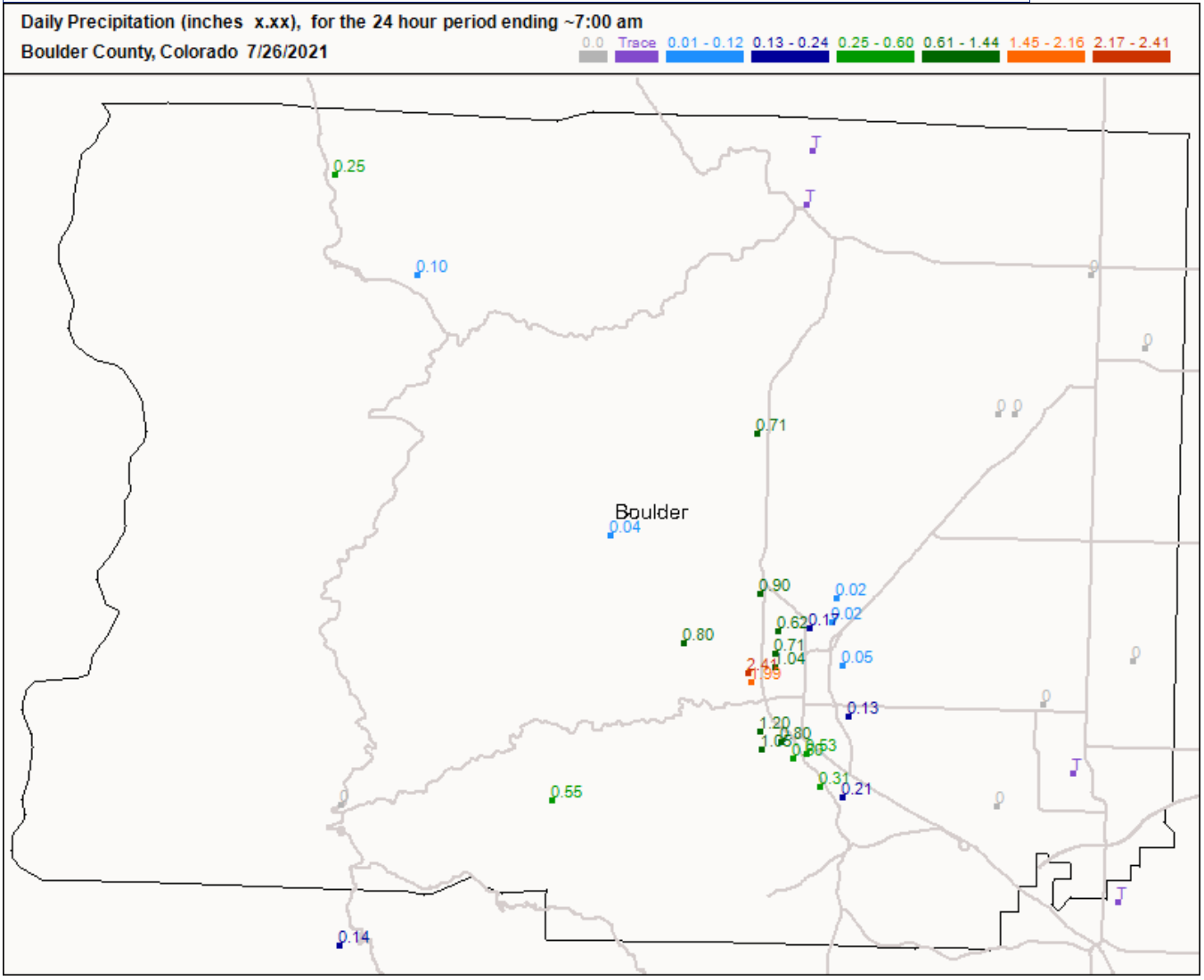
Observed rainfall totals from Sunday evening in Boulder County
A mostly hot & dry week under high pressure
The weather focus for the week ahead will unfortunately be another large ridge of high pressure developing across the western United States. Unlike our last few persistent ridges, this one will be located a bit further east and is forecast to sit directly over the merger point of Colorado, Kansas and Nebraska for several days. This positioning will lead to hot conditions for much of the lower 48 states, including the Front Range. The GFS 500mb height anomaly forecast animation below spans the entire week into Friday night. Notice how the ridge intensifies through the week and where the center is located.
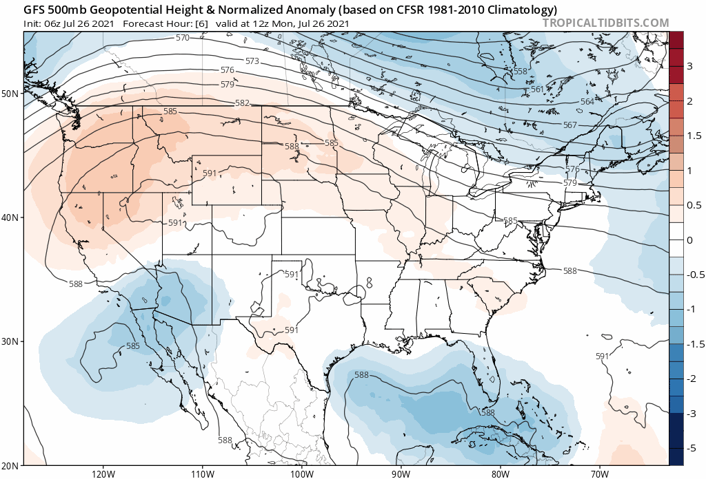
GFS 500mb height anomaly forecast animation through Friday night
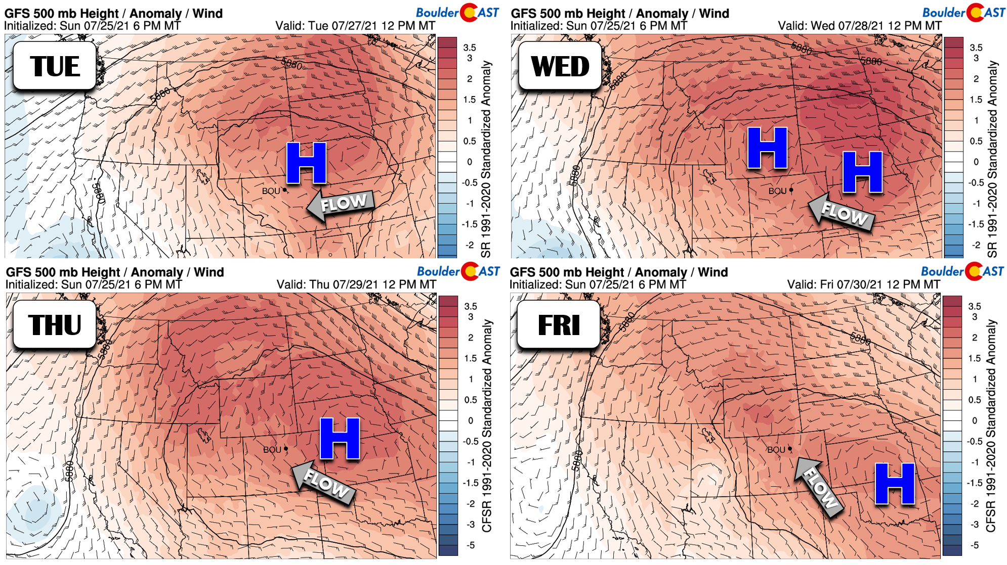
A more detailed breakdown of the ridge by day is shown below. The high pressure migrates from northeast Colorado Tuesday into Oklahoma by Friday. This is very slow progress and weather for us won’t change too much during this time; it will be hot and mostly dry. However, similar to other heatwaves this summer already, the large-scale flow pattern across our area will NOT be favorable for extreme, record-setting heat. Deep easterly flow early in the week will veer to become south-southeasterly by week’s end. This will facilitate an influx of relatively cooler, though still hot, air to the Front Range through the week.
With this easterly and southeasterly flow expected in Colorado through late week, moisture will be very hard to come by. Monsoonal flow into the Desert Southwest will relax somewhat and also shift to the west. Essentially…Arizona, southern California and Nevada will be the only ones in the monsoon game this week.
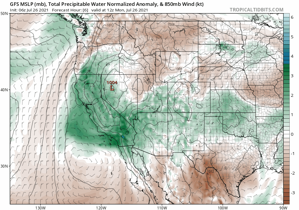
GFS precipitable water anomaly forecast through Friday night
Instead, moisture influx and precipitation chances for the Denver Metro area will largely be tied to mid-latitude cold fronts dropping southward across the center of the country. These will pump-up low-level moisture and seed the return of thunderstorm chances for our area, though don’t get your hopes up. The first front looks to arrive on Thursday, followed potentially by another stronger front on Saturday. After a hot and bone dry stretch through Wednesday for us, isolated storms will return to the forecast Thursday and Friday.
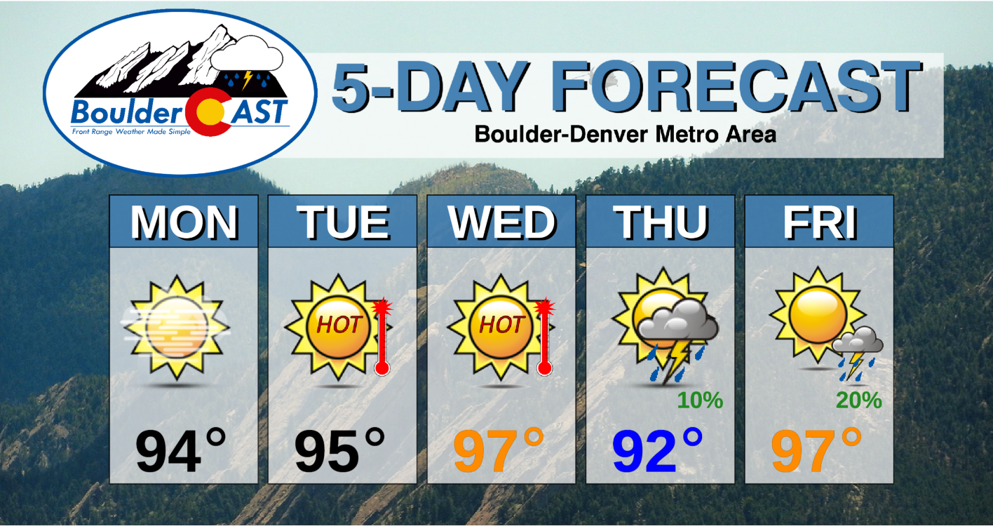
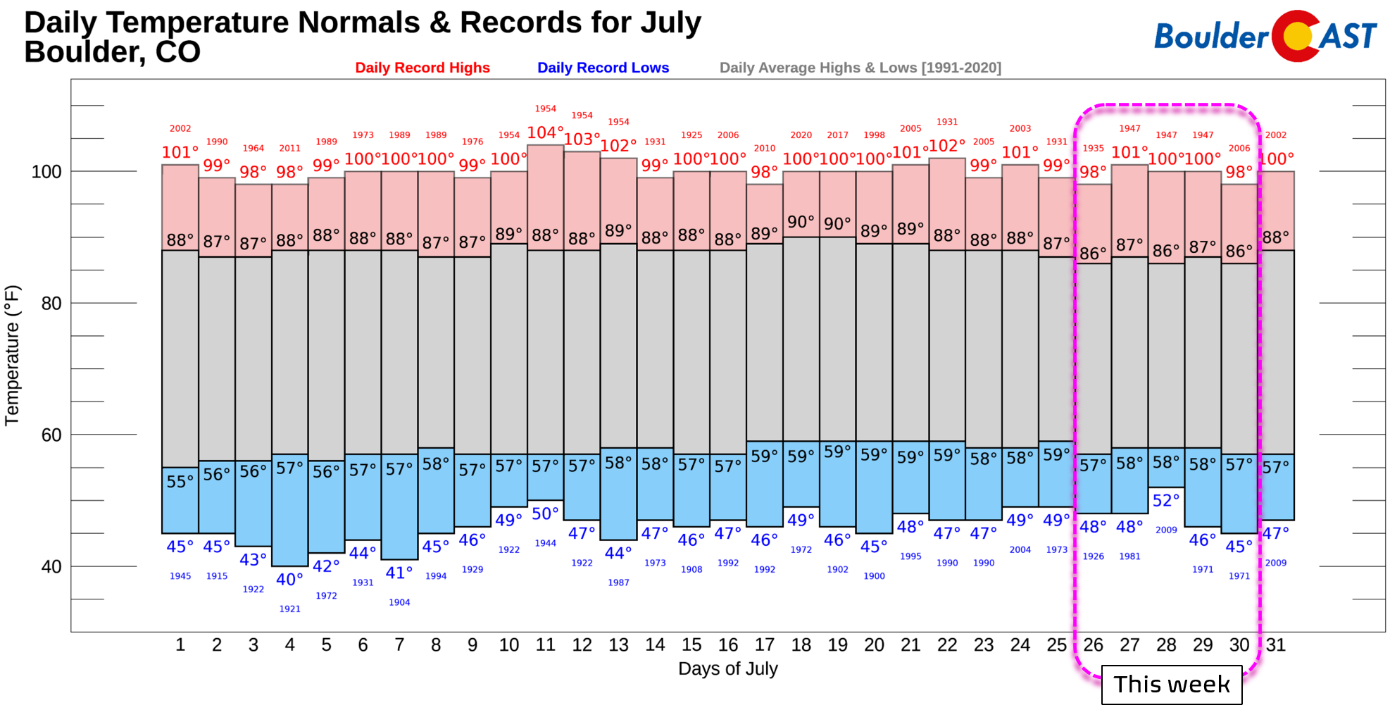
As mentioned, the heat dial will be turned up this week. Temperatures will remain in the 90’s through Friday, with perhaps Wednesday and Friday offering a slight chance for portions of the Denver-Boulder area to hit 100 degrees.
Comparing our team’s temperature forecast (above) with the existing record highs in Boulder (below), it’s noteworthy that most days will come up several degrees short of record territory during this heatwave. Right now it appears that Friday may be the day to watch for any record-breaking heat, but five days out we wouldn’t place any bets yet!
Smoke will continue to be elevated this week across the area. There are so, so many large wildfires burning across Montana, Oregon, Idaho, California, Washington and British Columbia right now. The atmosphere over the northern Rockies is absolutely loaded with smoke with no improvement in sight. This is the terrible view from space just before sunset yesterday (Sunday evening)…
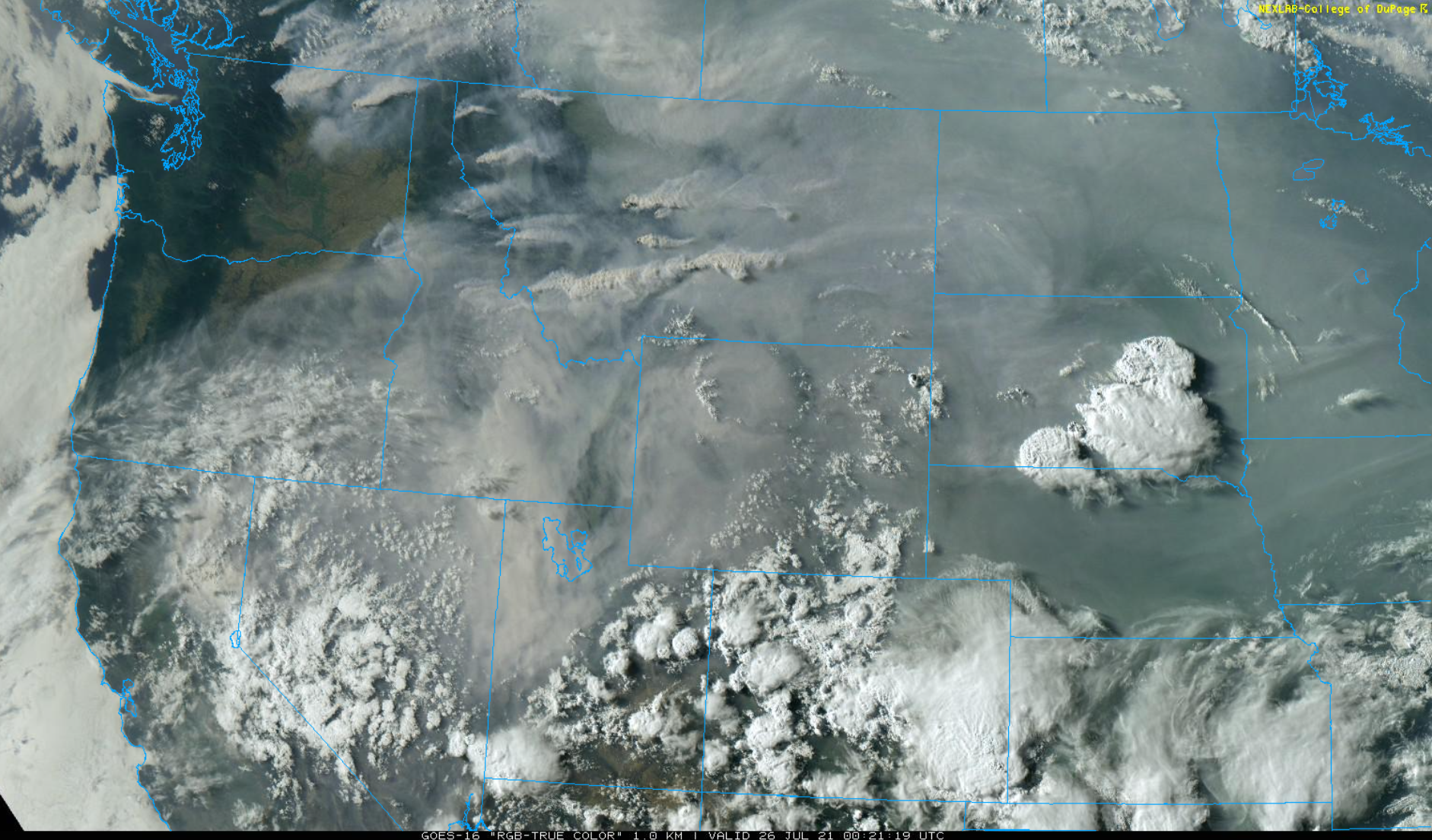
GOES-East visible satellite view from Sunday evening. So many fires. So much smoke.
Our latest smoke forecast shows the potential for short-lived bouts of improvement in our area early this week as less smoky air arrives from the east and southeast. However, the Front Range remains right on the edge of the smokiest airmass. We’re more confident that southern Colorado will see clearer air this week, while northern Colorado is likely to remain quite smoky through the week.
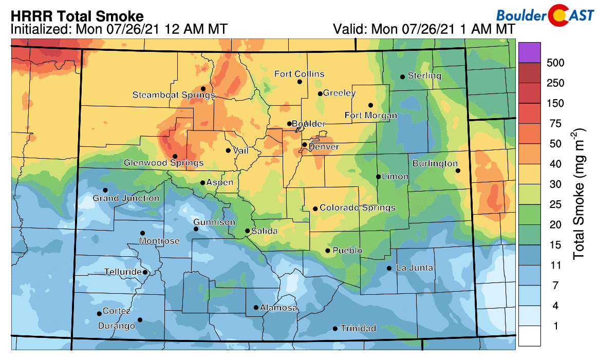
Smoke forecast for Colorado covering Monday into Tuesday night
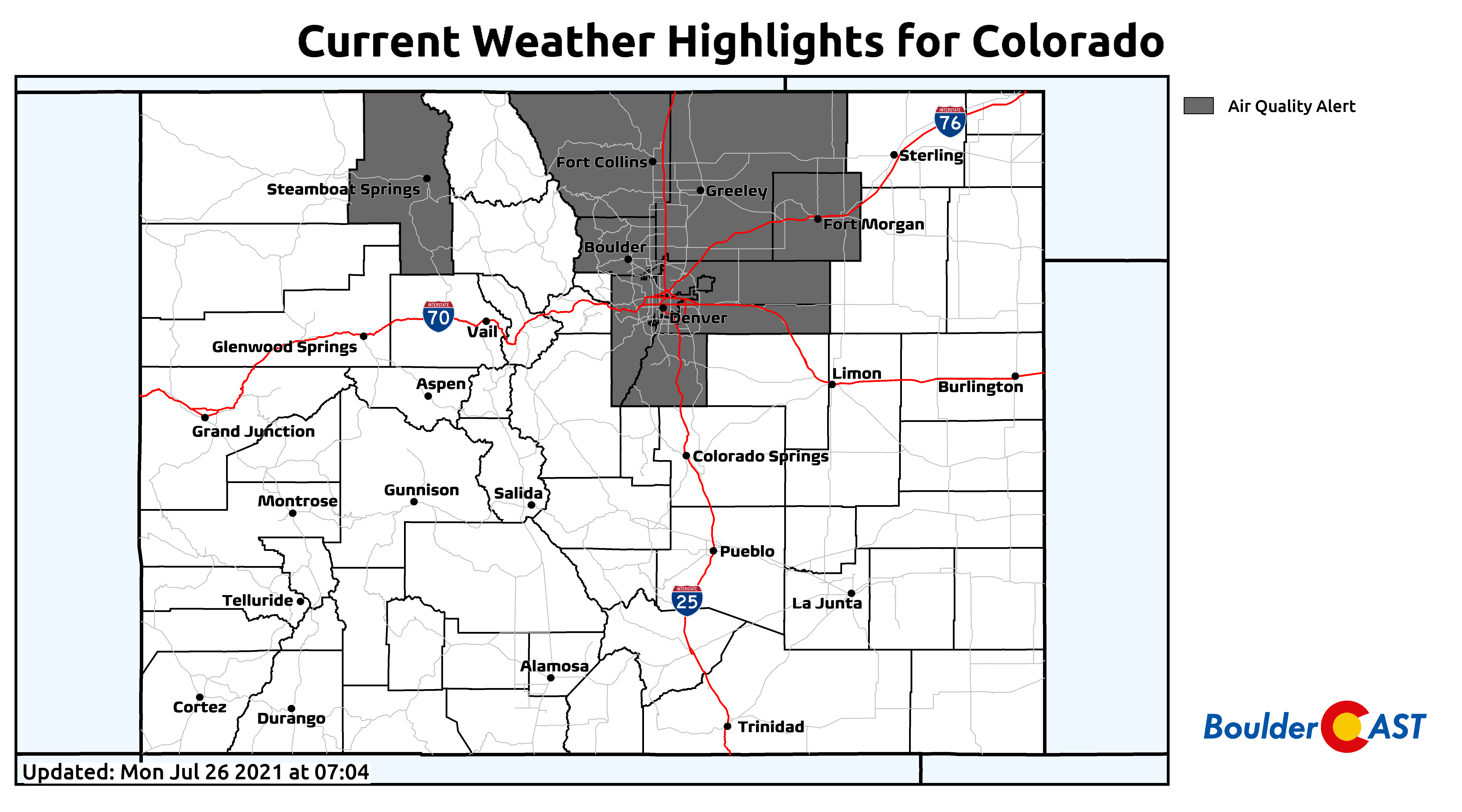
The aforementioned late-week cold fronts will certainly usher in a ton of smoke at the low-levels, so brace for it. Air Quality Alerts are poised to remain in effect for the next five days or more. Ugh! We’re so over this summer’s smoke…
Stay up to date with Colorado weather and get notified of our latest forecasts and storm updates:
We respect your privacy. You can unsubscribe at any time.
.
Forecast Specifics:
Monday: Mostly sunny, hot and smoky with highs in the middle 90’s on the Plains with lower 80’s in the Foothills.
Tuesday: Hot and sunny with highs in the mid to upper 90’s on the Plains and in the middle 80’s in the Foothills.
Wednesday: Mostly sunny and hot with temperatures reaching the upper 90’s on the Plains with middle 80’s in the Foothills.
Thursday: A mix of clouds and sun and slightly cooler with a very slight chance of afternoon and evening thunderstorms. Highs in the low to middle 90’s on the Plains with lower 80’s in the Foothills.
Friday: Mostly sunny and continued hot with isolated late-day storms. Temperatures reach the mid to upper 90’s on the Plains with middle 80’s in the Foothills.
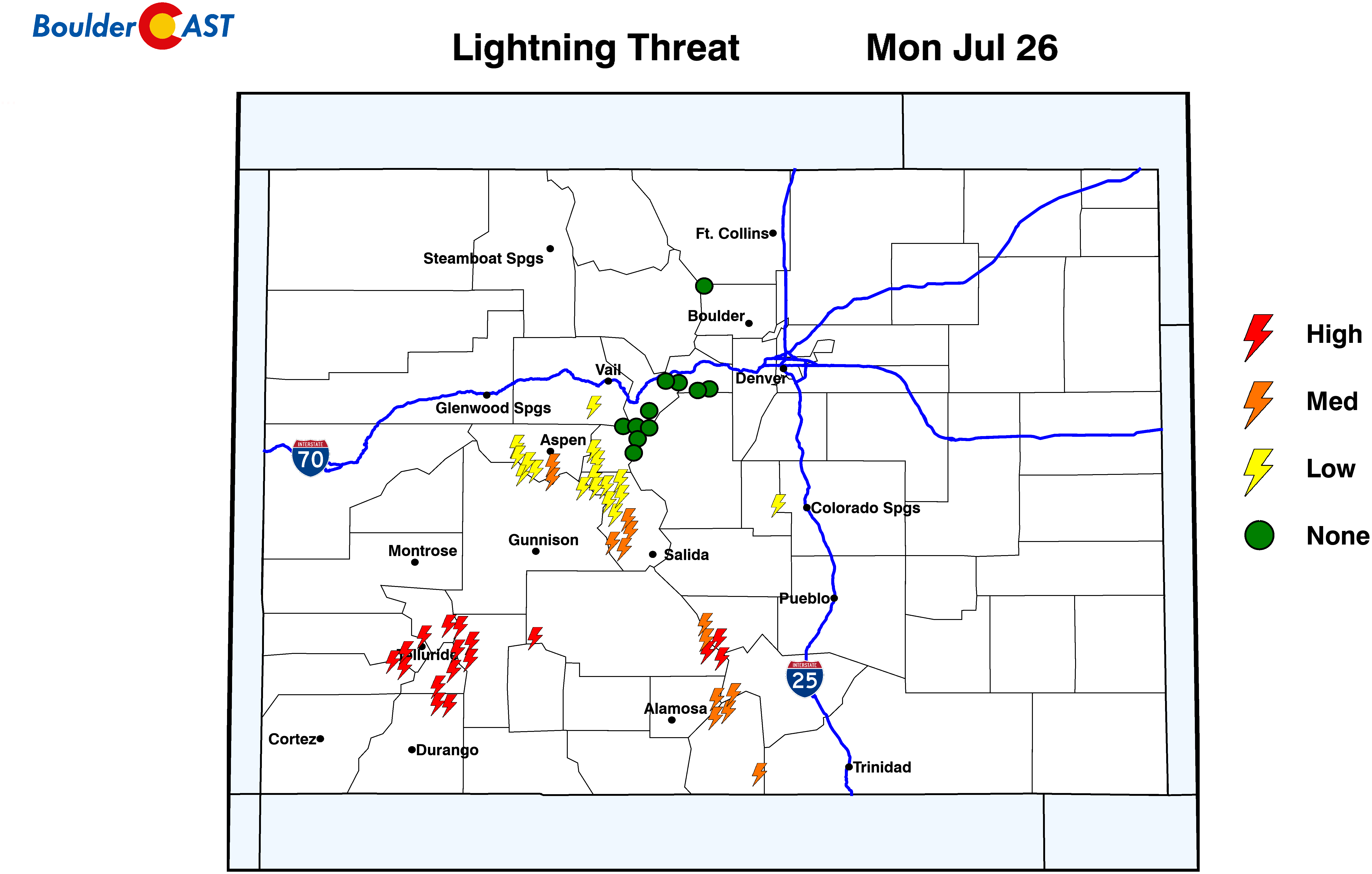
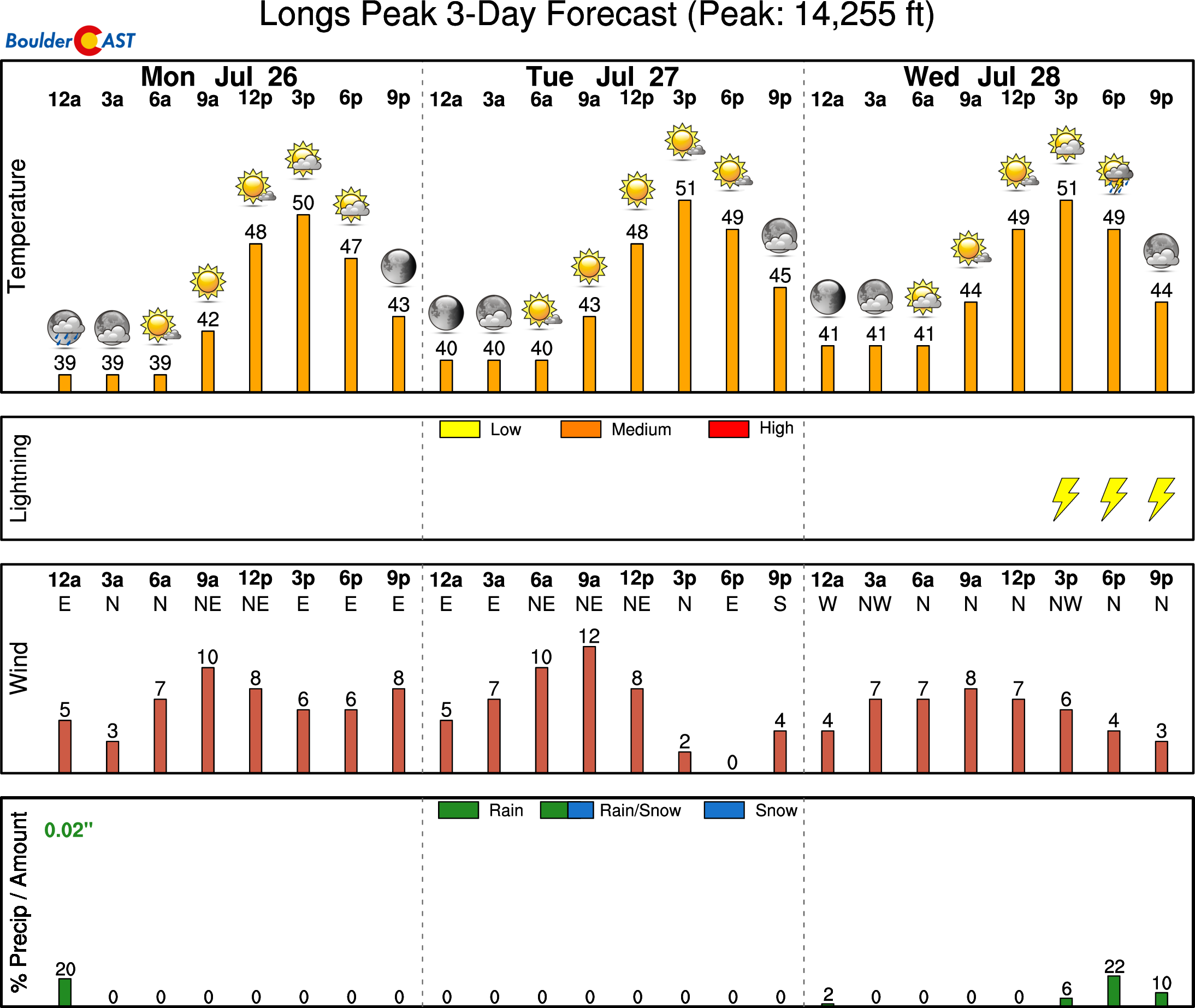
Mountains: Isolated to scattered thunderstorms will be possible in far southern and western Colorado each day this week where more moisture is present. The northern and central Mountains will largely be dry through Wednesday. Friday into the weekend will see moisture return and daily scattered to widespread storms across the higher terrain. Keep an eye to the sky!
Help support our team of Front Range weather bloggers by joining BoulderCAST Premium. We talk Boulder and Denver weather every single day. Sign up now to get access to our daily forecast discussions each morning, complete six-day skiing and hiking forecasts powered by machine learning, first-class access to all our Colorado-centric high-resolution weather graphics, bonus storm updates and much more! Or not, we just appreciate your readership!
.
Spread the word, share the BoulderCAST forecast!
.


You must be logged in to post a comment.