The winter storm advertised by the weather models remains on track to bring snow and much colder temperatures to the region tonight. We provide a timeline for the storm and our final snowfall forecast map.
Little to no updates need to be made to our forecast from this past Friday. The models remain consistent in bringing the first snow of the season to the lower elevations tonight, and potentially more than a foot to some locations in the Foothills!
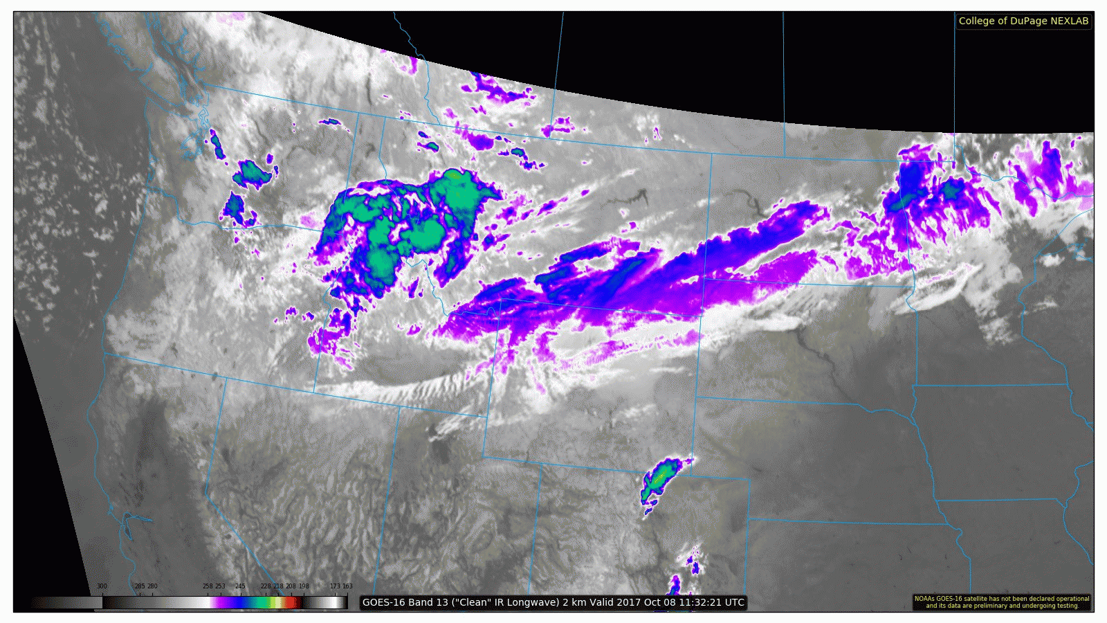
As of 10 AM, a look at infrared satellite shows the storm currently located over northern Wyoming. The system will slide south and east into Colorado tonight.
TIMELINE OF EVENTS:
- Sunday afternoon: Plentiful sunshine and with temperatures rising into the low 70’s. Enjoy the “warm before the storm”…
- Sunday ~9:00 PM: A strong cold front arrives from the north with gusty north winds up to 35 mph. Precipitation will begin as rain on the Plains, with all snow above 7,000 feet.
- Sunday night 10:00 PM to 2:00 AM: Temperatures will plummet into the 30’s behind the front on the Plains. Rain should fully change-over to snow from north to south by 2:00 AM at the latest (probably sooner for the northern Metro).
- Monday 2:00 AM to Noon: Widespread moderate snow will continue across the region. Rates could exceed 1″ per hour in heavier bands, especially in the Foothills. Breezy conditions will cause some drifting snow. This is the time-frame when a bulk of our snow accumulation will occur.
- Monday afternoon into early evening: Snow will decrease in coverage and intensity and wind-down in most locations as the storm pulls eastward into Kansas. Monday’s high temperatures will be 30 degrees below normal …only in the middle 30’s in the Plains with 20’s in the Foothills.
- Monday night: With skies at least partially clearing, temperatures will fall into the 20’s for our first hard freeze of the season. Expect teens in the Foothills.
- Tuesday: The snow melts as temperatures rebound back into the 50’s with sunshine.
SNOWFALL FORECAST CONSIDERATIONS:
- While the models remain in remarkably good agreement on the overall track and intensity of the storm, the lower resolution models want to delay the change-over of snow across the Plains by 3 to 6 hours. The higher-resolution models, which should have a better grasp on the low-level cooling, turn things to snow around midnight. We’re going to side with the higher-resolution models in our forecast as all factors for us point towards this cooler and snowier solution.
- Upslope looks deep and moderately strong, at least up to 700 mb beginning as soon as the cold front passes and continuing into Monday afternoon.
- Jet dynamics will be in play for this storm, especially before sunrise Monday. Snowfall rates of 1 to 2″ per hour may be possible at times in a jet-forced snow band.
- The ground will be very warm so expect lots of melting of the snow that does fall. What you see on the ground may be considerably less than this forecast. The best places to measure will be on elevated or grassy surfaces.
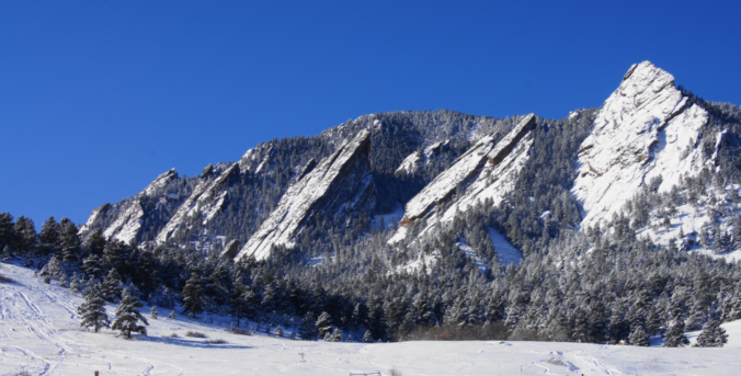
- The Foothills’ forecast is in good shape. Confidence in temperatures is much higher with the event being almost entirely snow.
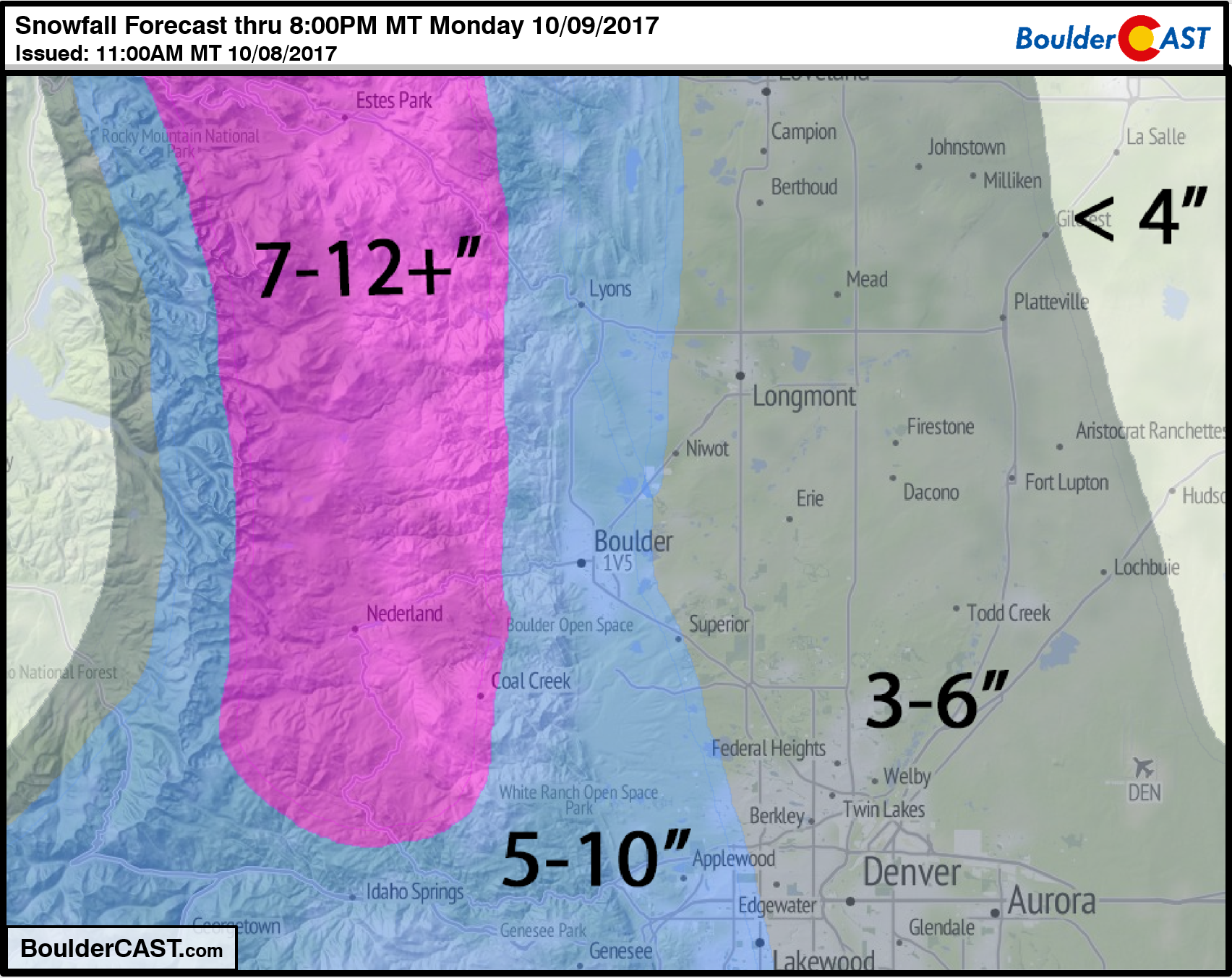
SNOWFALL MAP:
Watch for slick driving conditions Monday morning, especially in the Foothills. Roads across the Plains will likely remain just wet or slushy, with some accumulation on bridges, etc. Downed tree limbs and a few power outages are probable as well.
Our weekly outlook post will be out on Tuesday morning. Enjoy our first taste of winter!


You must be logged in to post a comment.