
Sun, heat, wind, and a few storms. Read on as we provide a quick, to-the-point forecast for the upcoming holiday weekend for the Plains and higher elevations.
Atmospheric Setup:
The main weather features to influence Colorado throughout the weekend will be a large trough to our west, and the ridge across the Mississippi Valley (seen below). Colorado will rest between the two. While the trough looks to dig southward all the way into northern Mexico by Monday (hello fall!) , it doesn’t propagate eastward much. As such, we’ll be in store for dry (ish) southwesterly flow through the weekend.
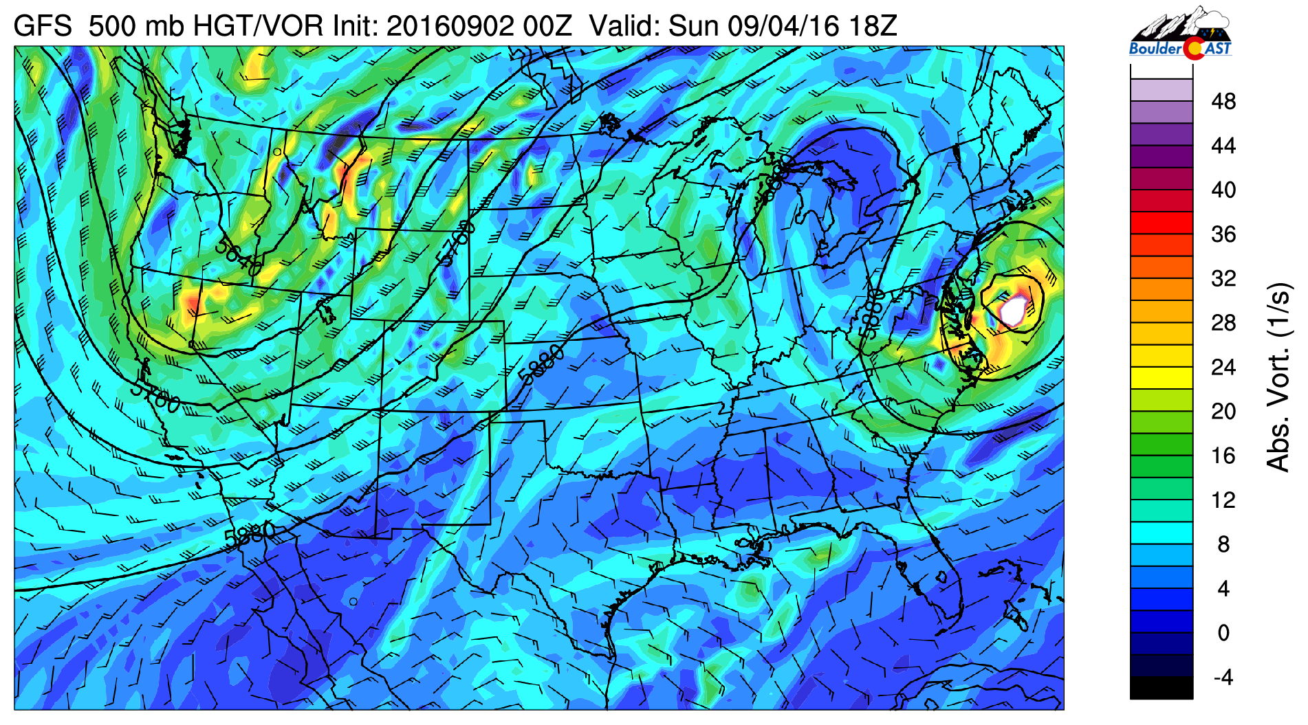
GFS 500 mb vorticity map for Sunday, showing Colorado in between a ridge and a trough, and Hermine off the eastern seaboard.
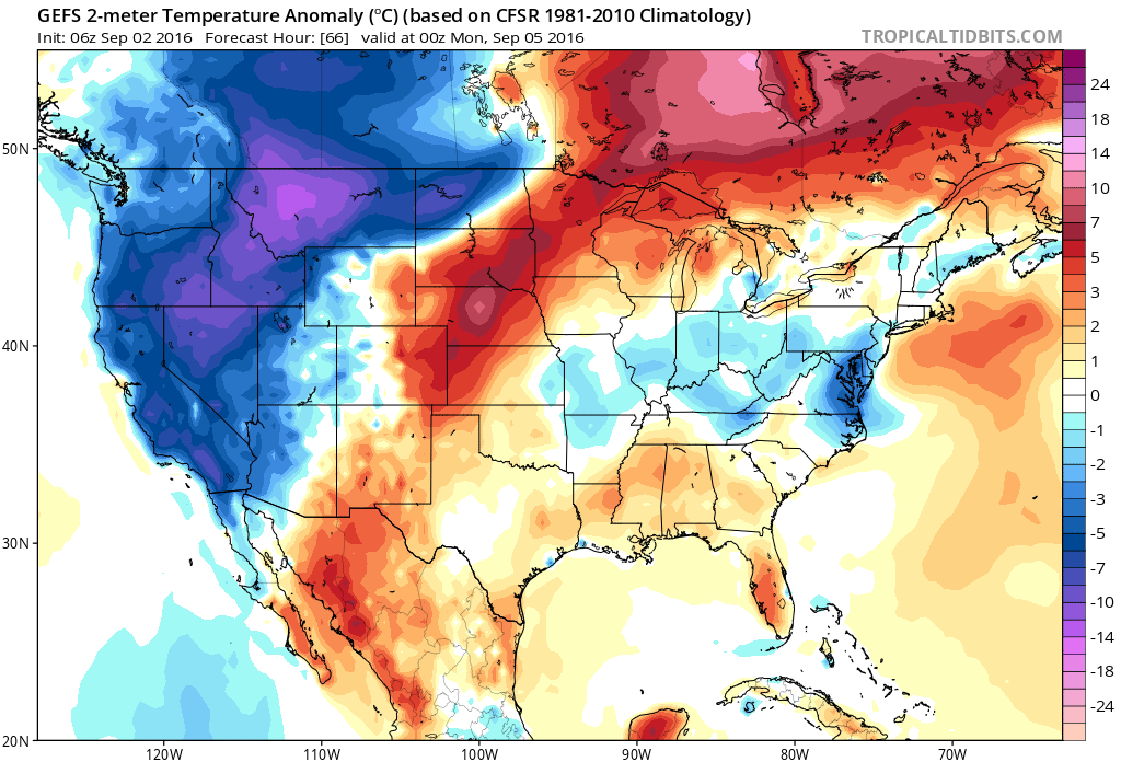
This setup will lead to above average temperatures, a good deal of sunshine, and only limited storm chances through the weekend. The surface temperature anomaly map for Sunday shows our above normal temperatures, as well as the very cold air looming to the west beneath the trough. As we mentioned, though, that cold air doesn’t look to be in hurry to move eastward at all.
One potential wrench in the forecast, particularly if you are heading to the higher elevations, is that the jet stream will be overhead both Sunday and Monday (and beyond). The 250 mb wind map below shows the jet on Monday, with 85 to 100 mph winds across northern Colorado (this altitude is about 35,000 feet).
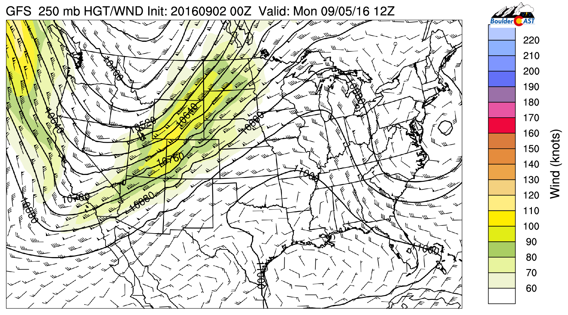
GFS 250 mb wind map map for Monday, showing a potent jet entering Colorado
At 500 mb (just above the height of our 14ers), winds increase from near 10 mph early Saturday to 40-50 mph Sunday and Monday. If you plan to head out for some late-season peak bagging, prepare for blustery conditions.
The dry downslope nature of the winds up and down eastern Colorado could allow for Red Flag Warning conditions to be met. Let’s just say it looks possible, if not probable at this point, especially Sunday afternoon, and possibly again on Monday. Be careful with your fires out there (if they aren’t banned altogether).
Enjoy the long weekend. It should be the exclamation point on SUMMER!
Forecast Specifics:
Saturday: Increasing clouds with lingering storm chances, especially across the Foothills and Mountains. Only isolated storm chances on the Plains. Highs will be in the upper 80’s across the Plains, with mid 70’s in the Foothills.
Sunday: Sunny, hot, and gusty. Dry everywhere. Fire weather conditions may be in place during the afternoon and evening. Highs on the Plains in the low 90’s, with upper 70’s in the Foothills.
Monday: Mostly sunny with a few isolated late day storms, primarily south of Interstate 70. The Denver Metro should remain dry. Breezy winds for the Foothills. Highs in the mid 80’s for the lower elevations, with low 70’s in the Foothills.


