
The atmosphere over the last several weeks has been transient across the western United States, with frequent (but weak) systems always keeping us on our toes. We haven’t had an extended period of persistent weather in quite some time. That changes this week as a ridge builds in across the region, bringing a sense of consistency to the forecast once again. Be that as it may, the ridge won’t bring entirely dry and sunny weather. Read on for our full outlook of the week ahead.
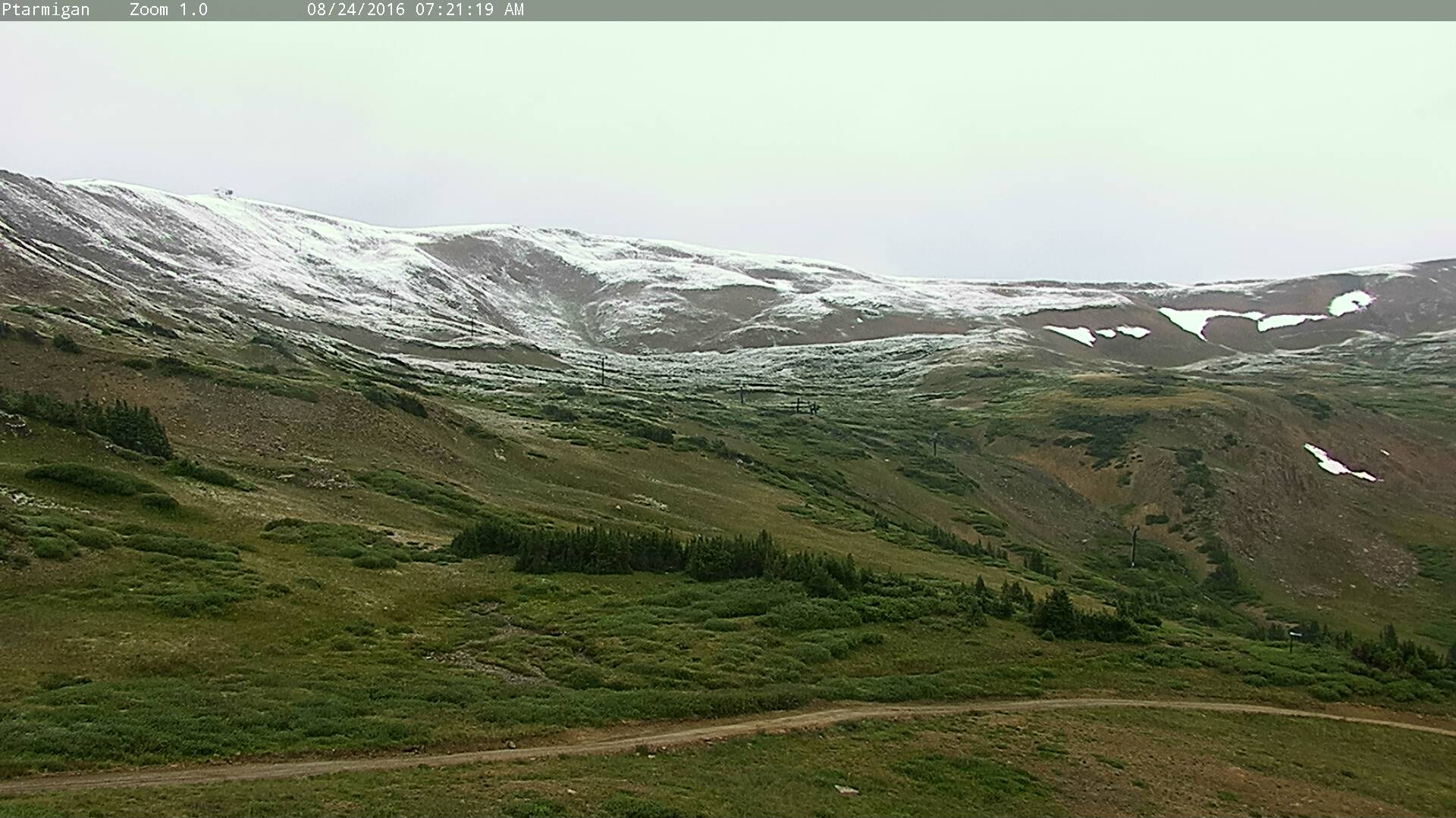
Loveland ski area at the end of last week. Just one of many high mountain locales across the state to see a dusting of snow
A little house cleaning
Despite a true taste of autumn last week, and even the first widespread snow since June in the highest elevations, warm (but not hot) conditions will make their presence known this week beneath a ridge of high pressure. However, before the ridge fully gets situated, a weak piece of energy across Colorado will run its course today.
In the 500 mb vorticity map below, notice the ridging across the western United States, with an axis situated across Montana. Underneath the ridge, you will notice the weak disturbance. It is so weak that it doesn’t even have its own height contour, and is only noticeable by the counter-clockwise rotation and elevated vorticity near the Four Corners region.
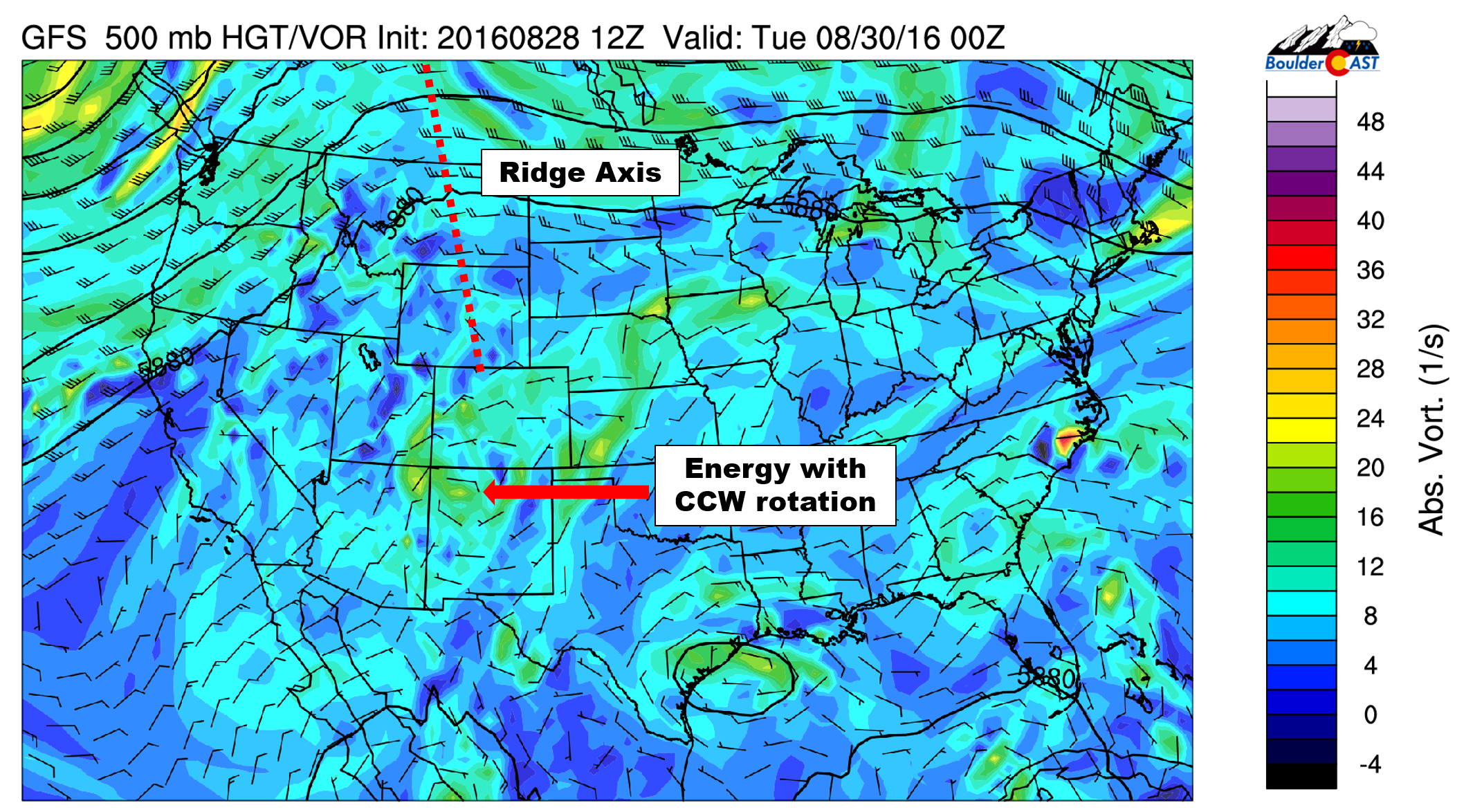
GFS 500 mb vorticity map for Monday, showing the ridge and embedded piece of energy undercutting it
This little guy was responsible for yesterday’s clouds and rain, and will impact our weather similarly today. In fact, our best chance of rain for the entire week will be this afternoon and evening. However, a combination of weak energy, limited moisture, and the southern track won’t push rain chances overwhelmingly high in the Metro Area. Look for just scattered storms today, alongside plenty of clouds and a temperature in the low 80’s.
Ridge begins to take shape
By Tuesday, that energy has weakened even further and has propagated eastward. This leaves the door open for the ridge to intensity, and it does just that. This evolution is seen in the 500 mb maps below for Tuesday (left) into Thursday (right). While the axis is almost perfectly centered across Denver on Tuesday, it slowly slides eastward into Kansas by Thursday.
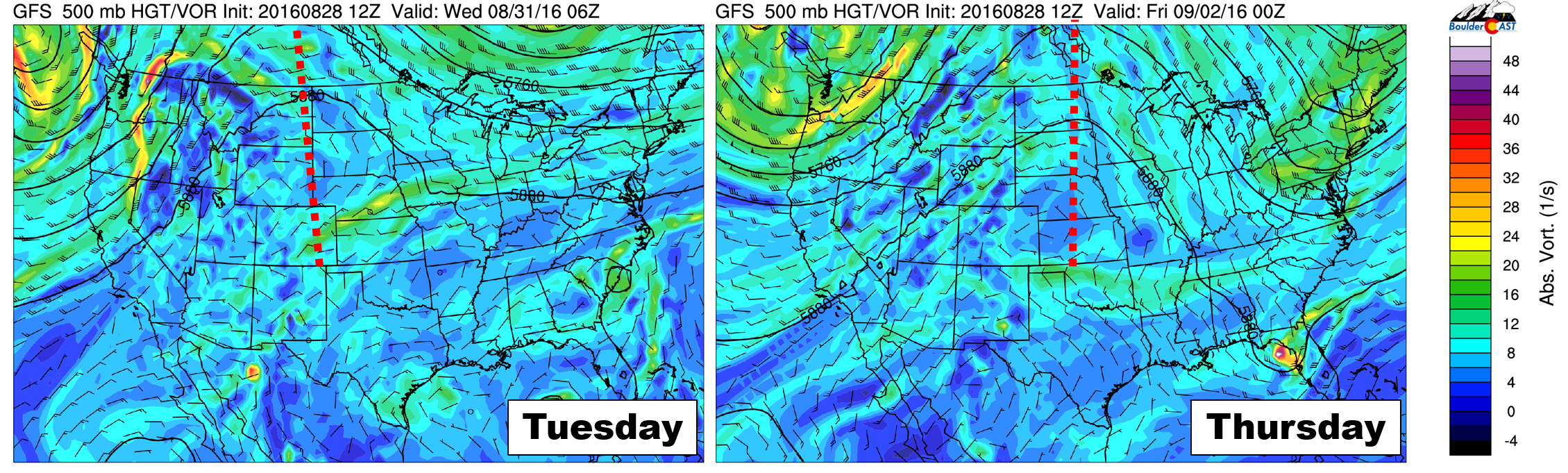
GFS 500 mb vorticity forecast for Tuesday (left) and Thursday (right) showing the eastward propagation and evolution of the ridge
Also of note is the foreboding trough that comes ashore Washington and Western Canada. It has fall-like cold air at its core. The forecast at 700 mb (about 10,000 feet elevation) shows temperatures in the low 20’s Fahrenheit (see below). Fortunately, the ridge across the center of the country should keep the trough away for the time being.
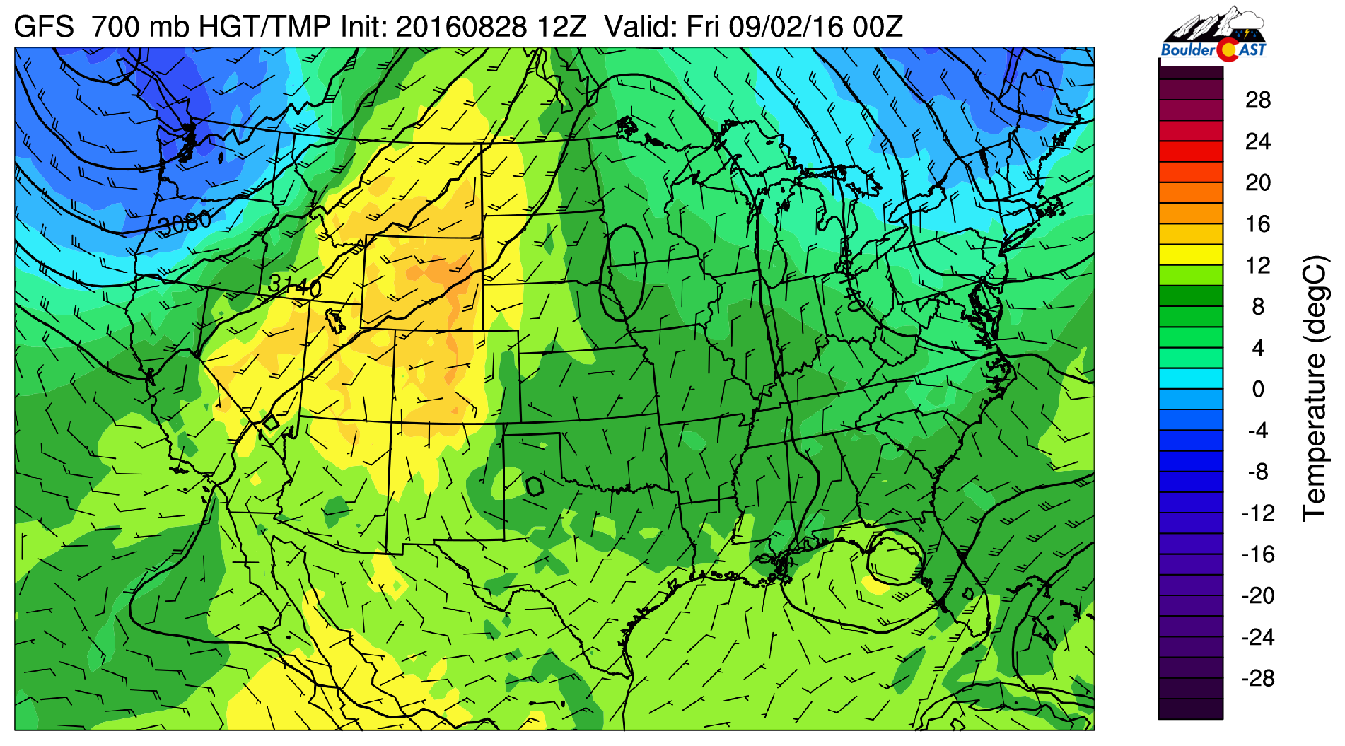
GFS 700 mb temperature forecast for Thursday afternoon, showing a surge of warmth across the Rockies, with cold air and a trough coming ashore in the Pacific Northwest
As the ridge builds, eastern Colorado will experience large-scale subsidence and gradually warming temperatures, from the low 80’s early in the week to mid 80’s by Friday. The day-to-day changes will be insignificant. Precipitation chances will be low Tuesday through Thursday, with just isolated storms possible for most areas. The action should be more intense and widespread south of Interstate 70.
By Friday, southerly flow ahead of that big trough will facilitate a surge of Gulf of Mexico moisture northward (see below). Therefore, expect slightly greater odds of rain to end the week, but probably just scattered activity. The southerly flow will also bring in marginally warmer air. However, the warmth will likely be offset by clouds and precipitation. Temperatures will be in the mid 80’s.
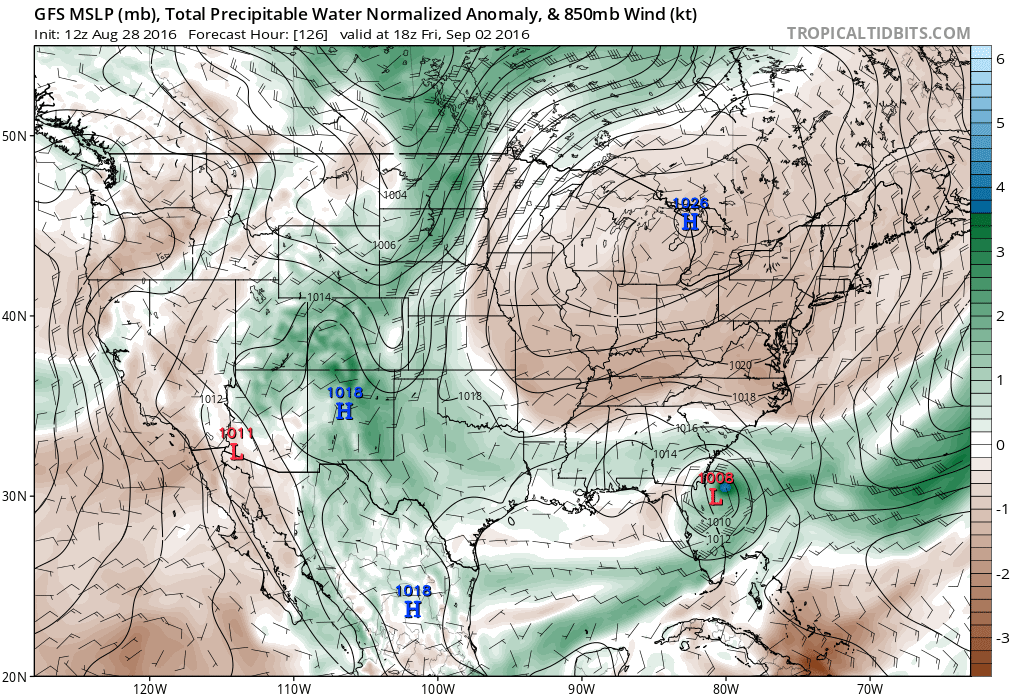
Moisture anomaly for Friday, showing a plume of Gulf moisture streaming into Colorado from the southeast.
Not related to Colorado directly, but we are nearing the peak of the Atlantic Hurricane season. The waters everywhere are very warm and the models tend to get a little over-ambitious with forming and intensifying tropical cyclones. With that said, as you can see above, the GFS shows a weak tropical cyclone off the eastern coast of Florida on Friday. This will need to be monitored, as the models thereafter take it up along the eastern seaboard. Right now this system is being tracked as Tropical Depression 9 and is just south of the Florida Keys.
Forecast Specifics:
Monday: Mostly cloudy with widely scattered showers and storms, primarily from Denver southward. Monday will offer our best chance at rain. Highs in the low 80’s over the Plains and low 70’s in the Foothills.
Tuesday: Morning clouds then partly sunny with isolated afternoon and evening thundershowers, especially south of Interstate 70. High temperatures near 80 for the Plains with upper 60’s in the Foothills.
Wednesday: Mostly sunny with widely scattered storms across the higher elevations, and isolated storms for the nearby Plains. Highs in the low 80’s on the Plains and near 70 in the Foothills.
Thursday: Mostly sunny with extremely isolated storms for the higher elevations. Dry for the Plains. Temperatures in the low 80’s for the Plains and low 70’s in the Foothills.
Friday: Increasing clouds with isolated to scattered afternoon and evening thunderstorms, particularly across the Foothills and Mountains. High temperatures in the mid 80’s for the Plains with low to mid 70’s in the Foothills.
High Country: Storm chances will exist over the Mountains throughout the entire week. The biggest threat will be Monday and Friday, but we can’t rule out isolated storms Tuesday through Thursday, especially south of Interstate 70. There won’t be any snow reports this week, as a warmer airmass takes hold compared to last week.
Extended: The upcoming weekend looks to be relatively calm across Colorado. The weather models diverge on what happens with that trough. The Euro brings it in faster, with a big cooldown (but not much precip) late Sunday into Monday. The GFS on the other hand has the ridge holding strong for a few more days. Regardless of the outcome, it’s likely both Saturday and Sunday will be in the 80’s with fairly dry weather.
Mon
Tue
Wed
Thu
Fri


Temperature
81
80
82
83
86


Precip Chc (Plains)
30%
20%
10%
10%
20%


You must be logged in to post a comment.