From start to finish, the early season Arctic airmass which overtook eastern Colorado this week has been truly remarkable! The prolonged period of fluffy snow and historically cold temperatures may not be matched the rest of this winter. We take a look back at the wild ride Mother Nature took us on over the last five days and check the snow totals from the second snow event wrapping up Wednesday morning.
T
he graphic below shows a timeline of weather conditions and temperatures from BoulderCAST Station beginning this past Saturday through Wednesday capturing in-full the crazy weather over the last several days (click to zoom!). We won’t discuss everything that has happened, but a few of the highlights include:
- The longest stretch of sub-freezing temperatures ever in October (approximately 110 hours)
- Back-to-back-to-back record low maximum temperatures (28F, 20F, and 25F Oct 28-30)
- 2nd coldest temperature ever in October (3F on Oct 30)
- New daily snowfall record (~2.4″ on Oct 27)
- 4th snowiest October in Boulder’s history (26.1″ in 2019)


We recapped the storm that brought the first wave of snow Sunday morning into Monday morning in a prior post. Following the first storm, the lull in the action was brief as a second slow-moving storm followed a near-identical track and spread snow back into the Front Range less than 18 hours after it had ceased. Despite the similarities, this second storm system vowed to be a completely different beast. There were to be no jet-forced snow bands, no freezing drizzle at the onset, potential downsloping winds around Boulder, significantly colder temperatures, and overall the best energy was passing just a bit too far south.
Still, the second wave of snow was just as impactful across the area as it followed a period of very cold temperatures which helped the snow accumulate better on the roadways across the Denver Metro area. The long duration of the event spread the impacts across three commute windows (Tue AM, Tue PM, and Wed AM)! The snow came in like a fierce lion before sunrise Tuesday and by early afternoon, nearly the entire Denver Metro area was shutting down in a fit of panic, despite clear indication that the worst had already passed and that the forecast was going to improve. Who can really complain about a (half) snow day, though?
Shown below is our snowfall forecast map issued Monday evening with actual storm totals overlaid in boxes. Green boxes indicate that our forecast verified to within one inch of the observed snowfall. Red did not.
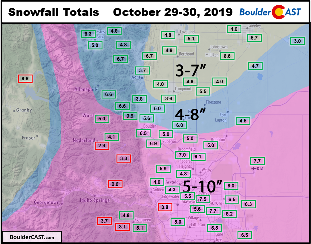
As you can see, we had another good round of accumulating snow across the entire area with totals ranging from 3 to 8″. This was a far cry from the ominous 6-12″ and 8-16″ Winter Storm Warnings issued by the National Weather Service which no-doubt partially seeded the public panic. Our snowfall forecast verified just about everywhere, expect in and near the Foothills of Jefferson County where amounts were only 2 to 4″ (sorry guys!). A small caveat: because the first and second storms only had a short 12 to 18-hour gap between them, we’re cannot fully assure these snow totals came solely from the second storm. We did our best to sift through the observations and match them on the timeline, but some totals may include a tiny amount of snow from the first system ending Monday late morning.
The second snowstorm’s official snowfall total in Boulder was 6.5″ and in Denver (DIA) was 7.7″. If you read our forecast, it should be no surprise that DIA beat out Boulder on this storm. Combined, the two systems produced a foot of snow this week in many locations:
- Boulder (official): 15.3″
- Aurora: 15″
- Denver (downtown): 13″
- Superior: 12″
- Broomfield: 12″
- Denver (official DIA): 11.5″
- Golden: 11″
- Littleton: 11″
- Erie: 10″
- Arvada: 9″
- Nederland: 9″
- Longmont: 8″
- Greeley: 8″
- Loveland: 7″
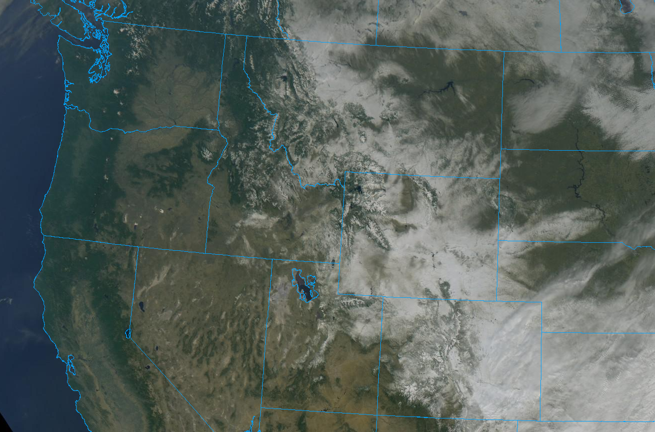
GOES-East visible satellite imagery this morning shows the swath of winter left behind by the Arctic blast stetching from Alberta to New Mexico.
| Seasonal Snow Totals (Updated Oct 30 2019) |
|---|
| Boulder | Denver |
|---|---|
| 26.1" | 12.5" |
The record-shattering frigid airmass will linger for one more day across eastern Colorado with highs in the lower 20’s on Wednesday. While it was originally expected that we could see the coldest October temperature ever recorded in many cities tonight (below zero!), models have been trending upward with our low temperatures. The reason for this is that winds are expected to turn southwesterly and ramp up just after sunset. This warm air advection and downslope will be battling strong radiational cooling from the fresh snow surface the entire night. While we don’t expect the models to handle this scenario all that well, most do show temperatures initially dropping back down to near 10 degrees in the hours following sunset, then slowly but steadily rising through the rest of the night. We still can’t rule out records being challenged in low-lying areas that hold on to the dense Arctic air a little longer. We don’t trust the models in this situation any further than we can throw them, which isn’t far since they are run on massive supercomputers!

Finally, here’s our forecast for the next five days. No Arctic outbreaks, but we sure do hope you like sun!

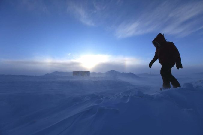
P.S. The featured image is NOT from Colorado this week, but it is from the Arctic! Just a normal day in central Greenland…
.
We discuss Boulder and Denver weather every single day on BoulderCAST Premium. Sign up today to get access to our daily forecast discussions every morning, complete six-day skiing and hiking forecasts powered by machine learning, access to all our Front Range specific weather models, additional storm updates and much more!

.
Share Colorado weather, share this post:
.


You must be logged in to post a comment.