February begins on a cold and wintry note! Read our complete forecast.
As we have be discussing all week, light snow, freezing fog and drizzle have been observed overnight across parts of Boulder and Denver area. Temperatures are in the 20’s right now, so be careful during your commute especially on bridges and overpasses.
Just to the north towards Fort Collins and Greeley, moderate snowfall as been falling associated with strong dynamic lift along a surface frontal boundary. Snowfall rates have been impressive! Some of the bands on radar looked jet-forced in nature (but are not). The radar snapshot below is from last night around 11:00 PM. Snow totals of 3 to 6″ have been reported near Fort Collins.

Radar image from Wednesday evening around 11:00 PM showing heavy snow bands north of Boulder.
The HRRR model forecast animation below shows all forms of precipitation generally ending by late-morning today. Mostly cloudy skies will remain through the day, with some sun possible this afternoon. Temperatures are only expected to rise into the upper 30’s. Overall the models did a fairly good job with this weak system, though the whole thing pushed about 30 miles further south than they were indicating, even last evening. This was enough to bring snow to Boulder, and mostly confine the freezing drizzle south of downtown Denver. It really wasn’t an overly consequential wintry set-up for us, but the details were subtle and it was indeed a tricky forecast for pinpointing the snow and freezing drizzle.
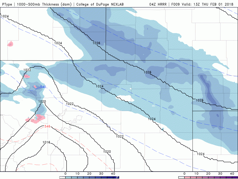
HRRR model precipitation forecast animation for this morning and afternoon. Snow and freezing drizzle will taper off by late morning.
Heading into the weekend, we’ll see northwest flow across Colorado with a moderate amount of moisture and several small-scale embedded waves passing through. Beginning Saturday afternoon, the Mountains may see near-continuous light snow through Tuesday (a result of a series of disturbances and moisture pulses). Many of the ski resorts north of Interstate 70 could pick up decent snow during this time.
For the lower elevations, things are much more uncertain this weekend, particularly on Sunday. We mentioned this in our weekly outlook on Monday, but an Arctic front will be knocking on the door of northeast Colorado come Sunday morning. It’s exact position is not well agreed upon by the models. As you can see from the GFS ensemble temperature plumes below, temperatures on Sunday are anyone’s guess. About 25% of the ensemble members show highs Sunday in the 50’s (A.K.A. business as usual). About 50% are predicting temps in the 30’s with minimum warming at all during the day. And the final 25% are showing Arctic air pushing into the region, with temperatures plummeting Sunday into the teens or 20’s. One ensemble member even dips temperatures Sunday night towards 10 degrees below zero! For now, plan on decent weather on Saturday with the potential for a really nice 50-degree day, a frigid snowy day, or anything in between for Super Bowl Sunday!
You can check our ensemble snowfall pages for the outlook for snow over the next 15 days (Premium only for now. These forecasts are still in development).
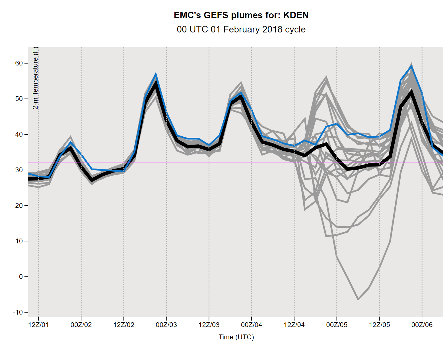
GFS ensemble plumes for temperature in Denver. Things get crazy on Sunday!
Remember, these daily forecasts are Premium content. Periodically, we open this forecast up to all of our readers. Today is one of those days!
Our promotion to save 30% is ending on Saturday. Use the offer code “WEATHER-2018” at checkout.
.
.


You must be logged in to post a comment.