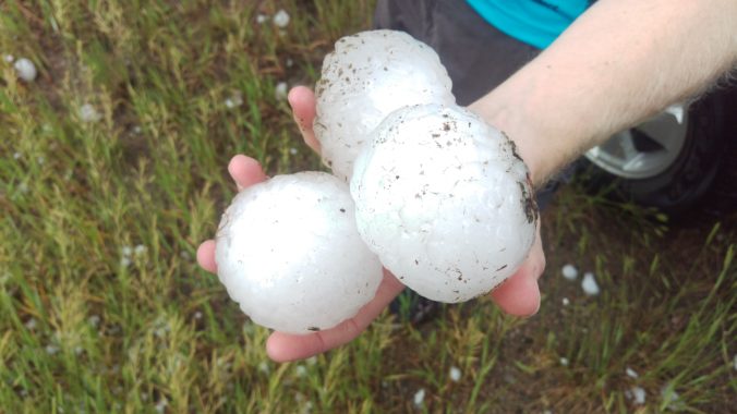
On May 8th 2017, a severe thunderstorm formed over the western suburbs of Denver around 2:30 PM Mountain Time. Hailstones up to 2.75″ in diameter pummeled cars and structures causing a total of $1.4 Billion (that’s billion with a “B”!) in damage, thereby becoming the costliest hailstorm in state history. We take a look back at this historic storm, and give you warning of the impending insurance spikes for 2018.
I was floored last week when I received my renewal notification for my car insurance from GEICO. After extending my squeaky-clean driving record another year and no changes in coverage, my 6-month premium jumped from $400 to $487, a whopping 22% increase from last year.

I immediately called and demanded an explanation for the increase, assuming there was some sort of mistake. Unfortunately, there was not… The customer service representative proceeded to explain my shocking rate increase was a “statewide rate adjustment due to an increased number of claims last calendar year.” While she wouldn’t directly confirm to me it was specifically due to the hailstorm in May, it has to be. My rate with GEICO has remained very steady for five plus years, never changing more than a few dollars each billing cycle. From conversing with friends and colleagues, it is clear that my rate spike was not isolated. Many Reddit users have also seen similar increases with GEICO and other insurance providers.
Our forecast issued on the morning of the hailstorm warned of the potential for severe storms capable of producing very large hail later in the afternoon, up to 2 inches in diameter. Our team actually discussed storm chasing on this day, but the atmosphere was not very favorable to produce tornadoes. Despite the promises of superb supercell cloud structure, it’s hard to convince folks to “hail chase”, especially the unlucky driver whom volunteers their car for the occasion.
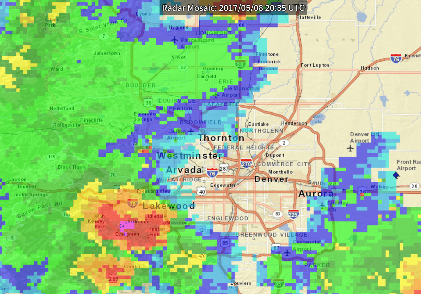
The thunderheads began to “pop” southwest of Denver over the Foothills around 2:30 PM, moving on to impact Lakewood, Wheat Ridge, and downtown Denver. The radar animation below from the date shows the explosive growth that afternoon.
The supercell was initially heading straight north towards Broomfield, where my company office is located . As a precautionary measure, I decided to drive my car to a nearby abandoned parking garage for protection. I was the first to arrive, and within the next half hour, a few dozen cars showed up. The storm eventually took a right turn (as many supercells do), with only heavy rainfall being observed in Broomfield. Other areas were not nearly as lucky. The Colorado Mills Mall was damaged so extensively it remained entirely closed for more than six months. Many car dealerships held “Hail Sales” in the ensuing weeks. Roofers and auto-body shops were totally booked for months following the disaster, completing the repairs required to bring things back to normal.
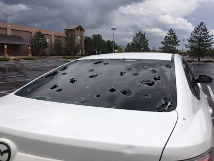
Hail damage of a car parked at the Colorado Mills Mall (credit: CBS)
A map of hail reports from the day is shown below (click to enlarge). The “official” data can be found over at the Storm Prediction Center. Lots of reports of giant hail (greater than 2″ in diameter). There was even a rare occurrence of severe 1″ hail reported over the higher terrain in Genesee.
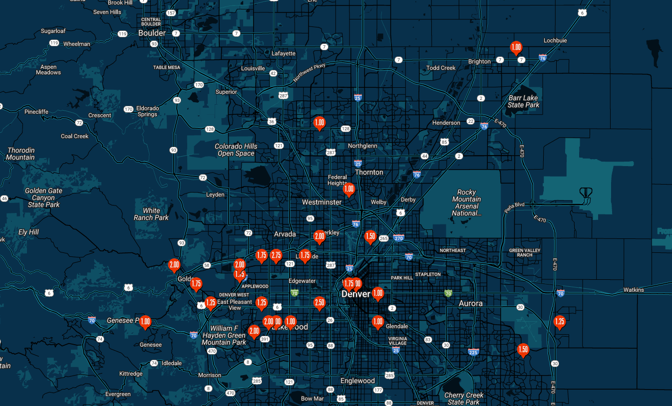
Mapped hail reports from May 8, 2017 across the Denver Metro area (Source: Stormersite.com)
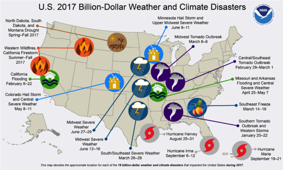
In the end, this hailstorm cost Coloradans $1.4 Billion. NOAA recently posted that this hailstorm was one of a record-breaking sixteen billion-dollar disaster events having occurred in 2017 across the United States.
Let us know in the comments if you have seen auto or home-owner’s insurance premium increases of late. And if you live closer to Boulder than Denver, feel free to provide your insurance agent with a link to the handy map below of hail reports since 2004 across the Metro area. The density of severe hail reports in Denver is MUCH higher than Boulder, and this is not fully related to population density. The western Metro area’s close proximity to the Foothills makes supercell formation difficult!

Mapped hail reports from 2004-2018 across the Denver Metro area (Source: Stormersite.com)
Here’s to hoping 2018 has smaller, less frequent urban hail across the Metro area!
This is a good time to remind you that our friends at CU-Boulder are studying hailstorms and need YOUR detailed storm reports of plowable hail. Check out this page for more information.
What is plowable hail, you ask? This video sums it up well…
.
Share this news:


You must be logged in to post a comment.