It’s been a while since we provided a forecast update for a significant weather event, but here we are. A potent and surprisingly cold spring storm is taking aim on the area with quite a bit of moisture set to drop over the next 36 hours. We take a look at timing of the cold rain, potential rainfall amounts, and discuss which areas may even see a little bit of late-season snow.
Key Points from This Post:
- A cold and gloomy Sunday is expected with our first significant storm in a long time moving through
- A chilly rain will fall through much of Sunday in Boulder and Denver with highs in the 50’s
- Accumulating snow in the higher elevations about 8000 feet, up to a foot in the highest peaks
- Snowfall in May is common in Boulder, but not late May. Fortunately, this storm isn’t cold enough for that
Help support our team of Front Range forecasters by joining BoulderCAST Premium. We talk Boulder and Denver weather every single day. Sign up now to get access to our daily forecast discussions each morning, complete six-day skiing and hiking forecasts powered by machine learning, first-class access to all our Colorado-centric high-resolution weather graphics, bonus storm updates and much more! Or not, we just appreciate your readership!

I
n what is typically our wettest month of the year, Boulder has received only about three quarters of inch of rain so far in the month of May. Fire bans have been enacted across much of the higher terrain, including western Boulder County. Severe to extreme drought has spread and intensified across southern Colorado.

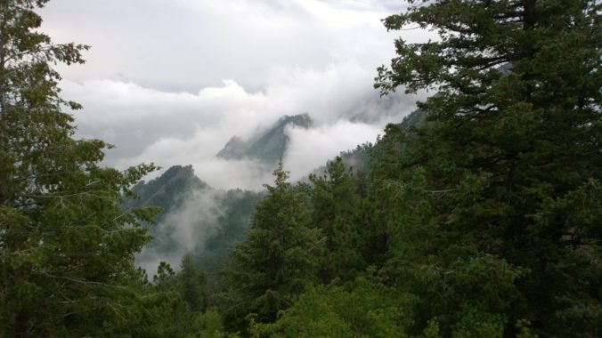
Some reprieve from the dry weather of late will come on Sunday as a large trough located over the Pacific Northwest will finally gain enough momentum to push eastward and through Colorado (see animation below). This trough has been “stuck” to our west for much of the last seven to ten days as a blocking pattern was present across the eastern United States. This will really be our first significant storm system since the onslaught that dumped more than three feet of snow in Boulder about six weeks prior. That seems like such a long time ago, doesn’t it?

GFS 500mb height and vorticity forecast animation from Saturday evening into Monday
The incoming storm system definitely will knock our temperatures well below normal for this time of year as chilly air works into the Front Range from the north. Latest model guidance suggests a secondary low pressure will “pinch off” across southern Colorado on Sunday helping to enhance the flow of cooler upslope into the Denver Metro area.

For the first time in what seems like forever, 700 mb temperatures will drop below freezing overhead during the daytime on Sunday with snow levels taking a late-season tumble. Let’s not forget…there’s a reason we don’t engineer our gardens until Mother’s Day or even Memorial Day: the next frost or snow could be right around the corner this time of year. For example, just three years ago we had accumulating snow during the daytime on May 18th (see video below). Furthermore, just one year ago, snow flakes were flying even later in the season on May 21st.
Three years ago today it was dumping snow in Boulder. This year, we're heading into the middle 80's.
Here's our forecast from 2017 for the powerful storm that produced more than 6" of snow in Boulder and nearly 3.5" of liquid. (mainly rain) –> https://t.co/RYFcOm60Uj pic.twitter.com/KUY2yGtlNl
— BoulderCAST Weather (@BoulderCAST) May 18, 2020
Unlike most places in the country, the Front Range is no stranger to May snow. In fact, whether you like it or not, it has happened 15 out of the last 19 years in Boulder. However, it usually occurs during the first half of the month. Rarely does snowfall grace us with its presence in the latter half of May! The normal (median) date of the last snow in Boulder is April 26th. Snow during the second half of May typically occurs about 1 out of every 10 years.
In the 73 years since reliable snow record-keeping began, accumulating snowfall has only happened five times on or after May 24th.

Fortunately (unfortunately?), this weekend’s system doesn’t have the truly cold air that is needed for snow to make it all the way down to the Plains. However, snow levels will be dropping down low enough Sunday morning and afternoon to see some snow accumulation in the higher Foothills west of the Metro area, mainly on the trees, grass, and elevated surfaces. Both the GFS and the NAM models show snow levels bottoming out around 8000 feet elevation on Sunday.

For the lower elevations, just a plain, chilly rain will instead be the story. Plenty of ingredients will come together to support widespread moderate rainfall across the area much of the day on Sunday into Sunday evening. We’re seeing good agreement between the GFS and European models for 0.5″ to 1.0″ of rainfall through Sunday night. There is a notable bias in the heaviest rainfall for the southern Metro area into Colorado Springs. This makes sense given the position of the low pressure in south-central Colorado.

The HRRR model, on the other hand, doesn’t have as much southward bias spreading a fairly equal ration of rain for much of the Boulder/Denver area. Similarly though, the HRRR model predicts between 0.5″ and 1.0″ for everyone.

HRRR model forecast total precipitation through Sunday night
Depending on which model you believe, rain could begin falling for some areas near Boulder and to the northwest by the early morning hours on Sunday as the upslope settles in. However, we expect the bulk of the rain to hold off until late morning or early afternoon, spreading eastward across the entire area thereafter.

HRRR model simulated radar animation from Sunday morning into Sunday night
Either way, Sunday will be a borderline washout for us with generally light to moderate rain showers enveloping the area. There could be a few rumbles of thunder mixed in, but by and large, Sunday will be more of a stratiform rain event. Temperatures likely won’t get out of the 50’s with the thick clouds and rain socked in.

Higher up, snow will be falling, especially above treeline where temperatures will be below freezing. It’s a little surprising that Winter Weather Advisories haven’t been posted yet for the Mountains above 10,000 feet. This will probably happen within the next few hours as it seems likely that 5-12″ of snow will fall in these areas.

Our snowfall forecast map for the event is shown below. This covers snowfall through Sunday night. Locations above 8000 feet elevation along Peak to Peak highway could see up to 4″ of wet snow on Sunday, with amounts dropping off quickly as you head east and go down in elevation. If you’re planning to drive through any of the Mountain passes on Sunday, plan for winter weather and slushy roadways in spots.

This time last year, I was able to bike along a well-plowed Trail Ridge Road. This year that won’t even be possible due to the fact that RMNP remains closed for COVID-19, let alone the closures that the wave of incoming fresh snow would have caused.
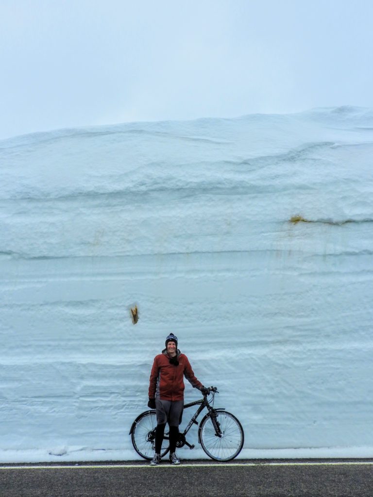
Photo taken along Trail Ridge Road in Rocky Mountain National Park, May 19 2019
Have a great rest of your Memorial Day weekend! Let’s not forget what Monday is truly about.

Spread the word, share this forecast:
.


You must be logged in to post a comment.