After a taste of snow this afternoon, it will be right back in the forecast for tomorrow as a weak system slides southward across the state. Read on for timing and amounts.
Today’s snow went largely as expected. Some early day sunshine contributed to warmer ground temperatures, which led to only small amounts of snow actually sticking, despite reports of moderate to heavy snowfall occurring. Across Boulder and the Denver area, totals look to be less than 2″ everywhere, except for maybe the Foothills of Jefferson County, which accumulated up to 4″. Boulder’s official total was 0.6″, while we only measured 0.2″ at BoulderCAST’s station.
After a very brief lull in the action, snow returns for Thursday, driven by a weak disturbance in the northwest flow. It is subtle, but it will produce a period of upslope Thursday afternoon into the evening.
The 500 mb vorticity map from the NAM for tomorrow is shown below. The responsible wave is in western Nebraska, with trailing energy into Wyoming.
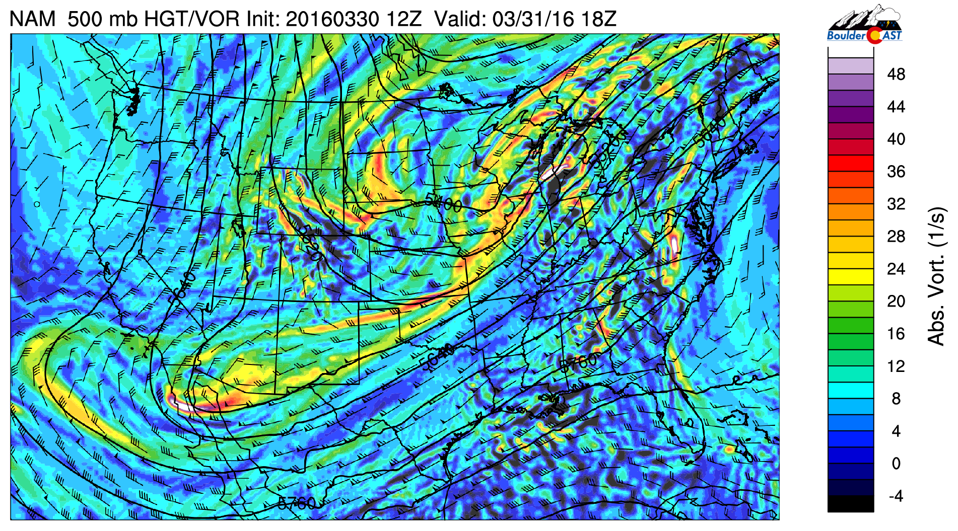
NAM 500 mb vorticity map valid Thursday afternoon. The feature responsible for the snow is in western Nebraska
After some clearing overnight, clouds will increase tomorrow morning before a push of cooler NNE upslope flow. The front looks to arrive mid morning. This is several hours earlier than today’s front. Consequentially, temperatures will only be able to climb into the mid to upper 30’s before the frontal passage. In general, tomorrow’s airmass is slightly cooler overall. Battling the (nearly) April sun, roads should remain just wet.
There is very weak, large-scale forcing and limited moisture. The biggest driver will be the upslope. Therefore, we are only expecting accumulating snow in the western portions of Denver, particularly in the Foothills. The best period of upslope lies between about 10AM and 7PM. Look for the heaviest snow during that time. The upslope/cold front can be seen below in the 800 mb forecast for noon Thursday. This level is just above the surface.
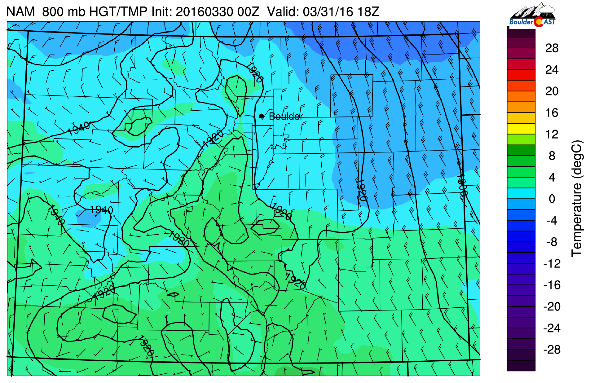
NAM 800 mb temperature and wind forecast for Thursday afternoon. Notice the cold front and NNE upslope across Boulder County
Our latest NAM snowfall map looks reasonable, demonstrating the sharp gradient in snow at the base of the Foothills.
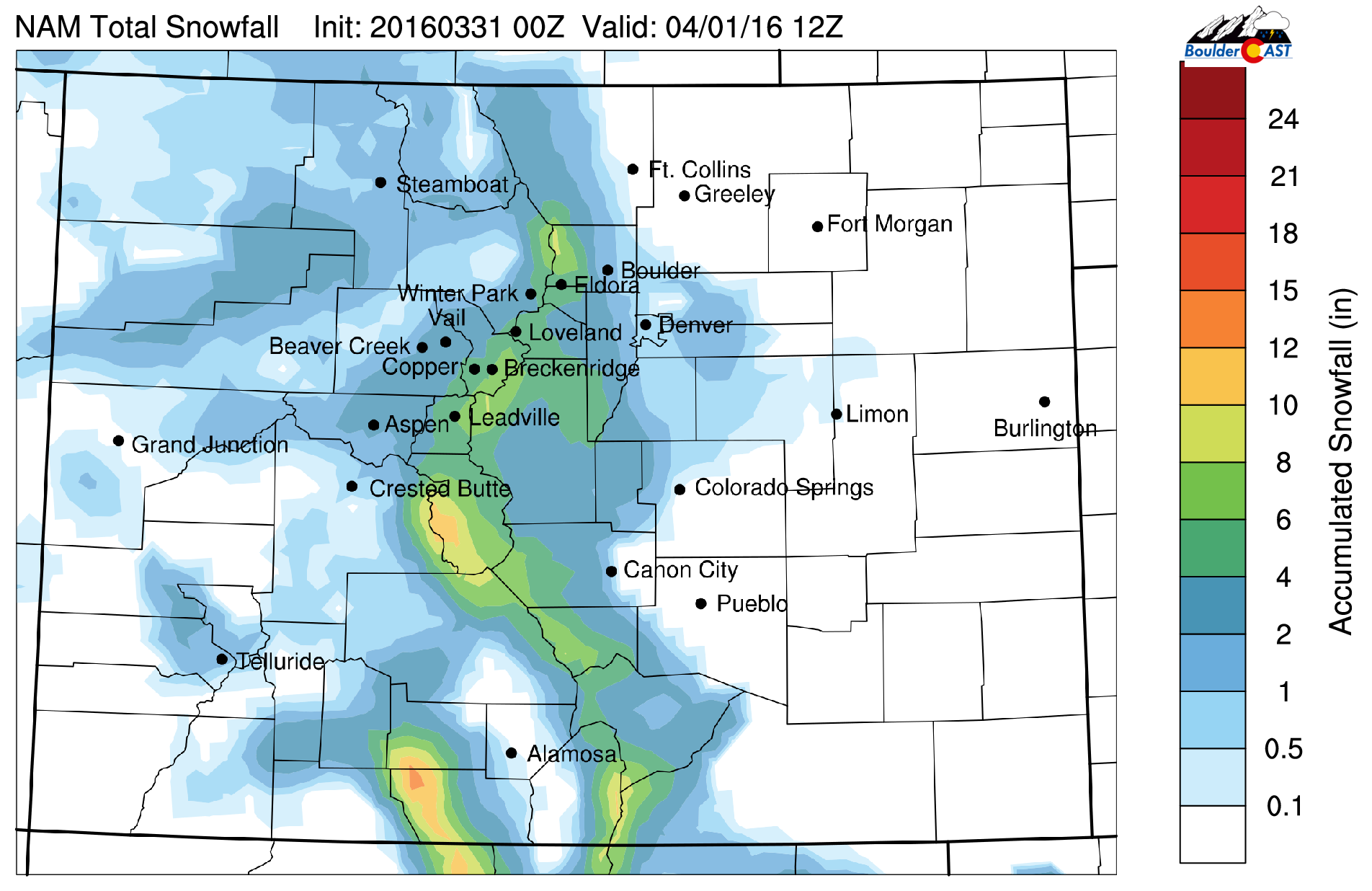
NAM snowfall forecast for Thursday’s event
NNE upslope tends to favor Jefferson County more so than Boulder County. We’ll look for marginally higher totals there. Below is our snow forecast for Thursday.

Heading into Friday, temperatures will remain cool and cloudy, with highs only in the 40’s. Sunshine and much warmer weather return for the weekend.


You must be logged in to post a comment.