The snowstorm we have been tracking for almost a week now is finally here. Models are consistent in keeping most of the snow to our north, but a little white stuff is still in our future. Read on for our final forecast.
Over the last week, the weather models have been trending more and more south with this system. Originally slated for southeast Montana, it now appears the heaviest snow will fall in the vicinity of Cheyenne, or slightly north (as we suggested on Monday).
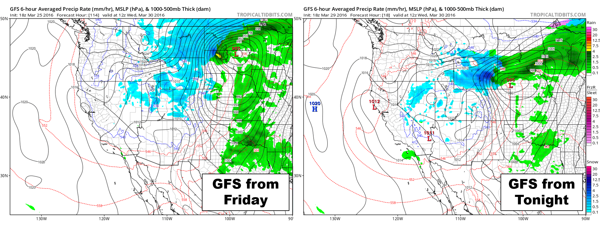
Forecast evolution of the system over the course of the last five days from the GFS. Notice the southward shift in storm track since last Friday.
Uncertainty in the storm’s track has decreased, with all of the big models remaining consistent over the last few days. As such, were not expecting any surprises this time around.

Live shot near Ward, CO at 6pm Tuesday. Snow is already falling at 9,000 feet
Light rain has already begun across the Plains, compliments of moist southeasterly flow. Though this is technically upslope, it’s often not cold enough to produce snow, especially in the springtime. We really need that northeasterly component this time of year. This upslope is shown below in the RAP 700mb forecast for 6PM tonight.
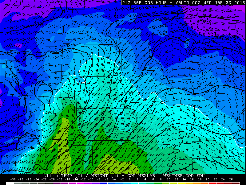
RAP forecast for 6pm Tuesday showing SE upslope flow across Denver area (rain!)
We’ll see the rain continue through the evening hours. Cold air aloft could produce a few rumbles of thunder across the area as well. Some lightning strikes are already occurring upstream in central Colorado. This round of rain will wrap-up around midnight.
After midnight, a cold front swings through from the northwest, knocking us down into the low to mid 30’s. Following a brief warm up in the morning (pushing 40), a deeper surge of colder air will move southward from Wyoming late morning or early afternoon behind the developing low pressure.
At noontime tomorrow, the 700 mb low will be located in extreme northeast Colorado (shown below).

NAM 700 mb temperature and height forecast for Wednesday afternoon.
Notice the strong northeasterly upslope in SE Wyoming, and potent NW downslope across our area. As the low sags southeast, we might be able to get in on the upslope action, but only briefly as the low moves away.
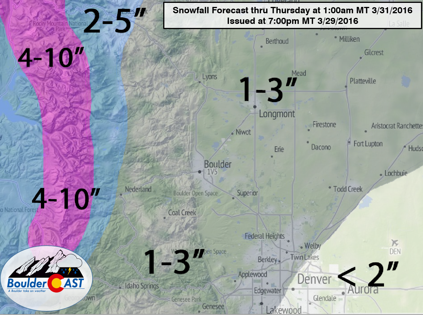
We’ll see a short period of rain changing to snow early afternoon, persisting into the evening. It could be moderate snow at times. Temperatures near 32 degrees and the afternoon sun will confine accumulations to grassy surfaces, with minimal impact to the evening rush hour. Snow totals will generally be less than 3″ everywhere, with even less from Denver south. Areas closer to the Wyoming border will be in the 3-7″ range. Boulder is on the fringe, to say the least. Denver is on the outside looking in.
Our forecast snow map summarizes our thoughts:
We’re also keeping tabs on another chance of snow Thursday afternoon and evening. To be honest, it could end up producing more for us than tomorrow’s storm. More on that later! Have a good hump day!


You must be logged in to post a comment.