After a sunny, dry, and at times, smoky weekend, which saw near record-breaking heat across the Plains, the week ahead will feel noticeably cooler. Late-season monsoon moisture will also invade our state once again, keeping the chance of rain in the forecast through the week.
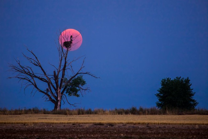
This past weekend was hot, culminating on Sunday, when high temperatures across the Plains climbed into the mid 90s. Boulder tied the record for August 30th at 96 degrees, while Denver fell two degrees short (reached 96, needed 98). The smoke has been intermittently thick across northeast Colorado in August. One upside are the vibrant colors at sunrise and sunset (see image above; photo credit: Bryce Bradford). Check out our explanation on how smoke can affect the color of sunsets.
As it stands Monday morning, change is already in full-swing, apparent by the cloudy skies, and if you were lucky, a few morning sprinkles here and there. This change is the result of a weak cold front which moved through overnight, bringing light upslope flow to our region. This front will be short-lived, as it is slated to stall, and essentially die just south of Denver over the next 24 hours.
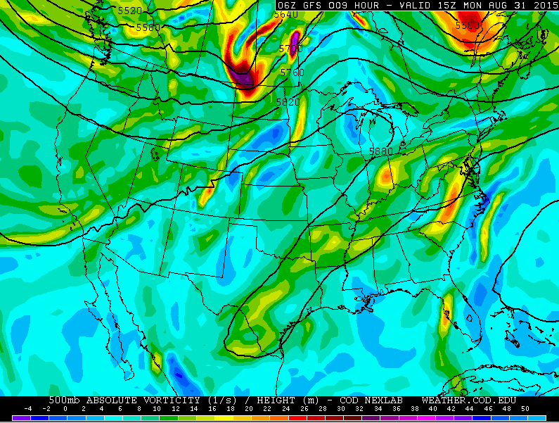
GFS 500mb vorticity map, valid at 11am Monday.
The GFS 500 mb map above shows the current weather set-up as of 11am Monday. There is a weak trough across much of the East, and for Colorado, not much going on. A bulk of the action associated with the jet stream will continue to remain to our north, near the Canadian border, through the week. However, if you are observant, you may have noticed that flow across Colorado is nearly southwesterly. This flow will strengthen through the week, bringing a slight revival to the monsoon!
But first, let’s focus on Monday. The shower activity this morning associated with the frontal boundary will dissipate as the front sags southward. However, we expect numerous showers and storms to redevelop this afternoon, particularly in the Mountains/Foothills, which will lie above the cooler, more stable airmass that has set up across the Plains. Despite the stability, it will still be possible for isolated to scattered showers and a few storms to pop up on the Plains this afternoon, especially in areas that see intermittent breaks in the cloud cover. Expect temperatures on the Plains to reach only into the mid 80s, with upper 70s higher up. Visibility may decrease today due to some post-frontal smoke, but it shouldn’t be nearly as extensive as it has been in recent weeks. The smoke threat will be gone by tomorrow, under southwest flow aloft.
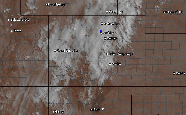
Visible satellite over Colorado, as of 9am Monday.
By Tuesday, not much will have changed. We should start the day off sunny, but day-time heating will quickly fill the skies with clouds, bringing a chance of storms by afternoon. Coverage should be slightly diminished, relative to Monday, with scattered storms in the higher terrain and just isolated storms over the Plains. With a little more sunshine, look for slightly warmer temperatures. Upper 80s seem likely.
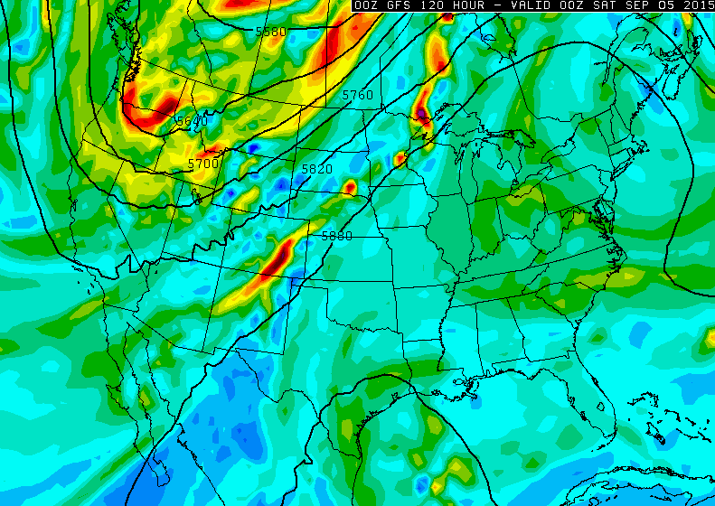
Shown below is the 500 mb map for Wednesday evening. There are three things to note:
- Continued southwesterly flow across Colorado, the running theme for the week. Though, the bulk of this will be over the western part of the state.
- Ginormous trough entering the Pacific Northwest. This will enhance the southwesterly flow through the week, and bring some cooler/wetter weather for the holiday weekend.
- Soon-to-be-named Tropical Storm Kevin moving up the western Mexican coast (visible below, in the very bottom left of the map). This energy and deep tropical moisture will be drawn northward and may be a (small) player for Colorado over the weekend, depending on exactly how far north it makes landfall

Wednesday will see our moisture temporarily dip, with precipitable water values around 0.7″, down from Monday’s values near 1.1″. With drier air, and no real large-scale forcing, Wednesday will be drier overall. Isolated to scattered afternoon storms will develop, mostly over the Mountains, with just a slight chance of a storm on the Plains. Further warming will ensue, with high temperatures in the low 90s.
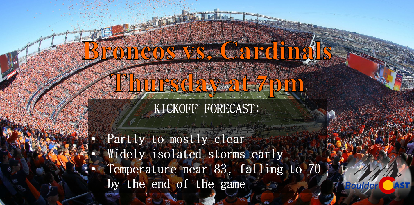
Similarly, on Thursday, that pattern will remain largely the same. There may be just a tad more moisture around, but overall, just some isolated to scattered afternoon/evening storms in the Mountains, and isolated storms on the Plains. Highs will be a tad cooler, but still quite warm, climbing into the upper 80s. The Broncos will play their fourth preseason game, hosting the Arizona Cardinals, at Sports Authority Field Thursday night at 7:00 pm. If your heading out to the game, you may want to take your poncho or rain coat, but definitely not a necessity as rain chances will be low during the game.
For Friday, moisture will be on the increase across the region, drawn northward by the approaching upper-level trough (see below).
GFS 500 mb vorticity map, valid Friday at 6pm.
Storm chances will be on the increase Friday, but once again, it will be rather hit or miss. Isolated to scattered storms will develop first over the Mountains, moving onto the Plains in the afternoon. This activity will also keep us a bit cooler, with temperatures in the mid 80s across the Plains.
In summary, we will see the return of monsoonal flow this week. However, it is quite late in the season, and moisture levels will not be all that high. The influence of the sun to fuel storms is also diminishing as we head even closer to the end of summer. Consequently, there will be rather small storm chances each day this week. The real winner for monsoon rains will be southwestern Colorado, as seen in the modeled GFS total precipitation forecast map below. Less than 0.5″ of rain can be expected through Friday for the Plains, with the potential for more than an inch over the Foothills of Boulder County.

The Forecast:
Monday: Mostly cloudy. On the Plains, scattered afternoon showers, with a few storms possible. More numerous storms over the higher terrain in the afternoon. Highs in the mid 80s on the Plains, with upper 70s in the Foothills.
Tuesday: Increasing clouds with scattered afternoon storms developing, mostly over the Mountains and Foothills. Isolated storms across the Plains, with high temperatures in the upper 80s for the Plains, with low 80s in the Foothills.
Wednesday: The “driest” day of the week. Mostly sunny with isolated storms developing in the afternoon, mostly over the Foothills. Hot with temperatures in the low 90s on the Plains, mid 80s in the Foothills.
Thursday: Mostly sunny with isolated storms developing in the afternoon, mostly over the Foothills. Warm with temperatures in the upper 80s on the Plains, low 80s in the Foothills.
Friday: Increasing clouds with isolated to scattered storms developing, first over the higher terrain. Cooler with highs only in the mid 80s on the Plains, with upper 70s in the Foothills
Source
Mon
Tue
Wed
Thu
Fri


BoulderCAST
85
89
91
88
85


NWS
83
86
89
89
85


AccuWeather
83
87
89
86
84


The Weather Channel
82
86
89
89
85
Last week’s recap:
Here are the results of last week’s forecast. First, the forecasts and observations:
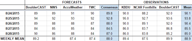
The consensus was for a hot beginning to the week, with a slight chance of rain through the week. Thursday and Friday were anticipated to be cooler. The chance of rain was only forecast by BoulderCAST on Wednesday and Thursday (and only very slight chances) for the Plains.
Now the error analysis. Shown is the amount of degrees (in Fahrenheit) that each source was off from the mean observed temperature for Boulder. Positive values indicate the forecast was warmer than what actually occurred, while negative values arise from a forecast that was cooler than what was observed.

The temperature trend generally went as anticipated. However, it was a bit warmer than expected on Wednesday, and cooler than expected on Friday. BoulderCAST had a rough forecast on Friday, where the post-frontal airmass did not warm up as rapidly as we anticipated. Still, 5 degrees of error 5 days out is not that bad. The only day with rain recorded was Thursday, and that was just a measly 0.02″. Running the numbers, BoulderCAST did have the best forecast on Tuesday and Wednesday (we really tend to nail down those scorchers!).
—
If you haven’t already done so, follow us on Twitter or Facebook for frequent weather updates and subscribe to the site to get these posts automatically delivered to your email box (enter your email in the sidebar widget to right).


You must be logged in to post a comment.