The Arctic chill and light snow are still on track to impact the region over the next 48 hours, just in time for the Thanksgiving holiday. Read on for details on when and how much snow you can expect!
No big changes are needed to our forecast issued on Monday, which called for the arrival of a bitter cold air mass and snow by mid-week. Here we are, on Wednesday, and that scenario is playing out just as advertised, with surprisingly very little deviation from our original thoughts.
The low pressure responsible has now come ashore, and is currently located over Nevada. It has already been producing widespread snow across much of the northern Rockies and Great Basin.
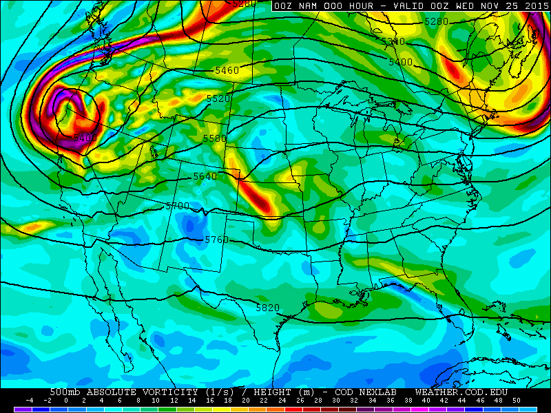
NAM 500mb height and vorticity map for Wednesday through Friday night. Notice the slow moving nature of the upper-low. It stalls and rotates over the Great Basin for days.
A quick look to our north shows the cold air has already taken over Wyoming, with temperatures near Cheyenne down in the mid 20’s.
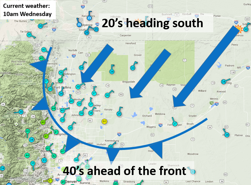
First wave of Arctic air moving in this morning.
The Arctic air will being to push into our neck of the woods by late morning today. After temperatures top out somewhere in the 40’s this morning, they will fall into the 20’s by evening with increasing low clouds. The air mass behind the front is very shallow and dry, so we expect it to take a while for things to moisten up enough for precipitation. We believe that will occur late Wednesday evening, between 8pm and midnight.
Precipitation may briefly be a mix of freezing drizzle and light snow, but the change-over to all snow should be rapid and happen before sunrise Thursday. Persistent upslope will drive on-and-off light snow across Boulder County through the day Thursday and into early Friday morning. The forcing is weak, and with a lack of moisture, snowfall rates will be low. It will be the shear duration of the event that contributes to our final snow totals, about 36 hours worth!
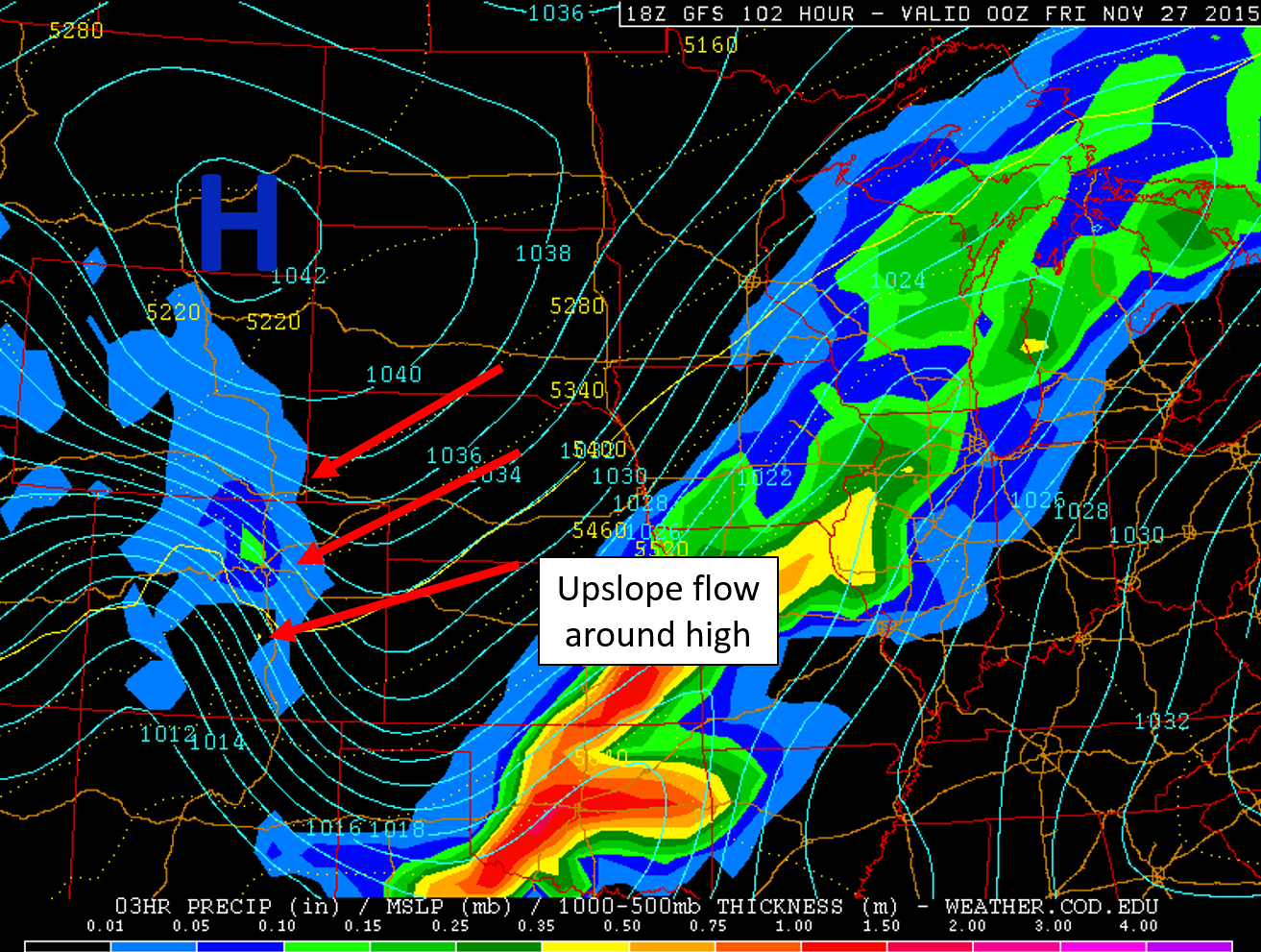
Intense area of high pressure in Montana will drive persistent upslope to Colorado, producing widespread light snow.
The most favorable time for sustained light snow will be Thursday late afternoon and evening. We aren’t expect anything too heavy, but snowfall rates of 1/4″ to 1/2″ per hour are possible at times. This is the period when everyone will pick a bulk of their accumulation. The GFS, NAM, and Euro models all spit out about 0.3″ to 0.6″ of liquid for Boulder.

GEFS ensemble plumes for precipitation in Boulder | BoulderCAST
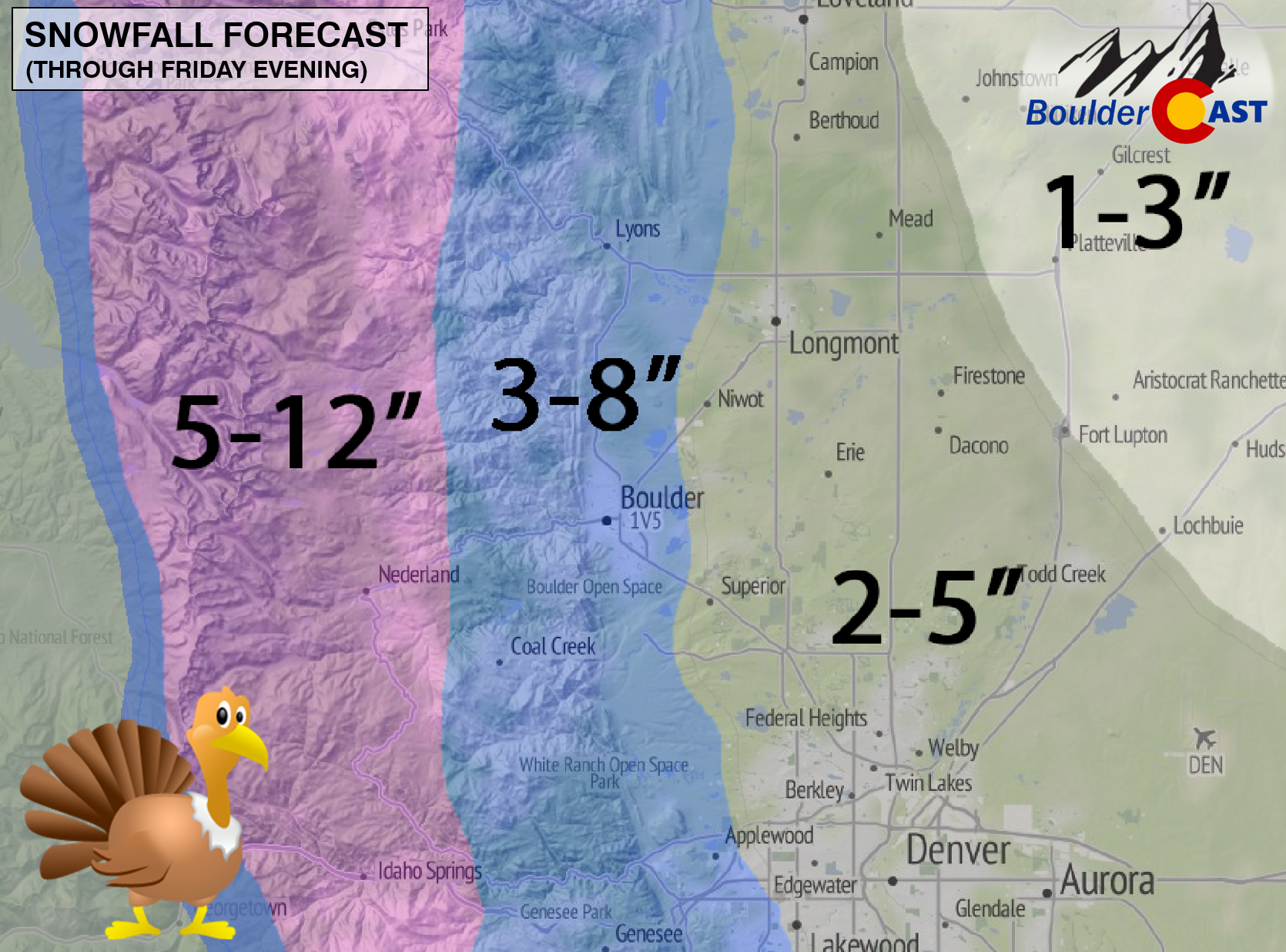
So how much snow is going to fall? Well, since there is no surface low developing, this weather set-up (weak but long-lasting upslope) favors the Foothills and those areas on the Plains immediately adjacent (including the city of Boulder). With bone-chilling air in place aloft, snow to liquid ratios will likely be around 15:1 for a bulk of this event. That equates to 4-9″ of snow for Boulder, which may be a tad high. In the end, we expect a somewhat sharp east-west gradient in snow totals, with less heading away for the mountains.
The models have been more or less consistent over the last few days with this system, bringing increased confidence in our forecast. It has no where near the bust potential of the storm last week! Our snowfall forecast for the region, is as follows:
- Lower Foothills & immediately adjacent Plains (including Boulder): 3-8″
- Plains to the east (including Longmont, Erie, & Louisville): 2-5″
- Higher Foothills & Mountains: 5-12″ (east facing slopes will do best)
- Denver Metro: 2-5″ (highest totals for the western suburbs)
Don’t forget! As we have reiterated before, the real story this holiday will be the unseasonably cold air that will entrench itself across eastern Colorado. Thursday and Friday (and maybe even Saturday) will see temperatures only in the 20’s for daytime highs (nearly 30 degrees below normal!). At night, the mercury will drop into the low teens, and maybe colder, if skies clear even briefly overnight Thursday or Friday.
Roads across the Front Range will be slick at times, especially Thursday afternoon through Friday morning. Exercise caution when travelling, particularly if you are in a post-turkey dinner food coma. Gobble gobble!


You must be logged in to post a comment.