Following a welcomed dumping of snow in the Mountains this week, our attention shifts to the lower elevations late Thursday night into Friday for our own shot of snow. We detail what to expect as far as amounts and timing, and express some of our lingering concerns with the set-up.
Mountain snow totals have been impressive thus far this week, with powder amounts through Wednesday morning ranging from 10-24″ across the resorts.
This snow should come as no surprise as we alluded to it earlier in the week. The current weather pattern has a large upper-level trough across much of the United States, with a ridge just off the California coastline. The snow maker we are tracking is currently located in Western Canada.
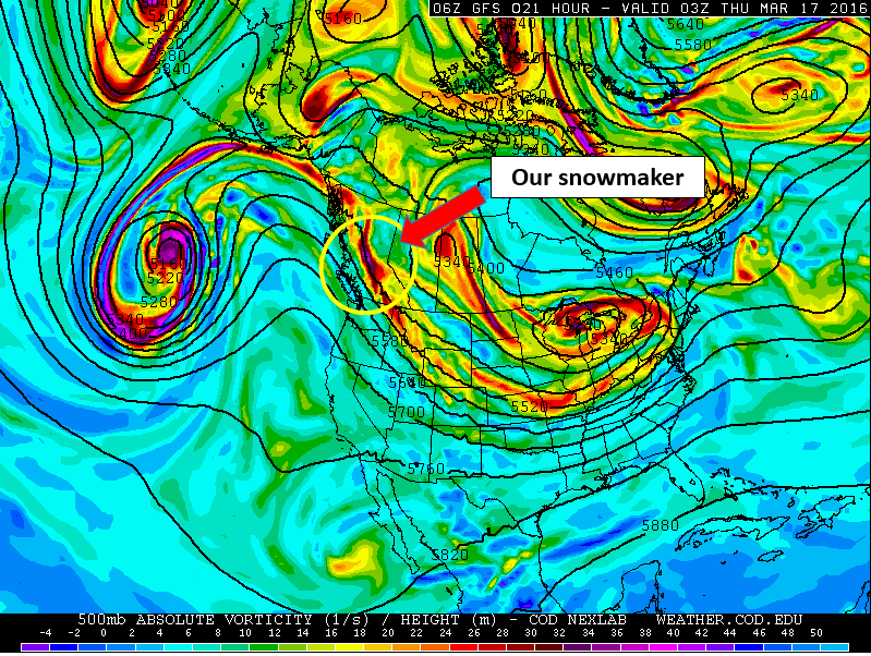
GFS 500mb vorticity map, valid Wednesday evening. Highlighted is the system that will be responsible for our snow Friday.
While it may not look all that impressive, sometimes that’s all it takes for Front Range snow. By Thursday night, the feature dives into Wyoming and northern Colorado, bringing with it favorable conditions for snowfall to the region.
This includes a shallow but rather potent cold front Thursday evening. Behind the front, low-level flow will be northeasterly (upslope). Combining this with some favorable upper-level dynamics and decent moisture, the stage will finally be set for snow across most of northeast Colorado. This is moisture that we desperately need.
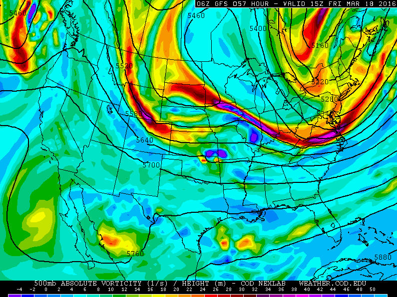
Side note: These quick-moving embedded features are often not well-forecasted by the models. So despite some agreement we discuss below, confidence is still somewhat low.
Current models runs bring the cold front through Thursday late afternoon and evening. The Euro is the earliest, around 5pm, with the GFS at 6pm (shown below), and the NAM a little later at 8pm.
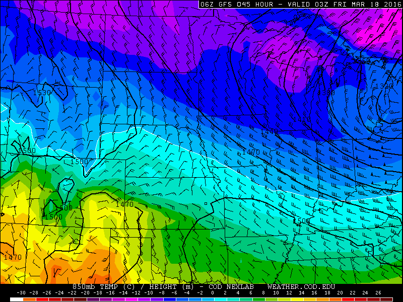
GFS 850 mb temperature map for Thursday evening at 9pm. The front is clearly visible across NE Colorado, already through the Denver area.
Around this time or slightly before, some light rain will be possible as temperatures Thursday afternoon will be in the mid to upper 40’s. Temperatures quickly fall into the low 30’s and 20’s behind the front, so the change over to snow should be swift and progress from north to south across the area. Don’t worry, there is plenty of cold air. Everyone should be all snow before midnight.
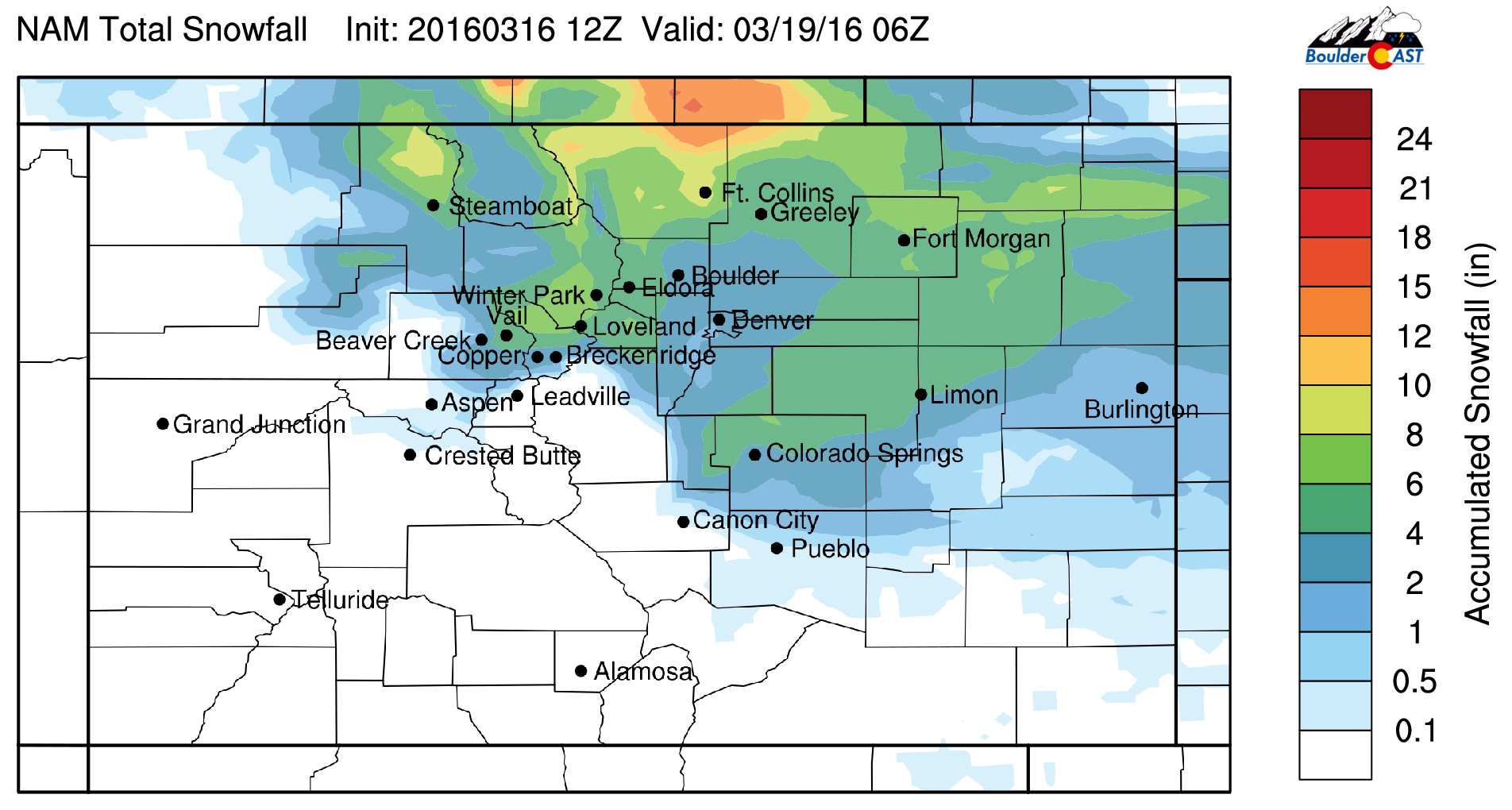
Precisely how far south and intense this system will be is still not clear. The GFS keeps the best snows north of Denver, from Ft. Collins into Cheyenne, while the Euro brings everything a little further south into the Denver Metro and Boulder. The NAM is similar to the GFS, but with greater intensity and thus has some heavier snow totals everywhere. Total liquid precipitation for the event from the GFS (left) and NAM (right) can be seen below.
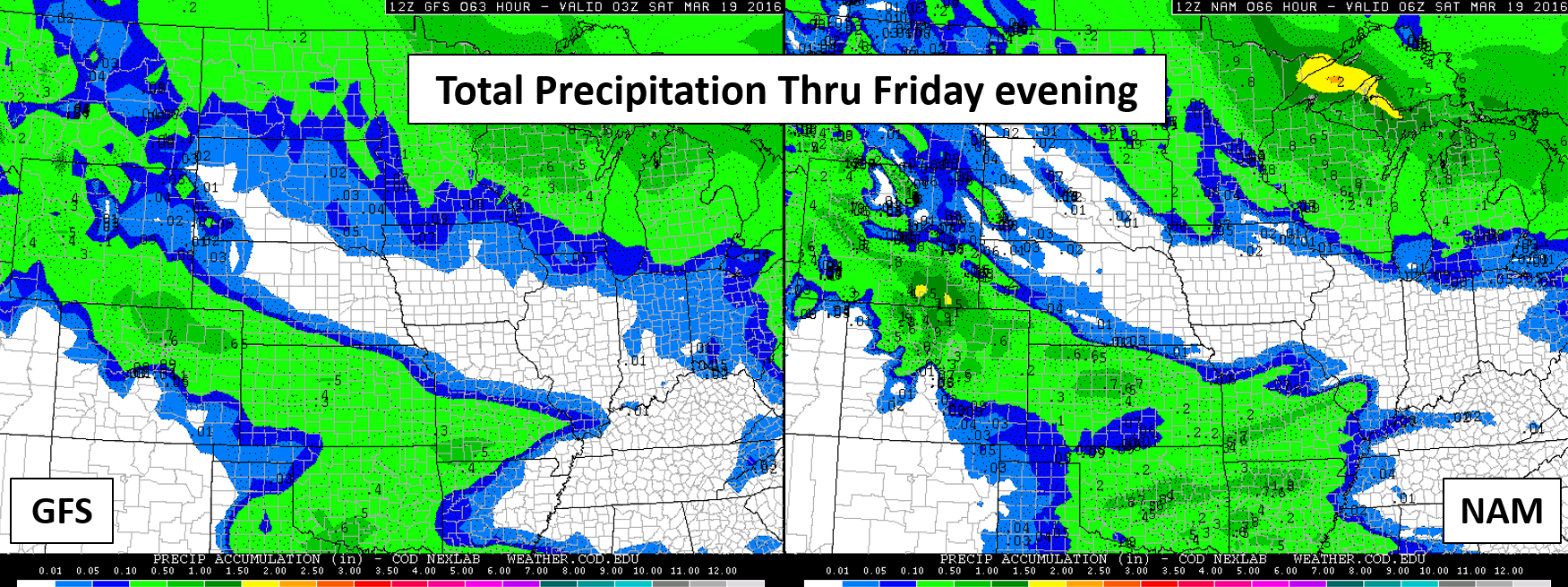
Both models indicate the northward bulls-eye, with about 0.25 to 0.75″ of precipitation in the Boulder/Denver area. Snow amounts from the NAM are shown below. Seems rather reasonable, but probably biased just slightly high.
There will also be some forcing associated with the jet overhead Thursday night. Models indicate heavy narrow banding of snow sagging southward overnight. Depending on where exactly these bands set up and move will greatly impact totals. The jet doesn’t make much north-south progression throughout the event, so these bands could hit some locations much, much harder than others. The orientation will be northwest to southeast.
Snow will be heavy a times, particularly overnight into Friday morning. With persistent but very shallow upslope in place Friday during the day, light snow will continue into the late afternoon or evening, especially in the Foothills and nearby Plains. Highs may not get out of the 20’s on Friday.
Amounts:
There is still a concerning amount of uncertainty in regards to how things will play out, so for now, our forecast amounts will be a bit broad and general (sorry no map just yet!). Considering the onset will be rain, there will be some melting initially, and some of the snow will fall during the daytime Friday with the strong March sun, we are thinking:
- 2-5″ is likely on the Plains north of Denver toward Ft. Collins, including Boulder
- From Denver south, 3″ or less
- Areas in the Foothills and the Plains Ft. Collins northward probably 3-8+”
Overall, not a hugely impactful event for our area. Snow will likely be confined to grassy surfaces, except very early Friday when roads may become slick. We expect better agreement in the models tomorrow.
Look for a more detailed and pinpointed forecast tomorrow afternoon. Brace for snow, but don’t expect a snow day.


You must be logged in to post a comment.