We got a couple emails from folks wondering if what they heard on the news was true…will there really be a snowstorm next week? We provide you with the latest information and give our take on the situation.
—
Over the last several days, the weather models have been depicting an interesting scenario for late next week (the November 16-18 time frame). While projecting a snow storm this far into the future is obviously out of the question for now, here is what we do know…
The weather pattern SHOULD become more active by the end of next week, at least compared to the weather of late. There looks to be a shift towards a negative PNA index (which correlates with cooler weather in Colorado during the fall). Ensemble forecasts are shown below for the PNA index. It hasn’t been negative since around the time of our last threat of snow during the first week of October.
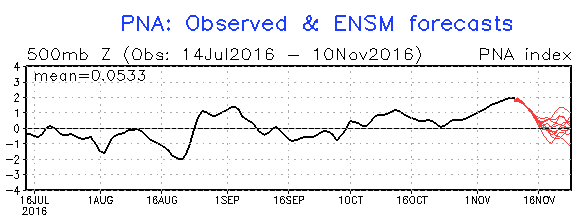
Pacific North America (PNA) index forecast plumes for the next two weeks….maybe heading negative!
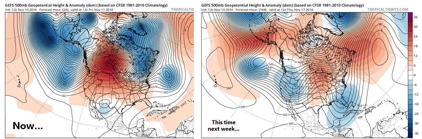
With the PNA shifting negative, we would expect to see more troughs enter the western United States, bringing at least some reprieve from of the huge ridge of late. One such trough is set to come ashore around the middle of next week, seen in the right panel below.
Here is what the latest GFS model run does with it next Thursday: a fairly impressive storm, but WAY too far north. This type of track downslopes the Denver Metro.
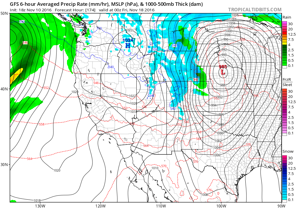
The latest GFS run has the storm tracking too far north, bringing unfavorable downslope conditions to the Front Range
However, variation from model-to-model, and even run-to-run is HUGE. Here is what the GFS thought would happen in its model runs from the last two days…

GFS run-to-run variation over the last few days for the location and intensity of next week’s potential storm
The track of the storm is all over the place, which lends little confidence to what may transpire next week. And as we all know, a fifty-mile shift in track will make-or-break every single Front Range snow storm. So for now, don’t get too hyped-up for snow….
Here’s what snow-lovers can hold onto for the time being….
- There should be enough cold air for snow (and not rain) if something does materialize for Colorado. It’s hard to tell from our recent weather, but it IS the middle of November. It’s actually getting close to the point where an “all-rain” precipitation event becomes near-impossible in the Denver Metro area. That’s right. If something happens, it is very, very likely there would be snow.
- The operational GFS model has a ton of variation (as we have seen in the panels above). However, the GFS ensemble puts the mean center of the storm in a near-perfect location for Front Range snow (right across east-central Colorado). The GFS ensemble mean track for the surface low has remained much more stable (as we would expect). This suggests, despite individual run variation, many of the runs do have a good track for us.
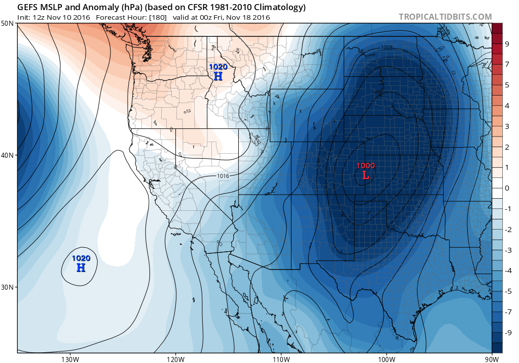
GEFS ensemble mean surface pressure map for next week’s storm. The mean, at least, bodes well for us seeing some snow
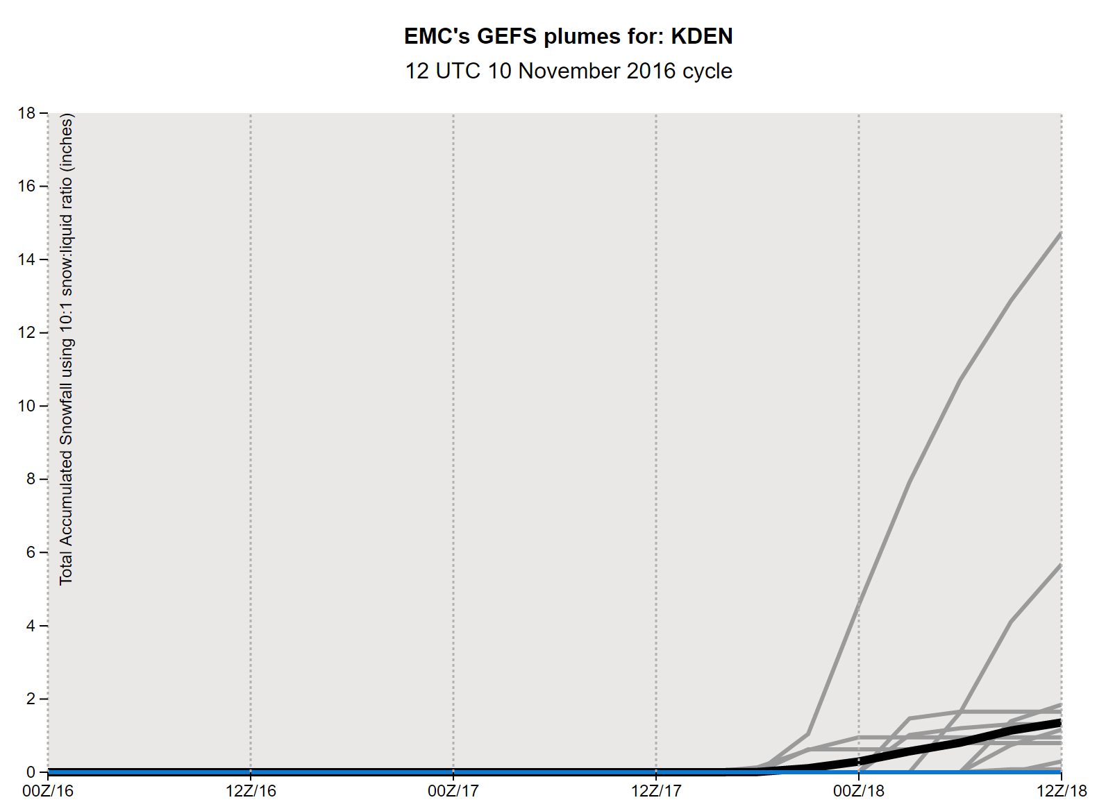
Just for fun, here’s how much snow the GFS ensembles are currently spitting out for snow at DIA. Most members show an inch or two, or nothing at all…
- The storm looks like it could go to our north, and we STILL have a week. Often times, models will bias storms northward early on, and as the storm approaches, slip it southward. The opposite, moving it northward in time, rarely happens. Once it passes to our south in the models, it’s usually GAME OVER for any snow. So while this northward track isn’t good news, it isn’t necessarily bad.
- With moist westerly flow, the Mountains have a higher chance of snow next week, regardless of what ultimately happens. Of course, whether it is just a few inches, or more, remains to be seen. The ski resorts will get something.
That’s all for now! We’ll be monitoring the end of next week closely. We’ll likely be revisiting this storm in some capacity in our weekly outlook post on Monday. For now, there are better uses of our time while Mother Nature decides what she wants to do. Enjoy yet another mild and sunny weekend. Highs will be in the 60’s both days.


You must be logged in to post a comment.