A quick post on the status of tomorrow’s potential snow, and good news for the weekend!
Earlier in the week, there was some indication by a few of the models that conditions could support a chilly rain with some (non-accumulating) snowflakes mixing in all the way down to the Plains. The approaching system is weak, doesn’t have (hardly any) upslope, lacks cold air, and is moving too quickly across Colorado to have much of an impact, let alone a wintry one. Earlier guidance suggested the system could dig a little deeper and possibility form a weak closed 700 mb low. This would help funnel the cold air southward and also provide the upslope. Without this facet, tomorrow’s weather will be a little tamer.
We will see a sizable cool down for Thursday, and a good deal of clouds, but precipitation should be fairly sparse. However, there will be a period of time during the day Thursday where a weak push of upslope should get some spotty light showers going in an near the Foothills.
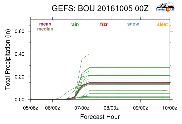
The GFS ensemble precipitation plume diagram for Boulder is shown below, predicting rain in the realm of 0.1 to 0.3″ for the city. Since the GFS is on the high-side compared to the other models, we’ll probably land somewhere in the low end of this range.
Not to be forgotten, this event could bring some parts of the Foothills their first flakes of the year. Forecast temperatures put snow levels around 7,500 feet.

Forecast snow level for Thursday afternoon (using in-house algorithms and GFS model data)
The GFS forecast snow map is shown below, and looks rather reasonable. Mountain areas near Steamboat and Vail favored by northwest flow will do best with this system. In those areas, look for 2-5″.
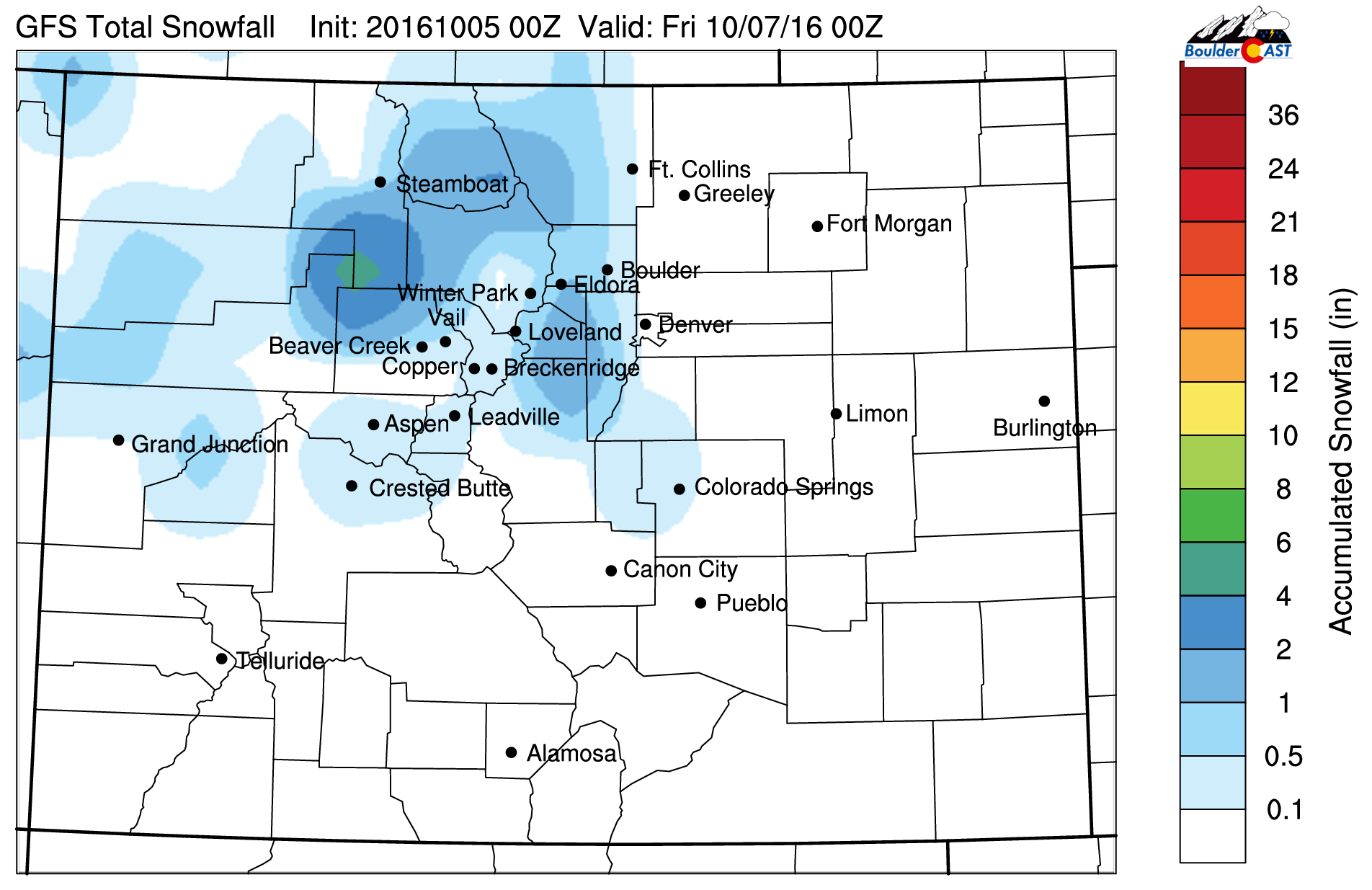
GFS forecast total snowfall through Thursday
Closer to home…we’d say a trace to 1″ of snow is on the table for Foothills areas above 8,000 feet that get lucky. Near and west of the Continental Divide, 1-3″ can be expected.
After the system passes, skies should clear Thursday night and bring a fairly widespread freeze to the Plains. Despite the misguided Freeze Warning issued last night (where most Denver locales barely dropped below 40, let alone 32), Friday morning should have many areas reach the 32-degree mark. Get those plants to safety!
The upcoming weekend will see lots of sun and seasonal temperatures in the low 70’s.
—
While we we’re hopeful this week would offer the chance to put out our first snow map of the winter season, it really isn’t warranted. Hang in there, snow is becoming climatologically more favorable with each passing day…


You must be logged in to post a comment.