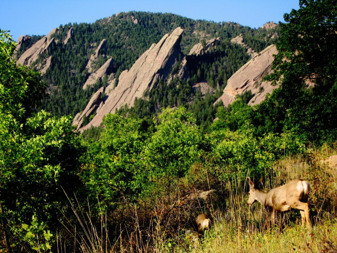
The weather this August has been very mundane, compliments of a pesky ridge of high pressure which has held its ground across the American Southwest. As a result, August was characterized by beautiful weather, albeit hot. The monsoon plume has largely been confined to Arizona, Utah, and western parts of Colorado, keeping the Front Range relatively parched the past month. Will this trend continue into September? Read on as we examine Boulder’s climatology and consider the current state of the atmosphere to give our outlook for next month.
As mentioned, hot and dry have been a thing recently. Boulder was officially 2.4 degrees above normal for high temperatures (including sixteen 90+ degree days), with only 0.31″ of rain for the month of August, about 1.8″ less than normal. This was in stark contrast to what was expected for the month. Mid-range weather models did not grasp the ridge persisting this long. Passing weather systems swooping down from the north struggled to beat down the ridge, and only for very short time spans when they did. One such system did just that on August 19th, which sure did feel refreshing: a morning low in the mid 40s, a dusting of mountain snow, and a high temperature 15 to 20 degrees below normal. The pattern in August also tended to steer many of the tropical cyclones in the eastern Pacific further west than normal. This helped to keep the deep, tropical moisture away from our region, and is currently making for an uncharacteristically dicey hurricane season in Hawaii.
Normally, September across the Front Range is fairly quiet, as the tail-end of the monsoon comes to a close in the first half of the month, leaving behind generally dry conditions with warm days and cooler nights. Let’s take a closer look.
Precipitation:
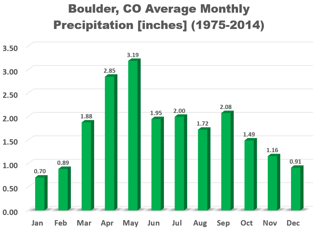
On average, Boulder receives 2.08″ of precipitation in September, technically making it the third wettest month of the year. However, without the 18+” that fell during September 2013, the average would only be 1.45″, actually solidifying September as one of the drier months of the year.
The graph below shows September precipitation totals since record-keeping began in Boulder.
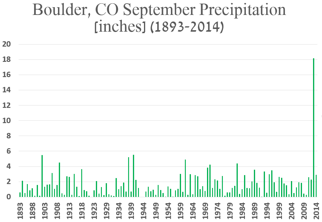
Wow, that really puts the unprecedented rainfall of 2013 into perspective! Check out our special two-year anniversary post commemorating the Boulder Flood. Needless to say (yeah, we’re saying it anyway), no one should expect that much rain this September!
And of course there is that elephant in the room: snow! Though snow is possible in our higher elevations year-round, September opens the door for weather systems that are cold enough to potentially produce snowfall on the Plains. Snow has been recorded in Boulder during 27 different Septembers since 1893 (about 1 out of every 5 years), so September snow is not unheard of, or actually even all that rare. Though, admittedly, most September snows are on the light side, usually just a slushy inch or two. However, on September 17, 1971, 21.0 inches of snow fell. Big snows can happen this month! Last year, Boulder recorded it’s earliest measurable snowfall on record, picking up 0.5″ of white stuff on September 12th! That’s right! Our first snow could be less than two weeks away! Realistically, though, climatology has our first snowfall occurring down the road a bit, in early to mid October.
Temperature:
Though most of September is technically part of summer, it is definitely a month of transition. The average high temperature plummets from 83 degrees on the first of the month, to just 72 degrees by September 30th. The hottest temperature for the month was 100 degrees, observed on September 2, 1983. On the last day of the month in 1980, the temperature dropped to just 15 degrees. Quite the range of possibilities! We see the disparity between all-time monthly maximum and minimum temperature begin to creep back up in September (see below).
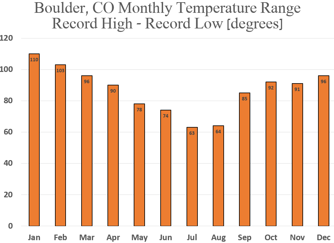
Disparity between all-time monthly record high and low temperatures. (Record high minus record low)
Outlook:
El Niño is still a player, currently sitting as the second strongest one since 1950 (the year when monitoring of such silly things as ocean temperatures in the middle of the Pacific Ocean became cool). Forecasts take this year’s El Niño off the charts (literally, see below) to THE strongest level ever, peaking sometime in late fall.

Model ensemble forecasts for Nino 3.4 region temperature anomaly.
Based on our analysis from a previous post, under moderate to strong El Niño conditions, there is no clear expectation (from normal) for precipitation in the month of September. However, Boulder’s median daily high temperature drops 1.1 degrees under these conditions. We should keep this tweaked climatology close-at-hand, as potentially the strongest El Niño on record continues to evolve.
Model consensus shows a relatively active pattern over the Mountain West for the first half of September. As many as three troughs are slated to impact the region, much more active than is typical for this time of year.
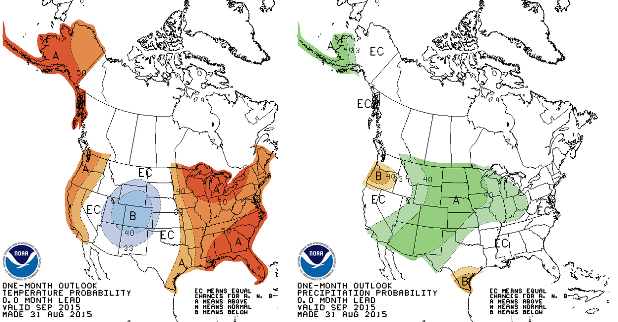
Because of the aforementioned factors, we will once again try our luck with a cooler and wetter than normal projection for September. The Climate Prediction Center provides a similar forecast for much of the American Southwest. They mention the same troughing across our region, and therefore bulls-eye most of Colorado into the >40% chance of above normal precipitation and below normal temperatures for September.
While it once again appears things could take cool/wet turn throughout the next month, they may not, just as August seemingly dodged the projected gloom. Hopefully it pans out, as we sure could use the moisture across our region, which has been turning browner with each passing day. Regardless, get outside and enjoy all that September in Boulder has to offer, whether it be the scorching heat, the tail-end of 14er season, or the year’s first snowfall! Before you know it, October and Fall will be upon us. Speaking of which, head over to Target or King Soopers to get your Halloween goods, as they undoubtedly already have them in stock. It’s only sixty-one days away, you know.


You must be logged in to post a comment.