
It’s hard to believe that August is now upon us! Where is the summer going? Thus far, El Niño and an active monsoon pattern have aided in keeping our temperatures relatively cool and wet. July recorded nearly 1″ above normal precipitation, and had an average temperature more than 2 degrees below normal. Should we expect more of the same in August? Read on as we examine Boulder’s climatology and consider the current state of the atmosphere to give our outlook for the next month.
Precipitation
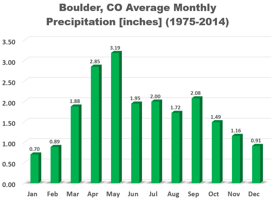
The monsoon is usually in full-force at the beginning of August, but slowly tappers off as the month progresses. August comes in as Boulder’s 7th wettest month on average, with a typical year seeing 1.72″ of rainfall.
Colorado also tends to see a weakening of the upper-level winds in August as high pressure builds aloft. Combined with the relatively abundant monsoon moisture, these reduced steering winds allow developing thunderstorms to drift very slowly or remain stationary for extended periods of time, bringing the potential for tremendous amounts of rain to fall.
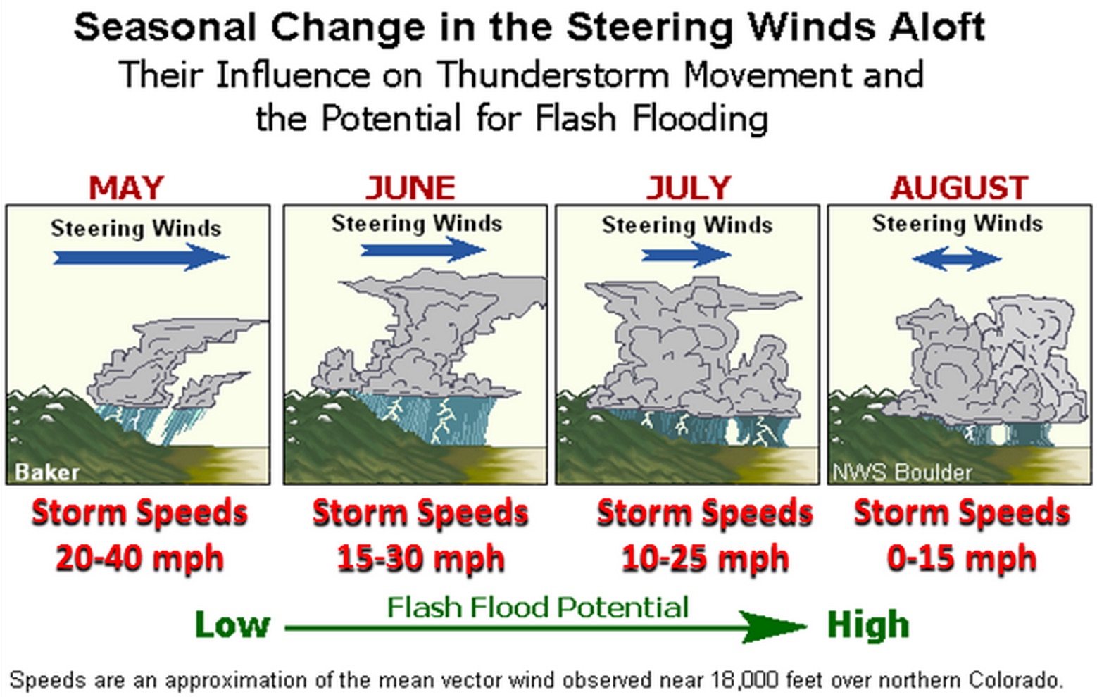
This is especially true when you add the remnants of an old frontal boundary to the mix. Heck, yesterday saw a few localized areas east of Denver drenched in 2 to 4″ of rain along a convergence line, aided by extremely weak steering flow.

Doppler estimated rainfall for Thursday, July 30, 2015 | NWS
As a result, not surprisingly, some of the worst floods in state history have occurred in (early) August. The Big Thompson Flood of 1976, the deadliest flood in Colorado’s history, occurred on July 31 (just a few hours before August began), and more recently, on August 10, 2013, heavy rain triggered flash floods and mudslides west of Colorado Springs. The last week of July and the first week of August are historically the peak in flash flooding for our region. However, the risk remains elevated into September, when moisture levels finally begin to drop and the upper-level winds pick up once again (e.g. remember that flood we had in September 2013?).
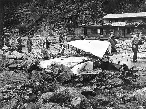
Big Thompson Flood aftermath | Denver Post
Wettest August: 7.41″ (1951)
Driest August: 0.03″ (1985)
Temperature
August is Boulder’s second warmest month, having a monthly mean temperature of 71 degrees (July is warmest at 73 degrees). Despite July 2015 landing statistically cooler than normal, we did officially reach the 90-degree mark 9 times (12 times at BoulderCAST). This is below the norm of 15 days, but serves as a reminder that summer in northeast Colorado can get very hot, with or without El Niño in place.
Climatologically, the first of the month begins the decline in average daily high temperature, trending from 85 to 82 degrees by the close of August. The all-time record temperature for the month is 102 degrees, occurring on August 24, 1936. The coldest temperature occurred on the 25th in 1910, when the mercury plummeted to 37 degrees.

Elk statue on Pearl Street Mall
Forecast
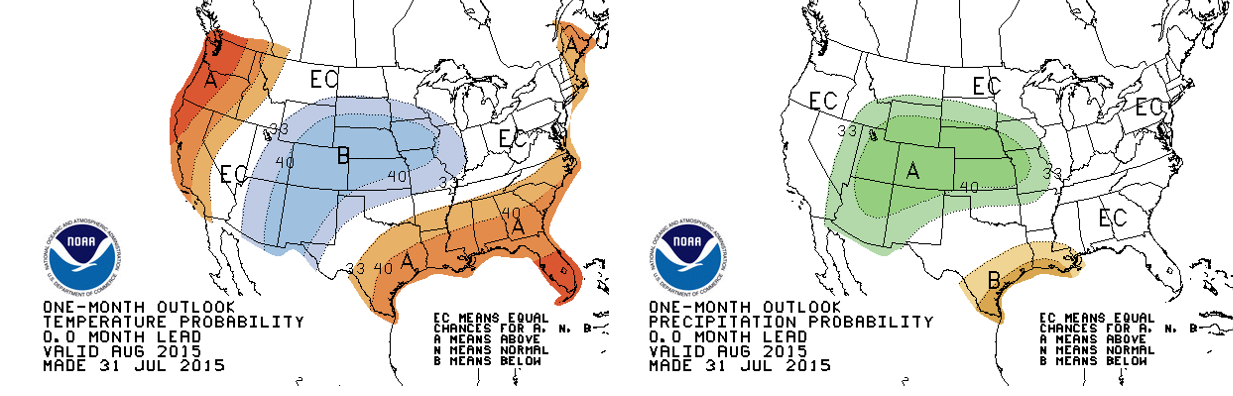
As we have outlined before, due to the presence of a strong El Niño, we expect August to remain cooler and wetter than normal, maintaining the running trend of 2015. This will continue to keep the fire danger across Boulder County virtually non-existent. The 30-day outlooks released today by the Climate Prediction Center also paint Colorado cool and soggy for August, with >40% chance in both respects (temperature & precipitation).
The main factor influencing these projections for our region is the warm eastern Pacific Ocean, which will likely continue to spawn tropical cyclones that transport copious amounts of tropical moisture northward. While the Atlantic is extraordinarily “lucky” to have gotten three named storms so far this year, the eastern Pacific is currently entertaining Hurricane Guillermo, the basin’s 7th named storm in what is sure to be an active season.
The outlook maps above look strikingly similar to the typical plume of monsoon moisture streaming into the Southwest USA this time of year, shown below.
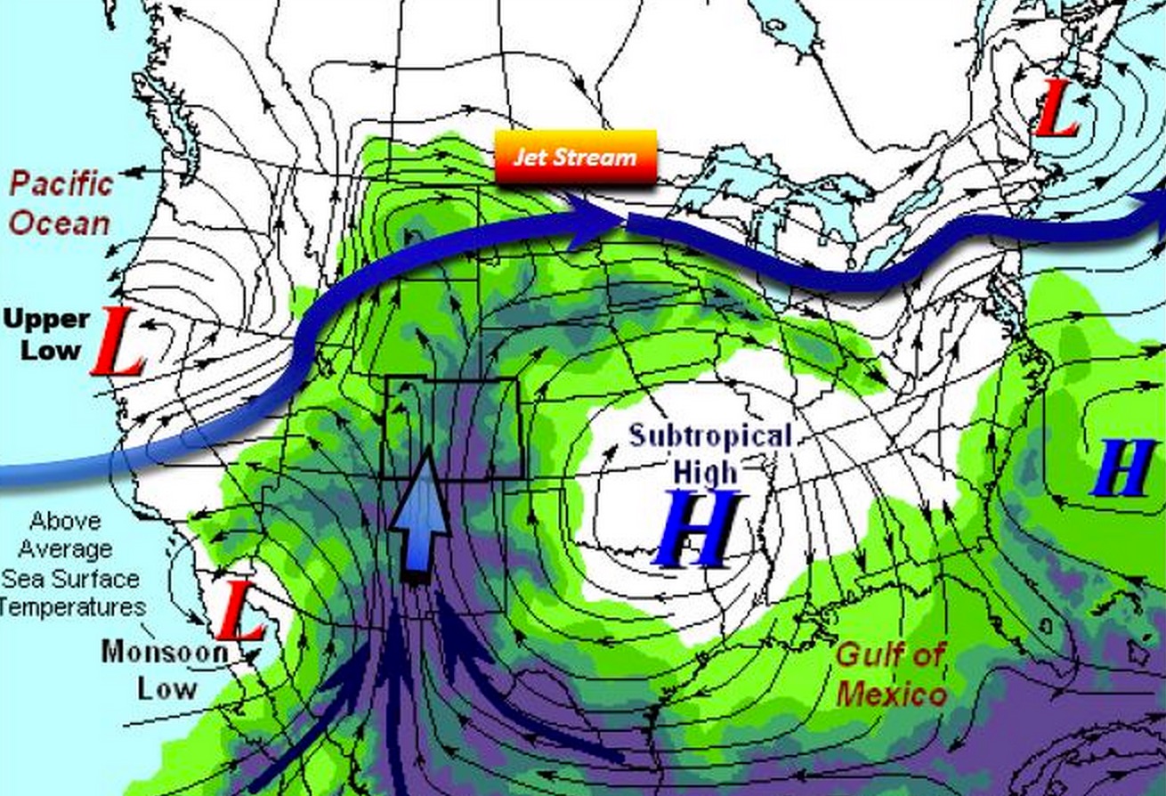
Southwest Monsoon Diagram | Created by NWS Boulder
Despite the dry end to July, your umbrella and rain coat may become necessary items as we head into August.


You must be logged in to post a comment.