Our storm has come ashore this morning in southern California and will be skirting south of Colorado tonight. After a round of showers and thunderstorms this afternoon, a cold front passes through this evening, causing snow levels to take a dive. Read on as we detail tonight’s messy forecast, including where to expect the spring snow.
The storm we have been anticipating for almost a week now has come ashore early this morning near the USA/Mexico border.
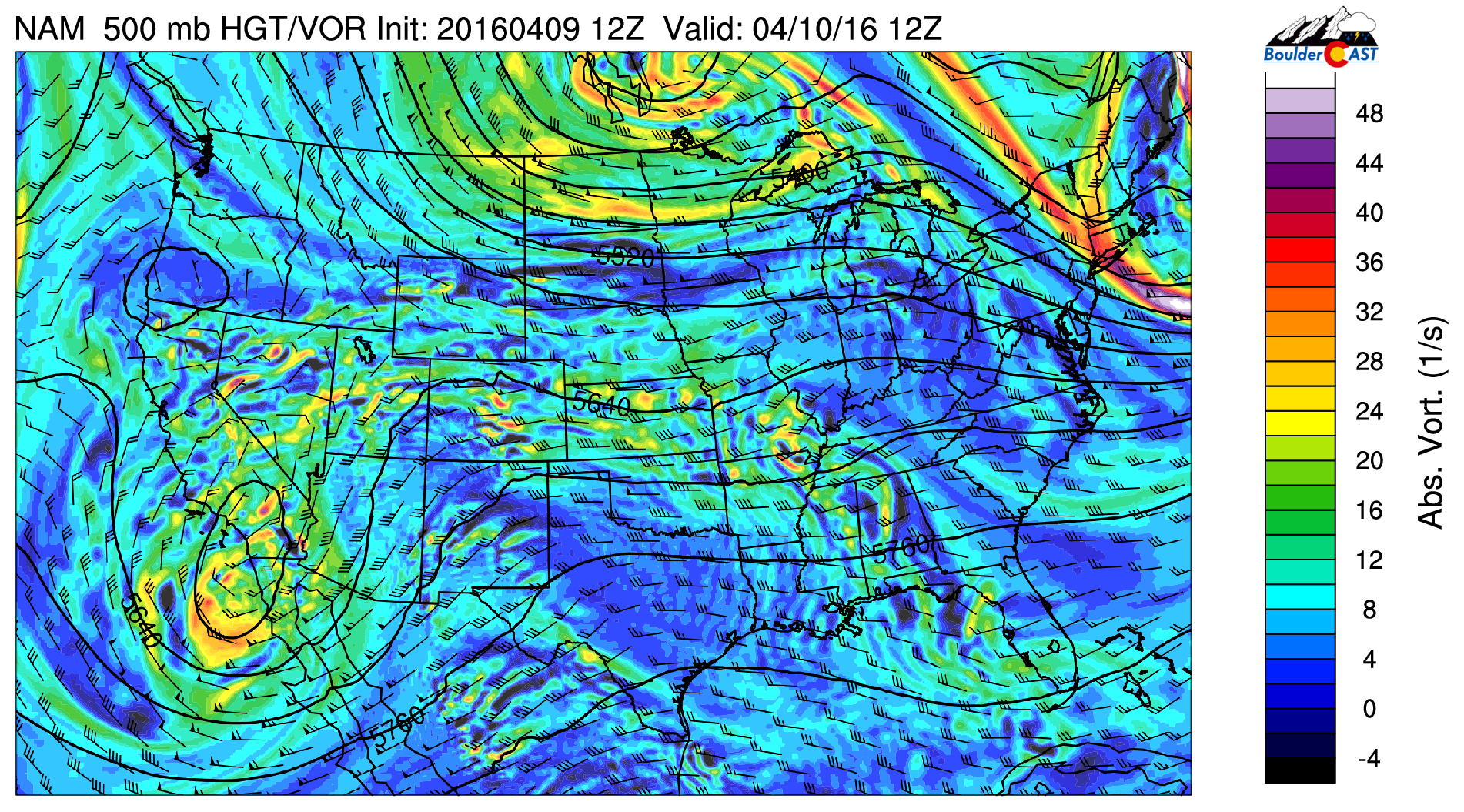
NAM 500 mb vorticity map showing today’s system coming ashore near San Diego.
Models have been trending southward and warmer over the last few days with this system (which we were concerned about). As such, we’re not expecting it have a major impact across the Boulder region.
The basics remain the same:
- The upper-low will track well to our south tonight
- Surface low develops in SE Colorado this afternoon
- Cold front coming through NE Colorado this evening, with upslope behind it and good moisture to work with (precipitable water near 0.5″)
- System is riding along the southern storm track, with no real linkage to the truly cold air
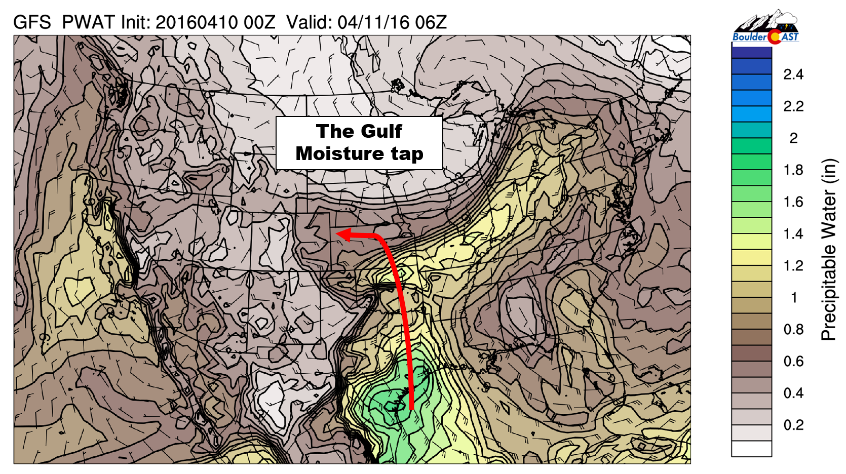
GFS forecast precipitable water for tonight, showing the stream of moisture coming into eastern Colorado from the Gulf of Mexico
Ahead of the front, temperatures will climb into the low 60’s this afternoon on the Plains. The pre-frontal airmass will be unstable, allowing showers and thunderstorms to break out by the middle of the afternoon with the solar heating. As the front passes from the north by mid-evening, the event will transition into a purely upslope event, with widespread light to moderate precipitation, heaviest near the Foothills.
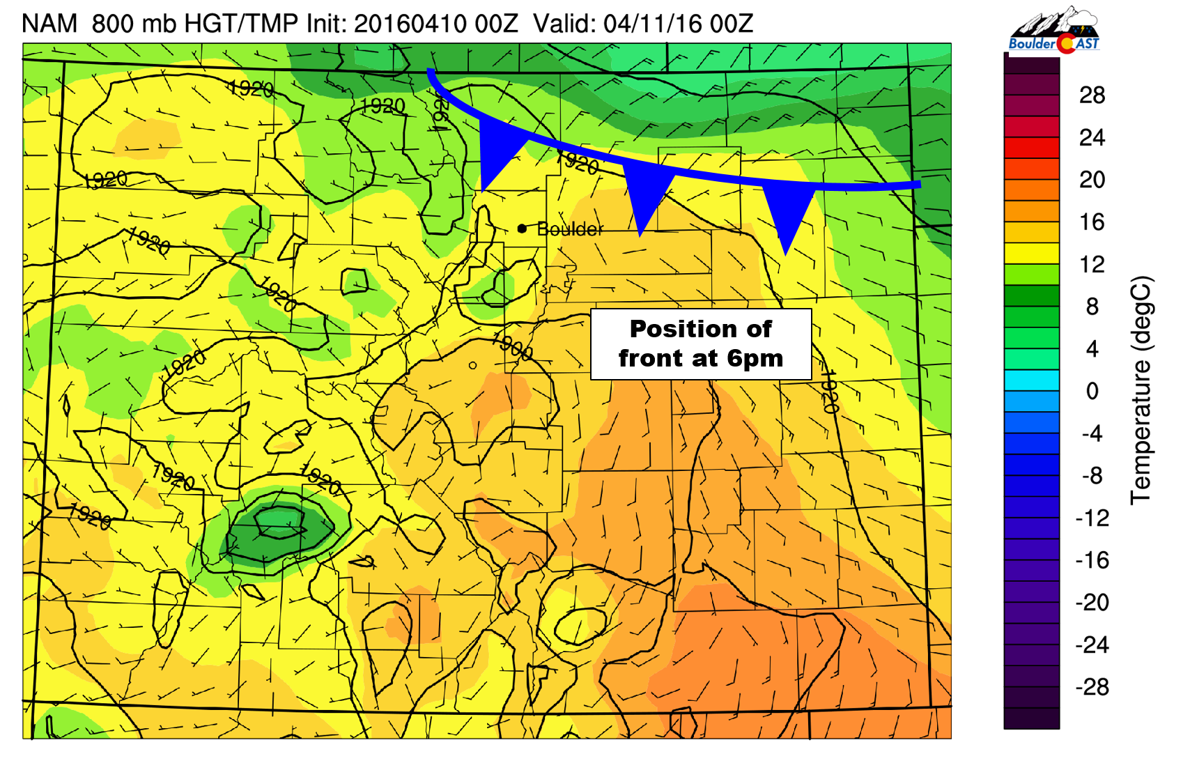
NAM 800mb temperature map for 6pm Sunday, showing the location of the cold front
Most models are indicating 0.3-0.6″ of precipitation in Boulder, with more south of Denver and in the Foothills; a good soaker but nothing incredible.
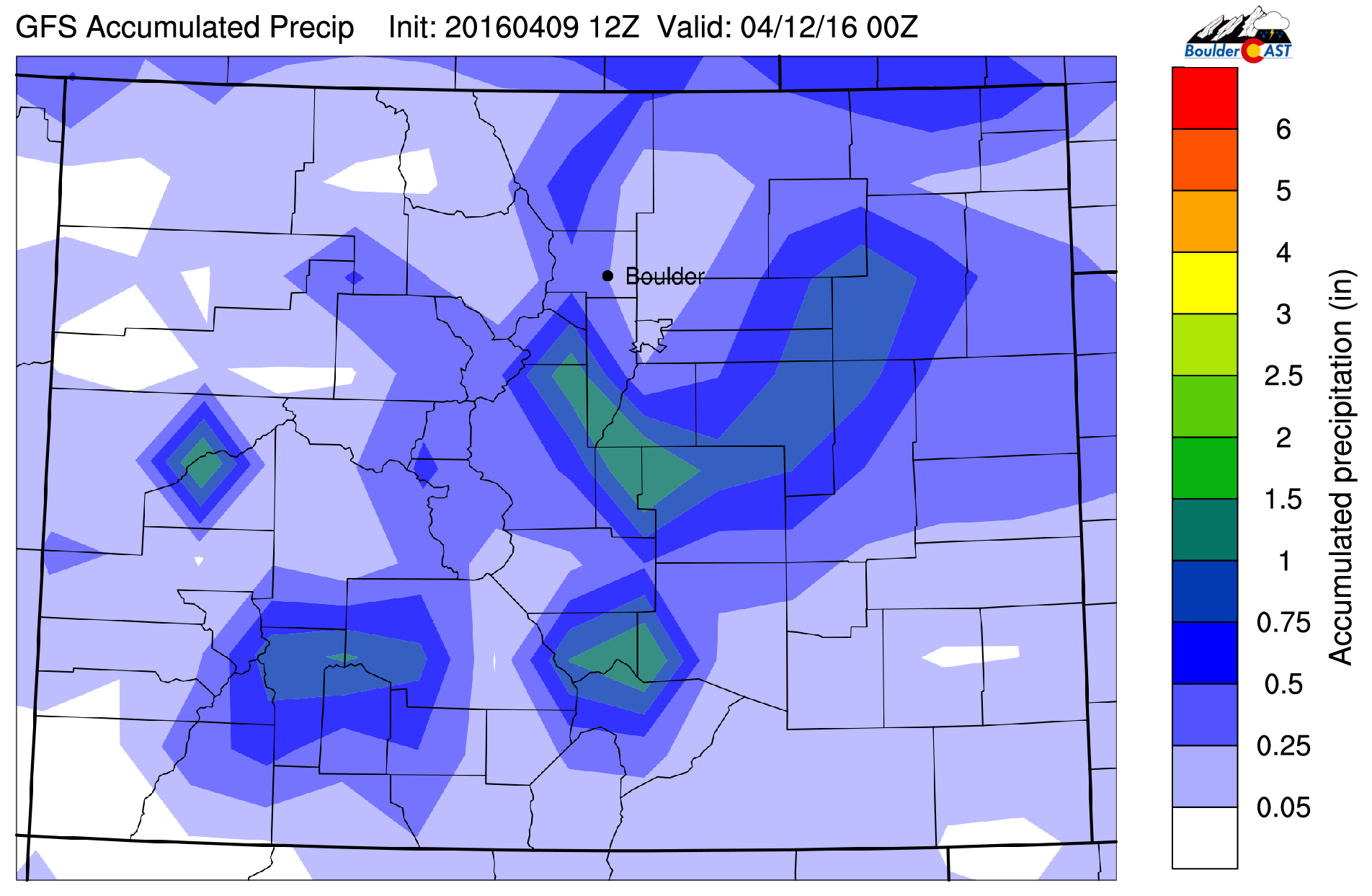
GFS total accumulated precipitation map through Monday night. Notice how most of the action remains south of our area
Where’s the snow?
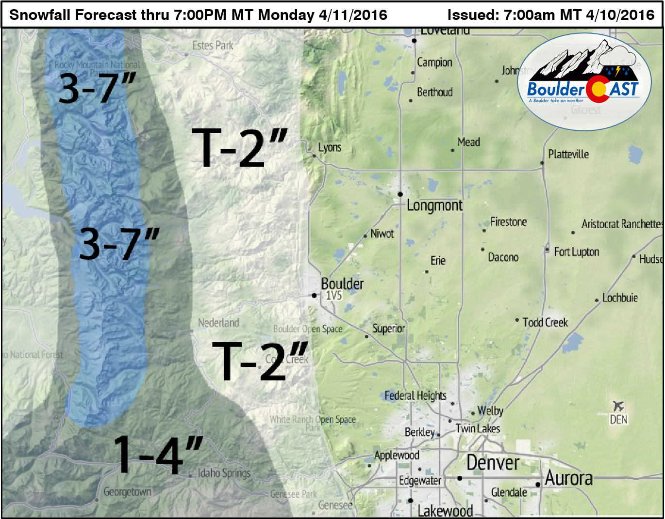
There are still large model discrepancies on the warmth of the system, and therefore, the resulting snow levels. Before the cold front this evening, snow levels will be very high, near 10,000 feet. Our best guess is that the level will fall to near 7,000 feet later tonight and into Monday morning. Areas like Nederland, Sugarloaf, Allenspark, and Jamestown should expect snow. Some flakes probably will mix in lower down, but it shouldn’t amount to anything. A few slushy inches of snow are likely in the higher Foothills, with more in the Mountains east of the Divide. Overnight lows will be in the 38-42 degree range tonight for the Plains, so we’re only expecting a cold rain.
Our snowfall map is shown below:
Things begin to dry out by Monday morning, with precipitation mostly ending before the lunch hour. Overcast skies and cool weather will prevail, with highs running well below normal in the 50’s. We could see showers and a few storms redevelop Monday afternoon, but that would mostly be confined to the Mountains/Foothills.
April weather systems can have many potential outcomes across the Front Range. Sometimes the cold air is there, other times it’s not. Tonight is the latter, and for all intensive purposes, we’re dodging a bullet. Most of us should brace for a healthy dose of rain, which is where we placed our bets in our April outlook. Beyond Monday, a weak storm system rolls through Tuesday night, with a more impressive one arriving just in time for the weekend. Look for more details on both these features in our weekly forecast tomorrow.
Don’t forget your umbrellas this evening. Enjoy!


You must be logged in to post a comment.