We’re currently tracking a spring storm set to arrive to eastern Colorado Sunday night. It has the potential to bring significant snowfall to parts of the area. The track has remained consistent for several days now, and the models seem to be converging on a common solution. As such, confidence is increasing and we’re here to outline what we know so far and what to expect to end the weekend.
We’ve been keeping tabs on the approaching system for several days now, providing updates to our Premium subscribers via our daily forecasts. The storm system is set to come ashore near San Diego Saturday night. This track is the furthest south we have seen since early February, and is one that can often produce significant springtime precipitation events for the Front Range, which looks to be the case this time around.
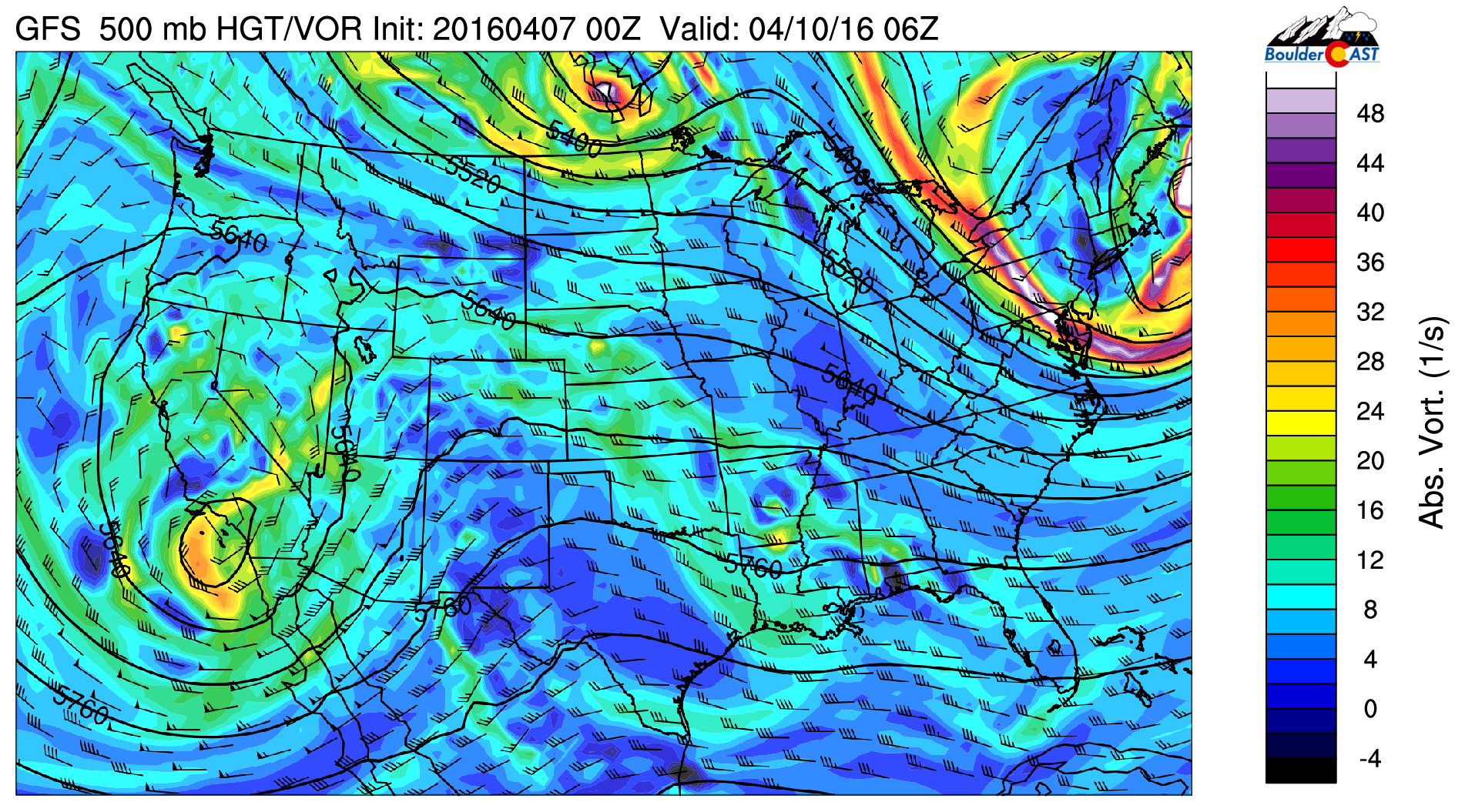
GFS 500 mb vorticity map for Saturday night showing the storm coming ashore in Southern California
The most advertised solution brings the disorganized upper low across northern New Mexico Sunday night…
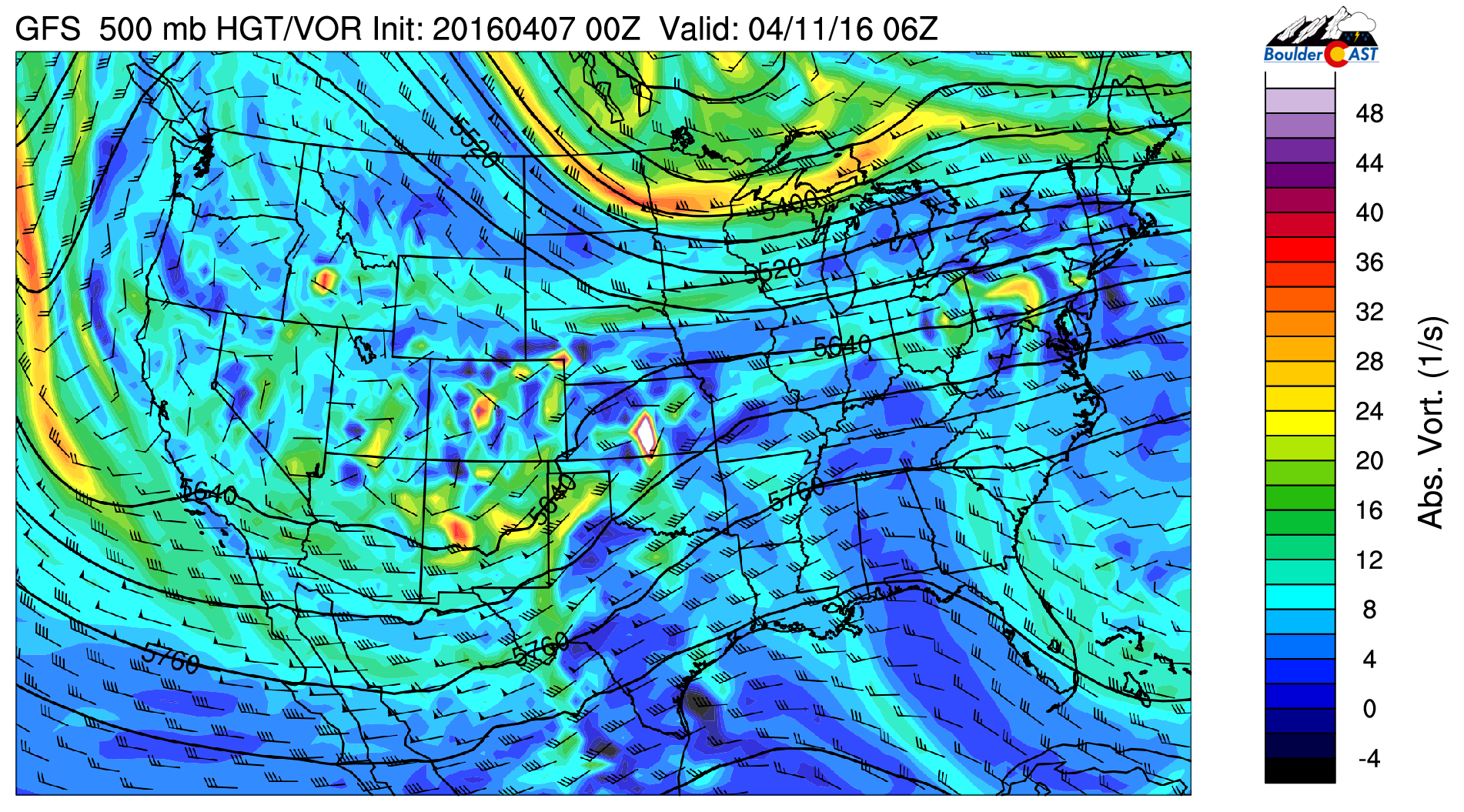
GFS 500 mb vorticity map for Sunday night showing the messy wave moving across New Mexico
…with a surface low developing in southeast Colorado. This brings a cold front through our region Sunday evening.
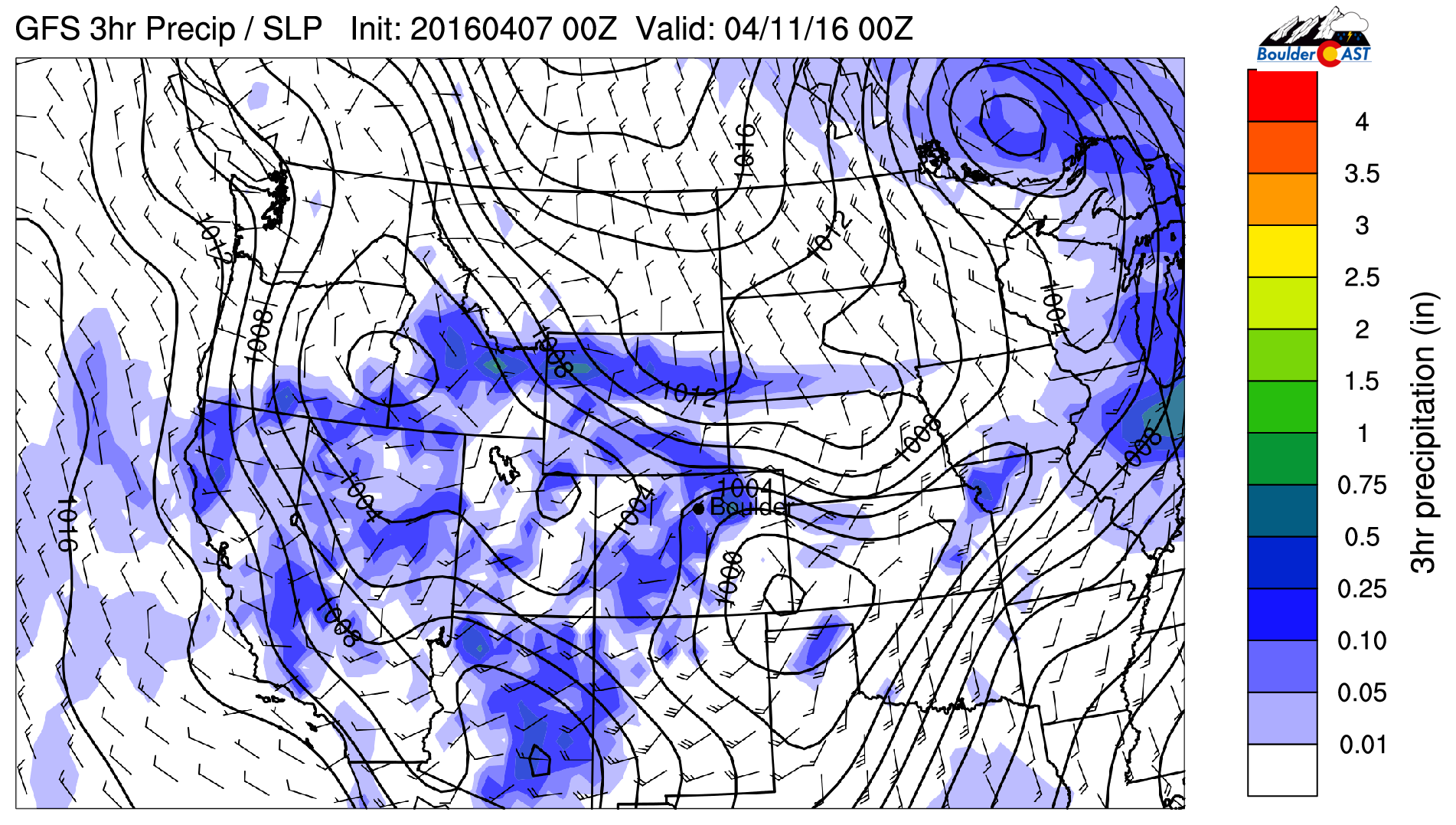
GFS pressure and precipitation map for Sunday evening, Notice the surface low in SE Colorado
Behind this front, a prolonged period of upslope ensues across northeast Colorado, with plenty of moisture available. The track and movement speed sustains the upslope from early evening Sunday into Monday morning.
Will it be rain or will it be snow?
Of course, the biggest concern is whether this is going to be a rain or snow event. At this point, most models are running several degrees too warm to support snow on the Plains. Instead, snow levels are projected to only drop down to 6,500-7,000 feet Sunday night, with temperatures remaining near 40 across the Plains.
The models (and their ensembles) produce 0.5 to 1.5″ of precipitation across the Denver Metro area, with the higher amounts west and south of the city where northeasterly upslope will have the biggest impact.

GFS forecast precipitation through Monday evening. Very wet across NE Colorado
Based on these precipitation amounts, the Foothills could be in store for a significant dumping of snow (maybe a foot!), with a good soaking of cold rain for the Plains. Here is the latest GFS snowfall forecast for the event:
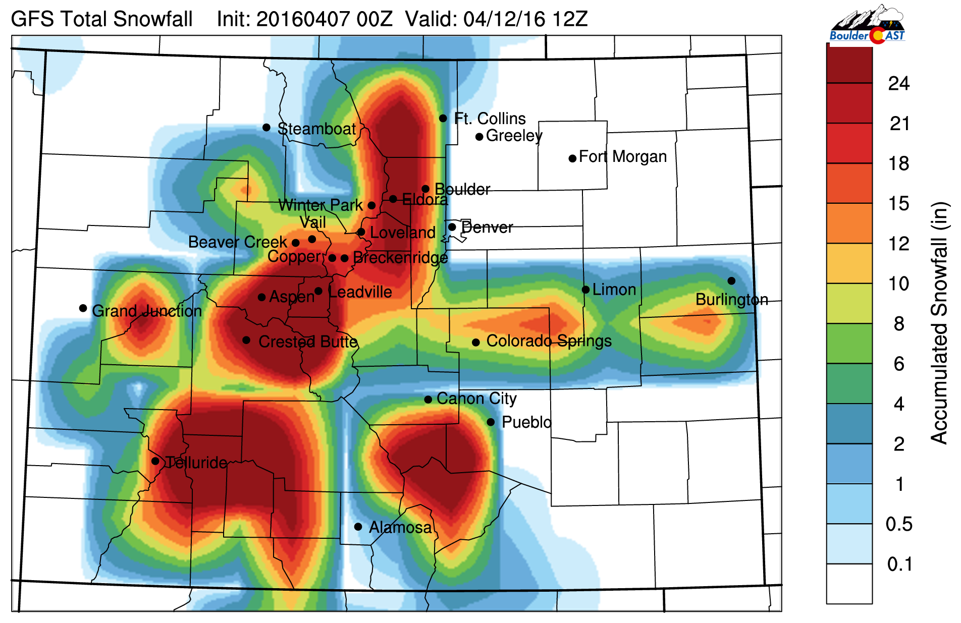
GFs forecast snowfall through Monday evening. The potential is there for lots of snow in the higher elevations
Still three days out, we’re not placing any bets yet. We have some concern that the low may shift southward over the next few days, taking the heaviest precipitation with it.
Just be aware that we’ll likely be starting next week wet and snowy (for some)! If things shift colder, major lower-elevation power outages could be a concern with spring in full-bloom.
We’ll pass along any necessary updates over the weekend. In the mean time, enjoy the dry and warm weather!


You must be logged in to post a comment.