Rain/snow mix changing to all snow this afternoon. Temperatures near 45 early, then falling through the afternoon. Light accumulations expected, mainly on grassy surfaces. Continue reading for today’s full forecast.
 DayCAST’s are Premium content. From now until Friday April 1, 2016, all BoulderCAST readers will have access to these daily forecasts. Subscribe to BoulderCAST Premium before April 1st and get 75% off your first month using the promo code SPRING or 17% off your first year with the promo code WEATHER.
——
The unsettled weather we have been advertising for many days arrived last night, with light rain, higher elevation snow, and even some thunder!
We’ll climb to near 45 degrees, with a cold front to move through late this morning. With it, precipitation returns to the region!
Look for a rain/snow mix early on, changing to all snow for everyone by the middle of the afternoon. Snow should wrap-up before midnight. We’re looking at 1-3″ for the area, mostly confined to grassy and elevated surfaces. Highest totals north and west, lowest totals south and east. Our forecast map is below.
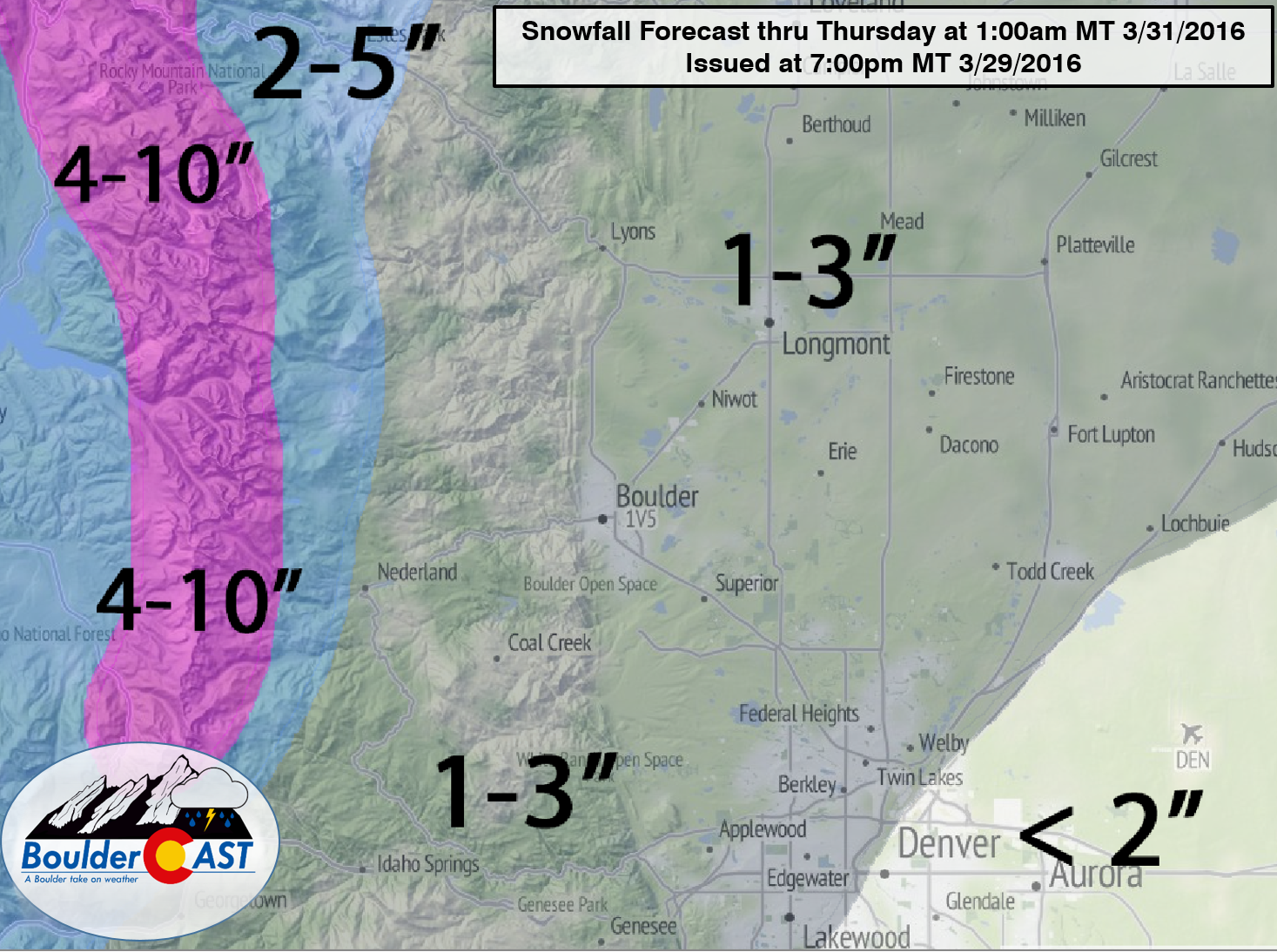
For more details, read our final snow forecast from last night.
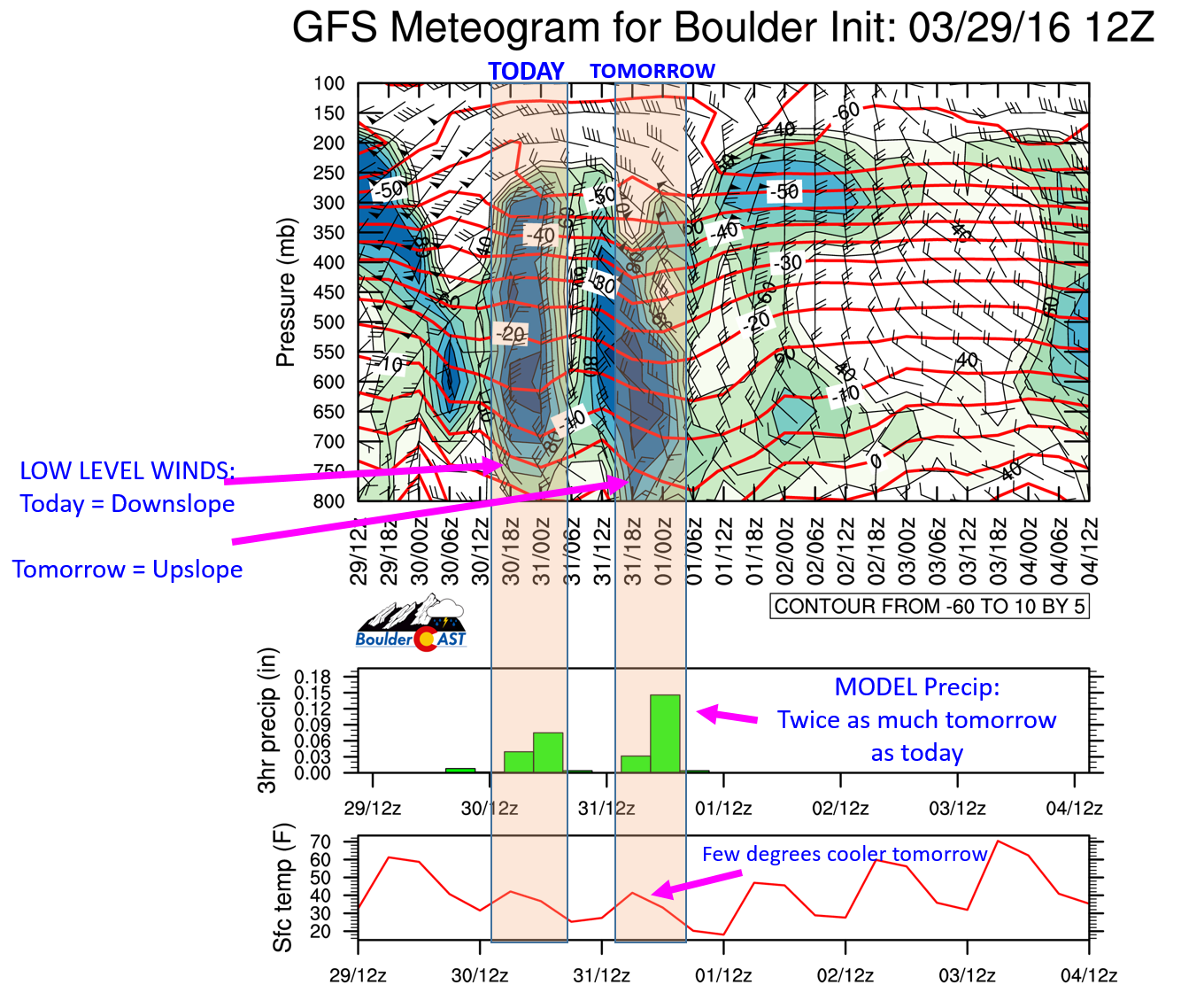
Looking ahead to Thursday, we have another round of light snow in the forecast, which could actually produce more than today’s storm. Our GFS meteogram will tell you why…
Have a great day! Take it easy for your ride home, though we suspect roads will only be wet.


You must be logged in to post a comment.