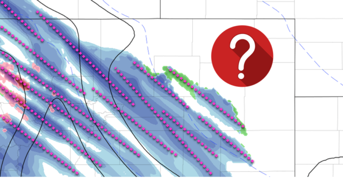
Following hot on the heels of the snowstorm earlier this week, another round of winter weather is expected Thursday evening into Friday evening across the Front Range. This one however will be a different beast, defined almost exclusively by a long window of scattered jet-forced heavy snow bands. Extreme uncertainty in the exact location and timing of the banding means potential snowfall amounts are not quite known. We discuss the setup and give our thoughts on what is sure to be a difficult forecast to end to the work-week.
W
e already covered the large-scale atmospheric setup for today’s snow chance in our weekly outlook on Tuesday, and provided deeper details in our Premium discussion this morning, but to summarize, the key player this time around is a moderately strong and stationary overhead jet stretching from western Canada into west Texas (below on left). This jet is a slow-mover an will be with us in this exact orientation for the next 36 hours into Friday evening before slowly crawling eastward. This position will put northeast Colorado and the Denver Metro area in the left-exit region of the jet tonight and on Friday, a location favorable for scattered heavy snow bands to develop during this time. Furthermore, and just as important, this jet also contains a significant plume of Pacific moisture (below on right). This will help to not only dump the Mountains with 1 to 3 feet of snow, but also provide a healthy moisture supply for the heavy snow bands across the lower elevations.
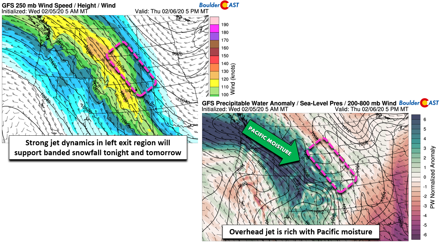
GFS 250 mb wind forecast (left) and moisture anomaly forecast (right) for Thursday evening
A bit paradoxically, this forecast is a major challenge because while we have very high confidence that the heavy snow bands will form across northeast Colorado, we have rather low confidence in the exact locations which will be most impacted. Earlier in the week, it looked like the worst of the snow would remain just north and east of the Front Range, impacting areas from Fort Collins and Greeley northward into Wyoming. As time has progressed, however, the focus appears to have shifted a little further southwestward to now include both Boulder and Denver. This may be the result of favorable timing from a weak frontal boundary backing into northeast Colorado this evening. The added push of north-northeast winds may just be enough to force the heavier snow into the immediate Denver Metro area, or perhaps even a little too far south and west initially.

NAM 800mb temperature and wind forecast for Thursday night
In addition to challenges in pinpointing WHERE exactly the bands will form, we also are having the same trouble with WHEN. The lift and moisture from the jet will begin to enter our area early Thursday evening. Scattered jet-forced heavy snow bands will be possible from this time all the way into Friday evening. It’s likely the bands themselves will wax and wane in coverage and intensity during this timeframe, as well as waver north and south a little bit. We can’t really get any more specific on this.
Given continued model differences in both timing and location of the banding, snowfall totals through Friday evening are very difficult to predict. For example, the GFS model is getting overly excited about the banding potential, with nearly a foot of snow for most of the Front Range. Hopefully that doesn’t verify…
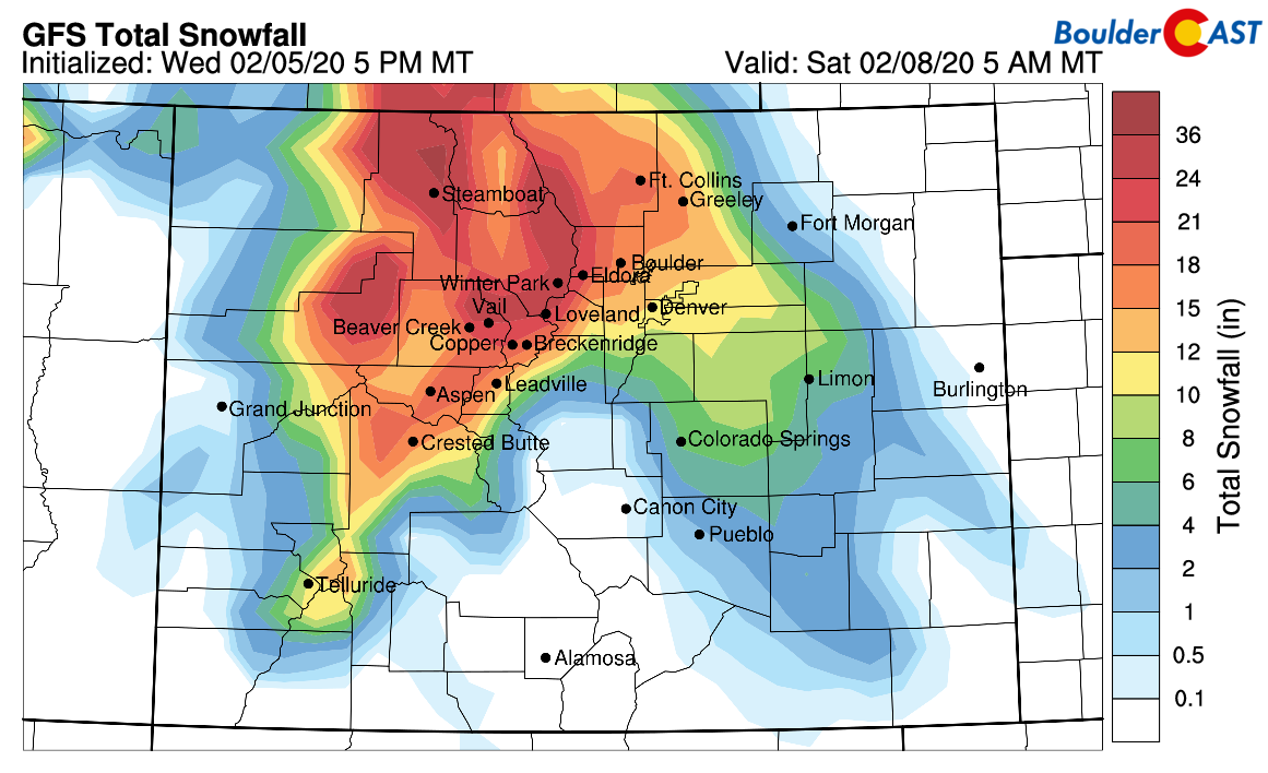
GFS model-derived total snowfall forecast through Friday night
The NAM and HRRR models (shown below) are much less enthusiastic about snow amounts, probably a little bit low at 0-4″ for the Metro area, but the distribution patterns look a lot better:

NAM model-derived total snowfall forecast through Friday night

HRRR model-derived total snowfall forecast through Friday evening
The Euro model falls somewhere in the middle and provides likely the most realistic forecast in our opinion. Note…unlike the BoulderCAST models which use an adaptive snow ratio, the forecast graphic below uses a fixed 10:1 snow ratio, so actual snow amounts are probably 50% higher.

ECMWF snowfall forecast through Friday night, using 10:1 snow ratio
Despite the large degree of uncertainty, our snowfall forecast must be a blend of what we’re seeing in the models but also include adjustments for how these type of events “usually” play out. After 6:00 PM Thursday evening, the threat of heavy snow bands popping-up enters the picture and continues into Friday evening. It certainly won’t be snowing everywhere all of the time or even most of the time, but do be aware the conditions will deteriorate rapidly in your location if and when a snow band moves in. Gusty winds and heavy snow will produce brief white-out conditions and blanket the roads. Be careful when traveling! In our opinion, the most probable timeframe for widespread banding is Friday morning into Friday afternoon.
In general, we’re expecting 2-6″ for most Front Range locations, though due to the scattered nature of the banding, some spots will see less (maybe close to nothing at all) and some will see more. Upper-end potential localized snow amounts could near a foot if a slow-moving band lingers for many hours or the same area gets hit multiple times, which definitely is possible. Our snowfall forecast map for the event is shown below. This covers snowfall from Thursday evening into Friday evening.

Thursday’s evening commute should be fine with snow likely to hold off until sometime later in the evening or overnight. Friday morning could be dicey in some areas, along with Friday evening. Be sure to check the road conditions for the full extent of your commute. The weather along the way and at your destination could be drastically different than your starting point.
Good luck tonight and tomorrow with the snow, whether that’s dodging the worst of it or being right in the middle! In the unlikely event that models happen to quickly converge later today and the forecast becomes crystal clear, we’ll let you know. As always, stay tuned for updates….
—
We discuss Boulder and Denver weather every single day on BoulderCAST Premium. Sign up today to get access to our daily forecast discussions every morning, complete six-day skiing and hiking forecasts powered by machine learning, access to all our Front Range specific weather models, additional storm updates and much more!

Subscribe to receive email notifications for BoulderCAST updates:
We respect your privacy. You can unsubscribe at any time.
.
Spread the word, share the BoulderCAST snow forecast!


You must be logged in to post a comment.