Though the Atlantic hurricane season doesn’t officially begin until the first of June, the first tropical storm usually doesn’t form until the latter part of June, when ocean temperatures are warmer and upper-level conditions become more favorable. However, the 2015 season may begin a little earlier than expected!
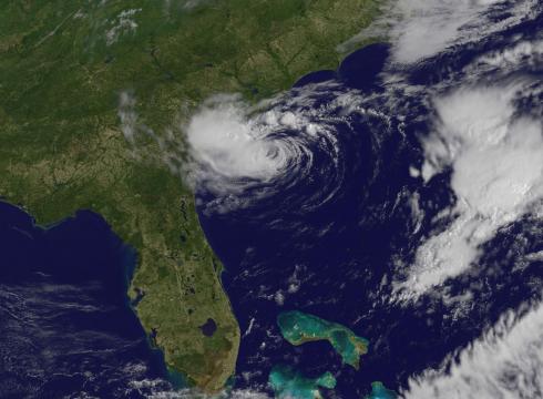
A small disturbance has been meandering its way northward towards Florida for the last several days. Model guidance has been consistent with this feature moving across the Bahamas Wednesday, and then developing the characteristics of the season’s first tropical system. The GFS’s representation at the surface can be seen below.
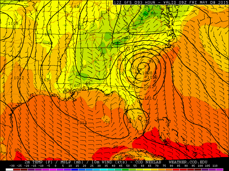
Surface map from the GFS, valid at 3am MT Friday, showing a potentially land-falling tropical storm just north of Savannah, GA.
The NAM depicts a similar track to the GFS, but explodes the storm into a weak hurricane before making landfall. This projection is most likely overdone, but the well-defined eye and accompanying eye wall sure do look magnficient!
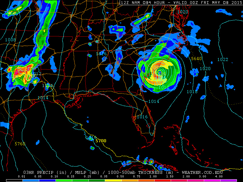
Surface map with precipitation from the NAM, valid at 6pm MT Thursday, showing the improbable existence of a hurricane off the coast of South Carolina.
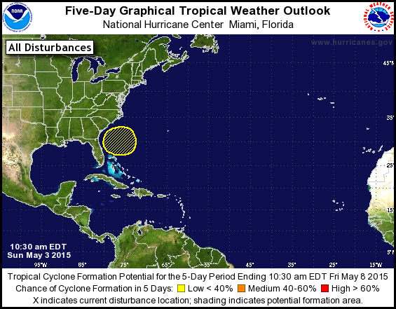
The exact track of this tropical low has varied in the last few model runs and between individual models, from a landfall in South Carolina (GFS/NAM), to a northeasterly track away from the Southeast Coast entirely (Canadian/European). Therefore, take the track with a grain of salt. The important thing is that ALL models have the system actually forming. As of now, the National Hurricane Center gives this disturbance a low chance (less than 40%) of developing into a tropical system. Nonetheless, being only a few days out, confidence is increasing at this point that we may see Tropical Storm Ana by week’s end!
 How much impact will Ana have on Colorado? Absolutely none! But the formation of the season’s first tropical system, especially one this early in May, is exciting stuff!


