There is nothing quite as magical as snow falling on Christmas Day. We’ve gotten lucky the last two years in Denver with snow falling on Christmas in both 2014 and 2015. We explain the meteorological definition and provide our thoughts on the potential for a third consecutive White Christmas.
White Christmas?
In general, there are two acceptable meteorological definitions for the occurrence of a “White Christmas.” There must either be 1″ of snow present on the ground at any point during the day (which is the “official” definition as denoted by the NCDC), or 0.1″ of snow must fall and accumulate on Christmas Day. Surely we all prefer the second option, with actual snow flying as you open your gifts. Old, disgusting brown snow on the ground doesn’t really tend to spread the holiday cheer.
In a recent podcast, we discussed Boulder’s “White Christmas” climatology. When just considering the last 16 years, Boulder has a 38% chance of recording snowfall on Christmas day, but a 63% chance of having some snow on the ground. The longer term averages for Denver (14% snowfall / 38% snow on ground) suggest we have been relatively more fortunate since the turn of the century!
The map below paints the Front Range above 40%, with near 100% odds in the western Mountains.
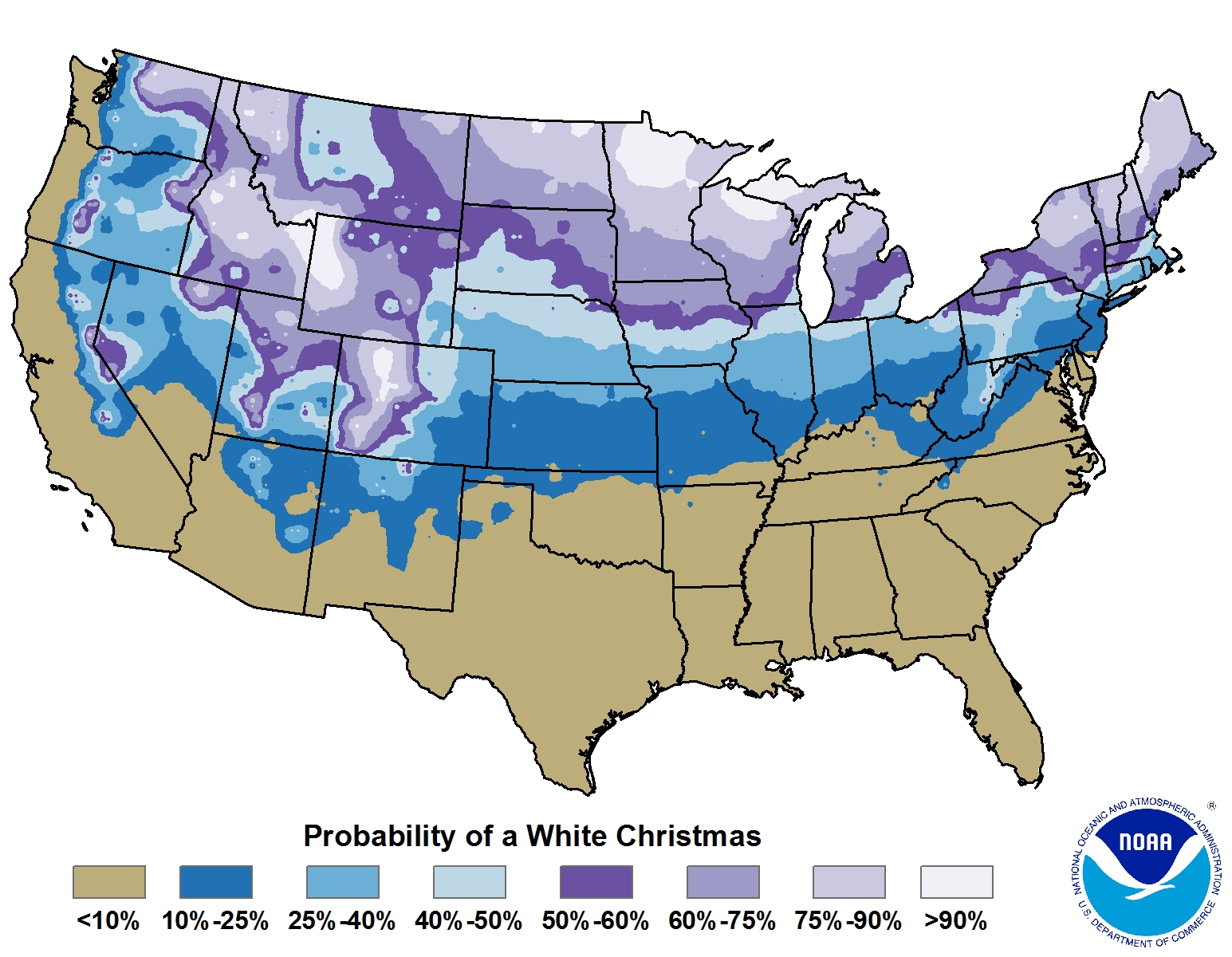
Percentage chance of having snowfall a White Christmas with 1″ of snow on the ground (Credit: NOAA)
Will the streak continue?
Last year, 2-4″ of snow fell Christmas evening, and in 2014, a foot piled up in Boulder towards the tail end of the day into the 26th. Let’s see if our streak will continue this year…
For the first “White Christmas” condition (at least one inch of snow on the ground,) Boulder will not pass. As of Thursday evening, Boulder was officially reporting only a trace snow depth. The 4″ or so that fell a week ago has melted. Denver on the other hand, saw a little more snow and hasn’t been as warm the past week. Therefore, DIA is still reporting 2″ of snow on the ground. However, the forecast for the next few days is filled with sunshine and temperatures in the 40’s and 50’s. It’s not likely that snow will persist into Christmas morning.
As far as the latter condition (0.1″ of snow falling on Christmas), it may be possible but is unlikely at this point. A large, upper-level trough will move across the state Sunday afternoon (shown below in the 500 mb vorticity map).
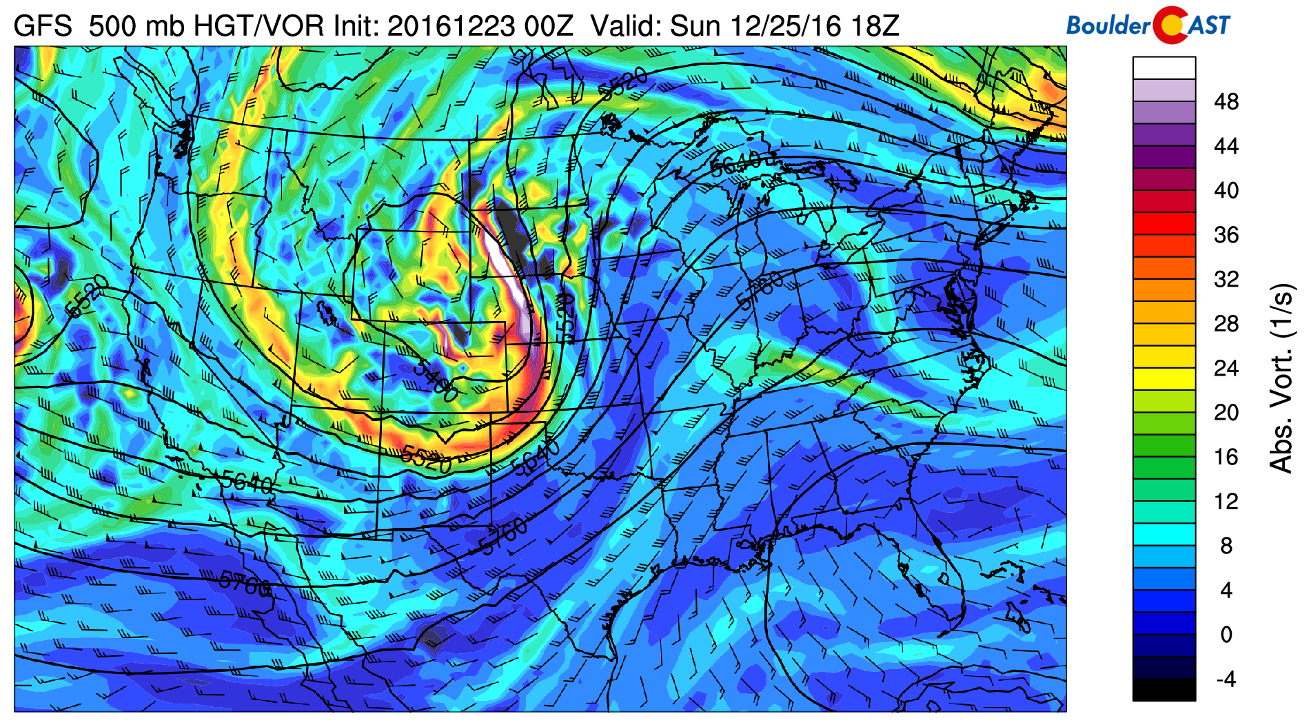
GFS 500 mb vorticity map for Christmas afternoon, showing a trough moving across the state, with a core to our north in Wyoming
We have been discussing this storm with our Premium subscribers throughout the week. Despite some early indication of a Front Range snow storm, the models have remained consistent over the past few days in keeping the bulk of the snow over the Mountains and well to our north in Wyoming where the surface low forms. The Front Range will get left with dry downslope…
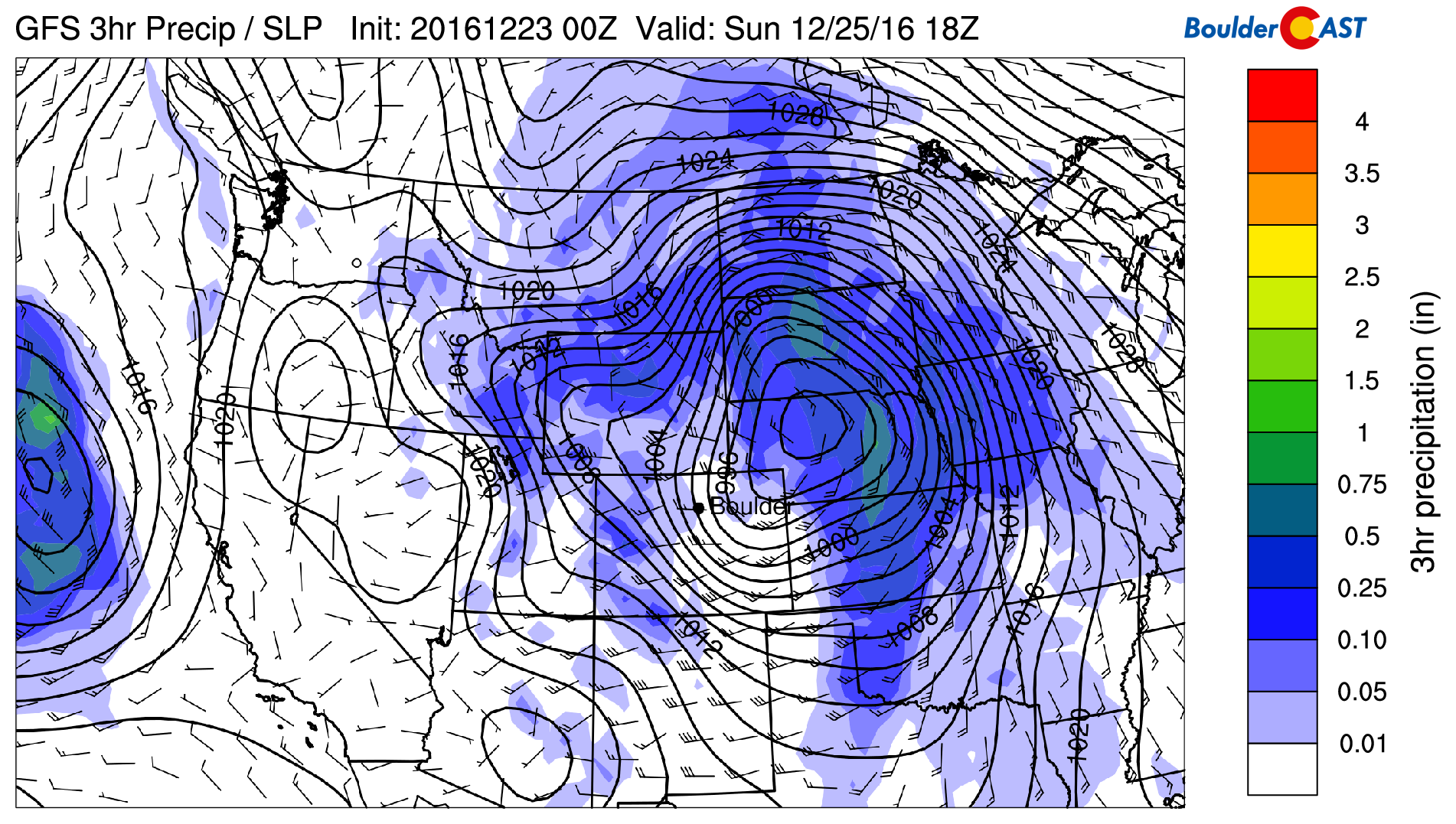
GFS pressure and precipitation forecast map for Sunday afternoon, showing a potent surface low forming in Nebraska and downslope across Denver
Temperatures for Christmas Day will likely be near 40 with partly sunny skies and gusty winds at times. We’ll need to watch the morning hours for the potential for a few spotty rain/snow showers as a cold front arrives. Even then, chances of any precipitation are 10-20% for the region at best given the strong downslope flow. Chances for reaching that 0.1″ of snow accumulation are even lower.
So alas….R.I.P. lower elevation “White Christmas” streak! It was fun while it lasted…
The Mountains on the other hand will do quite alright for snow Saturday into Sunday. Expect 4-8″ in most spots, with a little more possible in southwest Colorado. Our PowderCAST page summarizes our thoughts for the ski resorts this weekend. You may want to check there if you plan to hit the slopes!
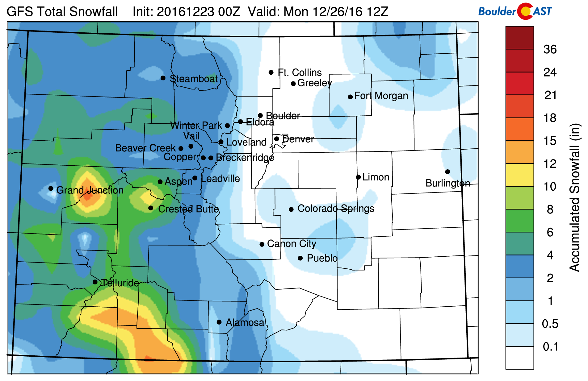
GFS model snowfall forecast through the weekend…
Sorry we don’t have better news for the snow lovers. That’s all for now.
Merry Christmas,
from the meteorologists at BoulderCAST
.


