A quick look ahead to the upcoming weekend shows substantial changes to our weather behind a Pacific cold front, including the season’s first widespread mountain snowfall! Read on for our complete weekend weather briefing.
As we alluded to earlier in the week, which began with near record-setting 90-degree heat, big changes arrive just in time for the weekend as a potent trough moves into northern Colorado. The current (Friday evening) 500 mb vorticity map is shown below, depicting this big trough.
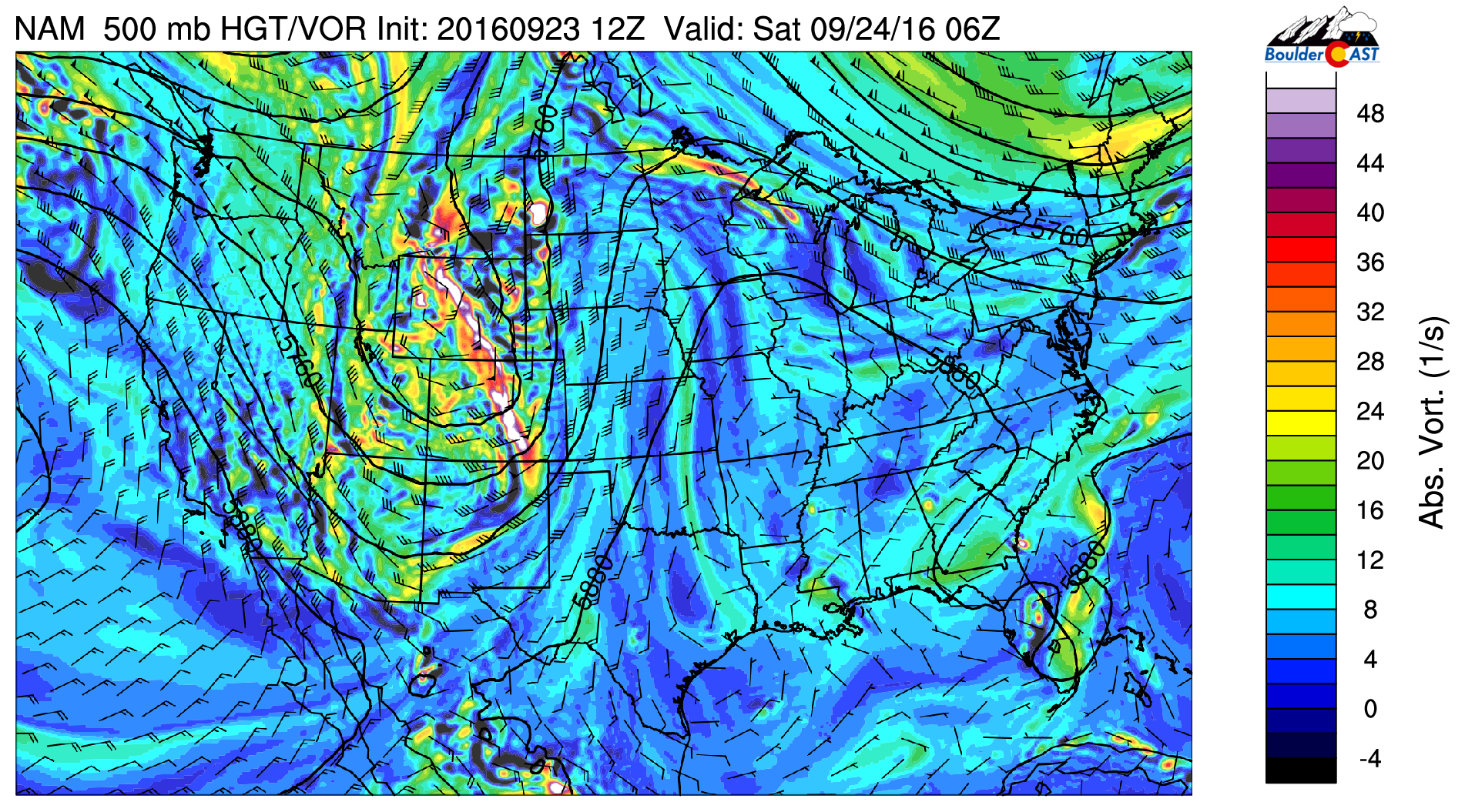
NAM model 500 mb vorticity forecast map for Friday evening, showing an expansive trough across the western United States. This trough is responsible for “big weather changes” this weekend
Notice the very strong, atypical due southerly flow across Colorado. Wind barbs indicate some of the strongest winds in the entire United States are currently in northeast Colorado (up to 65 knots at 500 mb)! The current radar loop shows rain and high elevation snow is just beginning to develop across the state.
Beneath the trough lies much colder air. After highs near 80 degrees on this beautiful Friday afternoon, a Pacific cold front will slam the Front Range before sunset this evening. Expect gusty winds at times up to 40 mph and temperatures falling into the low to mid 40’s by sunrise Saturday.
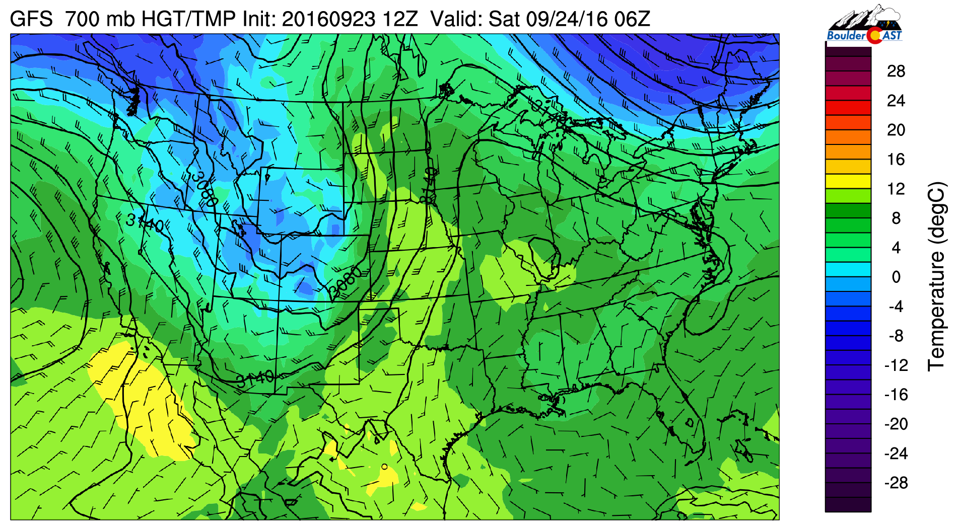
GFS model 700 mb temperature forecast map for Friday night showing the cold air infiltrating Colorado behind the cold front
Most of the precipitation will remain north of the Denver Metro area, but isolated to widely scattered showers are possible this evening. The high-resolution, short-range weather models have been rather insistent on a rain band moving through Boulder/Denver between 10pm and 2am tonight, verification of course to be determined.
In the Mountains, we are expecting the season’s first “widespread” snowfall this evening, tonight, and through the day Saturday. Moisture isn’t overwhelming and the best lift will be further north, but the cold air and some westerly flow is definitely there. Below is today’s temperature plot from the top of Winter Park at 12,000 feet. Can you pick out the cold front which has already moved through up there?
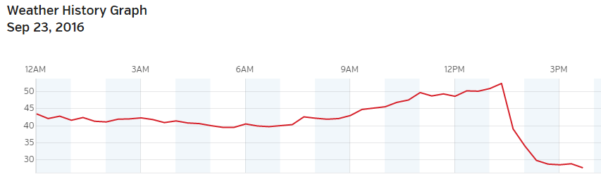
Temperature plot so far today at Winter Park showing the arrival of the cold air! Temperature now in the 20’s. Snow will be falling this evening
How much snow are we expecting? Anywhere from 1″ in most locations above treeline, up to 4″ in the favored higher peaks with west and northwest exposure near and west of the Divide. See the GFS model’s total snowfall forecast below…
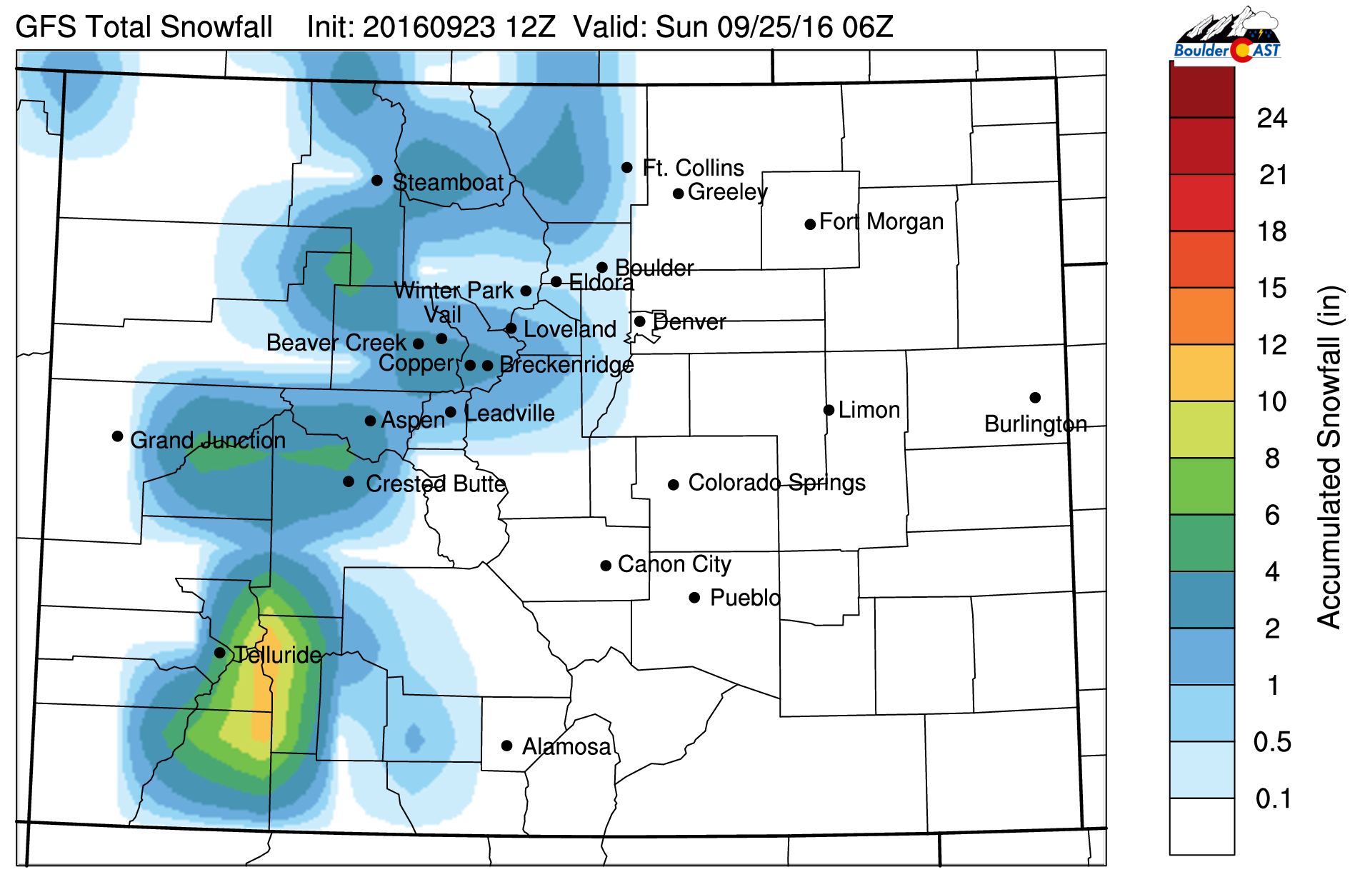
Just to be clear, as the map seems astray due to resolution constraints, we’re not expecting any snow below 9,000 feet. Furthermore, accumulating snow of at least 1″ should be confined to areas above 10,000 feet.
Down on the Plains, expect a cool and dry weekend with highs in the 60’s both Saturday and Sunday. After the showers tonight, westerly flow will downslope the region through much of the weekend, lending to dry weather prevailing with a good deal of sunshine, especially on Sunday.
Have a great first weekend of fall!
—
14er Memo: A group of the BoulderCAST team plans to make a 14er ascent on Saturday, so they examined the alpine hiking forecast rather closely. If you’re heading out to any peaks above treeline Saturday, dress very warm! Expect temperatures below 20 degrees, combined with gusty winds up to 50 mph creating dangerous sub-zero wind chills, and on-and-off snow showers. Stay warm!


