Historical warmth and persistently dry conditions have spawned numerous wildfires across the Pacific Northwest and British Columbia over the past few weeks. With a change in our synoptic flow direction yesterday, thick smoke has pushed into the Denver Metro area creating reduced visibility and air quality. We examine how the smoke got here and how the forecast for the weekend is shaping up.
Autumn had it’s way with northeast Colorado yesterday. The daytime high temperature in Boulder was just 63 degrees, about 25 degrees below normal. Denver’s maximum was just 67 degrees.
While we were all bundled up yesterday, the PNW has been absolutely baking this week under a high-amplitude ridge. Portland, Oregon hit 105 degrees, just two degrees shy of the all-time record there (keep in mind 105 degrees is Denver’s all-time hottest temperature). 40 degrees warmer in Portland than Denver on an August afternoon? Who would imagine!? There also was some speculation that Seattle could reach the nearly unprecedented century mark (this did not happen).
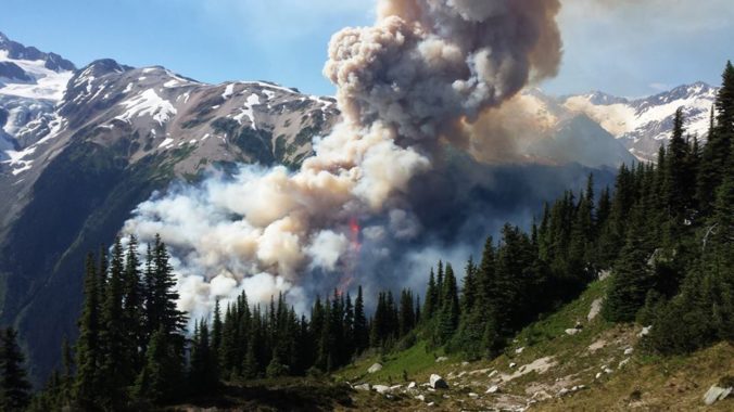
While July and August are typically the time of year where the PNW defies its cool and rainy reputation, the extreme heat and associated low relative humidities have facilitated widespread and now massive wildfires, especially just north of the border in British Columbia.
MODIS captured the visible imagery below as it passed nearby yesterday afternoon. The extensive pool of smoke is easily visible in the immediate vicinity of the fires (outlined in red).
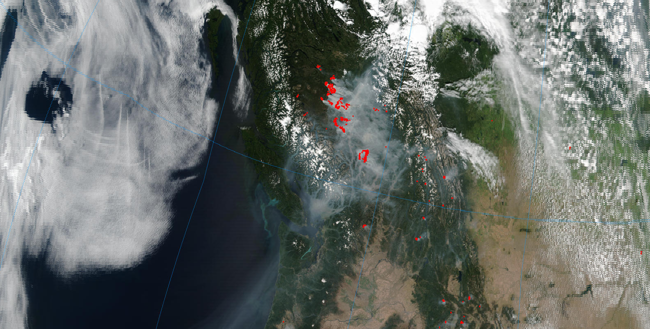
NASA MODIS visible imagery from Thursday afternoon showing extensive smoke across the Northwest. Red annotations are the outlines of active fires.
With the unseasonably strong trough moving into the north central part of the country (which brought our big cool down), northwest flow has taken over and pushed some of that smoke into the Front Range. The smoke actually was around yesterday, but with all the low clouds and drizzle, it was easy to mistake for fog. Prior to this wind shift, southwesterly monsoonal flow had been keeping us smoke free.
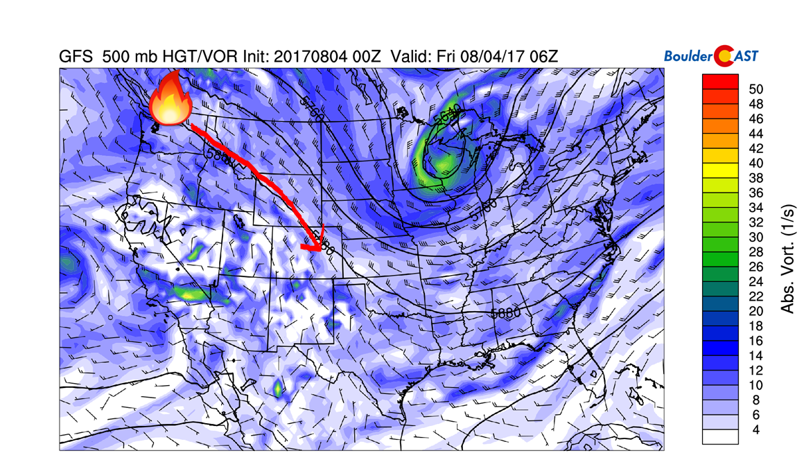
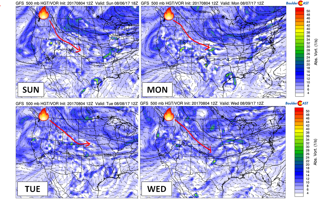
GFS 500 mb vorticity map for this morning showing northwest flow pumping smoke into Colorado from the fires in British Columbia
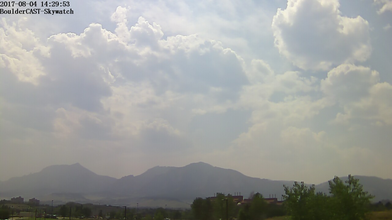
The view of the Flatirons is currently mildly obstructed from the BoulderCAST Livecam….
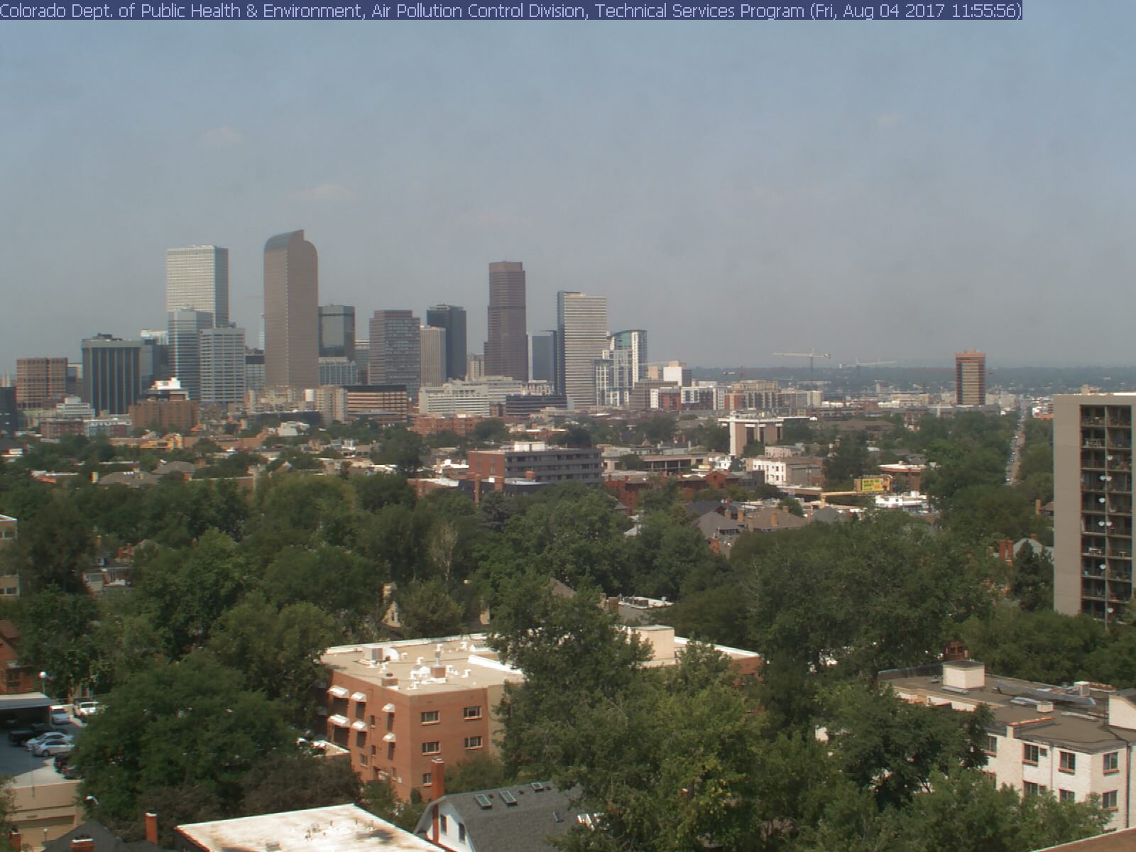
The Mountains are not even visible from downtown Denver…this camera is facing west….
See more live webcams of the smoke HERE.
The smoke content of the air is set to push our Air Quality Index into the triple digits this afternoon, enough to be potentially hazardous to “sensitive groups”.
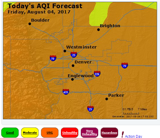
Air quality forecast for Denver on Friday, August 4th 2017.
Direct mid-level flow from the smoky source area to Colorado will be present for many more days, though the intensity will weaken. It also looks like the smokiest airflow will push northward into Wyoming. While we still expect light smoke for the foreseeable future, visibility and air quality should gradually improve.
Beyond the smoke, our weather pattern will not be changing much over the next five to seven days. The large ridge will remain parked across the Pacific Northwest, with a rather unseasonable trough across the Great Lakes. This pattern will favor consistent cold fronts for northeast Colorado every one to three days, surely keeping things active for the time being.
Highs temperatures Saturday should climb into the mid 80’s with a decent amount of sun and isolated storms. A weak front will push through Saturday night, knocking our temperatures back into the 70’s for Sunday with a pretty high chance of storms for the Mountains and Denver Metro area. A secondary, even stronger cold front is forecast to arrive Sunday night. Monday and Tuesday are both shaping up to be chilly, cloudy, and rainy overall with upslope in place. Early model guidance suggests both days won’t make it out of the 60’s. The GFS temperature anomaly map below for Monday should give you something to look forward to…
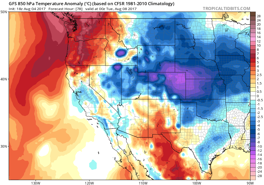
GFS 850 mb temperature anomaly forecast for Monday evening.
Enjoy the weekend…..get above the smoke if you can!


You must be logged in to post a comment.