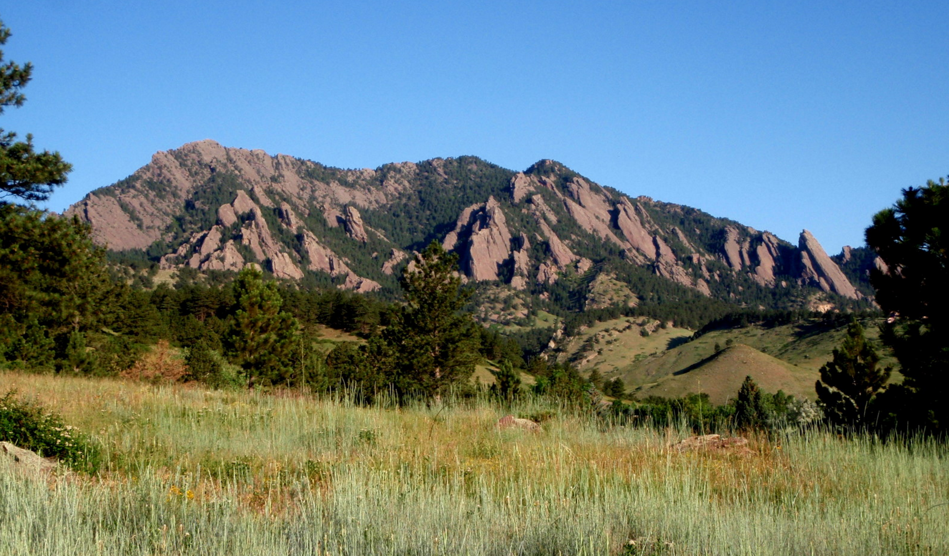
For the past several weeks, we have largely received the short end of the stick in regards to weekend weather. If it wasn’t rain, it was snow. If it wasn’t snow, it was the cold and fog. Mother Nature’s timing couldn’t have been more unfortunate, with storm after storm arriving promptly at the end of each work-week. However, this week we finally break this pattern as conditions quiet down and heat up across the Front Range. Continue reading for our full weekend outlook and when we expect the rain to return.
Last snow of the year?
First, a quick snow recap from the storm earlier in the week. While the lower elevations experienced all rain, 0.72 inches worth in Boulder, we were expecting accumulating snow for the Foothills and Mountains above 8,000 feet Monday afternoon into Tuesday morning. The dynamics of the storm didn’t play out exactly as expected. The heaviest precipitation set up north and east of Denver, not over the Foothills as the models were advertising. As a result, the higher elevations missed out on a bulk of the moisture, and the western Denver Metro area (including Boulder) just barely hit the low end of our forecast precipitation ranges (we were expecting 0.7 to 1.4″ of rain in Boulder).
The lackluster intensity didn’t impact our snowfall forecast too much, with solid verification across the Front Range. Though, we suspect the peaks (where no truth points exist) probably didn’t punch into our 8-16″ forecast range.

Our original forecast map created on Sunday (May 15). The observed storm totals per location are contained in boxes. Green ones indicate that the observed snowfall was within one inch of the given forecast range, while red was outside the scope of our forecast.
This may very well be our last snowfall forecast map of the season. We have updated our 2015-2016 Snowfall Forecast Verification post several times now (it just keeps snowing!). We encourage you to give it a read and see how well we did in your location this winter!
A stellar weekend awaits!
Just in time for the weekend, a slow-moving upper-level system is stalling across the Pacific Northwest. Strong southerly flow to its east will build a small-scale ridge across Colorado on Friday (seen below in the 500 mb map).
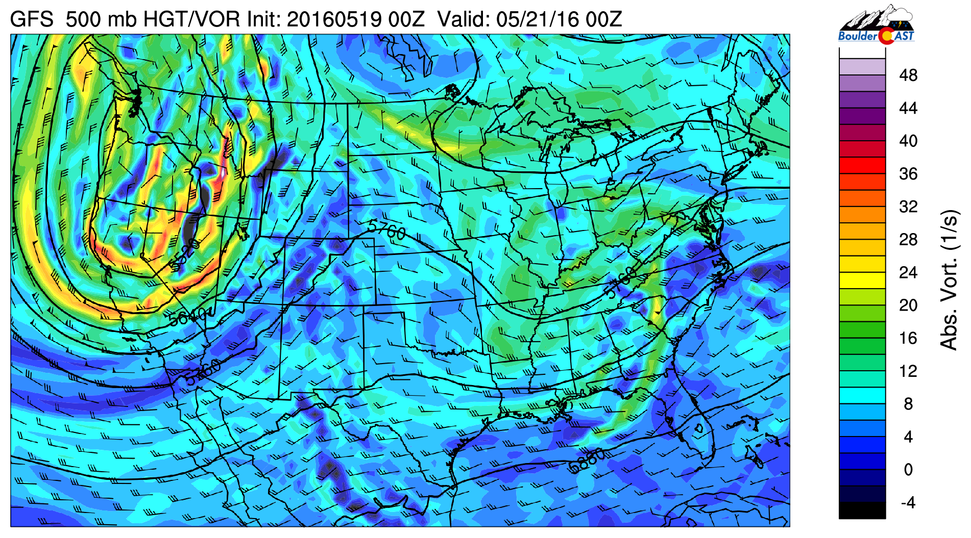
GFS 500 mb vorticity map for Friday
Here is the 800 mb temperature map for the same time (Friday evening). Look at all the warm air surging into Colorado from the south.
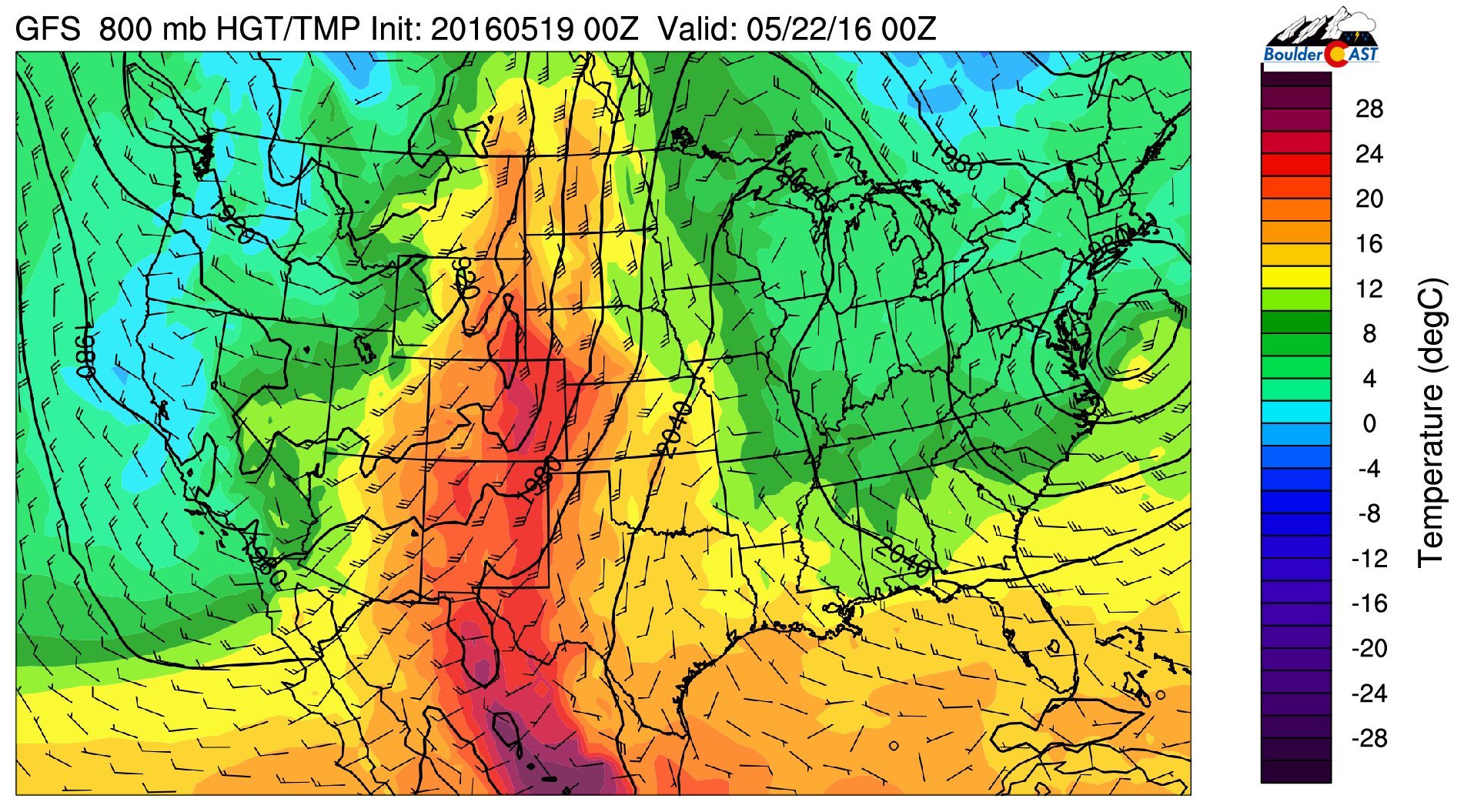
GFS 800 mb temperature map for Friday
We’ll see temperatures soar into the low 80’s for both Friday and Saturday. There will be a slight chance of storms, say 20-30% both days in the Mountains and Foothills (more-so Friday than Saturday), but the Plains will remain mostly dry and sunny! We can’t entirely rule out a stray brief shower for the Plains either day (less than 10% chance). Again, Friday’s rain chances are higher.
As that trough moves east on Sunday, the warmth goes with it.
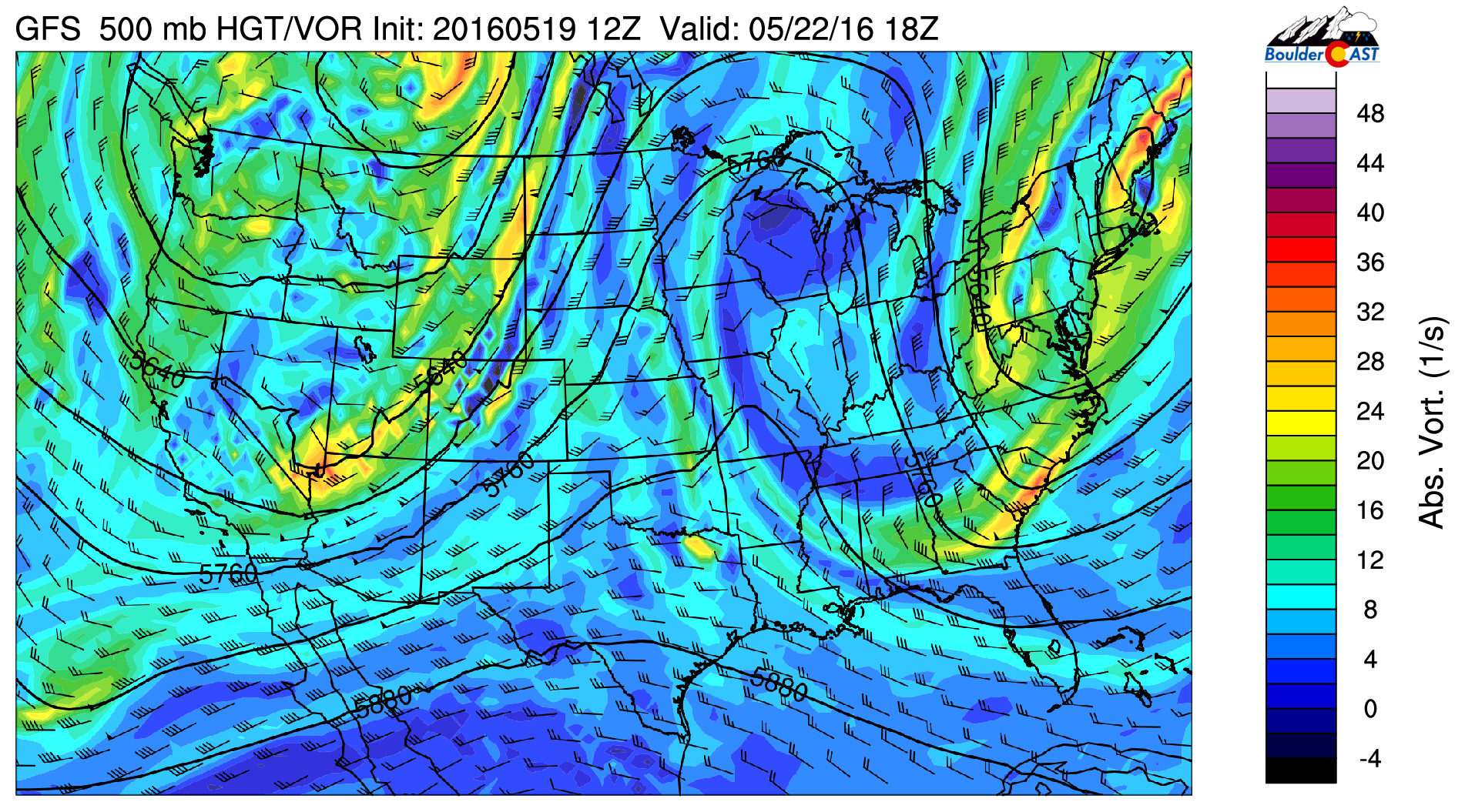
GFS 500 mb vorticity map for Sunday, showing the trough edging closer to Colorado
We’ll see cooler air work it’s way into northern Colorado along with more moisture to facilitate a few afternoon thunderstorms. Initiation will first occur over Mountains, but a few storms will likely make it out onto the Plains. Early indication is that some of the storms could be quite strong, with gusty winds and small hail. There is even a chance of a few becoming severe near the Kansas border late in the afternoon. The threat does not look widespread at this point, but it is going to need to be watched. Sunday’s high will be near 70 degrees.
The GFS total accumulated precipitation through Sunday evening shows most of the action remaining over the higher terrain. If your weekend plans include afternoons in the High Country, it wouldn’t hurt to take a rain jacket.
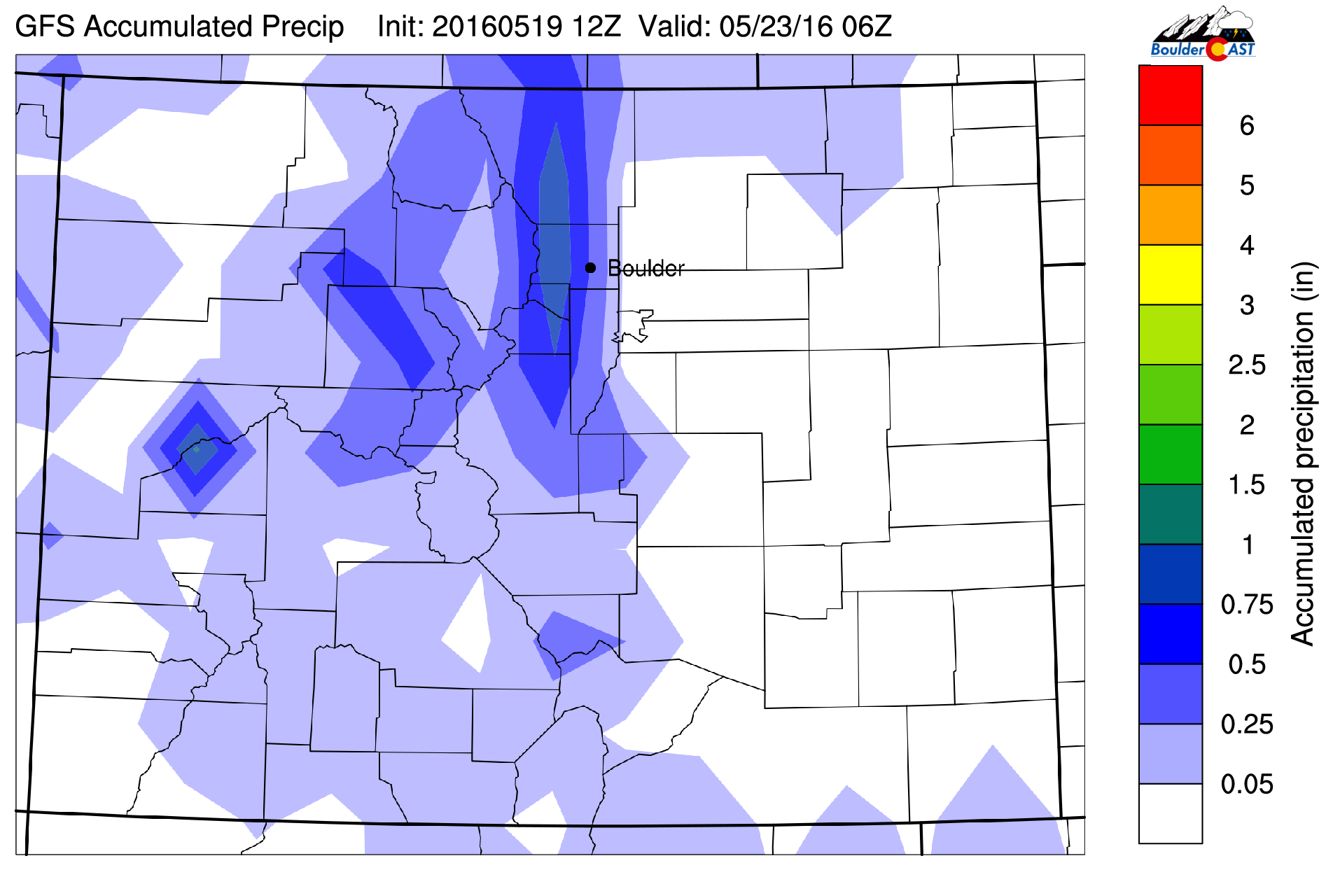
GFS forecast total accumulated precipitation through Sunday evening
We’re happy to strike three more tallies onto our 2016 “sunny day” counter. While not perfect, for May (our wettest and cloudiest month), this forecast is about as good as we can hope for, so get out there and enjoy it!
Thinking long term, as we move into June, the pattern should begin to settle down. We typically have a several-week dry period before the summer monsoon kicks in towards the end of June. We’re not seeing much indication of a quieter pattern just yet, but of course, it is still mid-May. More on this later….


