
2017 got off to a quick start with multiple snow storms dumping on parts of northeast Colorado and the Mountains. However, we’re seeing strong indication in the models that things are about to quiet down significantly for the foreseeable future.
Boulder has recorded 1.41″ of precipitation thus far in the month of January, which is surprisingly good enough for 8th wettest in Boulder’s history during what is our climatologically driest month of the year. We’ve also been chilly, with the region seeing temperatures three to five degrees below normal so far this month. This cold and snowy pattern is right in line with our January outlook.
Things, though, are about to change.
We noted in our extended outlook earlier this week that we were watching the potential for a high-amplitude ridge to form across the Pacific Northwest. Four days later, this “ridgy reality” is coming true. There is good agreement between the GFS, Canadian, and European ensembles for this ridge to build in this weekend and persist across Colorado into mid to late next week. With this change, the Pacific Storm track will push northward into Canada, providing us with a reprieve from the nasty weather for a while.
The loop below is the 500 mb height anomaly from the latest European ensemble model run for the next ten days. Notice the red shading taking over as we move through the weekend.
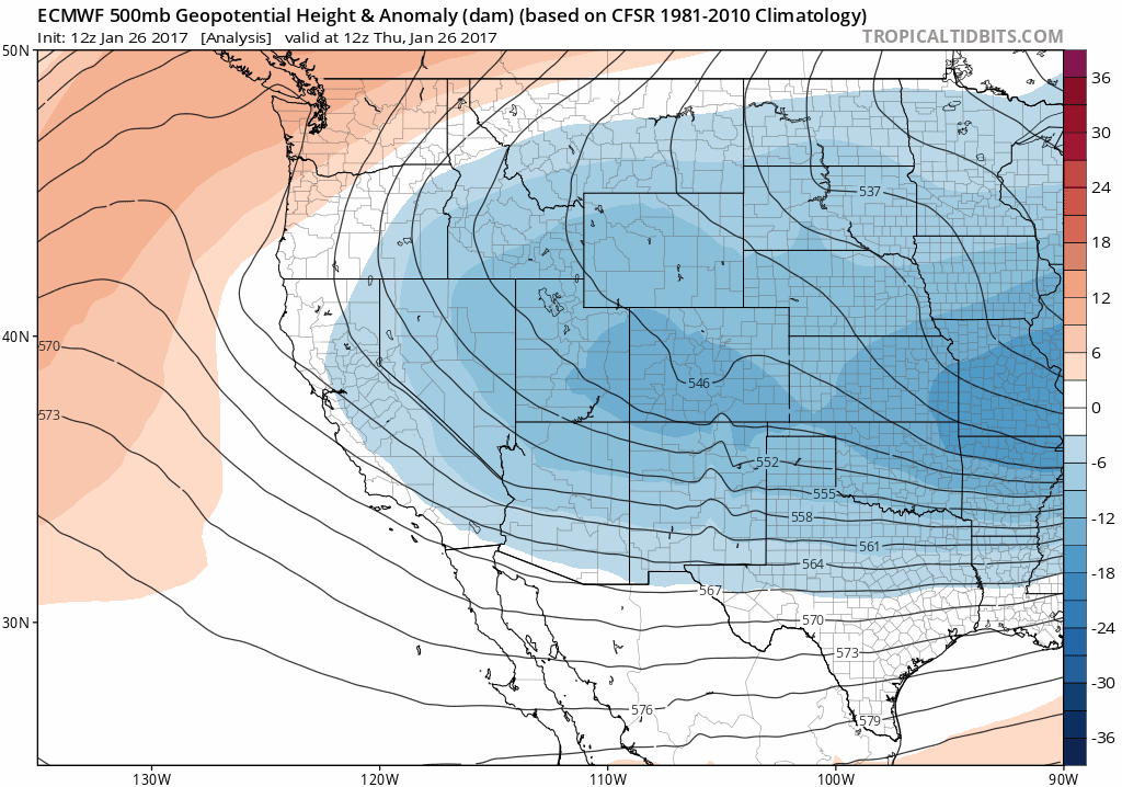
Towards the end of the animation, we see the ridge break down and a trough move ashore and arrive in Colorado around the Saturday timeframe. The GFS ensemble also has a similar feature, but brings it in a little earlier (Thursday). Regardless of which ensemble verifies, it looks as though the Denver Metro should have a solid week of dry and relatively mild weather. We’re not going to commit to a mid-winter spring thaw, but 50’s are likely, with possibly a day or two in the low 60’s.
The Mountains will see some snow, as is most always the case under northwest flow. The Park Range around Steamboat will probably be the winner through the next week. The latest GFS operational forecast brings next-to-no precipitation to the Denver Metro area in the next two weeks….
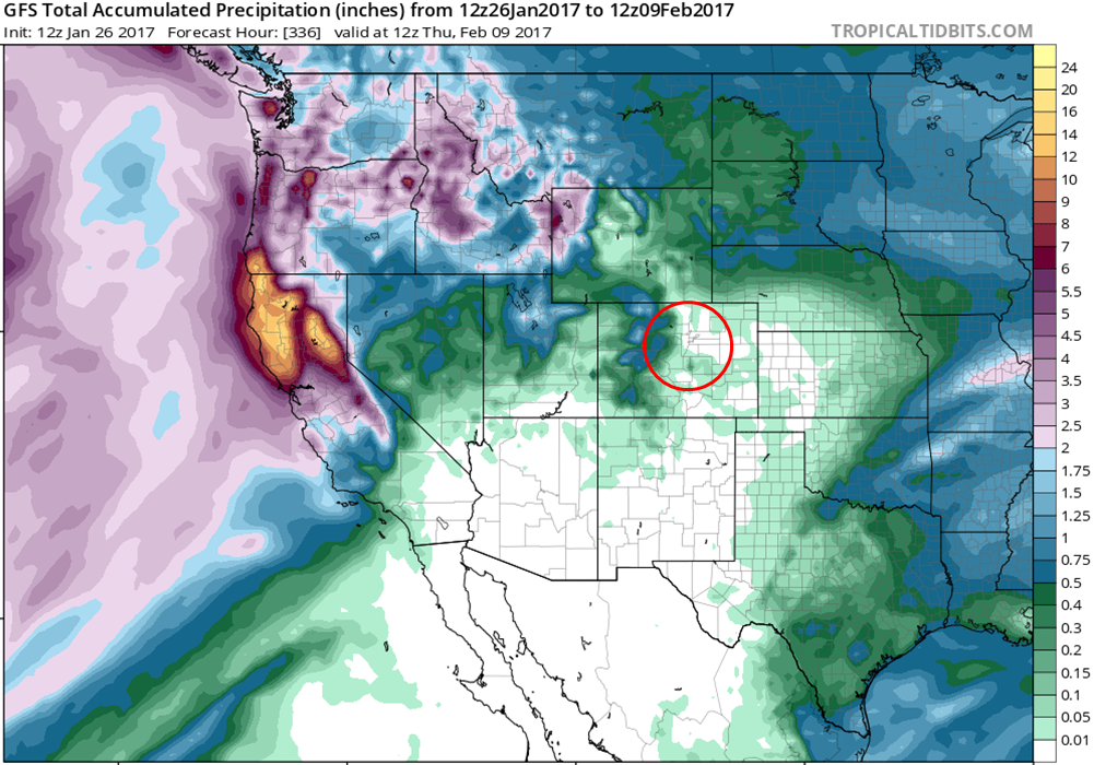
However, the GFS ensemble is a little more generous (as is expected)…
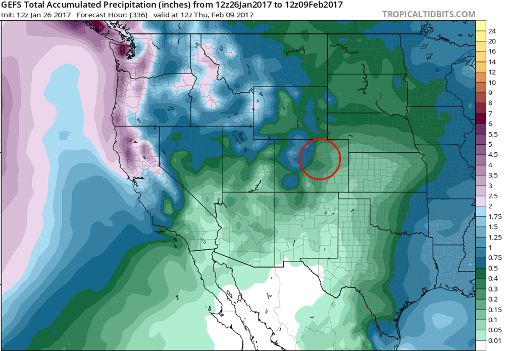
Even still, the ensemble mean only shows 0.25-0.4″ for our region, much drier than normal for that span.
Our one caution is that high-amplitude ridges across the Pacific Northwest tend to funnel cold air into the Upper Midwest and Northeast, with the potential for the cold air to take a backdoor route into northeast Colorado. We don’t think the towering ridge will remain intact long enough for this to happen. But if the ridge intensifies and lingers through next week, all bets are off.
As far as an actual forecast, look for slowly moderating temperatures through the weekend with lots of sunshine. Friday will be in the 30’s, with 40’s on Saturday and 50’s for Sunday and beyond. Enjoy the serenity…the worst of winter is likely still in front of us!


