The high temperature today in Boulder was more than 20 degrees above average. We review where this falls historically and discuss the weather for the upcoming weekend, including the potential for snow in the extended forecast.
Warm Turkey Day
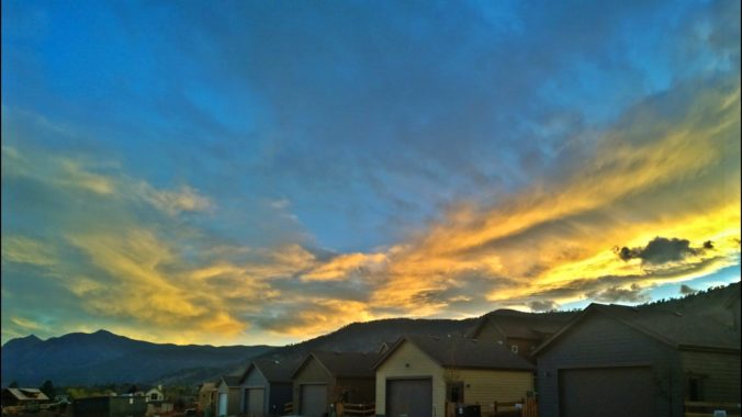
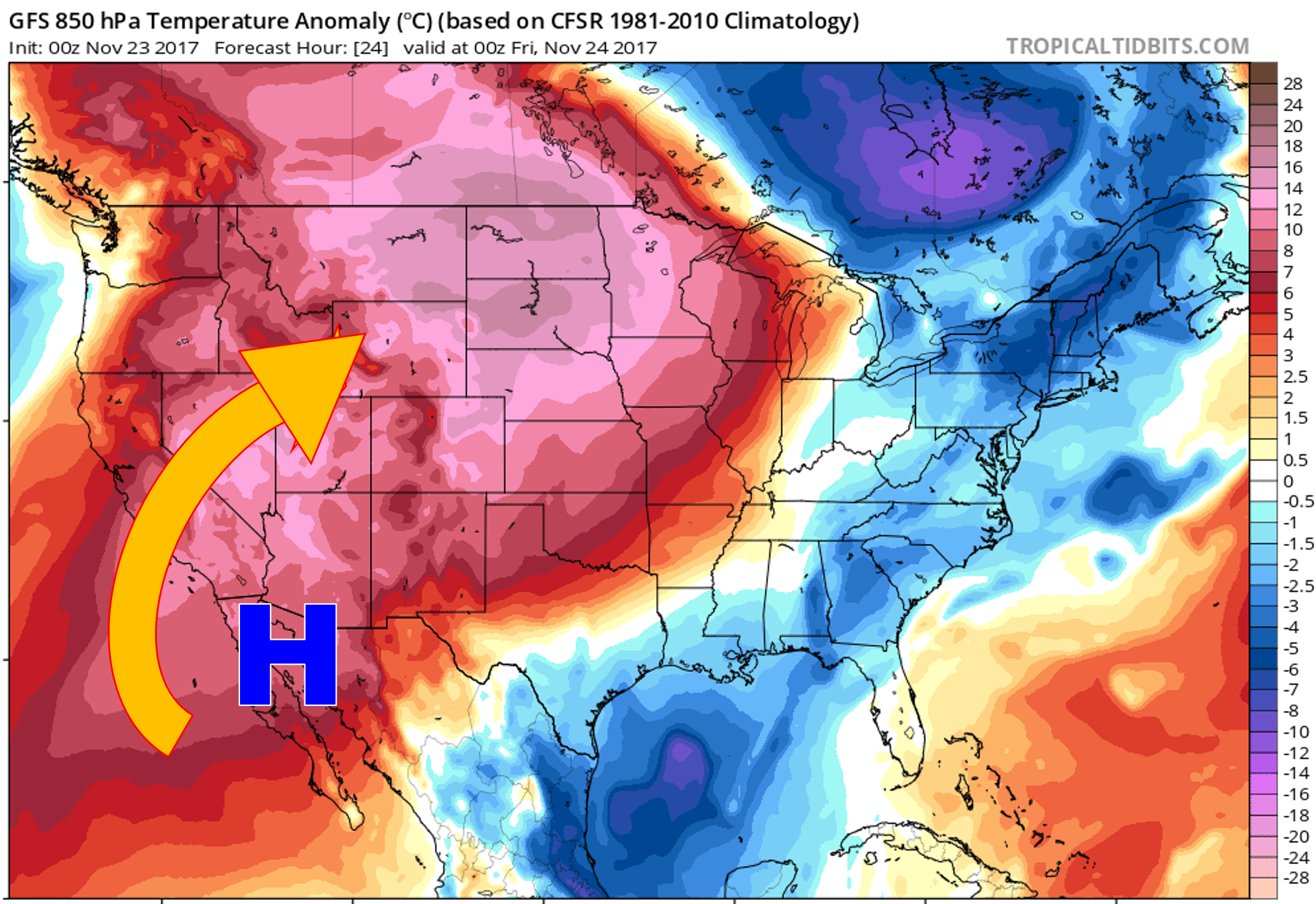
Mother Nature set the stage for a beautiful Thanksgiving this year. A combination of ridging aloft and downslope flow at the surface pushed temperatures into the lower 70’s across the Metro area, with 50’s and 60’s in the Foothills. The 850 mb temperature anomaly map below shows the warm air surging across the Rockies and into the northern Great Plains. The high pressure center, with clock-wise flow, is located in northwestern Mexico.
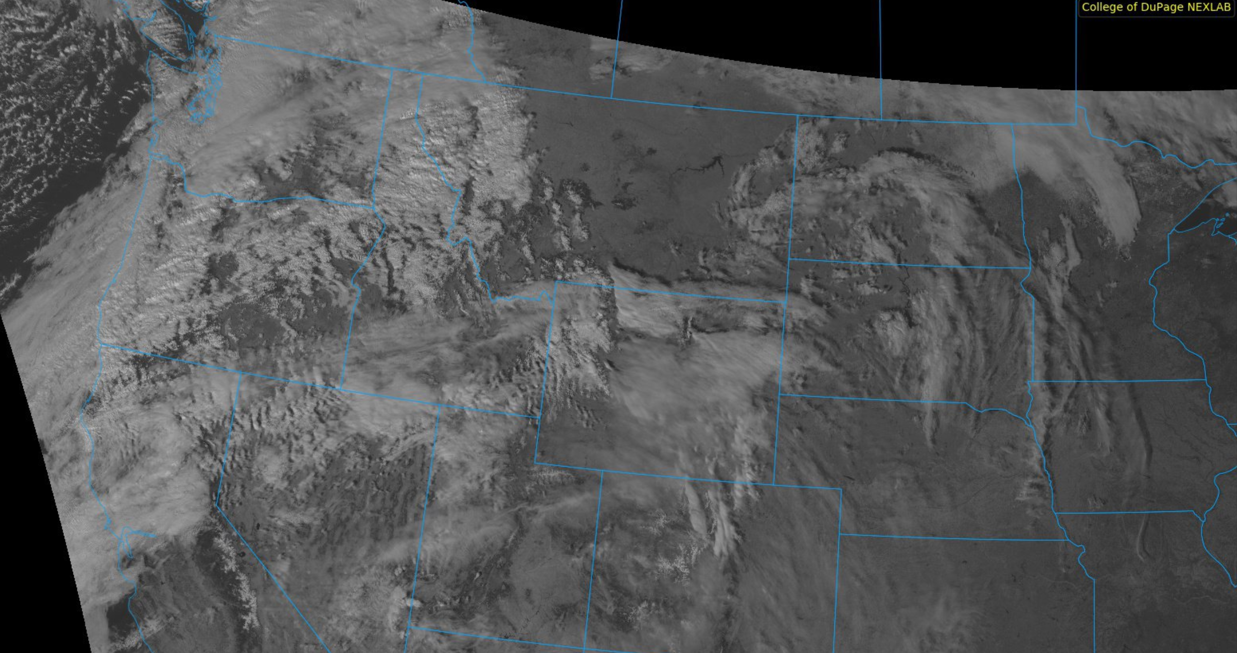
The GOES-16 visible satellite from this afternoon depicts just a few lonely wave clouds across the Front Range today. Otherwise, sunshine ruled statewide.
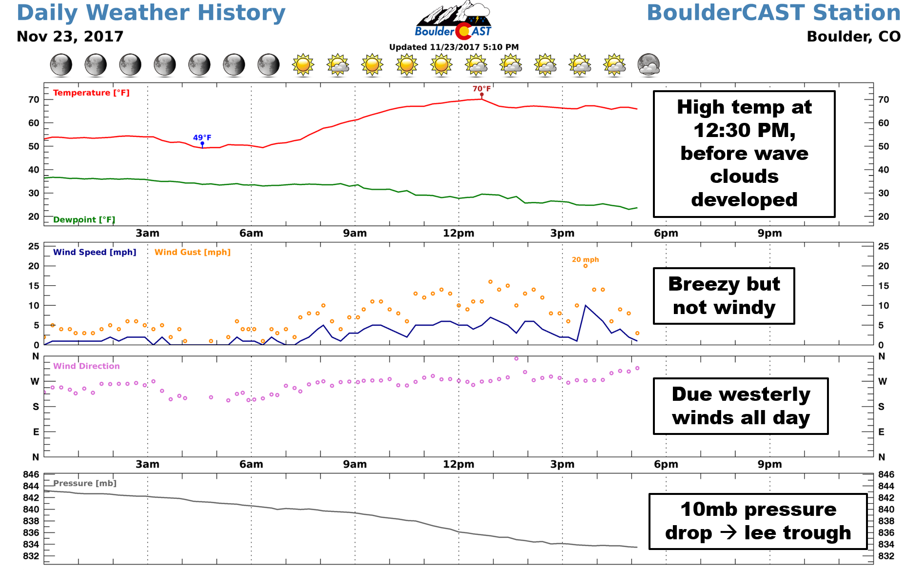
BoulderCAST Station reported a high of 70 degrees at 12:30 PM this afternoon. It was around this time that thick wave clouds developed overhead and limited solar heating. Temperatures dropped and then hovered in the 60’s the rest of the day.
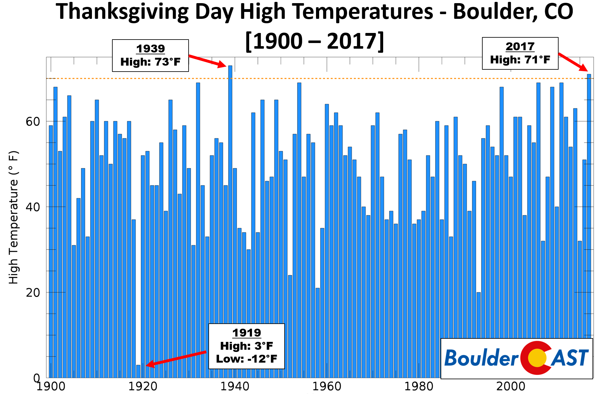
Boulder’s official high was 71 degrees (72 in Denver). While not a record for the date, this was the SECOND warmest Thanksgiving holiday ever in Boulder. The record remains at 73 degrees, set in 1939. A complete series of Thanksgiving high temperatures since 1900 are shown in the graphic below. Shockingly, the maximum temperature on Thanksgiving Day in 1919 was just 3 degrees! Can you imagine that?
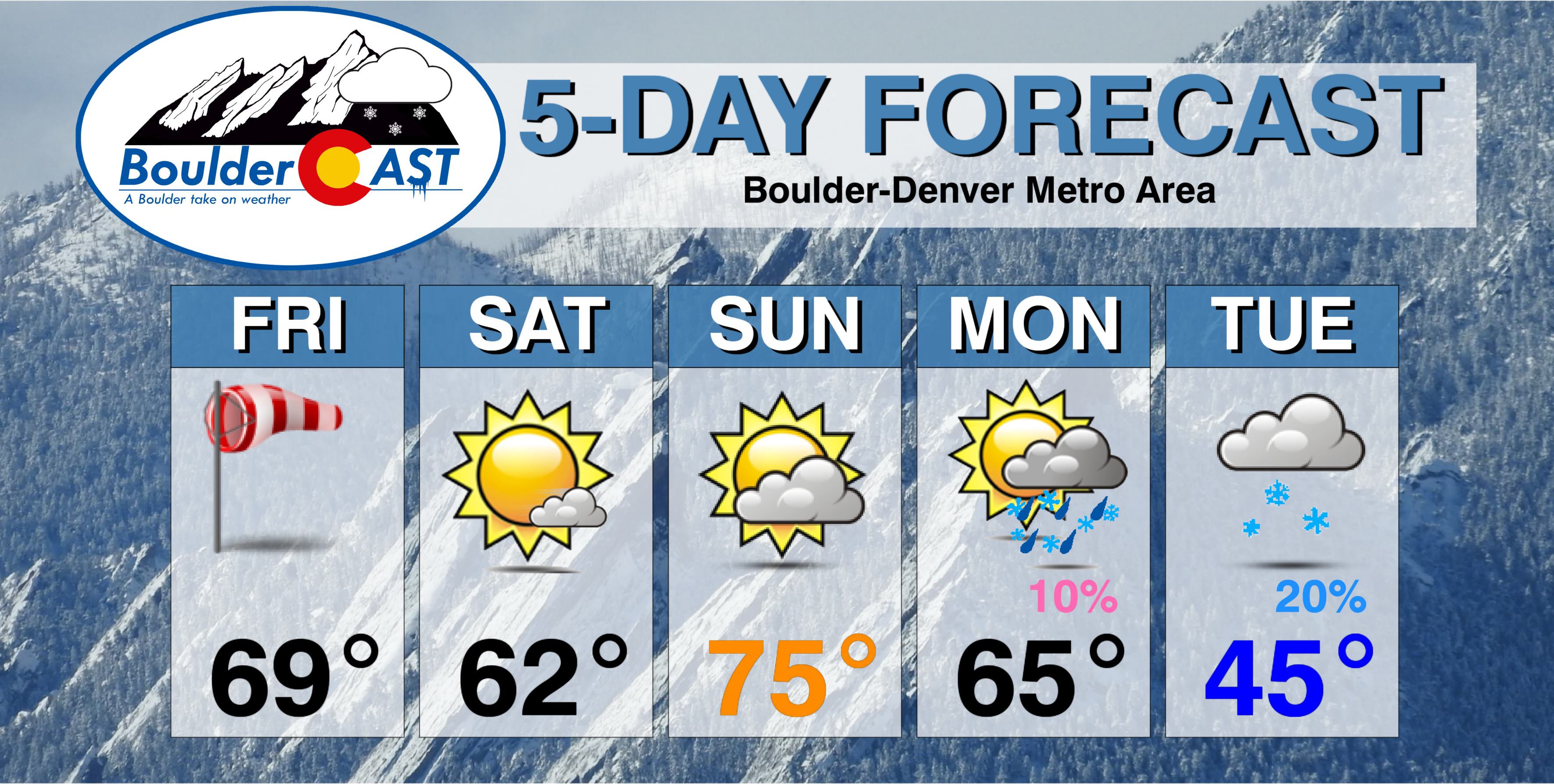
Weekend weather stays warm
We’ll remain on the warm side through Monday with the ridge continuing to dominate our weather. 60’s and 70’s will be widespread. Sunday looks to be the warmest of them all, likely climbing into the middle 70’s (say goodbye to the record high for November 26th).
Changes will arrive late Monday or Tuesday next week, however. A Pacific storm is set to impact Colorado during this time frame, potentially a strong cut-off one. The GFS and European models are coming into better agreement in the last few model runs, but it’s still four days out.
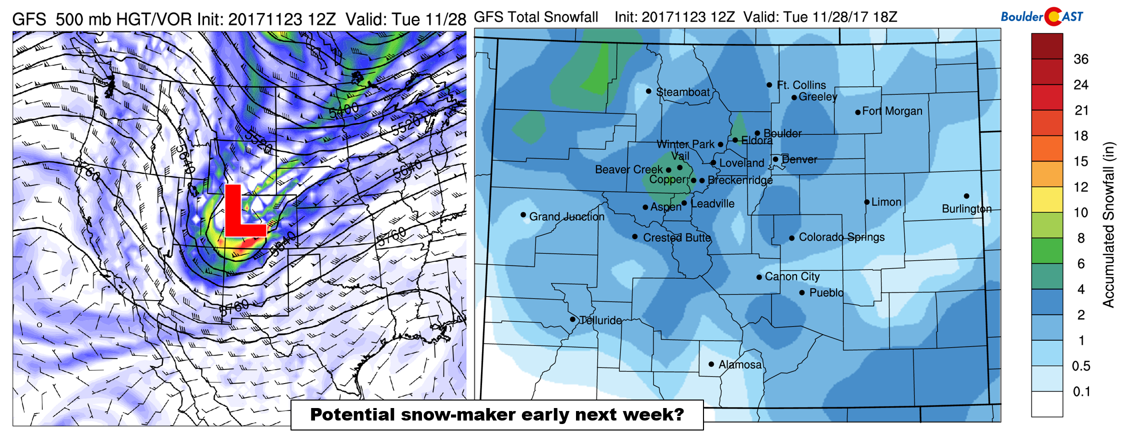
We have low confidence in this one right now, but it has caught our attention the say the least. Expect the threat of rain/snow Monday night into Tuesday with much colder temperatures Tuesday for sure. We’ll discuss this one with more certainty in our outlook on Monday.
Stay tuned and have a good weekend!


You must be logged in to post a comment.