It may be in the 70’s today, but snow is not far off! Find out the timing and how much we can expect in our storm update.
The year without winter?
Those six more weeks of winter proclaimed on Groundhog Day were clearly wishful thinking on Phil’s part. February 2nd was indeed snowy in Denver, but since then, temperatures have soared without a single day below normal and not even a flake of snow. It’s not just Colorado that has been this way…90% of the continental United States has been warmer than normal in February. Folks in the Midwest and Northeast are already calling this the “year without winter”, and with good reason! Ice cover over the Great Lakes is at a minuscule 8%, with Lake Erie and Ontario being entirely ice-free right now. Furthermore, seasonal snowfall totals are well below normal almost everywhere that actually has a winter. Heck, people in North Dakota can even make visual contact with their lawns! Very atypical!
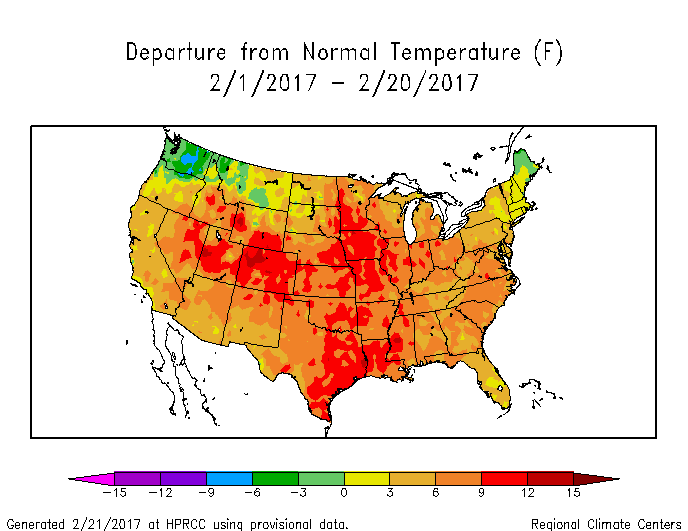
Colorado is top dog as the warmest state (compared to norms) so far this February, with temperatures statewide averaging nearly ten degrees north of normal. With temperatures on track to reach the 70’s today and 60’s tomorrow, February will conclude with more days above 60 degrees than below! With a week still to go, February 2017 is head-and-shoulders above the next closest contender for the warmest on record in Boulder and Denver.
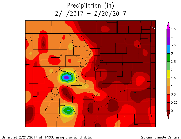
Outside of a little rain/snow mix on Groundhog Day, the month has been bone-dry for most areas on the Plains. The Mountains have done alright for snow this month, but definitely not great.
Not to be forgotten, last February was also windy and warm as well for the Front Range!
Our weekly outlook yesterday mentioned changes are on the way. We detail those below.
Snow returns to the forecast
After a warm and windy first half of the week, changes arrive late Wednesday night in the form of a cold front associated with a trough moving into the region (see below). Highs will drop from the 60’s Wednesday to near 40 for Thursday.
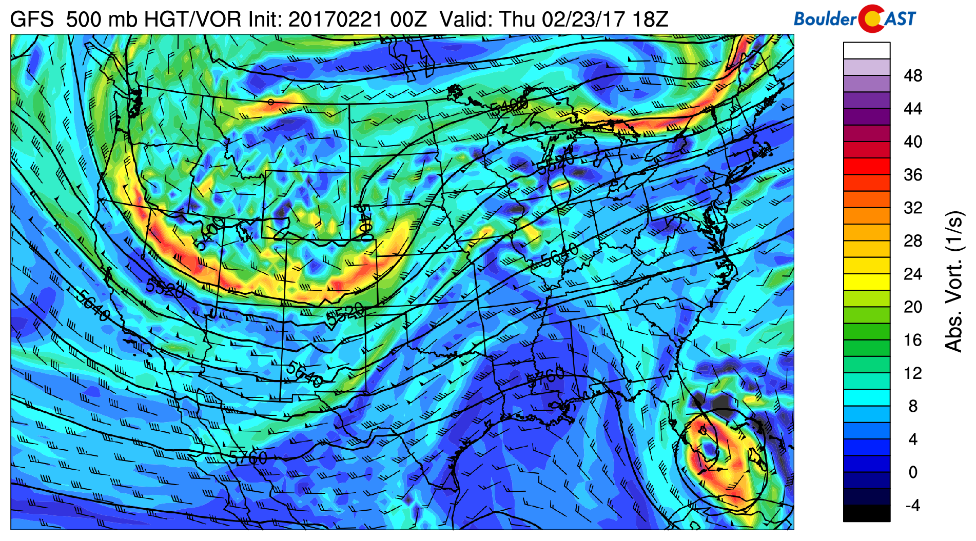
GFS 500 mb vorticity map for Thursday afternoon showing the trough and associated energy moving across Colorado and Wyoming
A few days ago, the track of this system was uncertain enough that the potential to bring significant snow to Denver was there. Models are now zeroing in on a track that takes the brunt of the storm across Wyoming. However, we are fairly confident that some flakes will fly in our region as well…
A secondary push of colder air and upslope Thursday night is the facet we are most interested in for snow at this point. This wrap-around flow on the backside of the core of the system should provide enough moisture and weak upslope to fuel a few snow showers in the Denver Metro, especially in the western and northern suburbs.
Here is the 800 mb temperature and wind forecast from the NAM model for Thursday morning. We see the surface low forming in northeast Colorado. This is just a shade too far north to bring much snow to Denver, but is great for Cheyenne.
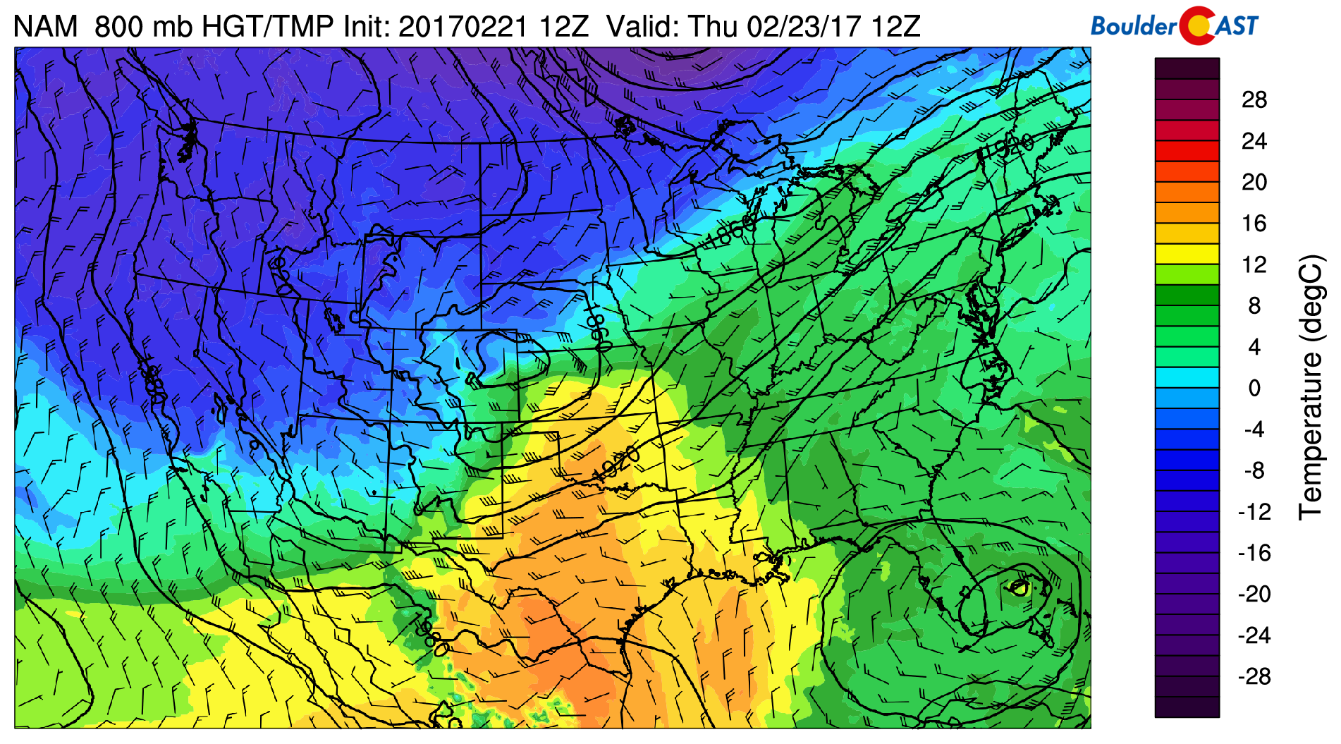
NAM 800 mb temperature map for Thursday morning, showing the surface low forming in northeast Colorado
Note the northwesterly downslope flow in place across Denver (see above). For this reason, we think the first half of Thursday will largely be dry, unless you’re in Wyoming or the Mountains. By Thursday afternoon or evening, though, much colder air and upslope flow should take over for the Front Range as well (see below).
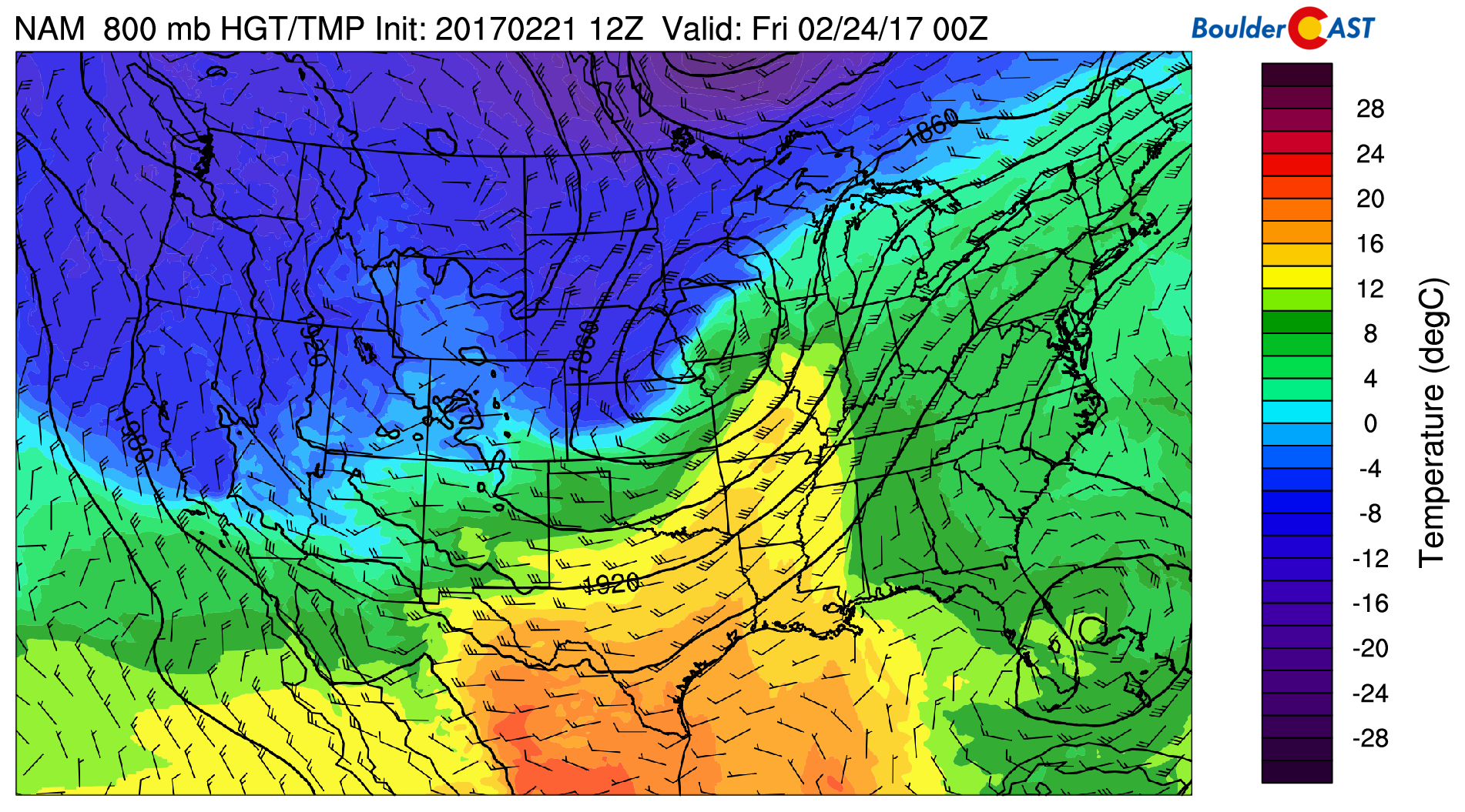
NAM 800 mb temperature map for Thursday evening, showing cold air and upslope across the Front Range
Though model variations still do exist, this upslope is present in almost every run of every model, to varying degrees. For this reason, we believe Thursday evening and night, plus at least a chunk of Friday will have the potential for light snow across our region. Few areas will probably exceed an inch, but the the potential is there for several inches in the Foothills and areas north towards Fort Collins.
NOTE: The NAM and the Europan models show about 1-3″ for the Metro Area as they bring the track slightly further south. The GFS has been trending more north in the last several runs and is drier, generally less than 1″ everywhere but the Mountains. Still some uncertainty, but we’re definitely not expecting any “big” totals from this storm across the lower elevations.
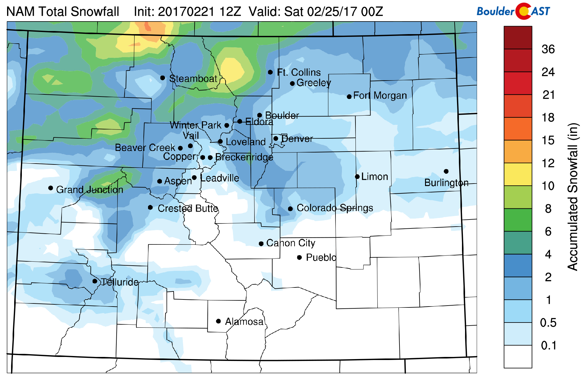
NAM total snowfall forecast through Friday. Looks fairly reasonable, and generally summarizes the “average” of most models and runs right now.
Expect increasing clouds Thursday morning with spotty rain/snow changing to all snow by Thursday evening. Friday will see snow showers linger at least through the morning hours, with overcast skies and temperatures likely remaining in the 20’s.
We’ll provide updates before the storm if needed. But for now, the biggest shock for everyone will be the return of those winter temps!
Subscribe to stay in the loop.


You must be logged in to post a comment.