As snow begins to fall, we provide our final thoughts on snow showers that will linger through the day today and into Friday, making for slick travel at times. Snowfall map included.
The storm in question actually turned out to be a good one, just not for us! Heavy snow has been falling in eastern Wyoming and western Nebraska overnight and will continue through the day. These locations can expect 8 to 16″ for storm totals!
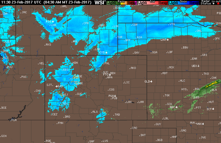
Current radar animation for Colorado as of 7AM Thursday
In Colorado, the action (if you want to call it that) is just getting started this morning. Some snow bands have developed from Boulder northward into Ft. Collins. Temperatures will peak in the low to mid 30’s today. There is some mid-level instability overhead during the day, so we can’t rule out quick bursts of moderate snow here or there, but this should remain mostly north of Denver.
A secondary push of cold air arrives this afternoon which will bring upslope and bump up snow chances for the Front Range. We had believed this feature would bring our best snow chances all along. The 800 mb temperature and wind map from the NAM model for 5PM this evening is shown below. 15 to 20 knot northeasterly upslope will be enough to bring light snow to the region, especially in and near the Foothills.
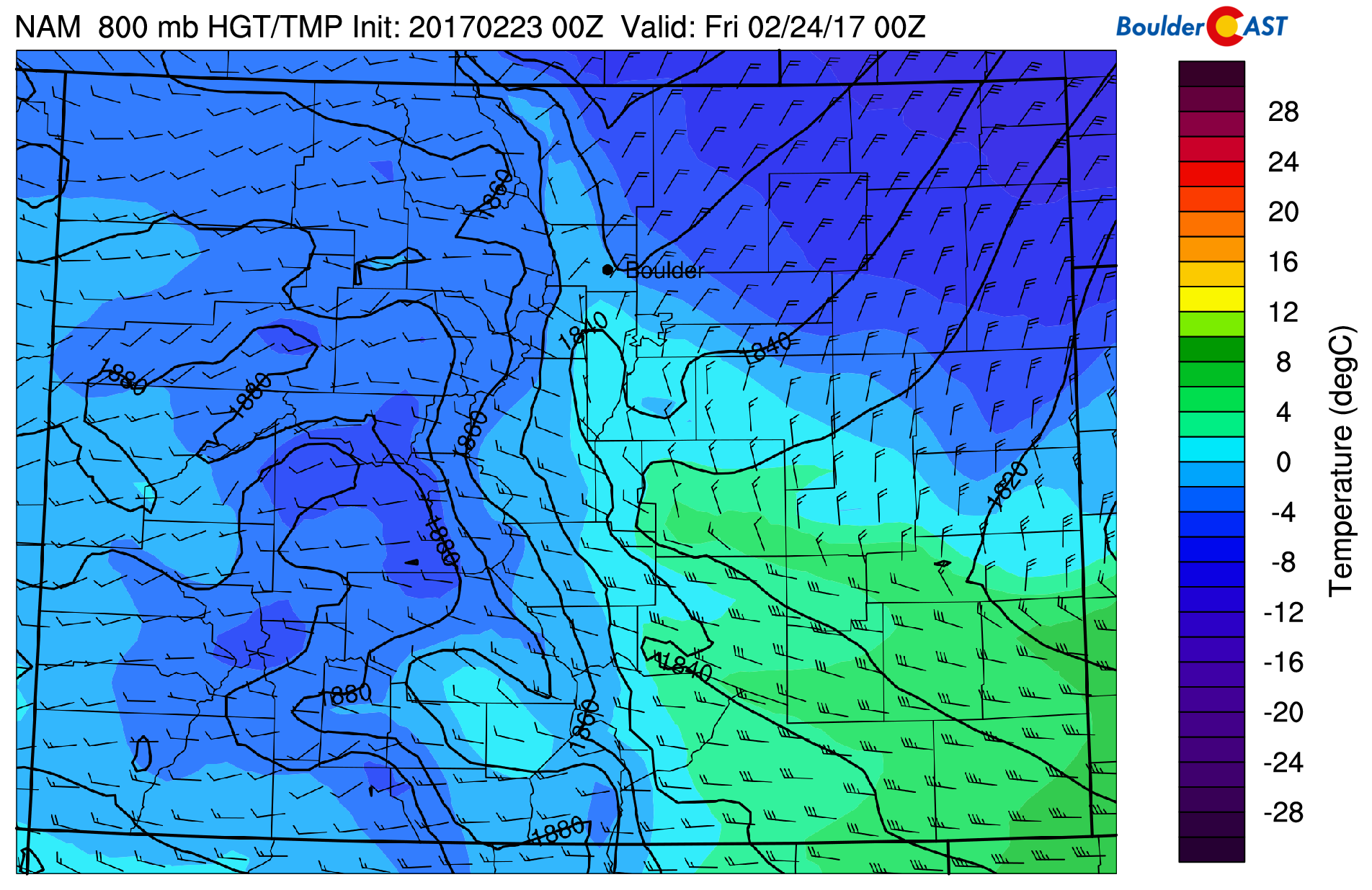
NAM 800 mb temperature and wind map for 5PM Thursday, showing stronger upslope and cold air arriving in Denver/Boulder
Models keep this upslope in place, though fairly weak, all the way through Friday afternoon and evening. For this reason, we think spotty snow showers should linger through the day Friday. But that’s all there is…no upper-level forcing from the trough, no where near the core of the low, no jet dynamics to speak of…just upslope. This should be enough to keep very light snow/flurries falling in the Foothills and the Plains around Boulder, possibly into Friday night in spots. Denver will largely miss out from this secondary push.
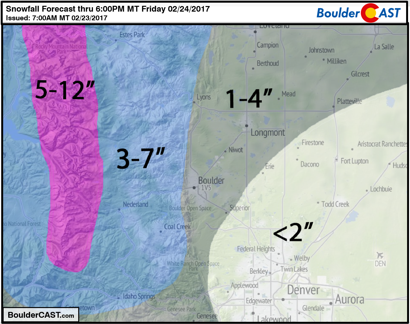
Our snowfall forecast map is given below, clearing showing the typical upslope east-west gradient, but also a northward bias! Generally 1-3″ on the Plains, with 3-6″ in the Foothills. South and east Denver may see less than 1″. We’re playing the “model middle ground” with our forecast, as the large-scale models have lower totals for the region, but the high-resolution models bring heftier snow slightly further south to include north Denver (especially Boulder) in 3+”.
Temperatures Friday will remain quite cold in the 20’s with the cloud cover and northeasterly winds. Saturday morning will be in the teens.
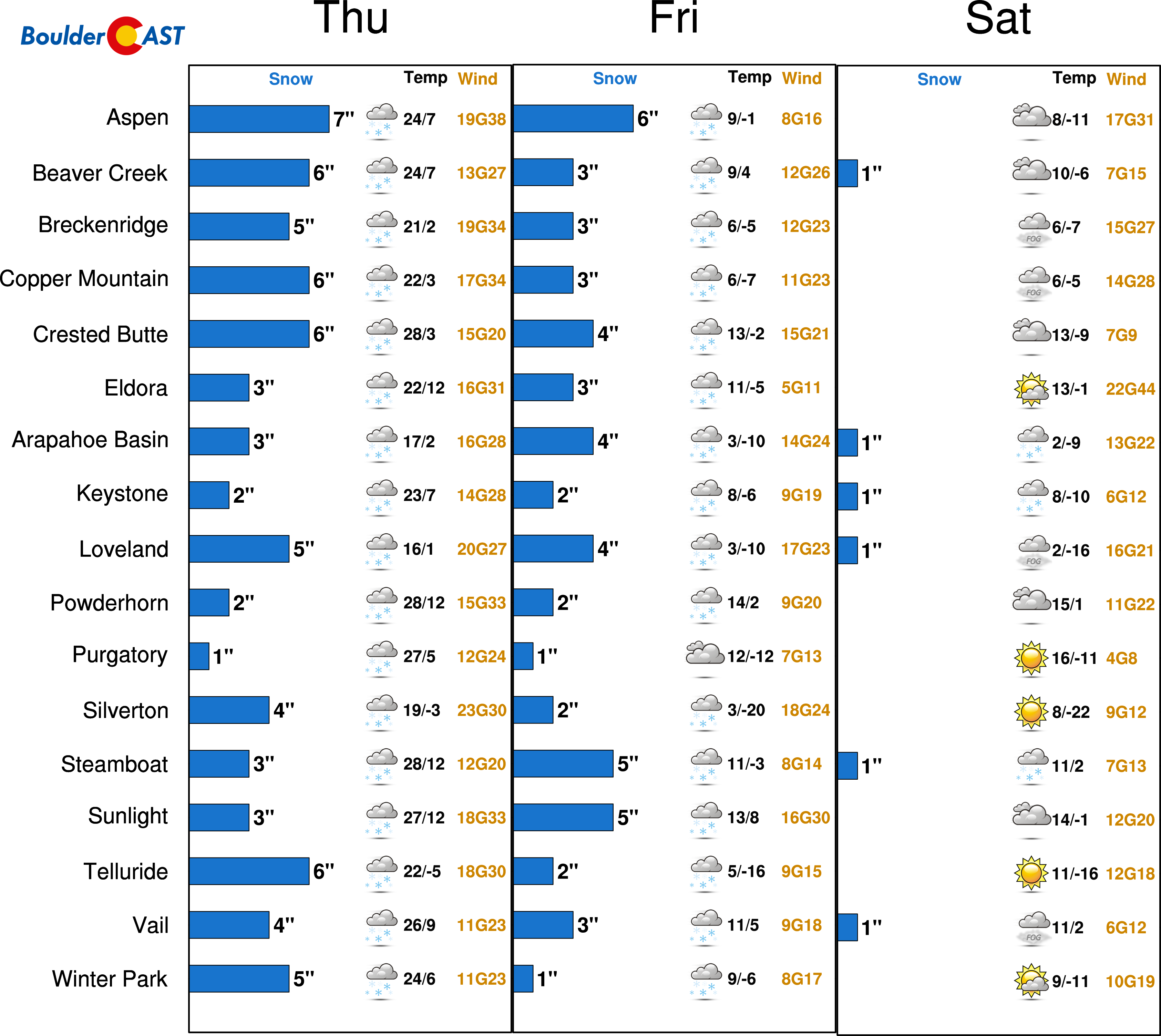
Skiers will be happy to know 5-10″ of fresh powder is headed the Mountains from this storm as well…
Have a good end to the week!


