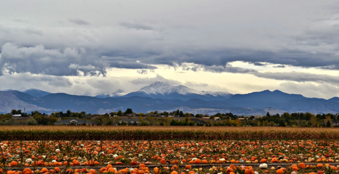
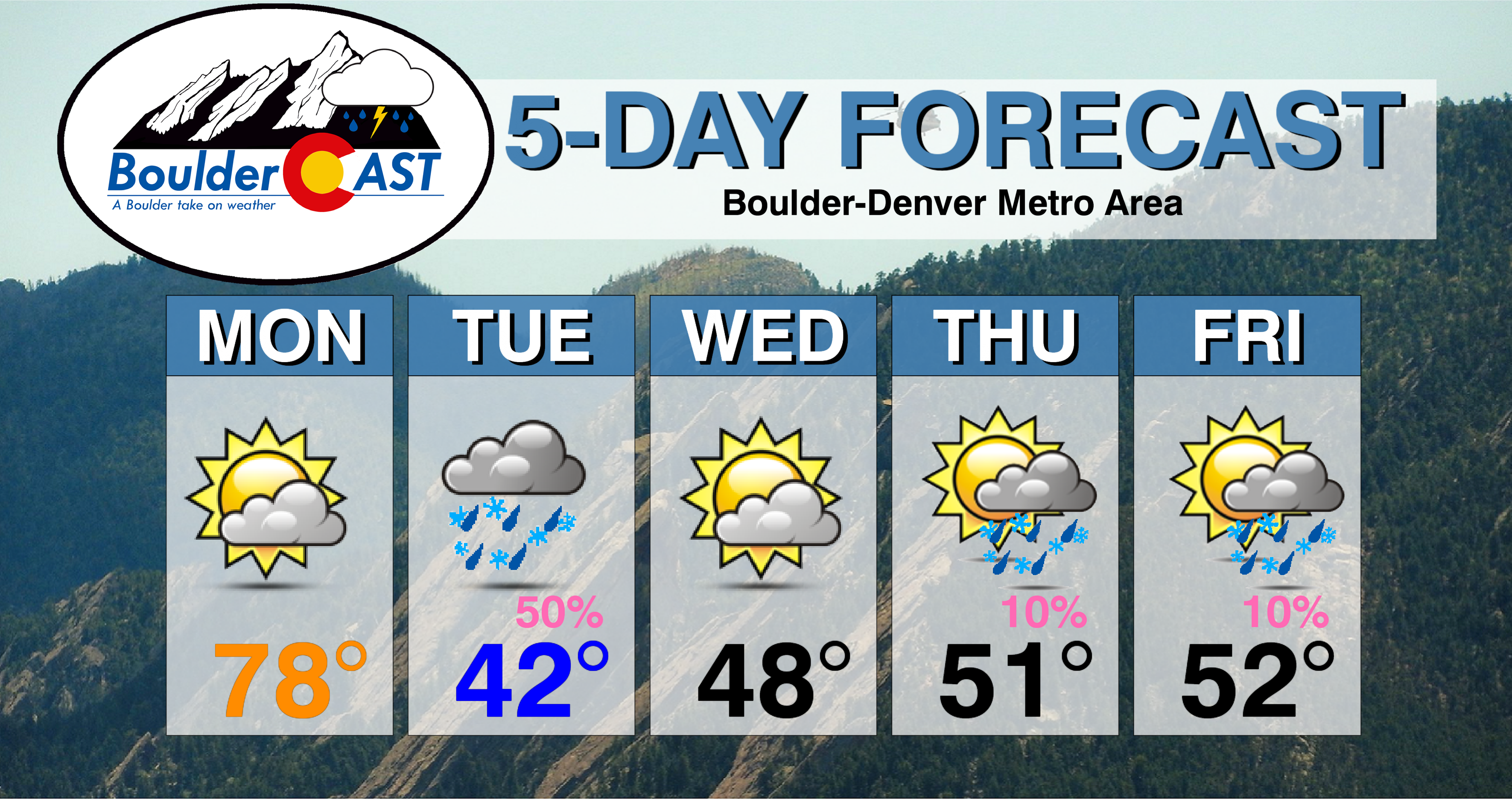
After a quiet and warm weekend, the weather turns chillier starting Monday evening. A persistent north-northwesterly flow will then keep the area cooler than normal to end October and begin November. We’re also watching a few chances of light snow. We cover it all in the week ahead forecast.
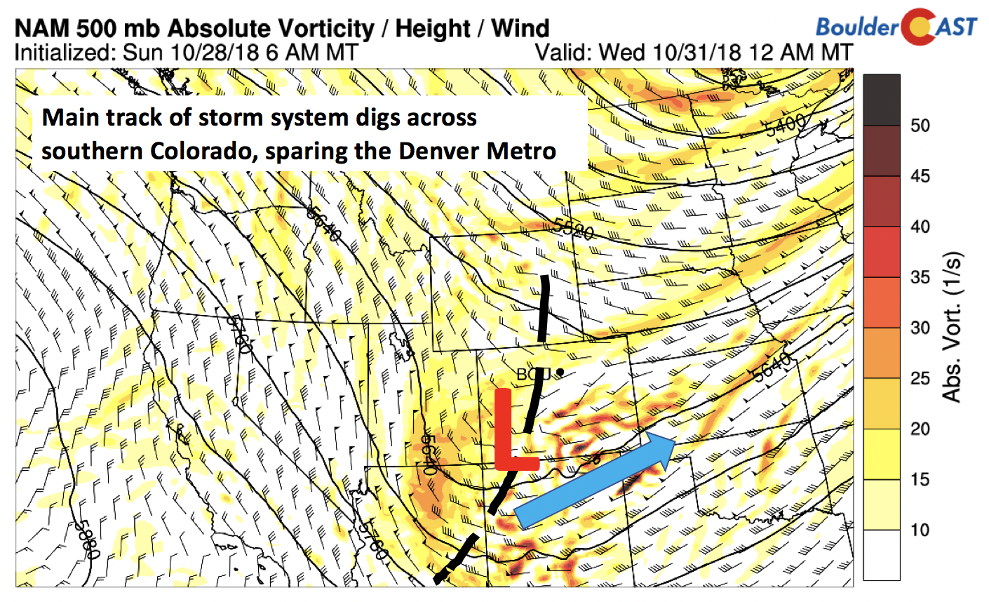
We start out the week with one more day of unseasonably warm temperatures. Typical highs for the 29th of October are in the upper 50’s. We should reach the upper 70’s, even a bit warmer than it was on Sunday. Below shows the 500 mb absolute vorticity map for this afternoon. Largely noticeable is the west-southwesterly flow draped across the area and much of the western United States. This pattern will lead to downslope and warm advection, making Monday our “hottest” day of the week.

NAM 500 mb vorticity today
Of note also is a trough to our northwest in Wyoming and Utah. This will be diving through this evening and during the day tomorrow, ushering in colder temperatures, cloud cover, and precipitation to the state.
Chillier with snow chances Tuesday into Wednesday
Even though we start warm on Monday, we will end colder this evening. As the sun goes down, a strong cold front will be making its way through in response to the trough. The below image shows the 800 mb temperatures late tonight. The front, as usual this time of year, will push in from the north and east and create upslope conditions on Tuesday for the Front Range. Gusty winds out of the north may approach 35 mph behind the front this evening with temperatures dipping into the 40’s overnight.

NAM 800 mb temperature tonight
We start our Tuesday with cloud cover and rain/snow. A combination of the digging trough, upslope conditions at the surface, and some weak jet forcing will produce a band of precipitation oriented southwest to northeast across Colorado early Tuesday morning. The high-resolution NAM simulated radar for Tuesday at 8:00 AM gives us an idea where this band may be located across the northern Metro area:

Simulated radar from the 3km-NAM early Tuesday shows a heavy band of jet-forced rain/snow draped across Colorado
The below image shows that a narrow swath of elevated precipitable water will be over the region as well. This will create just enough moisture with the forcing in place to give us showers to start our Tuesday.

GFS precipitable water anomaly Tuesday
As for snow chances, the devil is in the details. Overall, the models agree that temperatures will be borderline. The NAM (below) shows that snow levels Tuesday will hover around 6,000 feet, falling further Tuesday night into early Wednesday. By then, however, the trough digs southeastward with the brunt of the energy sagging south of the Metro area. Still, under the heavier bands of precipitation on Tuesday (especially that jet-forced band), snow mixing in with the rain at times is likely across the lower elevations.

NAM snow level 6PM Tuesday and midnight Wednesday
This rain/snow thinking is also echoed by the GEFS ensemble precipitation forecasts for Boulder and Denver this week (see below). Many of the ensemble members keep rain as the primary precipitation type; some members also show snow as well. Our best bet is that we’ll start out Tuesday in the lower 40’s and remain there much of the day under cloudy skies. Rain and snow showers will be off and on through the morning and afternoon/evening, with increasing odds of snow mixing in Tuesday night into early Wednesday morning.

GEFS ensemble precipitation forecast this week
We don’t expect much accumulation as a result, with the best chances being on grassy surfaces and trees/cars/shrubs. With the ground warm from the past weekend, as well as temperatures staying near or above freezing, this seems quite reasonable. The GFS and NAM model snowfall forecast (below) shows a consistent pattern of the best chance of accumulating snow to be over southern Colorado and the Mountains . We will include the Foothills west of Denver and the Palmer Divide in that as well, given their higher elevation and snow levels falling to 6,000 feet. We will post an official forecast for the event later Monday or Tuesday morning, but it’s looking like the Foothills could see 2-5” of snow, while across the Plains, less than 1” is expected.

GFS and NAM snowfall forecast through Wednesday
A chilly Halloween
The trough will be moving further south by Wednesday morning. With that, any precipitation and snow will also follow suit. Some light rain/snow showers may be around early in the morning before sunrise, but overall it will be a dry and cool day. Skies should be clearing as upslope flow transitions to a more westerly component over the state. Temperatures will warm only into the upper 40’s. Trick-or-treaters will be in-store for a chilly evening, with temperatures likely in the middle 40’s to start under generally clear skies, dipping into the lower 40’s to upper 30’s as the evening wears on.
Still cool on Thursday & Friday with Mountain snow
Come Thursday, a secondary system will be the next player to make an impact on Colorado. The GFS 250 mb upper-level jet stream and height pattern is shown below for Thursday over the western US. Of note is a dip in the jet stream from Canada through Colorado and into New Mexico. A strong jet streak is oriented north-south over western Colorado. While the pattern may change as the week progresses, its current position places northwestern Colorado in a favored position for accumulating snow, especially over the northwestern Mountains. The jet will be across our area through Friday, resulting in a good chance of picking up several inches of snow for places like Steamboat. You’ll want to check PowderCAST for updated ski forecasts if you are eyeing the slopes.

GFS 250 mb wind and heights Thursday
As for Boulder and Denver, we’ll see a west-northwest flow near the surface given the way the jet is oriented. Highs should be a few degrees warmer but still below average in the lower 50’s. A mixture of clouds and sunshine is our best bet three days out – we will likely see clouds drifting overhead from the high country and from the trough to our north. Any chance of precipitation will likely be scant, and mainly rain for the Metro area during the evening hours.
As we end the week and go into our first few days of November, we’ll run into some uncertainty. While the GFS has been consistent the past few days with a trough to our east keeping the area in the chilly northwest flow, we have seen in the past how this pattern can change quite dramatically by week’s end. For example, the below image shows the 500 mb low pressure center over Kansas and Nebraska, with the coldest temperatures just to our east. This places us in that upslope pattern as well. But we have seen in the past, especially in the summer, where the ridge out west overpowers the trough in the east for this set-up and the cold air is shunted further east, leaving behind warmer weather than was expected for Colorado. Given this, we are somewhat skeptical on this pattern. As for now, we are thinking lower 50’s to remain over the area with the persistent northerly flow. But if the trough is positioned further west or east will give or take some degrees from our predicted high – so stay tuned!

GFS 500 mb absolute vorticity and 800 mb temperature on Friday
As for snow chances, we will focus on a few things at play. The first is the north-south oriented jet stream, with a jet streak over western Colorado. This will aid in some large-scale lift over northeast Colorado Thursday night. A second factor is the upslope conditions. Temperatures, as mentioned above, are uncertain and will be the key factor of rain versus snow. As of now, we are putting out a slight chance of rain showers changing to light snow Thursday night into Friday. We don’t expect much accumulation with this system as well, barring any changes to the weather pattern. We’ll keep you updated for sure.
PLEASE NOTE: THIS WEEKEND STARTS DAYLIGHT SAVINGS. BE SURE TO CHANGE YOUR CLOCKS BACK ONE HOUR BEFORE GOING TO BED SATURDAY NIGHT
Forecast Specifics:
Monday: Partly cloudy and warm. Highs in the upper 70’s on the Plains and upper 60’s in the Foothills. As a cold front moves through this evening, temperatures drop into the 40’s with gusty northerly winds at times to 35 mph.
Tuesday: Overcast with light rain/snow showers during the morning and afternoon. Highs in the middle 40’s on the Plains and middle 30’s in the Foothills. For the lower elevations, little to no accumulation is expected. For the Foothills, 2-5” of snow is possible through the day and evening.
Wednesday: Light snow or drizzle possible in the pre-dawn hours on the Plains, with light snow in the Foothills, followed by cloudy skies early on. Clearing will occur through the morning and afternoon with highs in the upper 40’s on the Plains and upper 30’s in the Foothills.
Thursday: A mixture of clouds and sunshine with temperatures in the lower 50’s for the Plains and middle 40’s in the Foothills. A slight chance of rain/snow is possible Thursday night for the area with no accumulation expected.
Friday: Partly to mostly cloudy skies with a chance of isolated rain/snow showers in the morning. Highs on the Plains will be near the lower 50’s with middle 40’s in the Foothills.
High Country: Two chances of snow are possible this week over the mountains and ski resorts. The first is tomorrow into Wednesday, where favored areas look to be central and south-central parts of the state. The second is Thursday into Friday with northwestern and western Colorado being favored. Both of these waves could produce 4+” of snowfall for several mountain peaks and ski resorts.
DISCLAIMER: This weekly outlook forecast was created Monday morning and covers the entire upcoming week. Accuracy will decrease as the week progresses as this post is NOT updated. To receive daily updated forecasts, subscribe to BoulderCAST Premium.

.
Share our forecast!


You must be logged in to post a comment.