
We’ve had quite an unbelievable stretch of weather the past several weeks. However, the bad news is that there hasn’t been any rain in a long time. In fact, Boulder County is once again under a fire ban. We really could use rain or snow, but this week will unfortunately not bring any respite from the dry spell. This first half of the week will focus on a weak shortwave and mountain snow, with the latter week featuring warmer weather and a potential cold front. Read on for our full forecast.
Persistence forecast: Monday
On Sunday, temperatures were about ten degrees cooler than Saturday, which saw highs in the lower 80’s. For Monday, not much changes in the overall forecast, with persistence the name of the game.
The 500 mb vorticity map below shows a large trough hitting the Pacific Northwest over Oregon and Washington. If you haven’t followed the weather there, the Pacific Northwest has been hammered in the past few weeks with rain and snow. Unfortunately, that trough is not scheduled to move south to bring that precipitation our way…
Over Colorado, there is just a weak shortwave rippling through with the large trough over the Pacific Ocean. This weak system will usher in some high clouds through the day, but temperatures should still reach the lower 70’s under easterly flow.
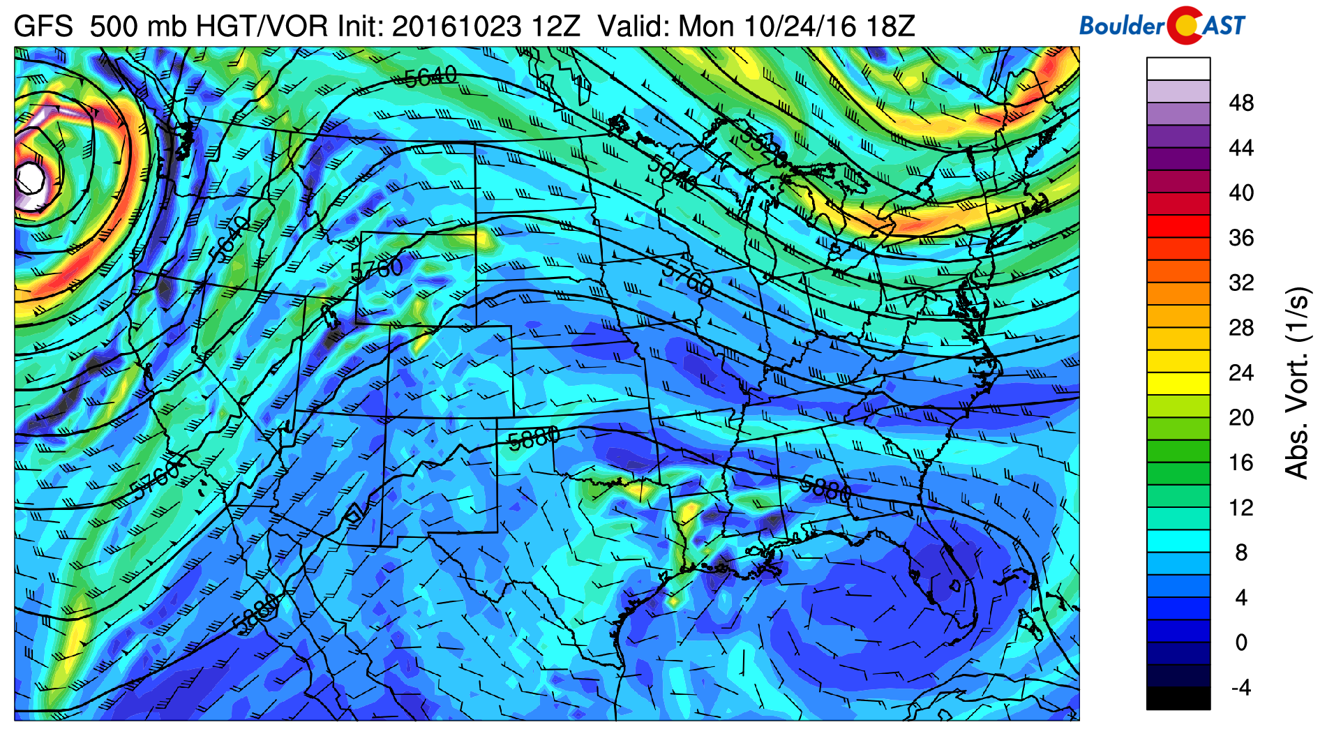
GFS 500 mb vorticity map for Monday
While this system could lead to a few isolated showers on the Plains, the main factor to watch will be light Mountain snow. The GFS model (below) is showing some snow accumulations in the 1-3″ range from Telluride, northeast into Aspen, Vail, and Breckenridge. This isn’t a major system by any means, but it will continue to keep our peaks snow-capped.
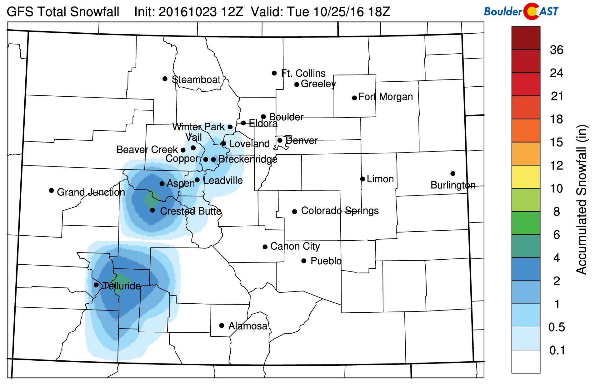
GFS accumulated snow Monday to Tuesday
Forecast snow levels through the duration of this event remain very high…just below 10,000 feet Monday night, and above 10,000 feet during the day Monday and Tuesday. Levels this high are remarkable for October! Downlsope warming east of the Continental Divide is evident in the map below, with snow levels even higher in the Foothills and Metro Area (~12,000 feet).

NAM forecast snow levels Monday night, near 10,000 feet across northern Colorado’s Mountains.
UPDATE: In a few weeks, BoulderCAST will be introducing “PowderCAST” ski forecasts with a new suite of weather products exclusively found on our site. These forecasts will allow you to plan your ski trips 3 to 5 days in advance, so you can decide when to skip work and which resorts will have the best powder and most tolerable weather. Additional and enhanced versions of the products will be available only to BoulderCAST Premium subscribers. Stay tuned for more news on this.

Slightly cooler: Tuesday
With a weak shortwave over the state of Colorado Tuesday, expect high clouds to be in place from the morning hours to early afternoon, with some sun thereafter. As a result, highs will be a few degrees cooler…near 70 on the Plains.
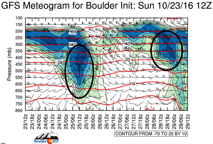
Below shows a time-height forecast from the GFS of upper-level relative humidity for the week. Focusing on the two areas circled in black, there is high relative humidity Tuesday (early in the week), followed by more high clouds on Friday with a potential secondary cold front. The first cold front moves through early Wednesday morning, which we will discuss below. Some models are showing light rain showers on Tuesday with the shortwave trough. However, the air is so dry anything that does fall should be rather spotty.
Wednesday: Cold frontal passage
Wednesday will see a weak cold front advancing through from the passage of the shortwave trough and cooler air moving in from the north. This front is evident below in both 500 mb mid-level atmospheric flow and low-level 700 mb temperatures. A northerly component to the wind is seen in both plots for Colorado, lending to highs will be a tad cooler than Tuesday, though you may hardly be able to notice. We’re thinking temperatures over the Plains in the upper 60’s.
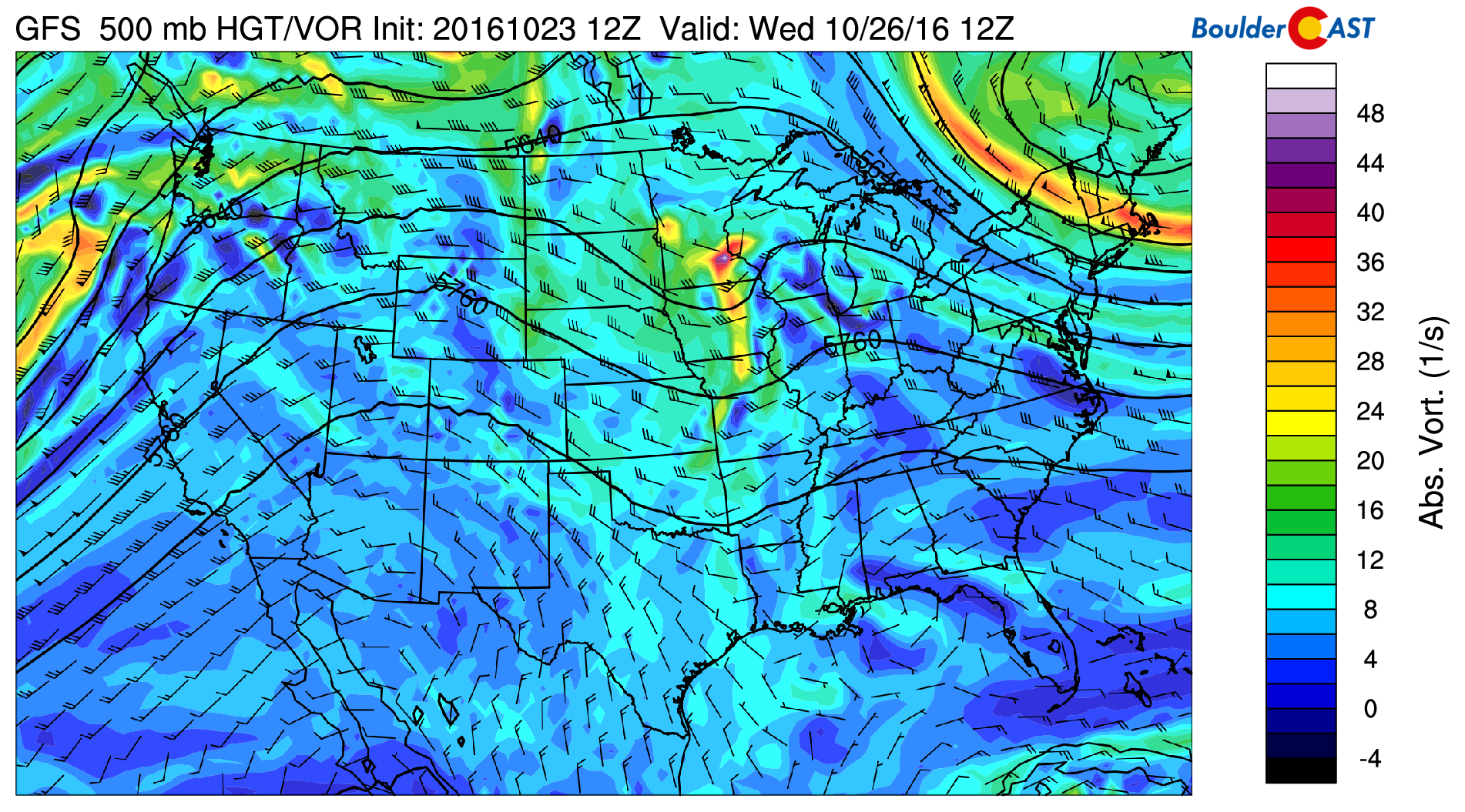
GFS 500 mb mid-level flow for Wednesday
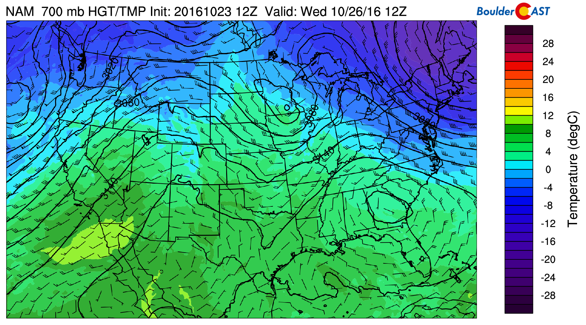
GFS 700 mb temperatures and wind for Wednesday morning, showing the cooler air and northerly flow
Thursday: Ridge, Ridge, Ridge!
Thursday is all about that resilient ridge! It just won’t leave and won’t let the cold air in Canada filter into the United States. Below shows 700 mb temperatures on Thursday. If you compare these to Wednesday, they are about 5 degC warmer. In addition, we are expecting a strong downslope flow with westerly winds gusting in the 20 to 30 mph range. This should help boost highs again into the upper 70’s.
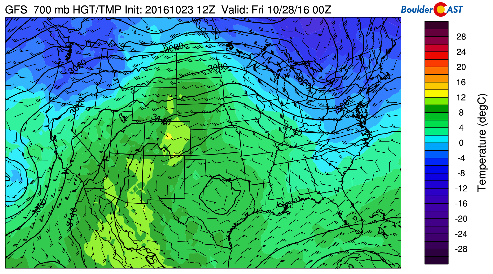
GFS 700 mb temperatures for Thursday, about 5 degrees warmer than Wednesday.
Friday: Watching a secondary cold front…
On Friday, there is the potential for another cold front to push into the Plains from the north and east. Current model forecasts are keeping the front just to the east of our region. However, this could change since we are five days out.
Shown below is the 700 mb temperature pattern on Friday. The cold air is located over Montana, southward into Nebraska, with northwest winds pushing as far south as northeastern Colorado. Low-level atmospheric fields show this frontal boundary barely reaching the Front Range. Nonetheless, given that we are in the autumn season, with the jet stream moving south ever-so-slightly each day, we would not be surprised if this front ends up moving through in later forecast model runs as the week progresses. Given the uncertainty, we are looking at highs cooler than Thursday in the middle 70’s, but could be the lower 70’s if the front moves through stronger than anticipated at the moment.
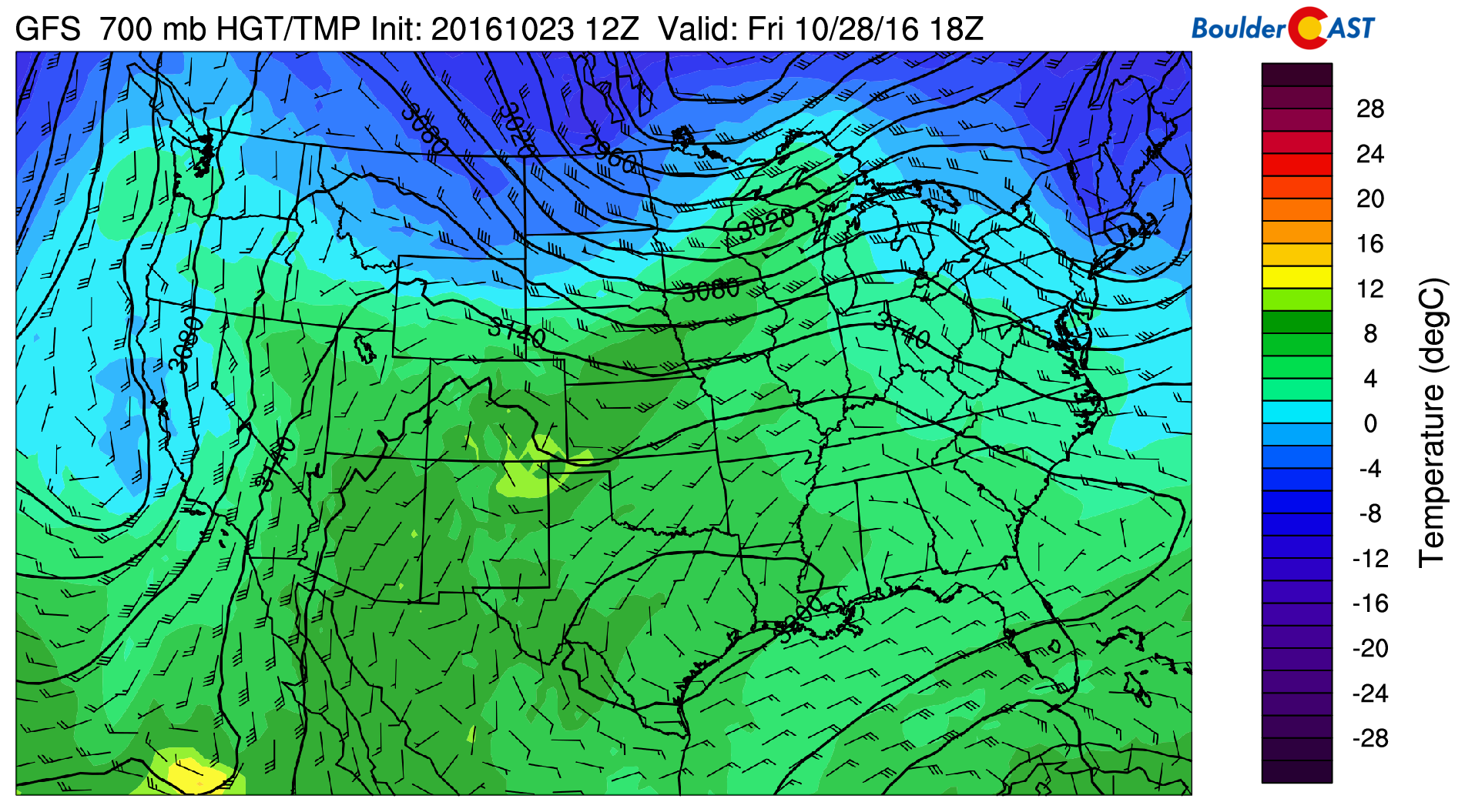
GFS 700 mb temperature pattern on Friday
Take advantage of the great week. There may not be too many more like it this year!
Forecast Specifics:
Monday: Sunshine early, then afternoon high clouds. Highs in the lower 70’s over the Plains, and lower 60’s in the Foothills.
Tuesday: Mostly cloudy in the morning and early afternoon, followed by late-day sunshine. Highs near 70 on the Plains with low 60’s in the Foothills. There is a slight chance of afternoon isolated showers, though most of us will remain dry.
Wednesday: Cooler temperatures and partly cloudy skies with east-northeasterly winds. Highs will be in the upper 60’s over the Plains with upper 50’s in the Foothills.
Thursday: Mostly sunny skies and breezy with some high clouds around. Temperatures warmer into the upper 70’s with middle 60’s in the Foothills.
Friday: Increasing cloud cover after morning sunshine. Temperatures in the middle 70’s, though it could be cooler if a secondary cold front advances through. Over the Foothills, expect highs in the middle 60’s.
High Country: The Mountains will see rain and snow showers Monday afternoon into Tuesday morning. After Tuesday, drier weather returns, continuing through the week. There may be some precipitation for the weekend, but that is too far out to say for sure at the moment.
Extended: Not much overall change in the pattern. The ridge of high pressure looks to remain in place to end October. However, there are signs that a few storm systems may inch southward from the recent norm and impact Colorado on Halloween or early November. These storm systems look to be southern track systems at the moment, so its unlikely they will produce snow over the Plains, though you never know. Long story short, expect mild weather to end October!
Mon
Tue
Wed
Thu
Fri


Temperature
73
70
68
77
74


Precip Chc (Plains)
0%
10%
0%
0%
0%


