
Our recent warm stretch is more typical of mid-September than mid-October, but it’s really hard to complain. Under the influence of an expansive ridge of high pressure, temperatures have exceeded 80 degrees each of the last four days, with several close-calls for record highs in many Front Range cities. For the week ahead, we’ll see a brief cool down and spurts of Mountain snow, but revert to boring summer-like weather before the weekend. Continue reading for our complete outlook of the upcoming week.
Weak Wave #1: Monday
The 80-degree heat won’t make an appearance this week, but today will still see above normal temperatures before the arrival of a weak Pacific system this afternoon.
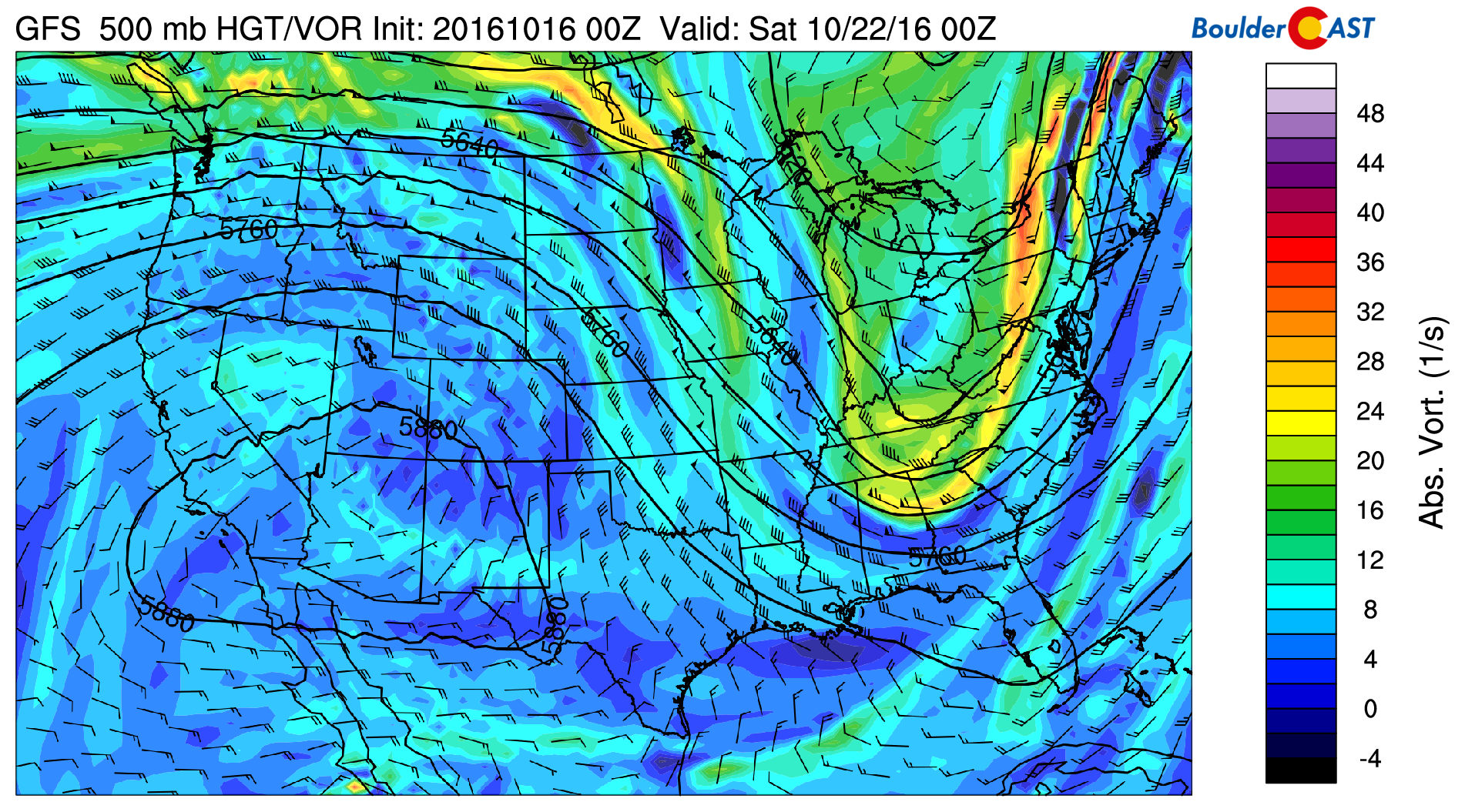
The 500 mb vorticity map below shows broad troughing across the northwest United States, with numerous small trough axes mixed within. It’s this disorganization that will ultimately limit the impact of the system as a whole.
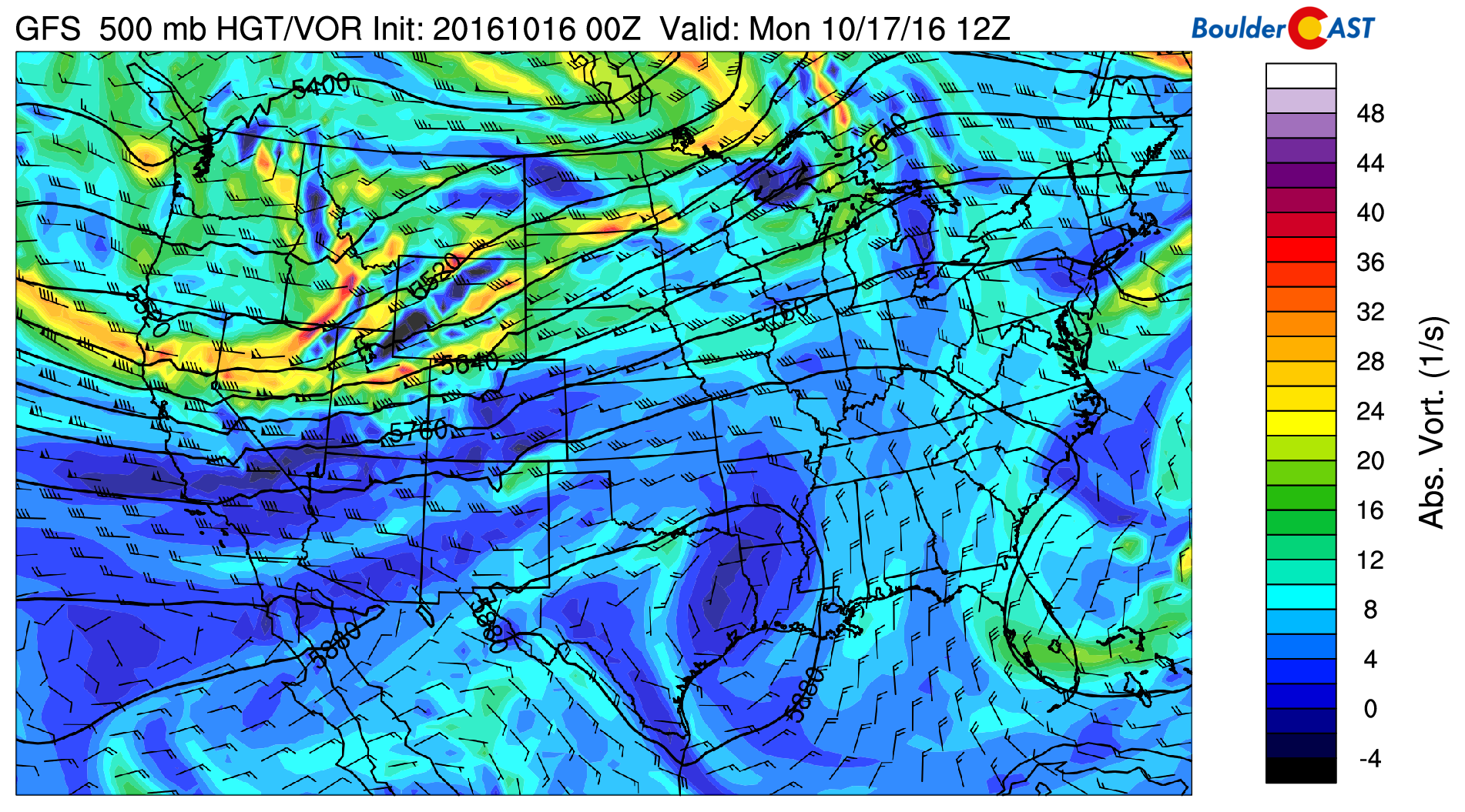
GFS 500 mb vorticity map for Monday morning, showing an approaching trough with several embedded waves
At the base of that trough is the jet stream, which can easily be picked out in the 250 mb wind map below, straddling the Colorado-Wyoming border.
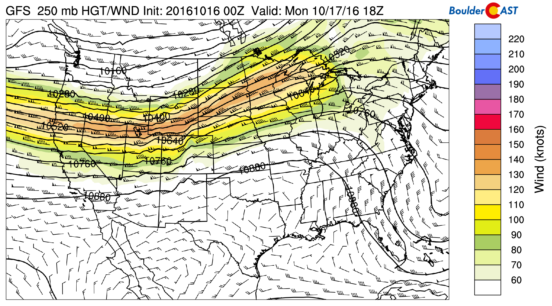
GFS 250 mb winds during the day Monday, showing the position of the jet sagged across southern Wyoming
Unfortunately, this trough doesn’t quite make it far enough southward this week to bring substantial impact to Colorado, outside of some much-needed Mountain snow. The Plains will have trouble squeezing out any precipitation. This northward track was something we expressed concern in last week.
Today will see warm and windy conditions across the Plains. Expect an early afternoon high in the low 70’s with winds gusting up to 50 mph. However, a cold front arrives during the afternoon hours, which will bring some chilly northwest air and falling temperatures by early-evening. As was the case over the weekend, fire danger will remain high today.
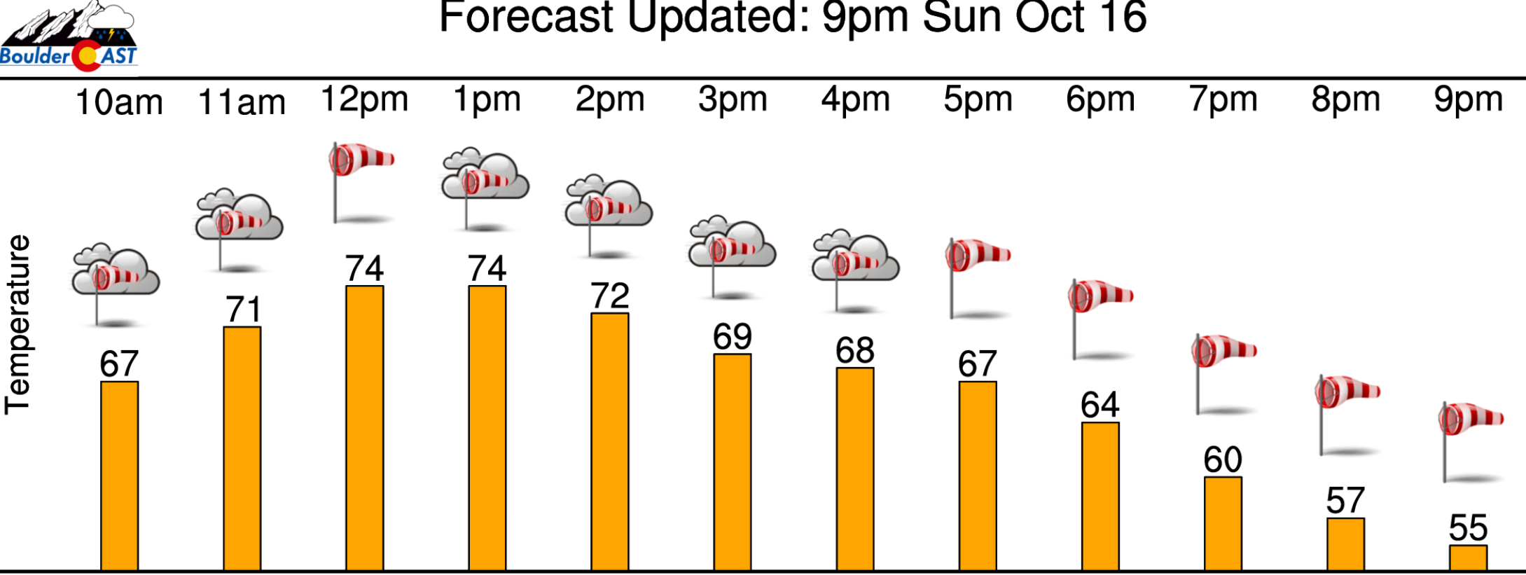
Monday’s warm and windy forecast
Behind this front, there will be a slight bump in moisture and lift in the Mountains, producing snow showers for areas above treeline this afternoon and tonight. Nothing major, but an inch or so of accumulation can be expected.
Weak Wave #2: Tuesday night
Despite plenty of sunshine Tuesday, temperatures will only rise to near 60 degrees on the cold side of the front for the lower elevations.
A secondary piece of energy moves along the Wyoming border Tuesday evening, bringing with it another cold front. It will pack a marginally bigger punch, but most of the precipitation should remain in Colorado’s northernmost areas.
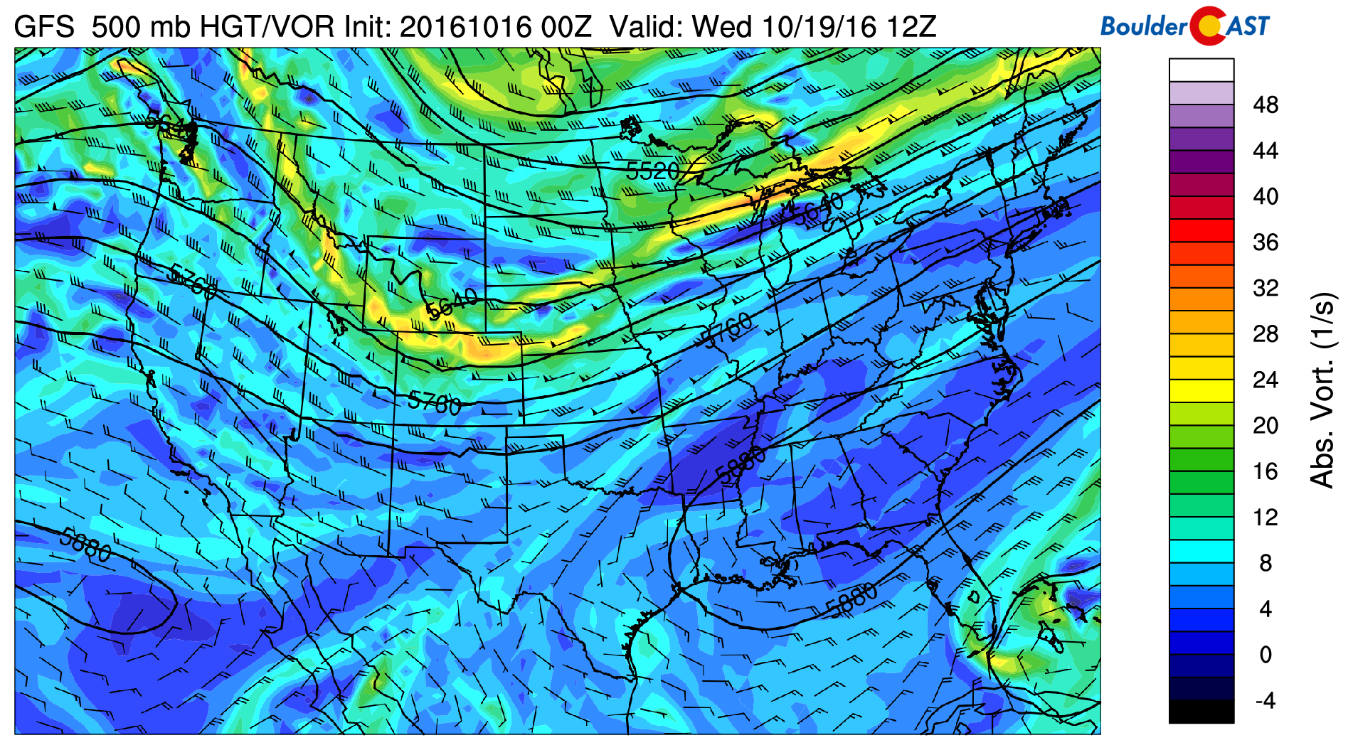
GFS 500 mb vorticity map for Wednesday
Around Steamboat and in Larimer Country, 2-4″ of snow will be possible by Wednesday afternoon above 10,000 feet. The I-70 ski resorts could pick up 1-3″ as well.
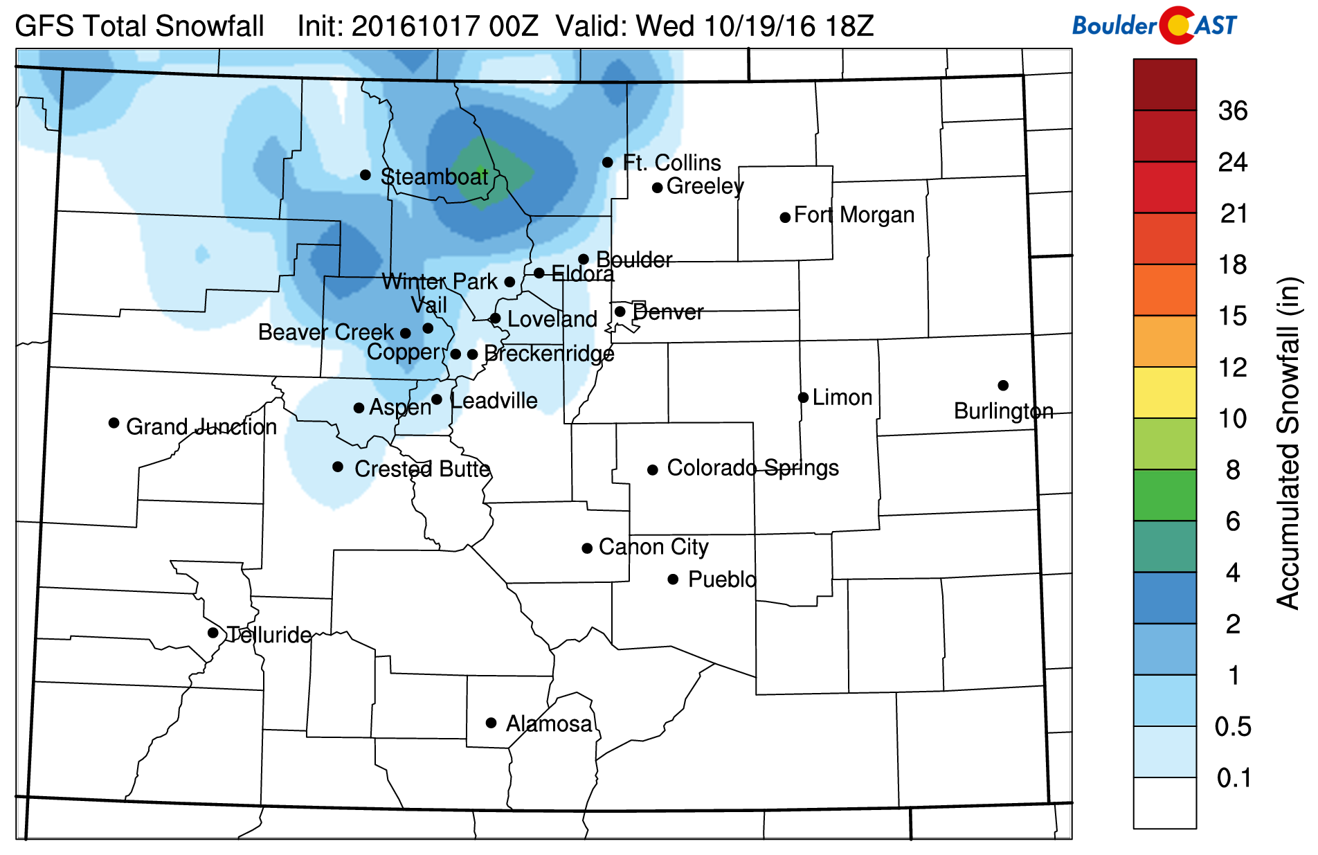
GFS total forecast snowfall through Wednesday morning
We should mention that we had closely been monitoring this second wave for a while now. Late last week and even this weekend, models wanted to develop some substantial upslope on the Plains behind that second front. While we still think some rain showers will be possible on the Plains north of Denver Tuesday night, it’s a far cry from some hints the models were sporadically dropping a few days ago! With the jet overhead, we’re expecting the precipitation to line up in bands Tuesday evening and night, oriented southwest to northeast. Most lower elevation locations should see less than 0.10″ of precipitation, according to the ensemble plumes.
Anything that does fall will be all rain for the Plains, as snow levels Tuesday night are forecast to be 6,500 to 7,000 feet at their lowest. The Foothills, especially from Larimer County north, could see up to 2″ of snow Tuesday night if one of those heavy bands lands overhead. Though, most areas will see less than 1/2″.
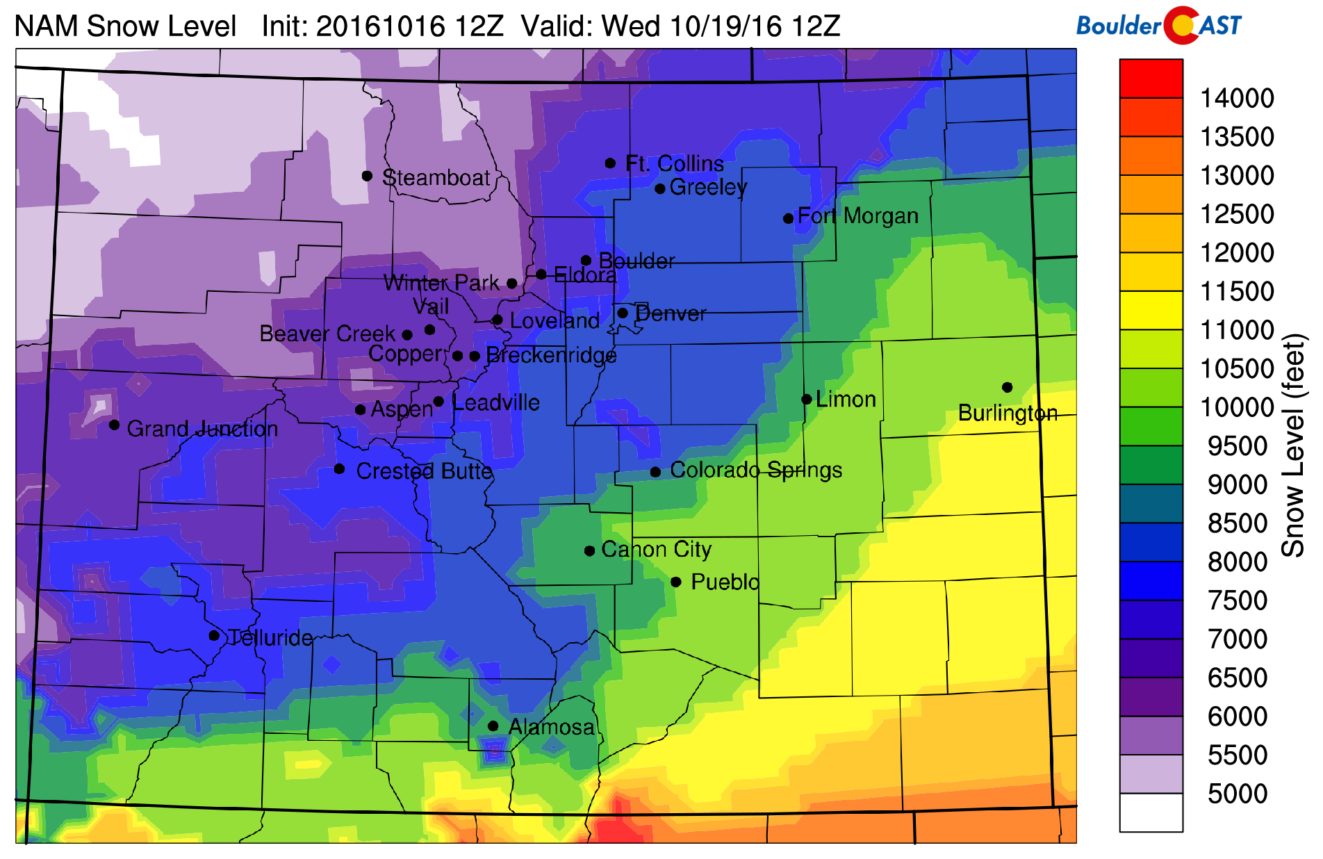
NAM forecast snow level Tuesday night… ~7000 feet across the Front Range Foothills
Quiet to conclude the week
Both Wedesday and Thursday will be cool, but quiet. Highs will be near 60 degrees both days with lots of sunshine. Some cloud cover Wednesday morning should prevent sub-freezing temperatures on the Plains. However, the same can’t be said for Thursday morning. Since many locations are yet to drop below 32 degrees, Freeze Warnings may be on the table.
With the cold air mass exiting the region Thursday (see below), we are less confident on temperatures that day, but nonetheless, it will be sunny!

GFS 700 mb temperatures for Thursday afternoon. The cold air mass will be exiting through the day, so it’s hard to pin down a reliable value.
Friday will have yet another ridge begin to build across the western United States (see below).
GFS 500 mb vorticity map for Friday afternoon, depicting a ridge rebuilding across the Desert Southwest
With this, Friday and the upcoming weekend will see warm conditions and very liberal amounts of sunshine. Friday’s high will be in the mid 70’s, or perhaps a little warmer.
Have a great week!
Forecast Specifics:
Monday: Mostly sunny, warm and windy. Expect an early afternoon high in the low 70’s across the Plains with upper 50’s in the Foothills. A cold front arrives in the afternoon with falling temperatures and strong winds up to 50 mph.
Tuesday: Sunshine early, with increasing clouds through the day. Highs will be near 60 for the Plains with mid to upper 40’s in the Foothills. Spotty rain showers (Foothills snow showers) will be possible Tuesday evening and night, primarily north and west of Denver. Generally an inch or less of snow above 7,000 feet can be expected.
Wednesday: Some morning clouds are possible. However, the afternoon will have plenty of sunshine. Highs remain cool in the upper 50’s across the Plains and upper 40’s in the Foothills.
Thursday: Sunny and seasonal. Watch for morning frost. Highs in the low 60’s over the Plains and low 50’s in the Foothills.
Friday: Mostly sunny and warmer. Temperatures climbing into the mid to upper 70’s on the Plains and mid 60’s in the Foothills.
High Country: The Mountains will see two rounds of snow this week. A brief shot Monday afternoon and night, then again Tuesday night into Wednesday morning. In total, 1-3″ can be expected for the areas north of Interstate 70. Favored areas for westerly flow may see up to 6″. Winds will also be roaring above treeline, especially Monday and Tuesday. Some gusts at 14er level could approach 100 mph!
Extended: It looks as though the ridge for the weekend will break down next week, but it’s unclear exactly what that means for Colorado. For now, we suspect more seasonal weather as we enter the last week of October.
Mon
Tue
Wed
Thu
Fri


Temperature
74
63
58
61
76


Precip Chc (Plains)
0%
20%(pm)
0%
0%
0%


