
The gorgeous weather pattern of last week will continue into the week ahead with warm sunny days and cool autumn nights. There isn’t much actual weather to discuss this week this week, but we’ll give it our best shot!
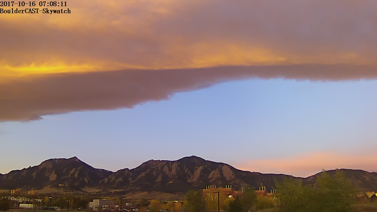
Northwest flow creating wave clouds for Monday morning’s sunrise
Monday: Calm
The weather for the week ahead is going to be very quiet. This may be our shortest weekly outlook we’ve written in the last three years!
Below shows the mid-level atmospheric flow today across the United States. Over the Northeast, a trough is sweeping through New England with cool autumn air. Over the inter-mountain West, west-northwest flow ensues across Colorado. To the south of us is a ridge of high pressure that will continue to bring sunny skies today and the bulk of the upcoming week. The main story will be the relatively unchanged pattern over the area. High pressure will remain to create borderline hot days and cool autumn nights. Expect warmer temperatures today thanks to downslope surface flow. Middle 70’s will be widespread across the region!
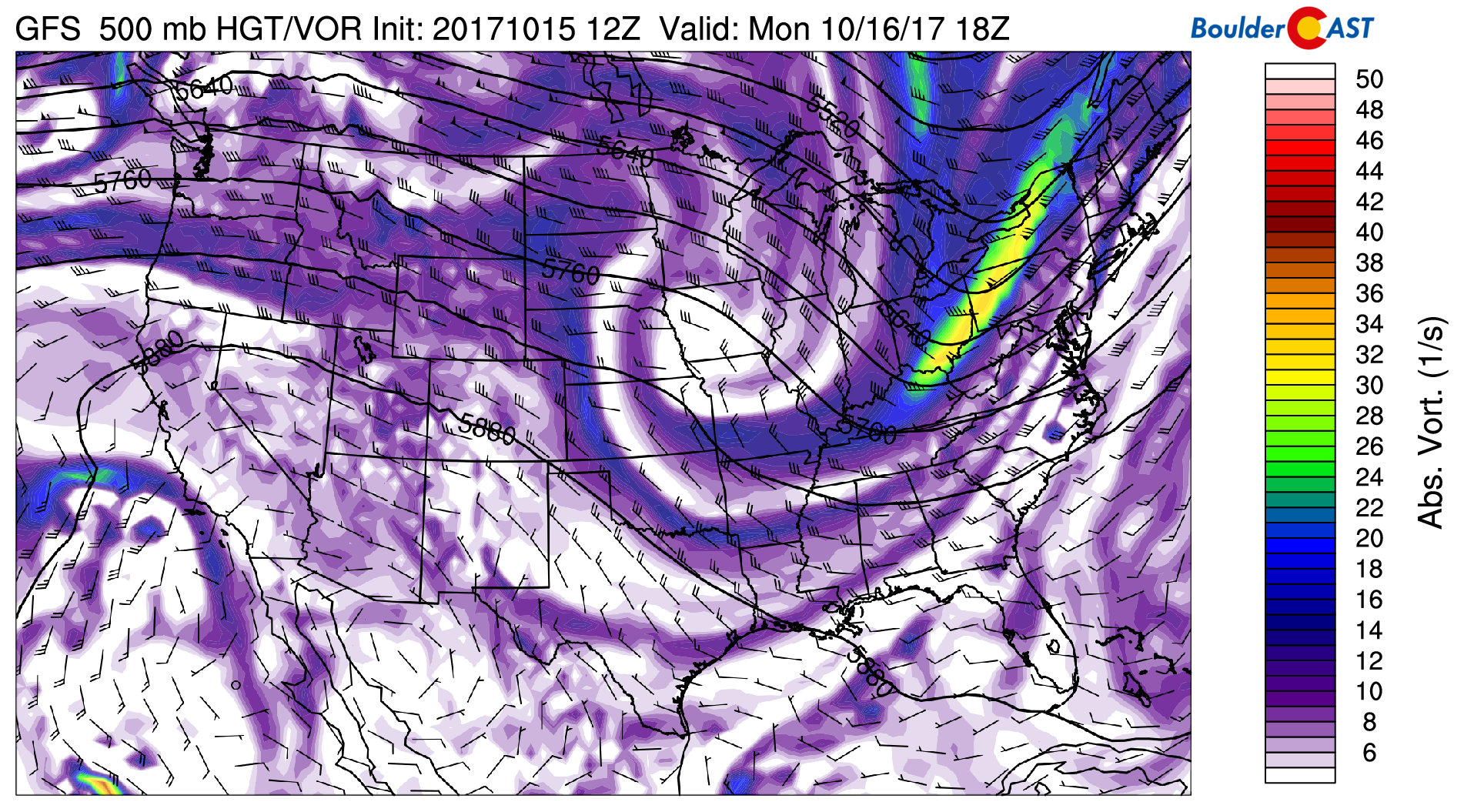
GFS 500 mb absolute vorticity pattern on this Monday
Tuesday: Calm
On Tuesday, virtually no changes occur in the weather pattern. Below shows that at the mid-levels, westerly flow remains. This will be a slight shift from the west-northwest flow Monday, helping to bump high temperatures up a few degrees with lots of sunshine.
GFS 500 mb absolute vorticity pattern for Tuesday
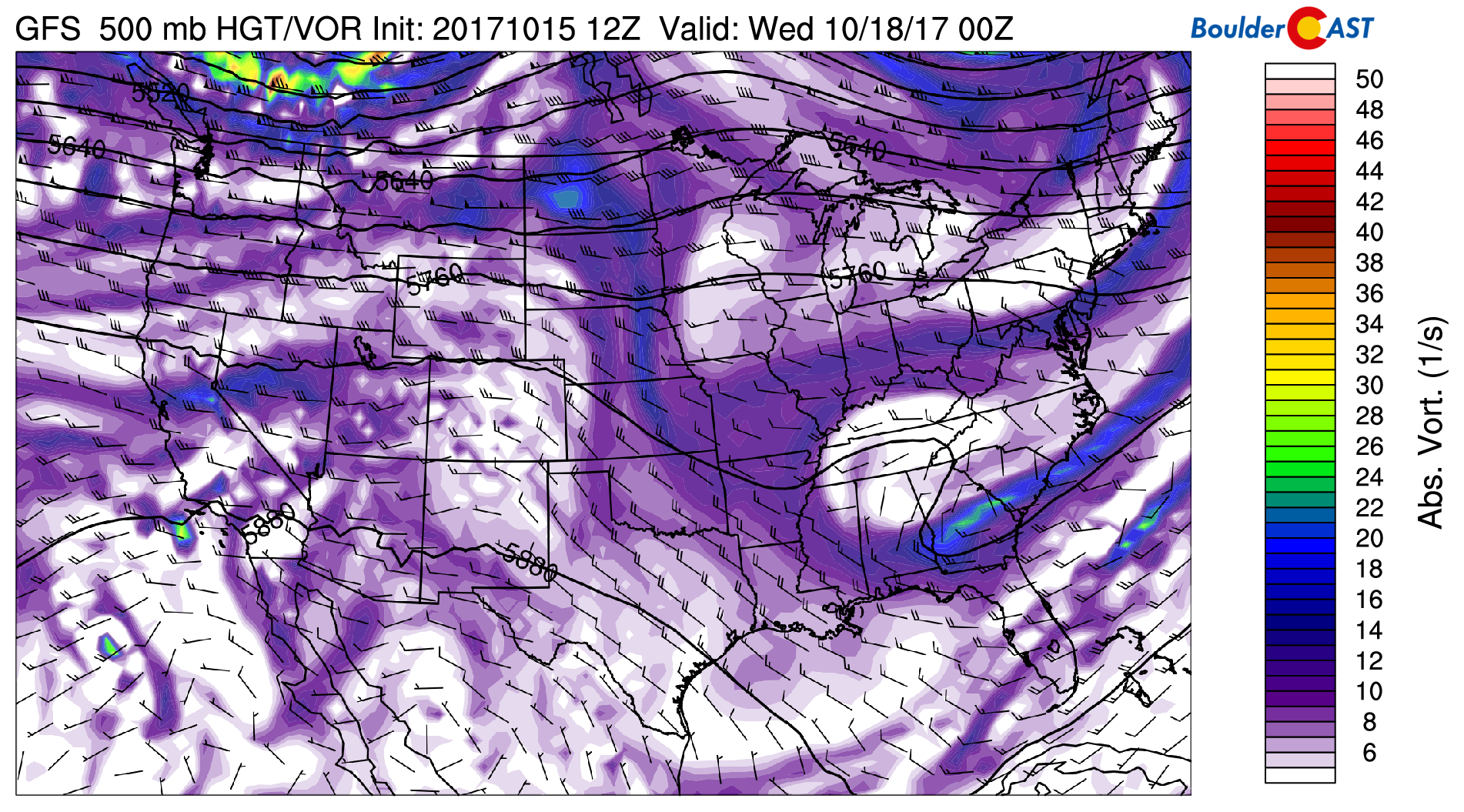
Wednesday – Friday: Calm
As we go into Wednesday, Thursday, and Friday, the overall pattern is almost identical to the beginning of the week. The figure below shows that on Thursday, weak southwest flow takes over thanks to a very weak shortwave. The moisture is very limited with the system and thus sunshine should once again be the common denominator. The airmass persists, with temperatures in the mid to upper 70’s likely.
GFS 500 mb absolute vorticity for Thursday
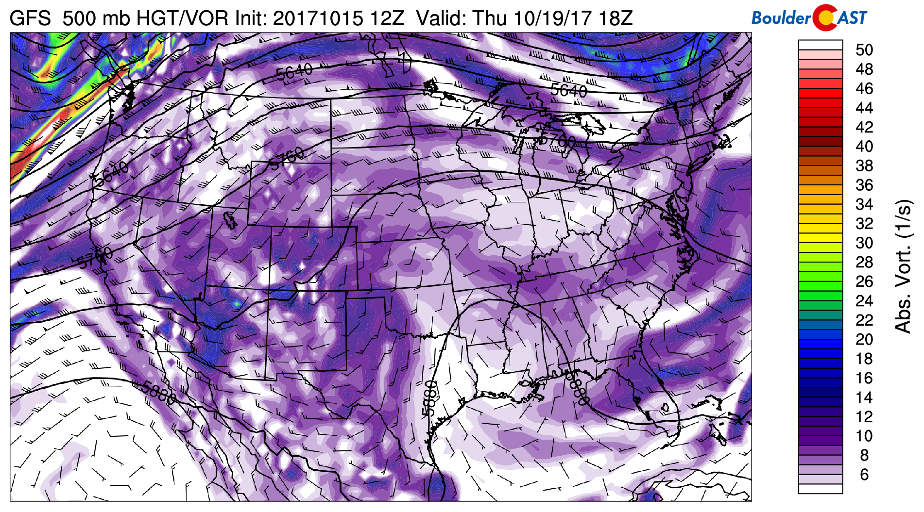
Finally, by Friday, southwest winds remain across the state (see below), with the approach of a trough of low pressure across the Pacific Northwest. This will lead to continued warmth across Colorado on Friday. Current indications are that this trough will skirt the northern part of our state on Saturday, keeping us dry but with more seasonal temperatures for the weekend. Light snow accumulations look probable for Saturday and Sunday in the Mountains.

GFS 500 mb absolute vorticity for Friday
Enjoy the warm weather this week! And carry a jacket for the evening as nights will be some 30 to 40 degrees cooler than the afternoons!
Forecast Specifics:
Monday: Mostly sunny and warm with highs in the mid 70’s for the Plains and lower 60’s in the Foothills.
Tuesday: Sunny, warm, and dry. Highs in the upper 70’s on the Plains and middle 60’s in the Foothills.
Wednesday: Partly cloudy with temperatures in the upper 70’s on the Plains and middle 60’s in the Foothills.
Thursday: A mix of clouds and sun. Temperatures in the middle 70’s on the Plains and lower 60’s in the Foothills.
Friday: A few passing clouds but overall sunny with middle 70’s for the Plains and middle 60’s in the Foothills.
Weekend: The upcoming weekend shows a trough of low pressure to skirt the northern section of the state Friday into Saturday. This may bring a weak cold front through to drop temperatures back into the 60’s Saturday and Sunday. We remain dry, however, thanks to abnormally low moisture in the area.
High Country: The quiet week across the Metro area will also translate into tranquil weather for the mountains. Abundant sunshine will dominate each and every day this week! Get out there and enjoy it! A few inches of snow look to arrive by Saturday above 10,000 feet. Find the latest forecasts for the mountains over at our SummitCAST page.
DISCLAIMER: This weekly outlook forecast is was created Tuesday morning and covers the entire upcoming work-week. Accuracy will decrease as the week progresses as this post is NOT updated. To receive daily updated forecasts, subscribe to BoulderCAST Premium.

Share our forecast:
Mon
Tue
Wed
Thu
Fri


Temperature
74
77
78
74
76


Precip Chc (Plains)
0%
0%
0%
0%
0%


