
As we enter the last week of November, temperatures continue their above normal stretch on this Monday. The week ahead will feature a series of two systems moving through, each of which will produce swings in temperatures, as well as the very slight chance of rain and snow showers. Read on as we detail the week and look into early December’s outlook.
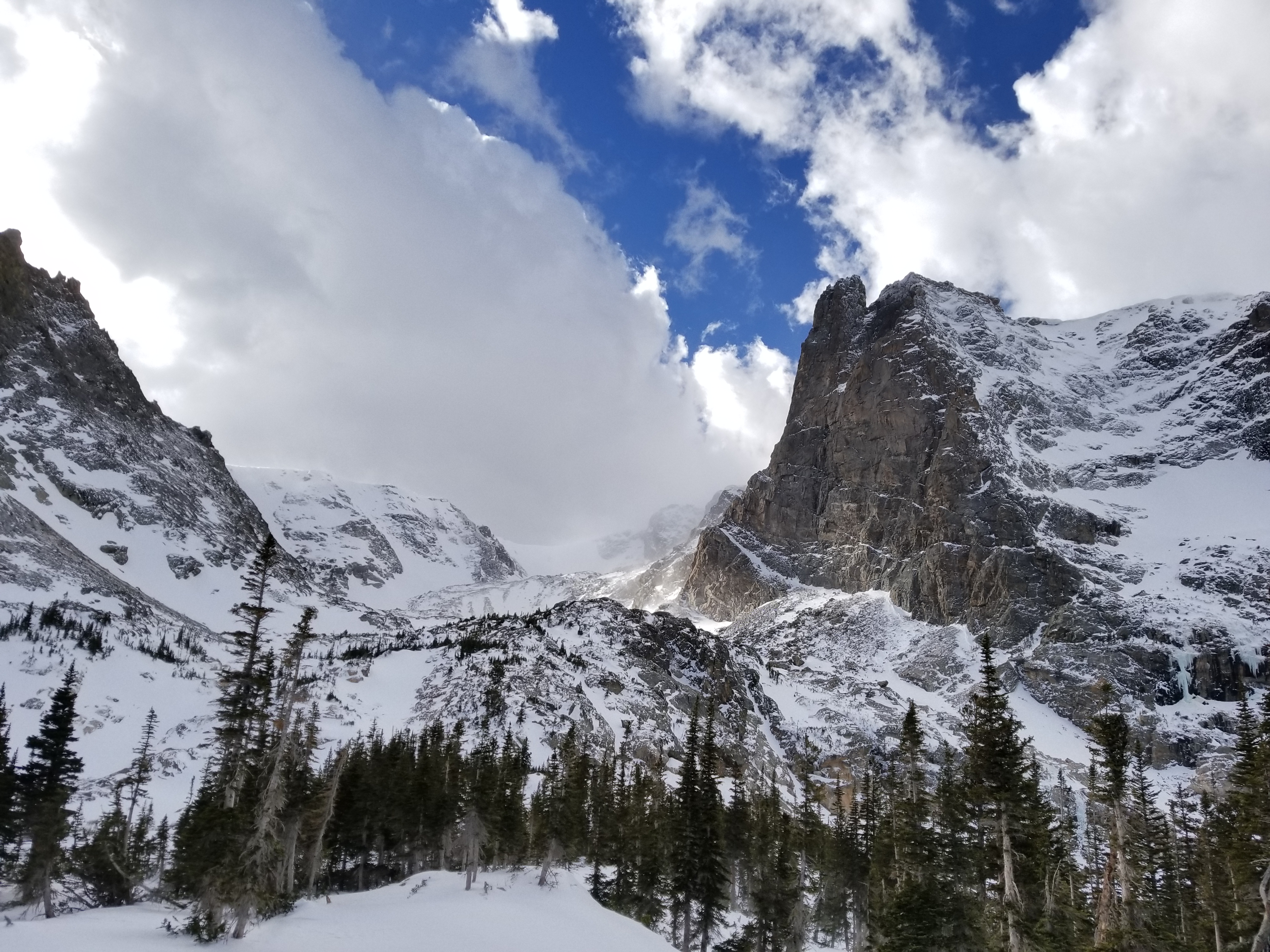
The BoulderCAST team hiked Lake Helene in Rocky Mountain National Park this past Friday
Warm trending cooler with rain/snow
The maps below show a very similar pattern to that which has existed through this past holiday weekend….warm southwesterly flow. However, there are some differences. A low pressure system today is present across southern Nevada, with a jet stream anchored to the south, stretching northwards into Montana. This system will be advancing through tonight, ushering in another weak cold front, along with the chance of rain/snow showers. Today’s temperatures will be in lower to middle 70’s once again with a mix of clouds and sunshine. Boulder, by the way, broke a record hitting 73 degrees yesterday. Another record is possible today as well.
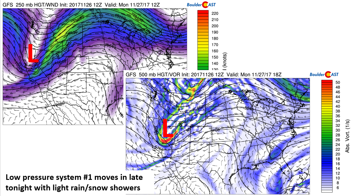
GFS 250 mb jet pattern (left) and 500 mb absolute vorticity (right) for today
The track of the system is not very promising for precipitation here as it is more favorable for southern Colorado. Nevertheless, a short duration of upslope from about midnight tonight until 10:00 AM Tuesday will lead to light and spotty precipitation over the Foothills and Plains. Snow levels begin around 7000 feet, but drop to below 5000 feet by Tuesday morning. Therefore, any precipitation will likely start out as light rain showers on the Plains, with light snow showers or flurries overnight.
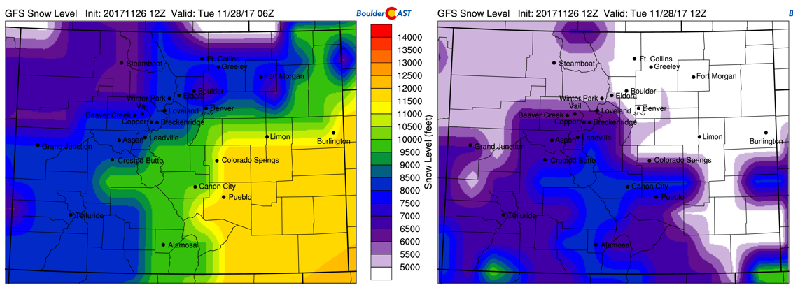
GFS snow levels for tonight at 11 pm (left) and 5 am Tuesday (right)
Predicted snow accumulations north of Interstate 70 are only a trace east of the Divide, and generally less than 1″ in the Mountains (shown below). Any snow will be at most a dusting but do be careful on the roads as any light rain may freeze up before Tuesday morning’s commute. 3-6″ is expected across the higher elevations of southern Colorado.
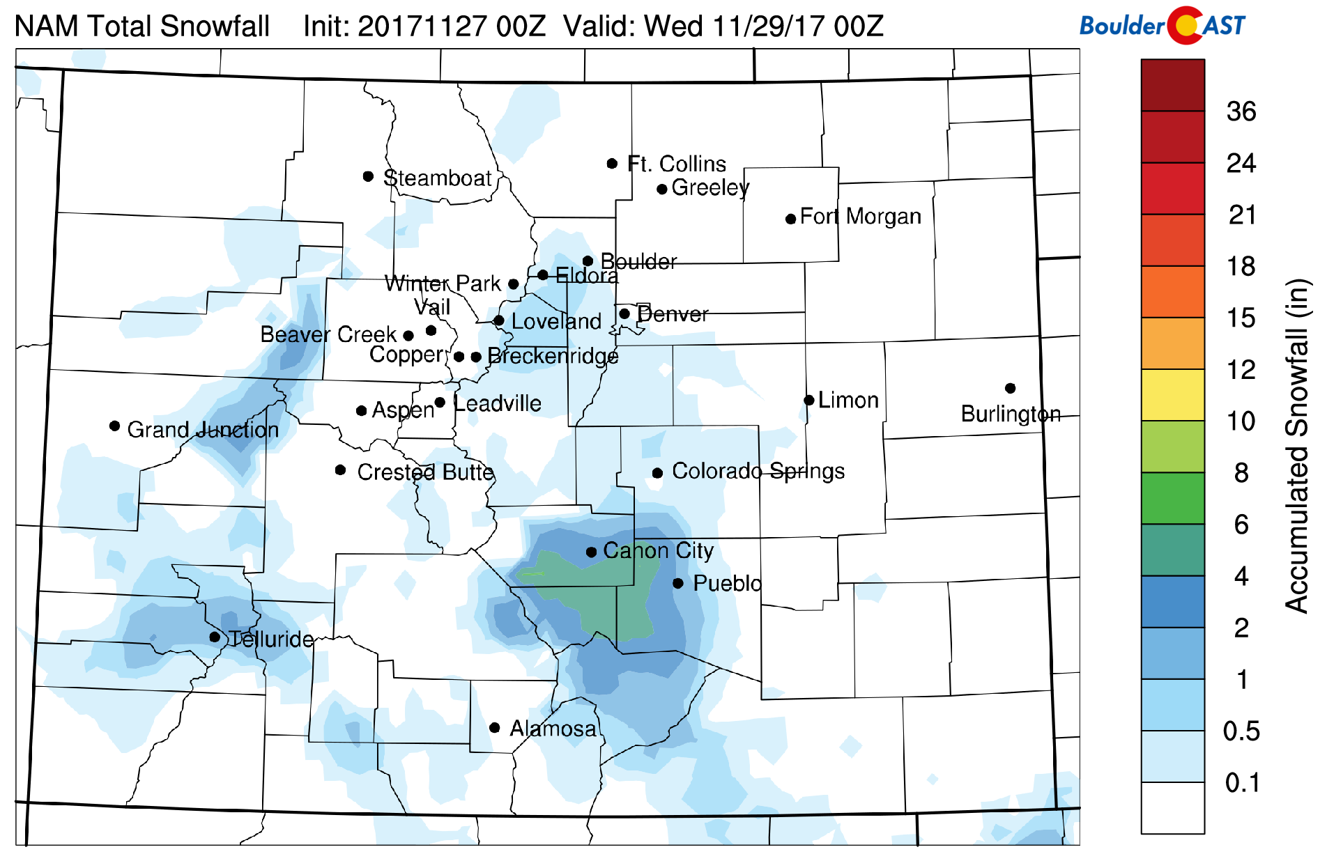
NAM derived snow accumulation through Tuesday morning
For us, the main impact from tonight’s system will be MUCH colder temperatures Tuesday! Below shows the temperature pattern for Monday afternoon and Tuesday morning after the frontal passage. The airmass cools about 14 degC behind the front, sending highs tumbling on Tuesday into the middle 40’s, about right where we should be this time of year.
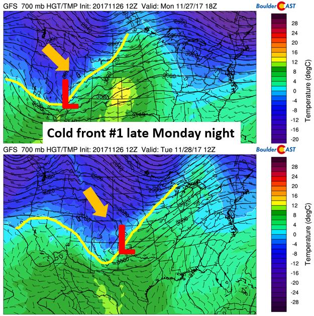
GFS 700 mb temperature for Monday evening (top) and Tuesday morning (bottom)
Another swing in temperatures Wednesday to Thursday
On Wednesday, temperatures at 700 mb rebound towards 2 degC, helping highs rise slightly to the middle 50’s. By Wednesday night, another cold front pushes through in the early evening, with temperatures falling back a few degrees for Thursday.
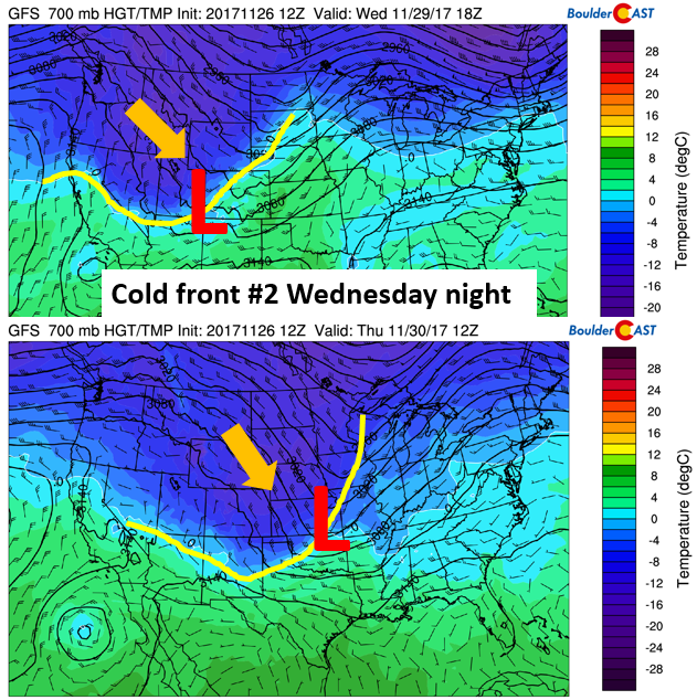
GFS 700 mb temperature for Wednesday afternoon (top) and Thursday morning (bottom)
This second system by midweek doesn’t look all the impressive either. The bulk of the energy will pass to our north across Wyoming on Wednesday night. The end result may be a few isolated rain or snow showers once again across Colorado Wednesday evening or night. Nothing to be concerned with as of now.
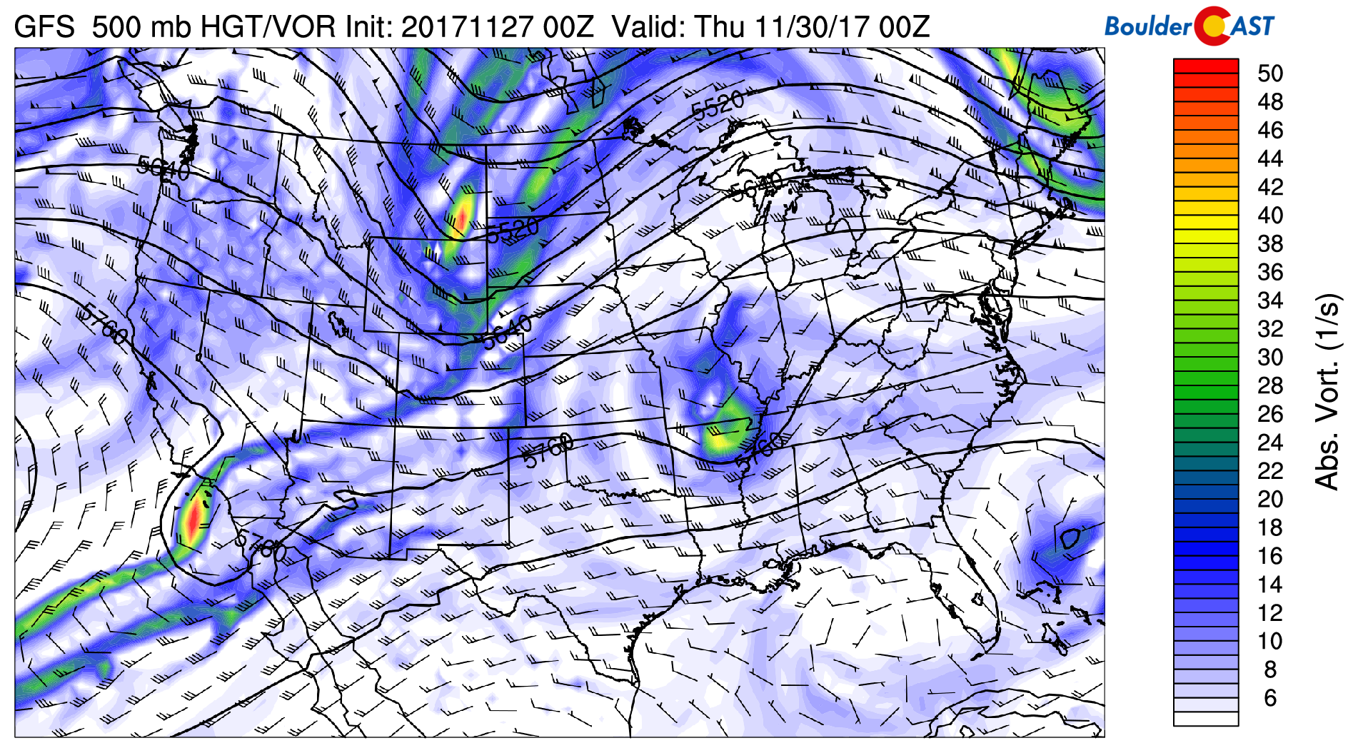
GFS 500 mb absolute vorticity for Wednesday afternoon.
Friday mild, but extended more active
The week ends on Friday with temperatures returning into to the 50’s. By early next week, however, both the Euro and GFS models, even their ensemble forecasts, are hinting that a low pressure system may take a southern track across northern Arizona. Of course, the details are not fully agreed upon right now…the track is not favorable for some models (too far south versus more north), so the devil will be in the details as we progress through this week. Nevertheless, the trend looks cooler and more active early next week.
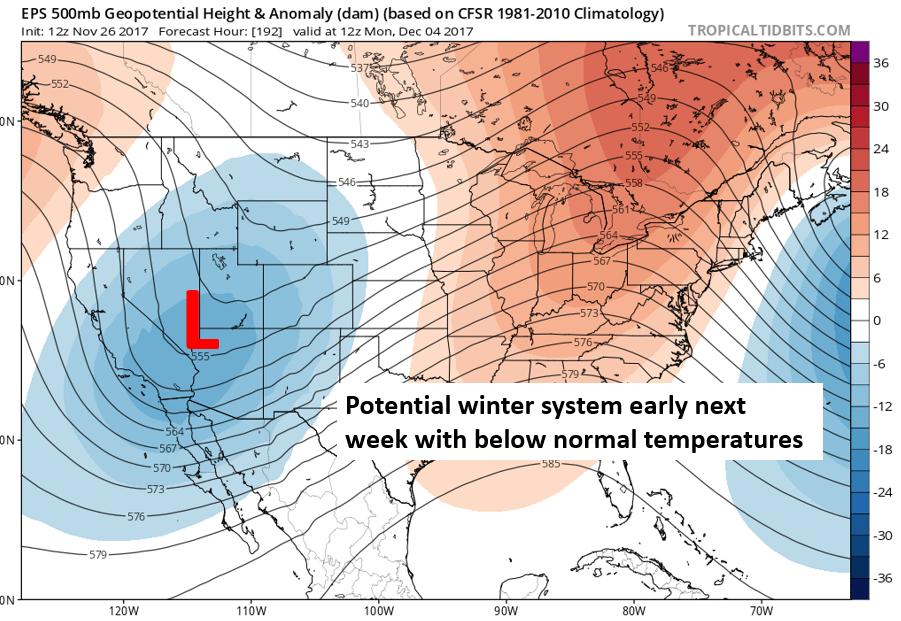
ECMWF ensemble extended range forecast early next week
Forecast Specifics:
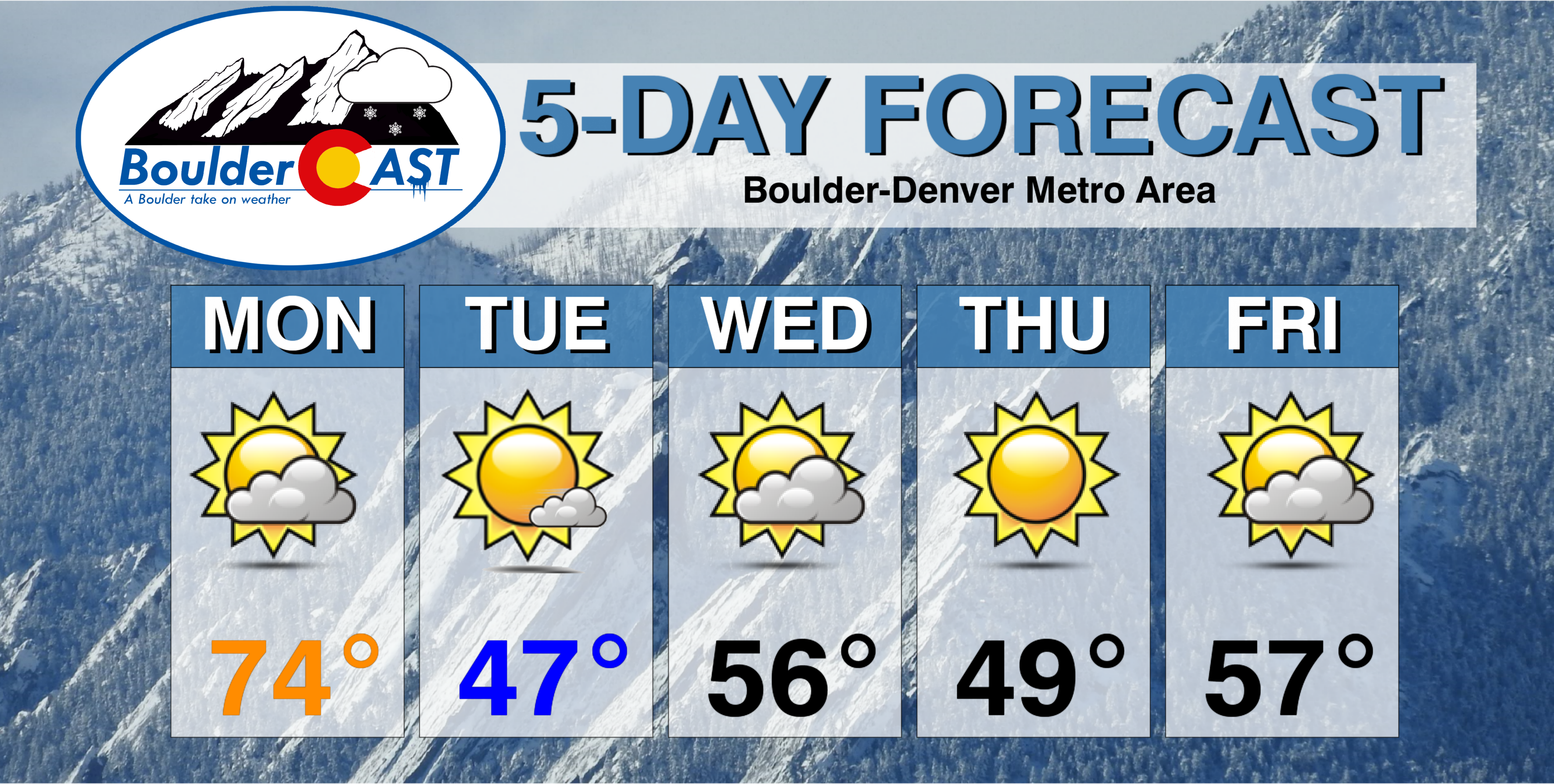
Monday: A mix of clouds and sunshine with near-record warmth. Temperatures in the low to middle 70’s across the Plains and middle 60’s in the Foothills. Isolated rain showers overnight, followed by isolated flurries.
Tuesday: Isolated light snow showers possible early in and near the Foothills, then mostly sunny. No accumulation expected. Highs cooler in the mid 40’s for the Plains, with mid 30’s in the Foothills.
Wednesday: Increasing clouds and mild with highs in the middle 50’s on the Plains and middle 40’s in the Foothills. Temperatures turn chilly later by evening with a very slight chance of rain or snow showers in the late evening. Little to no accumulation is expected.
Thursday: Sunny with highs in the upper 40’s on the Plains and middle 30’s in the Foothills.
Friday: Partly sunny and possibly breezy. Highs in the middle 50’s over the Plains and middle 40’s in the Foothills.
Weekend: Tranquil weather is expected Saturday and possibly Sunday. There is indication of a system moving through next Monday and Tuesday that could bring snowfall for the state with below normal temperatures.
High Country: Light snow will be present in the higher terrain today, Tuesday, and Wednesday. Snow accumulations look to be fairly light each day, generally 1 to 3″ at most overall. Tranquil weather returns Friday with our next weather maker possibly early next week. Find the latest forecast for all your favorite Colorado ski resorts on our PowderCAST page.
DISCLAIMER: This weekly outlook forecast is was created Monday morning and covers the entire upcoming work-week. Accuracy will decrease as the week progresses as this post is NOT updated. To receive daily updated forecasts, subscribe to BoulderCAST Premium.

Share our forecast:


You must be logged in to post a comment.