
We hope that you enjoyed the long weekend as much as we did. The shortened work-week ahead will see the threat of disorganized afternoon showers and storms each day…some more than others. Additionally, these same storms could be a damper on your plans for the upcoming weekend. Continue reading for our full weather outlook for the next five days.
The forecast for the week ahead is rather straightforward, at least compared to the last few weeks anyways. A large ridge of high pressure will move slowly across the region as the week progresses. The axis of the ridge can be seen below, stretching from the Desert Southwest into Canada. This will keep temperatures above normal through the week for the Front Range.
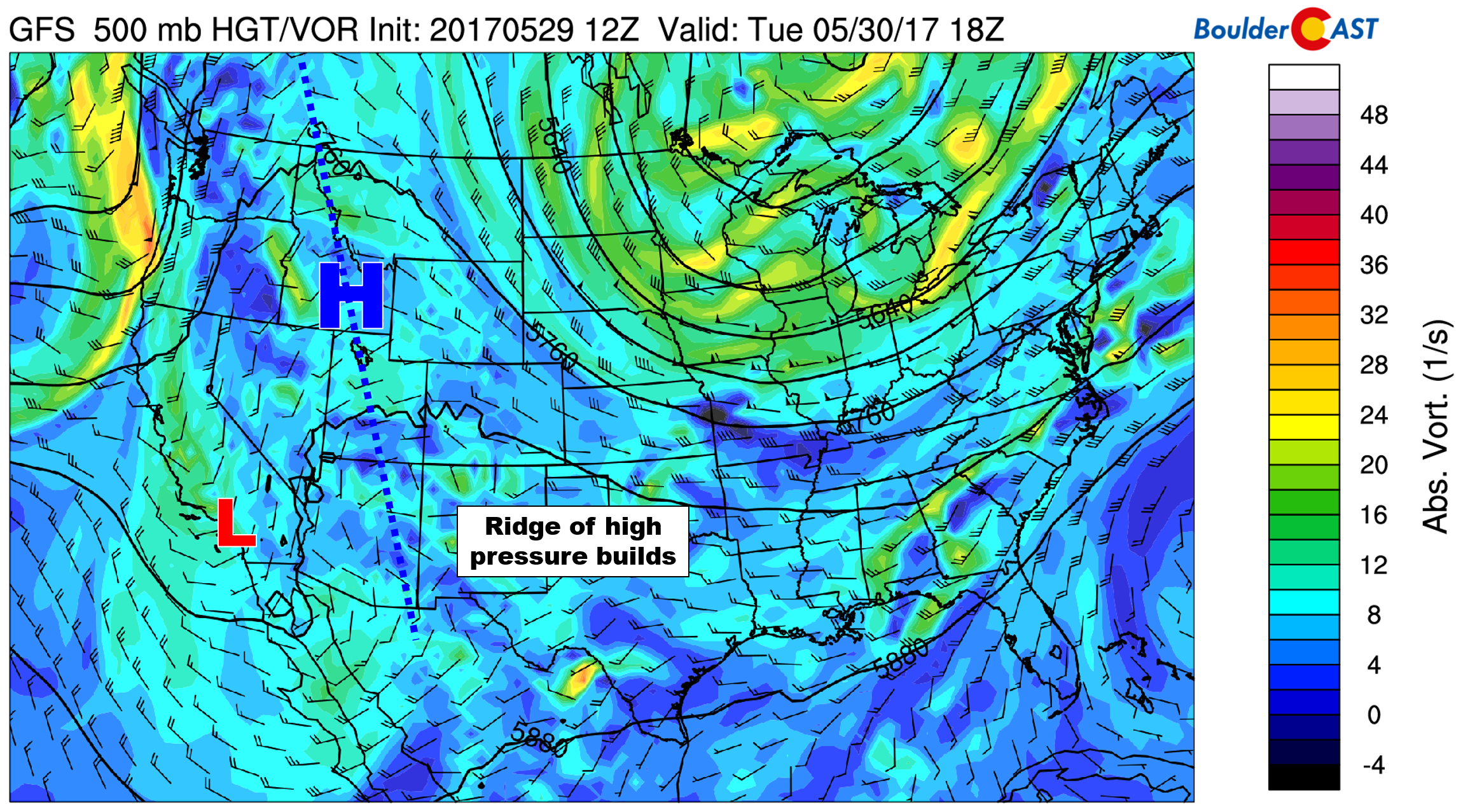
GFS 500 mb vorticity map for Tuesday afternoon
We’ll actually be on the very southern edge of the ridge, with the strongest warming and subsidence located from Montana northward into the Arctic Ocean! Quiet the amplitude on this one, eh?
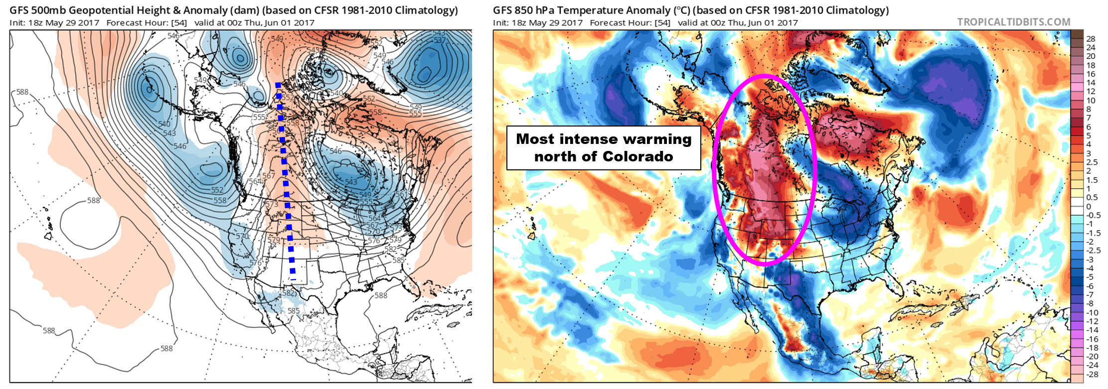
GFS 500 mb height anomaly (left) and 850 mb temperatures anomaly (right). The ridge stretches from Colorado all the way into the Arctic.
On the southern flank of this ridge, the top map above shows a weak trough in southern California that will help keep the threat of storms in our forecast each day this week. This is especially true over the higher elevations where instability will be slightly greater. Moisture is limited, so we’re not expecting much impact to the region, just some weak hit-and-miss afternoon showers and thunderstorms. Temperatures will be warm but not “hot” by any means. Expect highs in the 70’s today, then reaching into the 80’s on Wednesday and Thursday.
By Friday, models are in slight disagreement concerning a piece of energy that may split from the flow and move across Colorado. There are several weak features interacting together to produce what the models are showing for the late-week time frame. It’s hard to say which one may win out at this point. Regardless of what happens, the impacts for Friday should be increased cloud cover, slightly better chances of rain, and cooler temperatures. Expect highs to fall back into the 70’s.
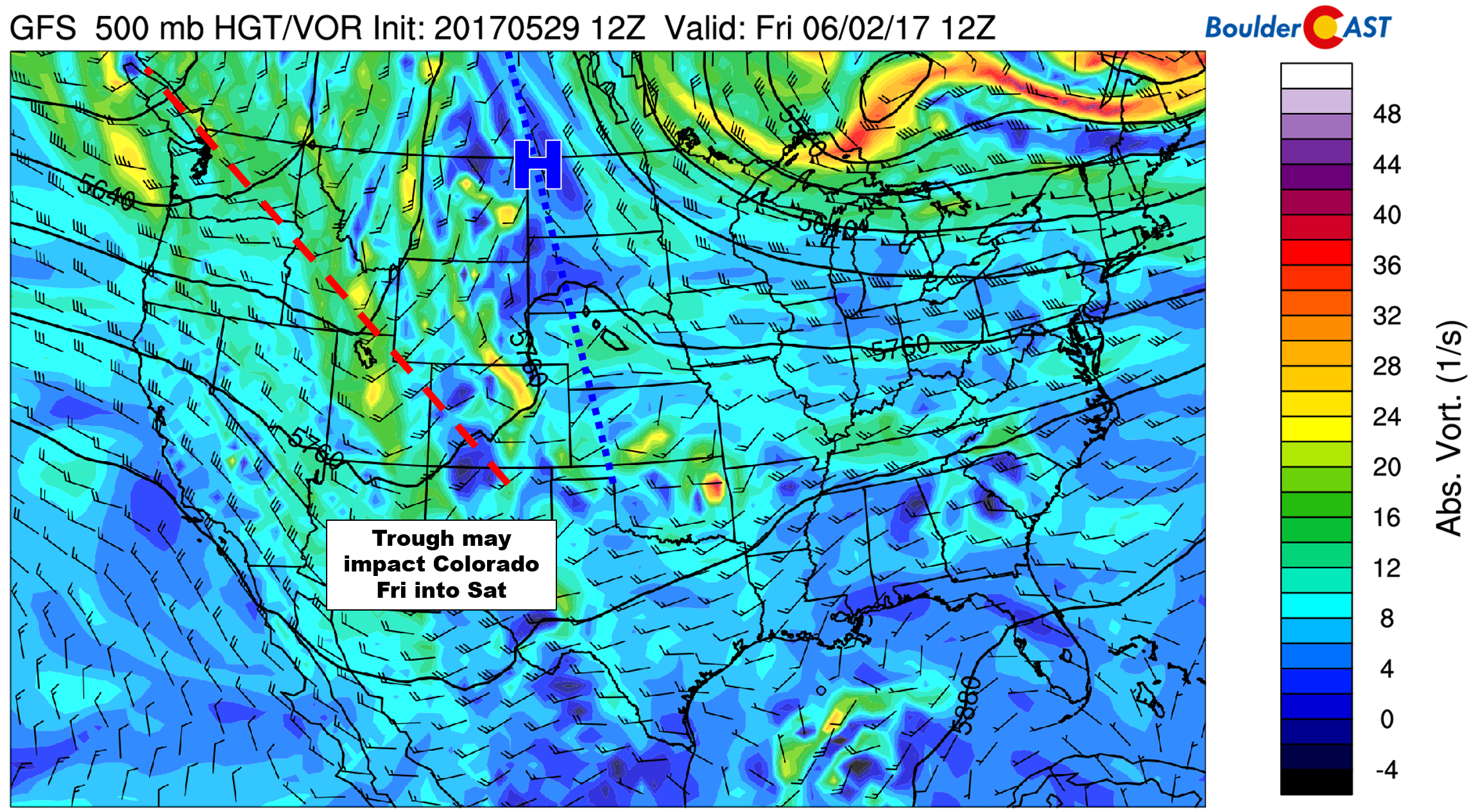
GFS 500 mb vorticity map for Friday morning
The weekend forecast will undoubtedly be impacted by how the feature on Friday evolves. For now, we see no reason to believe that there won’t be continued spotty storms across the state both Saturday and Sunday. Saturday is currently looking drier than Sunday, but this could certainly change…
Fun fact: Through May 29th, Boulder’s precipitation total for the month is 6.28″, good enough for 7th wettest in Boulder’s history. With about another half inch of rain, we could jump to spot #5. While not likely to happen over the next two days, it’s at least possible given the stormy setup.
Have a good week!
Forecast Specifics:
Tuesday: Sunny early, with partly cloudy skies in the afternoon. Scattered storms will develop across the higher terrain, with a few potentially spreading east onto the Plains by late afternoon and evening. Temperatures will be in the mid 70’s across the Plains and in the low 60’s in the Foothills.
Wednesday: Mostly sunny and warmer with isolated afternoon thundershowers, especially across the higher terrain south of Denver. Highs in the upper 70’s for the Plains and mid 60’s in the Foothills.
Thursday: Partly sunny skies with scattered afternoon showers and thunderstorms, especially across the higher elevations. Expect temperatures to top out in the low 80’s across the Plains, with upper 60’s in the Foothills.
Friday: Partly to mostly cloudy with scattered showers and thunderstorms possible in the afternoon and evening. Highs will be in the middle 70’s for the Plains, with low 60’s in the Foothills.
High Country: Spotty storms will be present in the mountains each afternoon and evening this week. Storm coverage will be more isolated in nature Tuesday and Wednesday. However, coverage will increase Thursday and Friday as the upper-trough approaches. Snow levels will be very high (above 14,000 feet) so we’re not expecting any additional snow accumulation this week, just melting!
Don’t be selfish…share our forecast with your friends!
Tue
Wed
Thu
Fri


Temperature
75
80
83
77


Precip Chc (Plains)
20%(pm)
10%(pm)
20%(pm)
30%(pm)


