What a beautiful Memorial Day weekend it has been so far, with morning sunshine and afternoon isolated to scattered storms. Today culminates one of the most popular events of the year for Boulder — the 2016 Bolder Boulder! We discuss the weather for this Memorial Day as well as the week ahead. Read on for our full forecast.
The week starts off with the Memorial Day holiday. Please, take a moment to reflect and remember those who risked their lives for our great country over the years. It is thanks to them for our freedom we now enjoy!

The annual Bolder Boulder on Memorial Day, which ends at the CU Folsom Stadium
Persistence is key to start the week
Like we saw yesterday, not much has changed in the atmosphere. Below shows that our region is under the influence of weak southwesterly flow in the mid-to-upper levels. Also of note is a weak area of low pressure over southwestern Arizona and another over eastern Montana. These two systems are helping to bring in moisture from the west and southwest. Much like this past weekend, expect sunshine to start for the Bolder Boulder race, with afternoon clouds taking over and storms developing by mid afternoon. These storms look to be more numerous than Sunday as the upper-levels of the atmosphere are a little more unstable to favor more widespread storms. Keep a rain jacket handy if you’re staying for the BB festivities! Highs will be in the upper 70’s on the Plains before storms cool us off! Storms may linger into late evening before again tapering off as the atmosphere stabilizes near sunset.
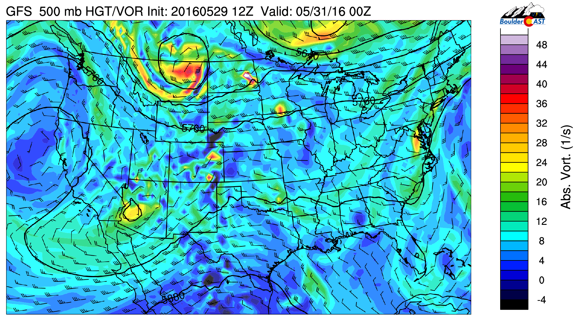
GFS 500 mb vorticity for Monday
Tuesday starts a brief cool down in the weather
The aforementioned low pressure system over eastern Montana Monday evening will bring down a strong cold front from Wyoming very early Tuesday. The NAM forecast model shows a strong temperature gradient in the low-levels at 800 mb (left figure below), with a large drop compared to Monday. Northeasterly flow is also evident with relative humidity well above 80% indicating low clouds and possible fog. In fact, we would not be surprised if some light drizzle or isolated light showers are around Tuesday morning.
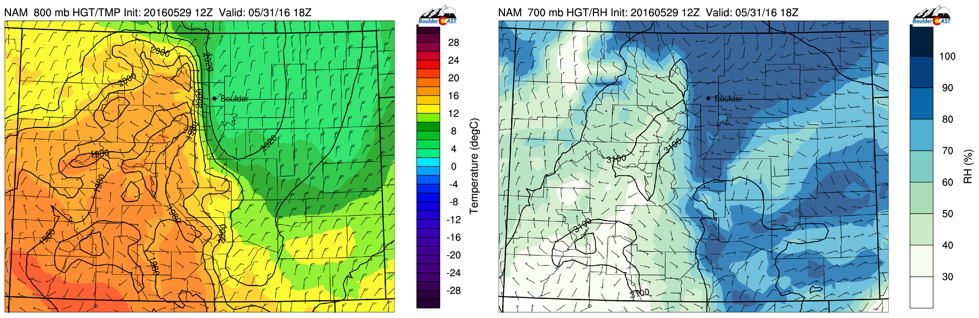
NAM model 800 mb temperature and wind forecast (left) and 700 mb relative humidity (right) for Tuesday afternoon
As a result of the cold front arrival Tuesday, expect highs some 15 degrees cooler compared to Monday…only in the lower 60’s on the Plains and near 50 in the Foothills. With upslope flow in place and west northwest flow in the upper-levels, the forecast will also favor another threat for unsettled weather. However, the devil is in the details…
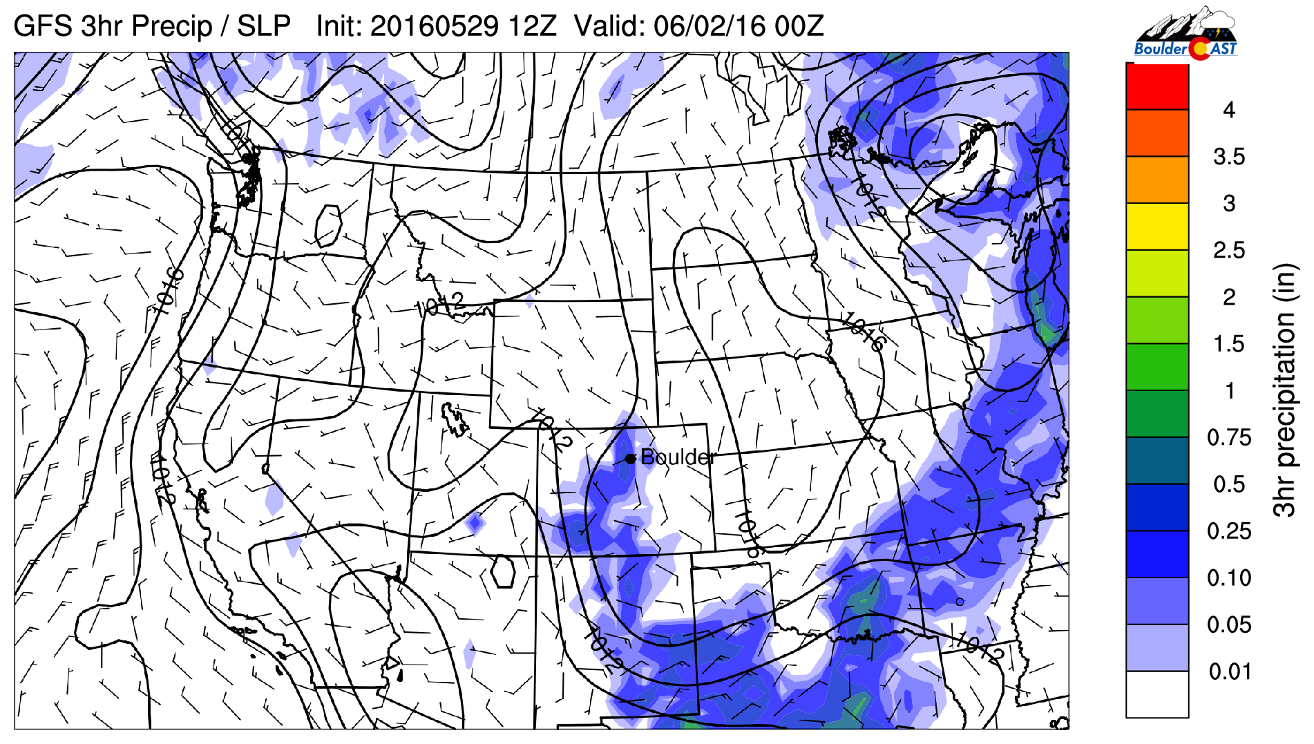
The GFS model indicates a large threat of widespread rain and storms over the Plains. The NAM, however, is almost exactly the opposite, with storms favoring mostly the Foothills. The reason for this difference is due to the fact that the NAM shows low clouds lingering much of the day, limiting daytime heating and lessening our chance of storm activity. The GFS is forecasting clouds to break up and storms to develop in the afternoon. We think the GFS precipitation forecast is overdone. We’re expecting clouds to be with us through much of the day with the chilly upslope flow, reducing that afternoon instability. As a result, look for unsettled weather in the form of rain showers with maybe a few rumbles of thunder in the afternoon/early evening, just not as bullish as the GFS. However, if our forecast busts with sunshine developing, widespread storms could occur. This activity will taper off by late evening, regardless.
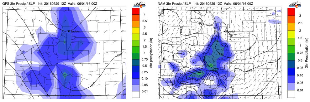
GFS (left) and NAM (right) 3-hr precipitation forecast for Tuesday afternoon / evening
Wednesday stays cool
Wednesday is still chilly with the cold front pushing further south and east into the Midwest. Northeasterly flow will shift to a southeasterly direction Wednesday afternoon. Due to that, we’re expecting more afternoon sunshine with a better chance of storm activity compared with Tuesday as light upslope still remains in place. The GFS is showing storms draped up along the Front Range Wednesday afternoon. Storms to taper off after sunset. Highs warmer, but still cool…. upper 60’s on the Plains and middle 50’s in the Foothills.
The heat is on to end the week!
The latter part of the week will turn much warmer as a large dome of high pressure situates itself over the Inter-mountain West. Northwesterly flow will be in place over Colorado Thursday and Friday and instability remains in place across the High Country. As a result, storms will likely continue to form in the mountains and push eastward. However, as they shift east onto the Plains, most storms should die out as downslope flow at the surface limits their ability to impact the area. Therefore, while we can’t rule out an isolated storm or two Thursday, we think drier conditions will take over Thursday and especially Friday. This ridge pumps in warm air from the desert southwest. Afternoon clouds will keep us likely in the lower 80’s but a little warmer is not out of the question.
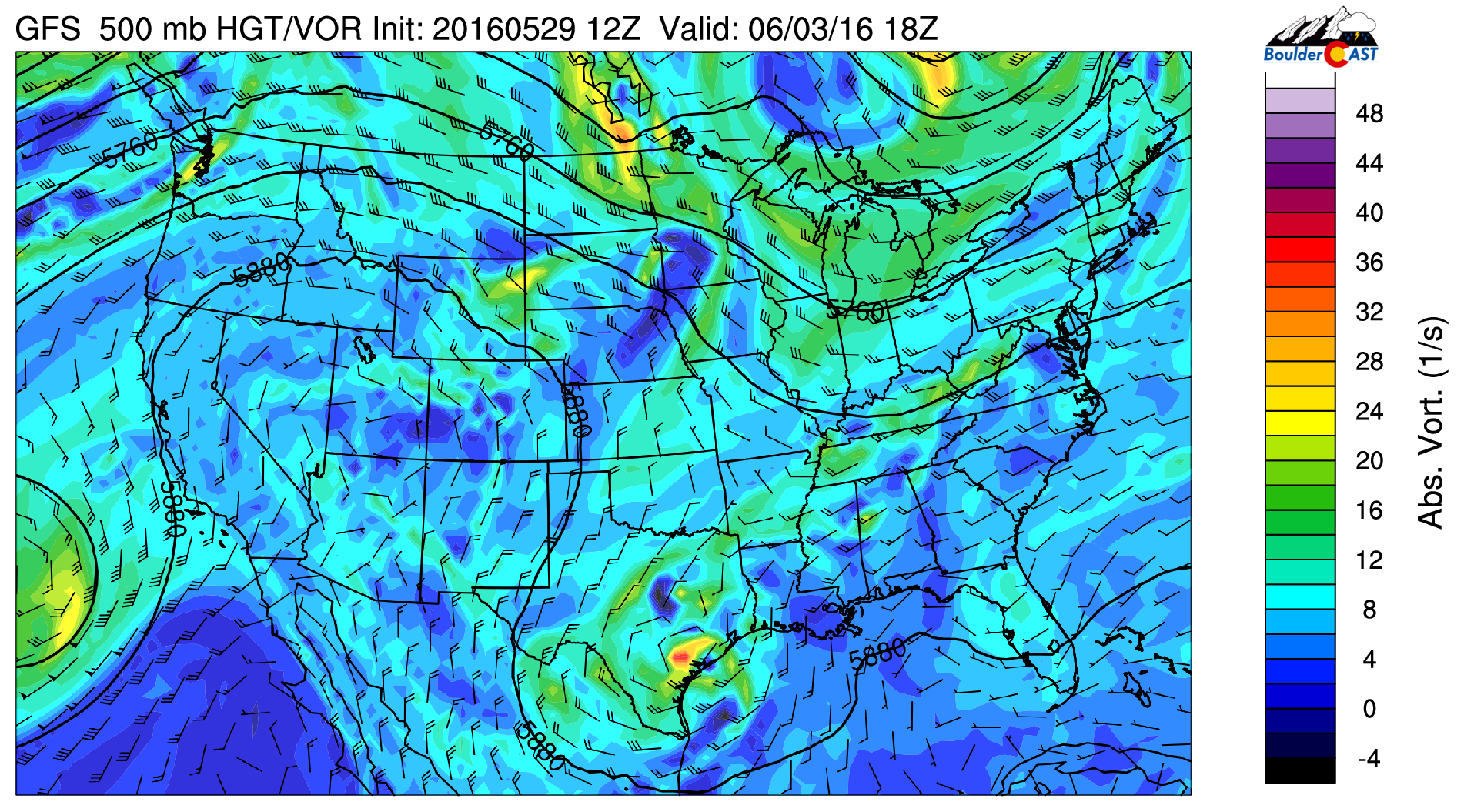
GFS 500 mb vorticity for Friday
Summary
Remember, persistence is key for starting our week, with upper 70’s and afternoon / evening storm development. Tuesday and Wednesday are cooler and unsettled, but we end the week with a warm-up and drier weather in store!
The Forecast:
Monday: Morning sunshine, followed by afternoon clouds and scattered storms starting in the Foothills and moving onto the Plains. Storms to linger into late evening, then taper off. Highs in the upper 70’s on the Plains and upper 60’s in the Foothills.
Tuesday: Morning low clouds with even a few sprinkles or drizzle early. Clouds remain in place much of the day with afternoon shower activity developing and continuing into early evening. A few thundershowers are possible. Highs only in the lower 60’s on the Plains and near 50 in the Foothills.
Wednesday: Morning clouds, followed by partly cloudy skies and late-day storms developing with highs upper 60’s on the Plains and middle 50’s in the Foothills. Storm activity tapers off after sunset.
Thursday: Mostly sunny skies becoming partly cloudy in the afternoon. A few isolated storms are possible but should be confined to the Mountains and Foothills. Highs near 80 on the Plains and upper 60’s in the Foothills.
Friday: Mostly sunny, warm and dry, with highs well into the lower 80’s on the Plains and low 70’s in the Foothills.
High Country: Afternoon scattered storm activity will be the norm Monday through Wednesday. On Thursday and Friday, upper-level instability will remain in place for isolated storms. Friday looks to be the driest day in the High Country with only spotty afternoon storms. Snow is likely in the portions of the High Country Tuesday but will be confined to the high-mountain peaks (10,000+ feet).


