
Happy First of May! Last week’s wintry weather will indeed be a tough act to follow. The week ahead will be quieter for sure, but the threat of rain and higher elevation snow is still a concern. We also see 80-degree temperatures and a stellar weekend on the horizon. Read on for our complete forecast of the upcoming week.
Cooler start to the week
We begin the month of May under northwest flow as the major winter storm which impacted our region Saturday heads off into the Great Lakes (see below). This flow pattern will keep temperatures a few degrees below normal across Colorado. Expect a high near 60 degrees with partly sunny skies on Monday. There is a very slight chance of a few showers late in the day, but most places will be dry.
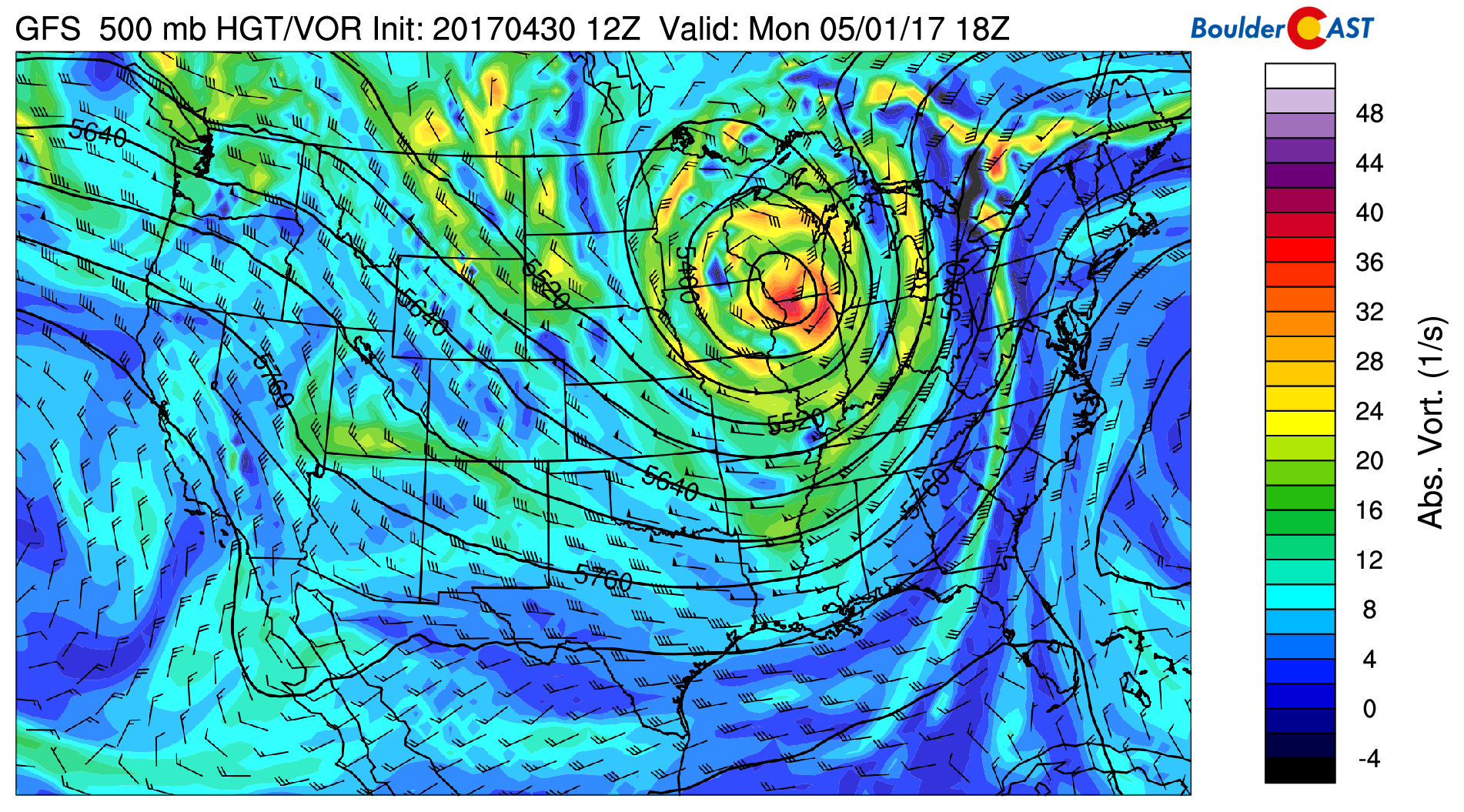
GFS 500 mb vorticity map for Monday afternoon
On Tuesday, west northwest flow continues, but a weak embedded system will drop southward from Montana into Colorado during the afternoon and evening. This storm looked much more impressive a few days ago, but now it appears to be of little impact to our region. This however will be our best shot at precipitation for the upcoming week. The energy will bring scattered showers to the Front Range and plenty of cloud cover Tuesday afternoon and evening. These showers will be all rain on the Plains, with snow levels generally above 7,000 feet. Little to no accumulation is expected in the Foothills. Some light showers could linger in and near the Foothills into Wednesday morning. The GFS model forecasts a smattering of precipitation across the Front Range, generally less then a tenth of an inch (see below).
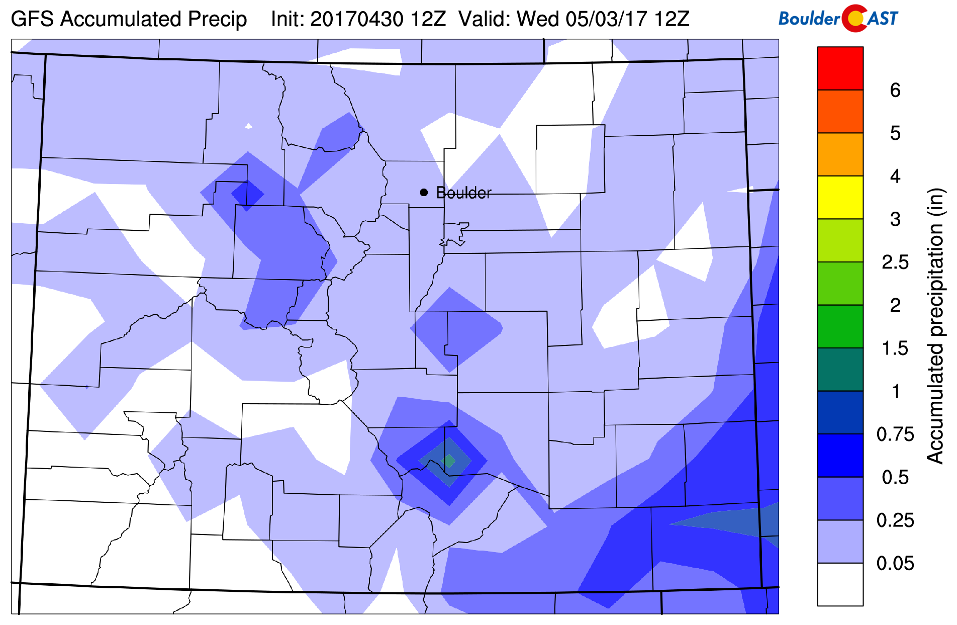
GFS total accumulated precipitation forecast through Wednesday morning. Tuesday’s rain/snow will be minor.
One more chilly northwest flow day will ensue on Wednesday before things begin to warm back up. Look for sunny skies during the afternoon with highs in the low 60’s.
Intense ridge may bring back the 80’s
Late in the week, we are seeing superb agreement in models and ensembles that a high-amplitude ridge will build-in across the Rockies.
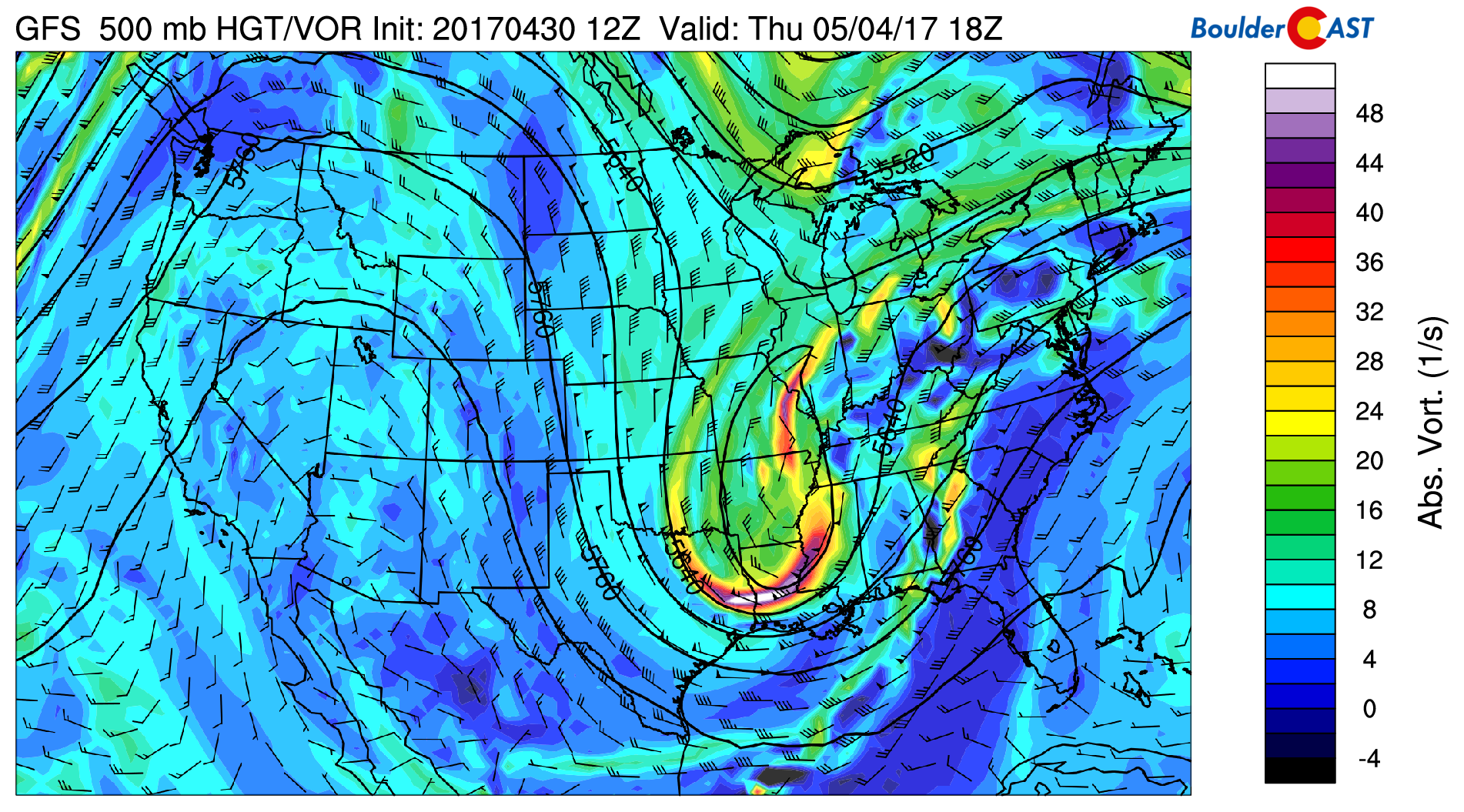
GFS 500 mb vorticity map for Thursday afternoon showing a ridge building across the West
This will usher in warmer conditions along with beautiful blue skies! Expect temperatures Thursday in the low 70’s, with highs near 80 degrees on Friday. The weekend looks great as well! After a warm and mostly dry day Saturday, the ridge axis could shift east of Colorado by Sunday. This would allow continued warmth, but likely opens the door for thunderstorms across the Denver area. Just something to keep in mind if you are planning for the weekend…
Have a great week!
Forecast Specifics:
Monday: Partly sunny and cooler with a slight chance of a late-day shower, particularly north and east of Denver. Highs in the low 60’s for the Plains and in the upper 40’s in the Foothills.
Tuesday: Mostly cloudy with widely scattered showers during the evening and overnight into Wednesday. These showers will be snow above about 7,000 feet elevation, but little to no accumulation is expected. Temperatures will be near 60 across the Plains and in the mid 40’s in the Foothills.
Wednesday: After morning fog and isolated showers in and near the Foothills, mostly sunny skies take over with seasonal highs in the low 60’s for the Plains and low 50’s in the Foothills.
Thursday: Mostly sunny and warmer. Temperatures will rise into the low 70’s across the Plains, with upper 50’s in the Foothills.
Friday: Sunny and even warmer with highs across the Plains reaching near 80 degrees. Expect upper 60’s in the Foothills.
High Country: Moderate northwesterly flow will be in place across the Mountains on Monday with some light snow possible early in the day. Tuesday’s weak shortwave system will bring clouds, fog, and light snow to the higher elevations during the day and evening. 1 to 3″ of accumulation at most is expected on the higher western slopes. Wednesday through the weekend will be dry with sunshine and warmer temperatures settling in.
Weekend: The upcoming weekend looks excellent. Saturday will see mostly sunny conditions with possibly a few isolated afternoon storms. Sunday has a slightly higher chance of precipitation. Both days will see temperatures above normal, likely in the mid 70’s to low 80’s.
Mon
Tue
Wed
Thu
Fri


Temperature
62
59
61
72
78


Precip Chc (Plains)
10%
40%(pm)
10%(am)
0%
0%


