
After a very warm and calm weekend, the weather turns active to start our week ahead with snow for the High Country along with high winds in the Metro area. The weather returns to above normal temperatures by midweek which will continue into the weekend. Read on for our full weekly outlook.
Monday is windy, snowy, and cold
Monday will involve the most interesting weather for the week. The 500 mb vorticity map below for Monday afternoon shows a strong shortwave system centered around southern South Dakota, with large embedded energy across Colorado.
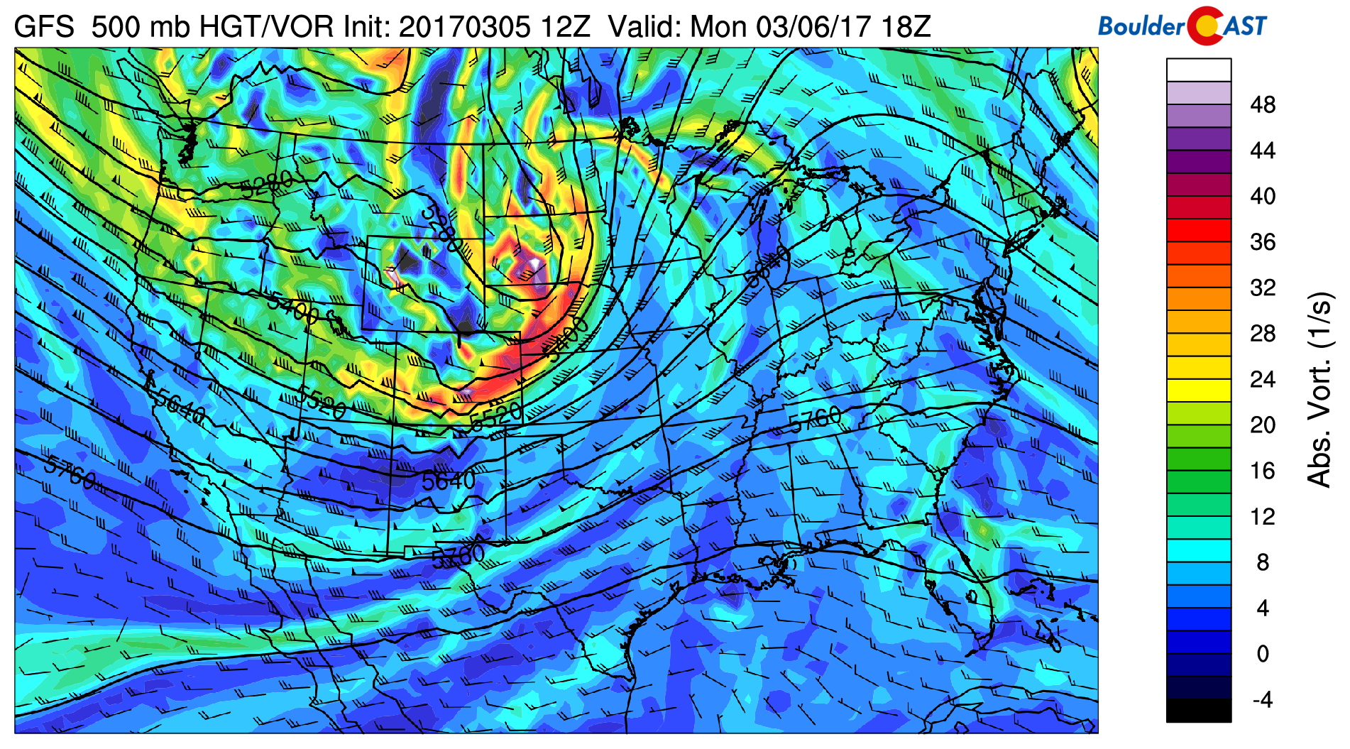
GFS 500 mb absolute vorticity for this afternoon
This system is responsible for the colder air and high winds in the forecast across the Plains today. A High Wind Warning has been issued by the National Weather Service today with wind gusts approaching 60 mph at times. Temperatures will be in the middle 40’s today.
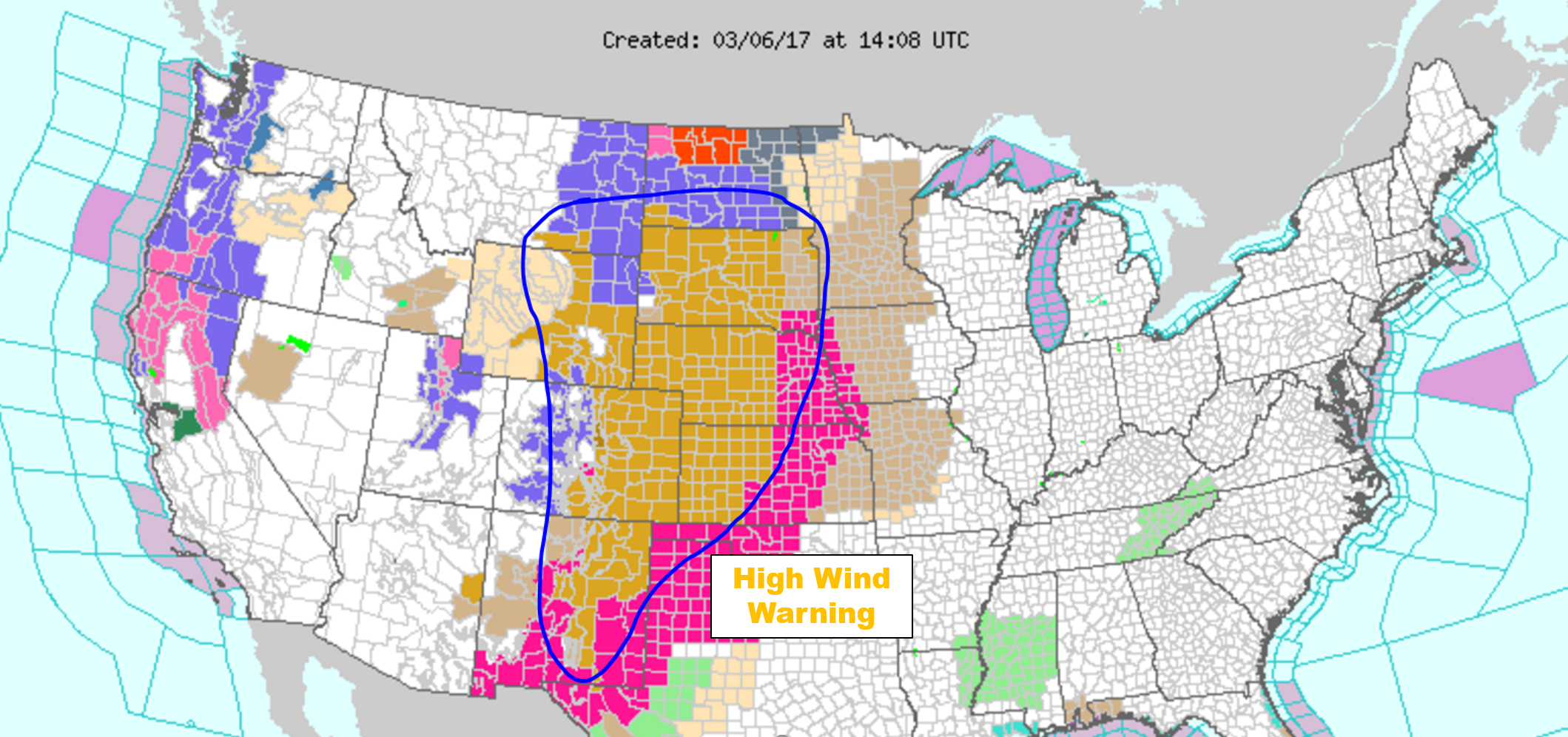
Quiet the threat for high winds across the western Great Plains on Monday
Below shows the NAM model low-level wind and temperature fields across the state today and tomorrow. South-southwest winds are evident exceeding 50 mph today in the model. High winds will be with us much of the day but taper off by evening. Then another wave of high winds looks to redevelop again overnight tonight into Tuesday morning/afternoon (bottom right figure), this time with west winds at times again approaching 60 mph. This second wind event Tuesday morning is a mountain wave setup, so winds could be stronger than Monday, but may be confined to areas in and near the Foothills. Let’s hope for no wildfires as it’s quite dry across the state!
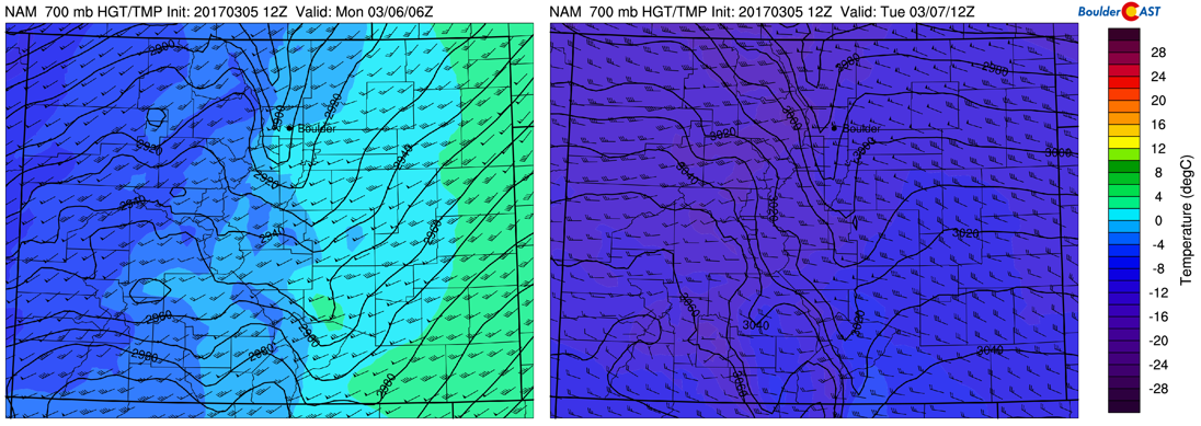
NAM model 700 mb temperature and wind for today (left) and Tuesday (right)
The system today will be producing snowfall in the High Country, continuing into tomorrow and part of Wednesday. The ski resorts could pick up 4 to 8″ of new snow. On the Plains…although snow is possible off and on into the afternoon Monday while mixing with rain, we should see little to no accumulation. The main flow is from west to east, thus a downslope flow and not conducive to snow for the Denver Metro. Also, the warm ground temps will be a hindrance to any accumulation.
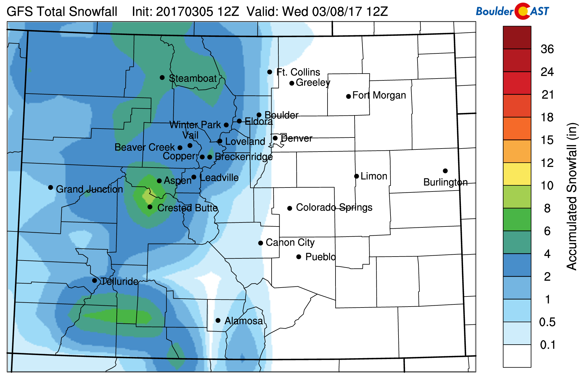
GFS total snowfall by Wednesday
On Tuesday, northwest flow will remain across the state in the upper-levels of the atmosphere (see below). As mentioned above, Tuesday will likely see another windy start to the day, with winds potentially again seeing gusts up to 60 mph. Snowfall in the High Country will remain, primarily along and west of the Divide. Highs on the Plains will be warmer into the middle 50’s.
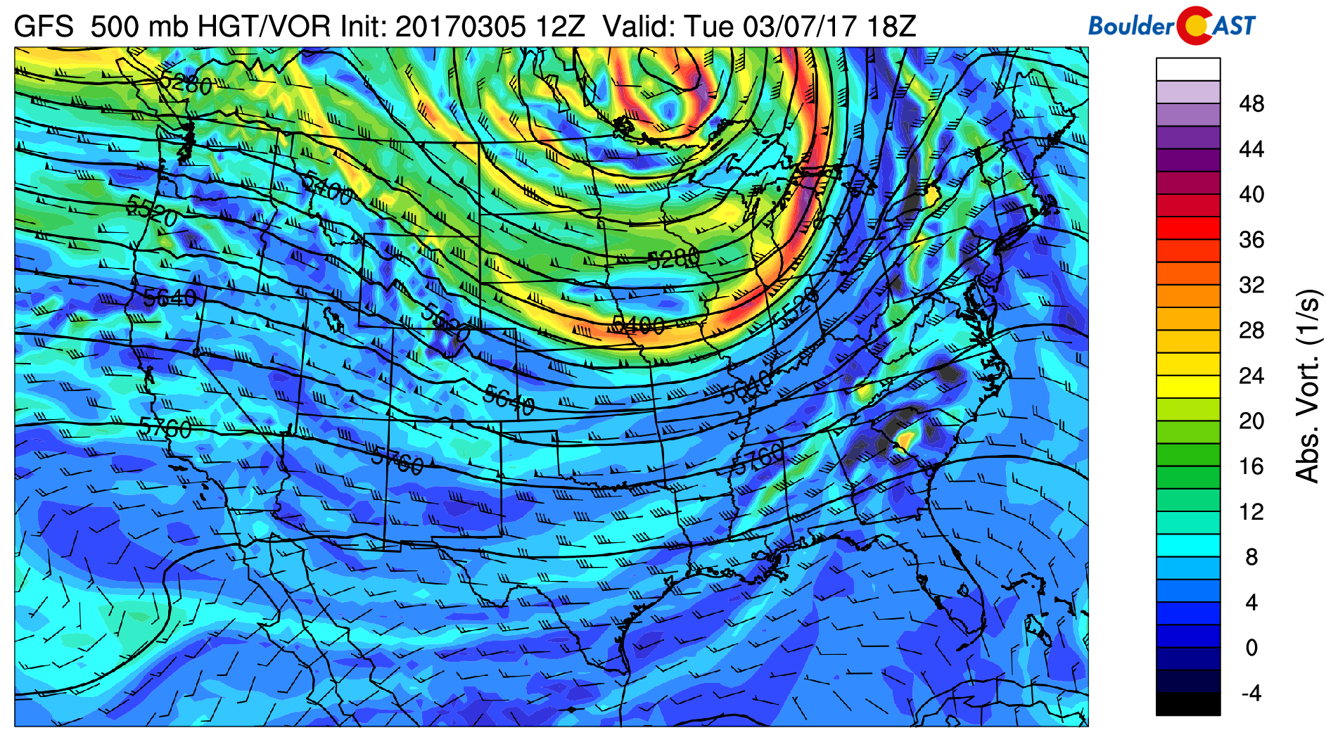
GFS 500 mb absolute vorticity for Tuesday
Wednesday, Thursday, Friday above normal and quiet
By Wednesday, our weather will turn warm, similar to what we experienced this past weekend. Below shows the mid-level pattern for: (1) Wednesday:
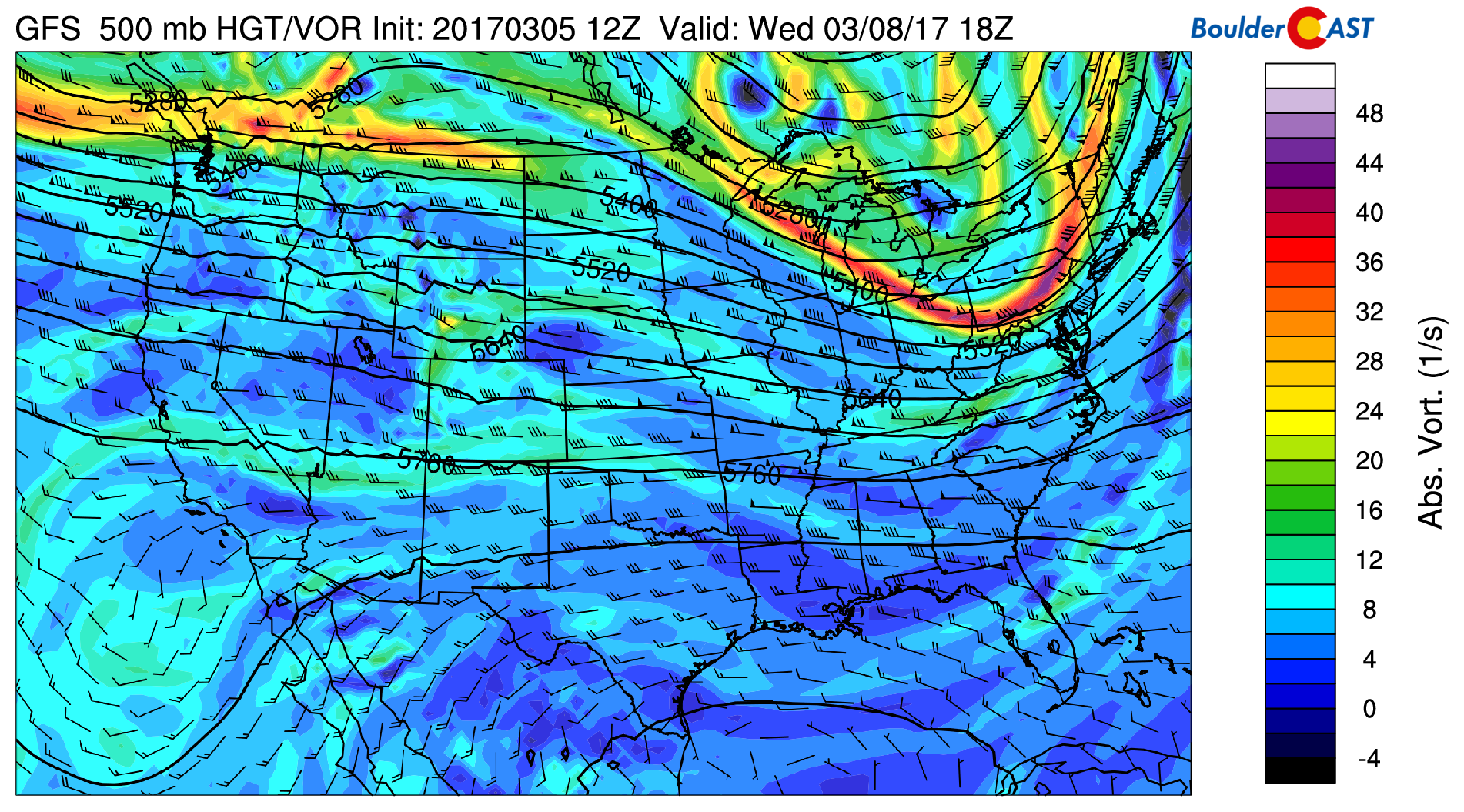
GFS 500 mb absolute vorticity for Wednesday
(2) Thursday:
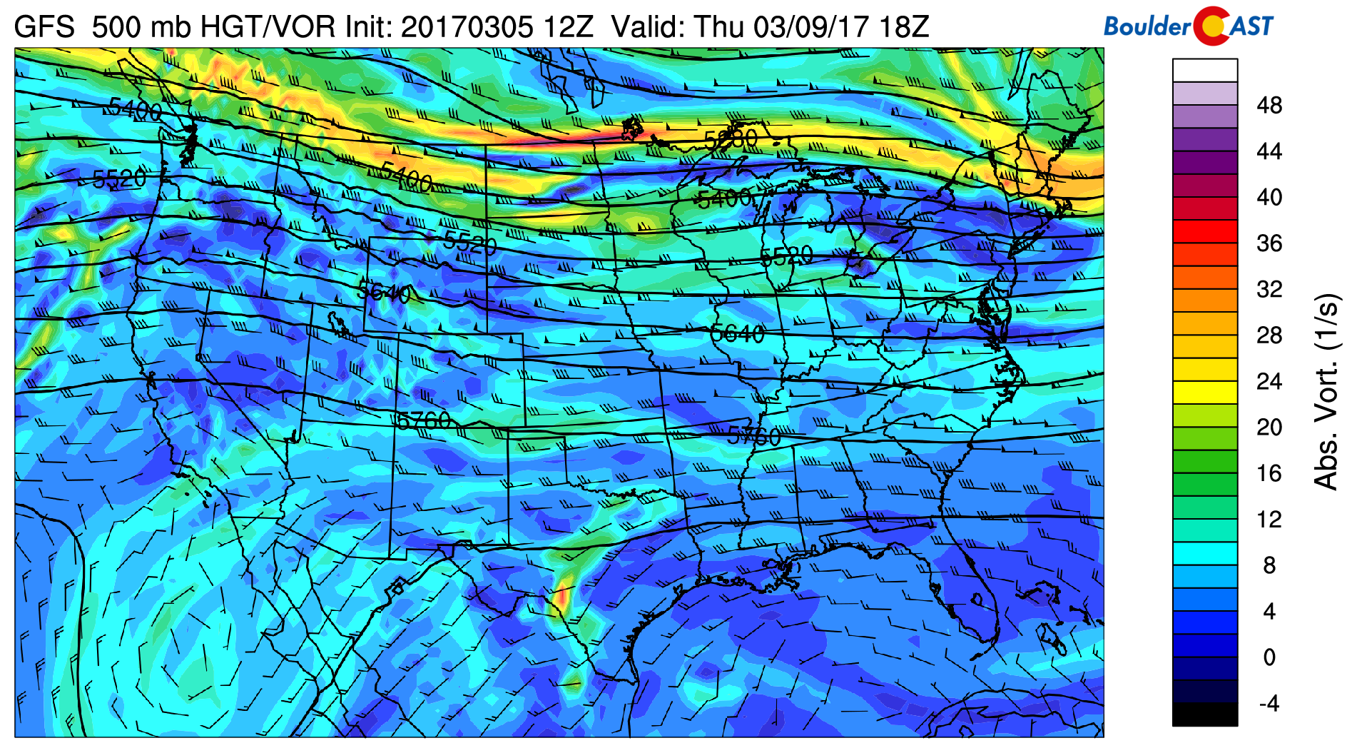
GFS 500 mb absolute vorticity for Thursday
and (3) Friday:
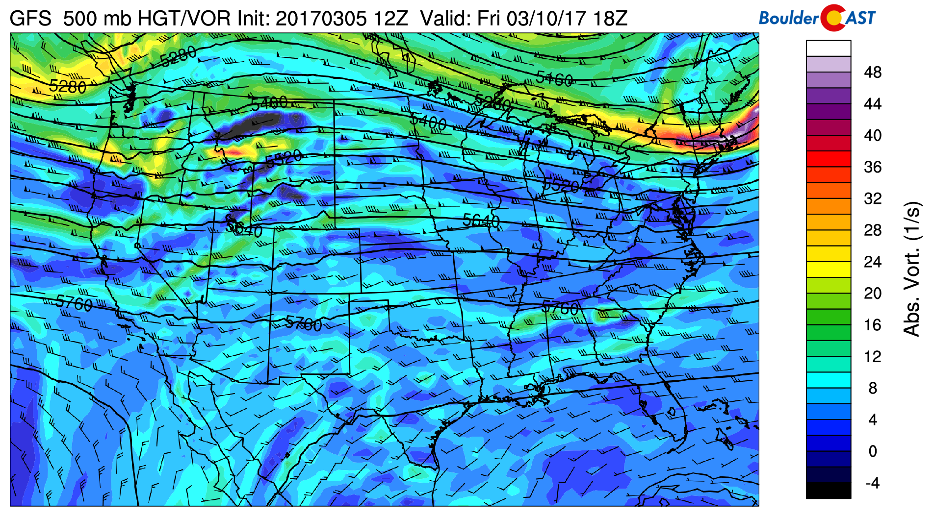
GFS 500 mb absolute vorticity for Friday
The high winds we will experience in the early part of the week will be responsible for advecting warm air from the west and producing warm downslope flow for the latter part of our week. We can expect middle 60’s on Wednesday, then upper 60’s to lower 70’s Thursday and Friday. Again, light snow is possible in the mountains Wednesday but nothing widespread compared to Monday. Dry weather returns to the Mountains by Thursday.
Have a great week and stay warm today!
Forecast Specifics:
Monday: Very windy with isolated rain/snow showers in the morning and early afternoon, then partly cloudy skies with highs in the middle 40’s on the Plains and middle 30’s in the Foothills. West-southwest winds sustained at 30-40 mph with gusts approaching 55 mph at times in the morning and afternoon. Winds may exceed 70 mph in the Foothills. Little to no snow accumulation expected, except in the higher Foothills where up to 2″ could fall during the day.
Tuesday: Partly cloudy and windy with gusts in the morning approaching 60 mph at times. Highs in the middle 50’s for the Plains and lower 40’s in the Foothills.
Wednesday: Mostly sunny and warmer with high temperatures in the middle 60’s for the Plains and middle 50’s in the Foothills.
Thursday: Sunny and well above average with lower 70’s on the Plains and lower 60’s in the Foothills.
Friday: Partly sunny skies with temperatures in the lower 70’s on the Plains and middle 60’s in the Foothills.
High Country: Snow showers will increase in the Mountains during the day Monday and persist into late Tuesday. Light snow will exist into Wednesday with persistent northwest flow, with areas seeing anywhere from 4 to 8″. Drier conditions and sunshine take over Thursday and Friday.
Extended: The upcoming weekend looks great as quiet weather continues across the central Rockies. Zonal flow or slight ridging looks to persist well into next week in the forecast ensembles. With this, any precipitation will be confined to the High Country and temperatures will be above normal for Colorado as a whole.
Mon
Tue
Wed
Thu
Fri


Temperature
45
57
68
70
72


Precip Chc (Plains)
20%
0%
0%
0%
0%


