Great conditions for skiing will continue this week, as well as an active pattern for snow on the Plains. The focus for the week ahead will be a fast-moving system Wednesday, which will usher in below normal temperatures and little bit of white stuff. Beyond that, we’re also monitoring a second chance of snow for the weekend. Read on for our full forecast.
Below shows the infrared satellite image animation as of yesterday afternoon, depicting a large upper-level trough over the Northeastern Pacific Ocean, with mid and high-level clouds stretching east of the trough into the Pacific Northwest. This trough is the system we are watching for late Tuesday night and Wednesday across Colorado.
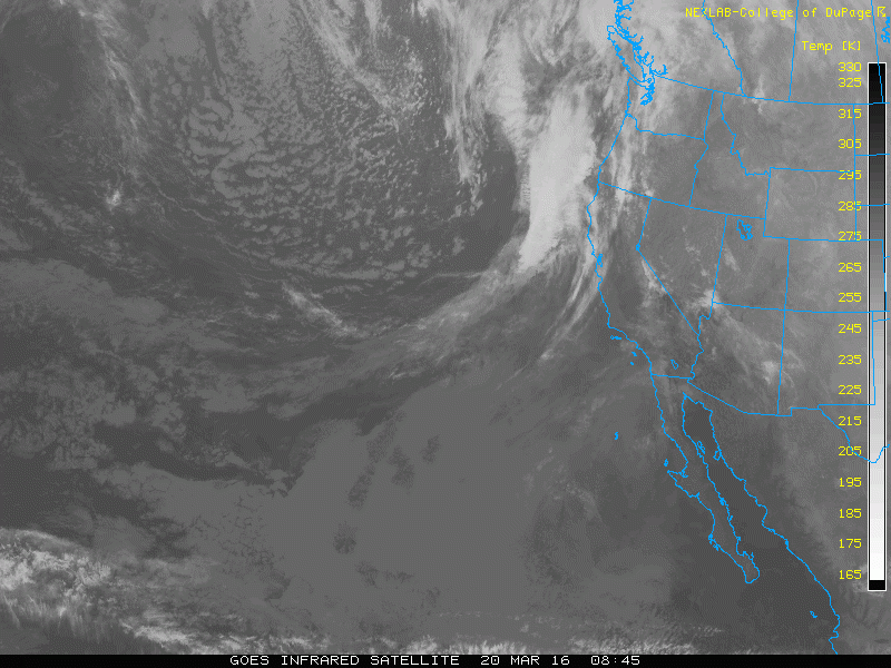
Infrared satellite loop as of Sunday afternoon
We begin calm
Today, there’s not much to speak of weather-wise. We are under the influence of an upper-level ridging pattern, as is evident below. There is some high-level moisture streaming in from the southwest ahead of the trough in the Eastern Pacific, so there will be abundant wave clouds around through the day.
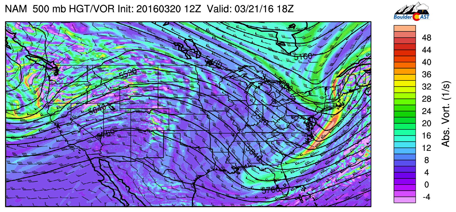
NAM 500 mb absolute vorticity this afternoon
Westerly downslope flow will produce compressional warming. Notice below the tight gradient in the height contours. Despite some cloud cover, highs should soar to near 70 degrees across the Plains. Any snow that is left will likely melt completely by the end of today. Gusts this afternoon will approach 30 to 35 mph.

NAM 700 mb temperature, height, and wind for this afternoon
Tuesday is a transitional day between a warm Monday and the approaching trough and cold front early Wednesday. The trough will be centered over eastern Nevada and western Utah in the afternoon. To the east, the Plains will still experience southwesterly low-level flow, continuing the warm temperatures with highs again in the upper 60’s. Clouds will be on the increase through the day, but still a fair amount of sunshine. The cold front with the trough does not approach until after midnight Tuesday night. However, in the High Country, snow will develop Tuesday afternoon and continue Wednesday ahead of the trough.
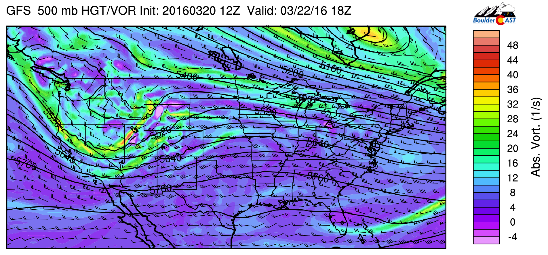
GFS 500 mb absolute vorticity for Tuesday
Snow returns
Wednesday turns colder with the threat of snow across the Plains with a fast moving, potent low-pressure system. Below shows the 700 mb map over Colorado, with a circulation of low pressure in southeast Nebraska. Along the Foothills, Boulder, and Denver, northwesterly downslope flow is present. Not great for snow!
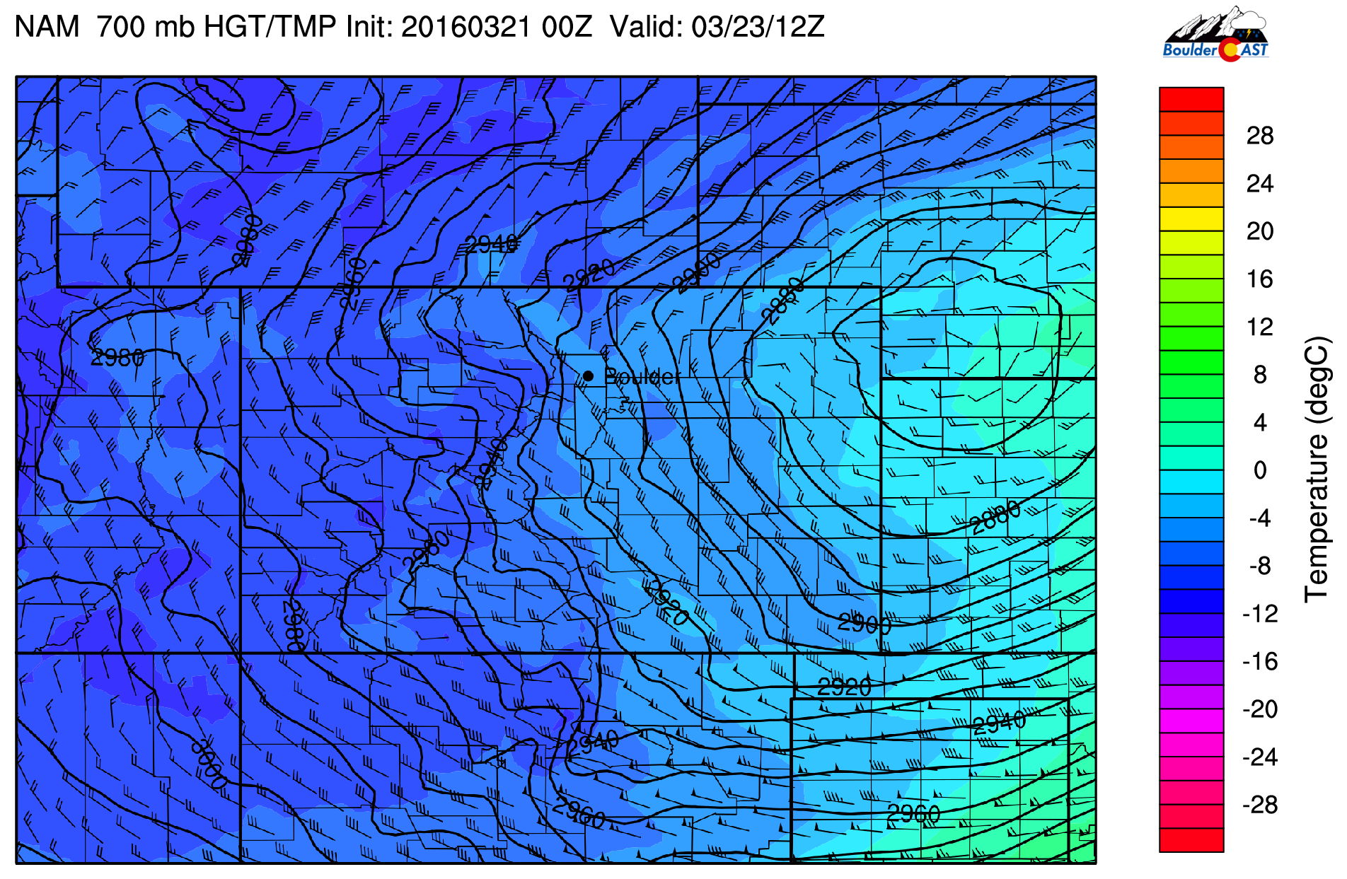
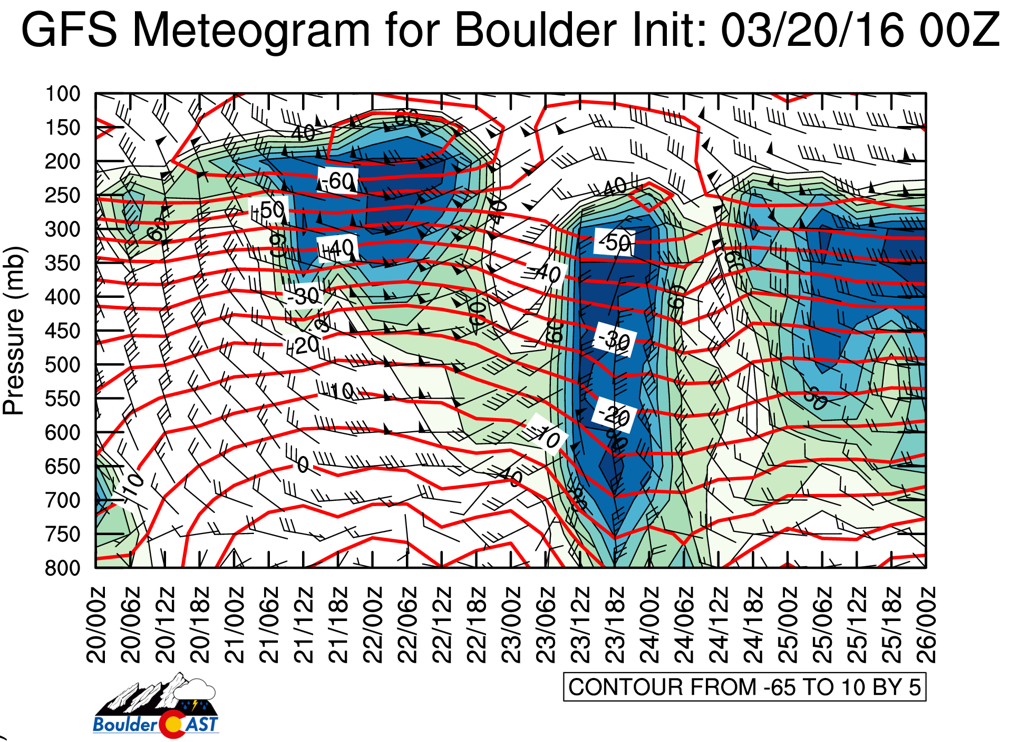
The GFS depicts a more northerly direction to the flow, which is still not ideal for Boulder County, but more promising (see 23/18z below in the meteogram).
We see several factors at play for Wednesday’s storm:
- System is fast-moving, with snow potential starting after 3am Wednesday morning, ending early Wednesday afternoon
- Snow falls primarily during the daylight hours. March sun will cut down on snow accumulations
- Surface temperatures in the mid to upper 30’s will keep most accumulation on grassy surfaces, and possibly allow some rain to mix in at times
- Upslope is very limited or non-existent during the event
All in all, this does not appear to be a great storm for the Boulder/Denver area. The system just doesn’t want to get it’s act together quick enough, developing into a powerful storm just a little bit too far east. Significant snow is likely towards the northeast corner of our state. Though, the NAM/GFS are still showing a couple of inches of snow from Denver into Boulder, so it bears some watching. However, we suspect the downslope component to the wind in Boulder will greatly limit our accumulation. Uncertainty does remain, so keep it here on BoulderCAST as we’ll post an official storm forecast on Tuesday (if warranted).
Areas further out on the Plains northeast of Denver will also be in line for strong winds during the day Wednesday. Notice the very tight pressure gradient on the backside of the low (below), with sustained surface winds 25 to 40 knots. Combining the intense wind with 4-10″ of snow, NE Colorado will be in store for blizzard conditions!
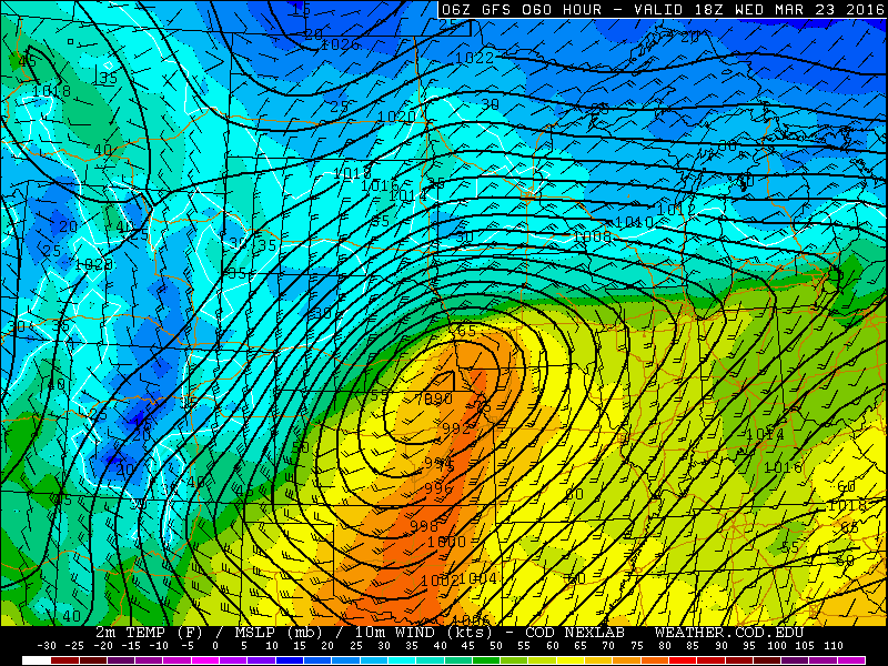
NAM surface temperature, wind, and pressure map, valid Wednesday at noon
Highs Wednesday will be in the upper 30’s with the clouds and snow around. Over the High Country, Wednesday will be a great powder day with an additional 3-7 inches across several of the ski resorts. The snow should taper off in the mountains early Thursday. As we will discuss later, a more significant snow storm for the Mountains may be in place for Easter weekend!
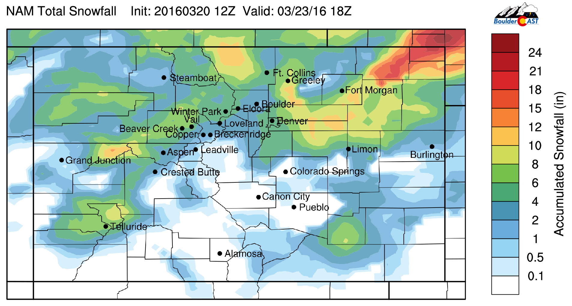
NAM total snowfall through Wednesday
Thursday transitions from cold and snow to a gradual warm-up, back to near 50 degrees across the Plains. West-northwest flow will exist in the mid-levels of the atmosphere, producing downslope east of the Front Range. Mostly sunny skies should ensue, but a few high-level clouds are not out of the question.

GFS 500 mb absolute vorticity for Thursday
The models are hinting at another cold front dropping down from Wyoming Friday evening with cold air filtering in from Canada. Highs Friday to be a few degrees cooler than Thursday in the upper 40’s. The setup is due to the polar jet stream stretching from the Pacific Northwest into the middle of the country. This will produce northwest flow across Colorado and, as a result, snow conditions are looking favorable not only for the High Country, but potentially for the Plains, over the weekend as another system moves through.

GFS 250 mb wind and isotachs for Saturday
High Country Easter weekend outlook
- The northwest flow will bring in a large fetch of Pacific moisture into the western slopes, with many of the ski resorts, such as Steamboat, seeing several inches of snow Friday through Sunday. Accumulations are difficult to pin down at this stage of the game, but expect powder conditions through the holiday weekend. If you do go skiing next weekend, be sure to drive safe as the roads will be icy.
Plains Easter weekend outlook
- Below shows the comparison among the long-range models of the GFS and ECMWF for the Saturday-Sunday time frame. Lots of discrepancy exists among the two forecast models. The GFS depicts a weak circulation across Utah that spreads into Colorado Friday night into Saturday with snow across the Mountains and Plains. This pattern from the GFS looks eerily similar to last week’s snow storm. The ECMWF forecasts a more well-defined low-pressure system that is cut-off from the jet stream. This pattern would favor good upslope across Boulder Easter Sunday. All in all, lots will change in the forecast between now and next weekend, but we are already keeping our eyes on a potential snow storm for the weekend.
Have a great week! Look for potential snow updates here and there as needed. Stay tuned!

GFS (left) and ECMWF (right) 500 mb pattern Sat-Sun
The Forecast:
Monday: Breezy with partly to mostly cloudy skies. Highs will get to near 70 across the Plains and upper 50’s in the Foothills. Westerly downslope winds gusting to 35 mph.
Tuesday: Mid and high-level clouds in the morning and afternoon, but still expecting a fair amount of sunshine. Southwest winds gusting to 30 mph. Highs to be in the upper 60’s over the Plains and upper 50’s in the Foothills.
Wednesday: Scattered snow showers in the morning to early afternoon with highs in the upper 30’s across the Plains. Temperatures in the Foothills in the low 30’s. Gusty northwest winds to 30 mph through the day. We are expecting only light accumulations with this storm. More snow northeast of Denver.
Thursday: Partly sunny skies and warmer. Highs over the Foothills in the lower 40’s with 50 degrees on the Plains.
Friday: Partly sunny skies and tranquil. Temperatures warming to the upper 40’s over the Plains and low 40’s in the Foothills. We’re monitoring another chance of snow Friday night into Saturday.
High Country: Snow will redevelop in the mountains Tuesday night and continue through Wednesday, with a few lingering snow showers ending early Thursday. A swath of 3-7 inches of snow can be expected at several of the ski resorts, producing powder conditions Wednesday and Thursday. Quiet conditions take hold Friday, but a more active pattern returns Easter weekend with snow likely Friday night through Sunday.
| Mon | Tue | Wed | Thu | Fri | |
|---|---|---|---|---|---|
| Forecast Highs | 69 | 67 | 40 | 50 | 48 |


