
This weekend began cloudy and chilly with light drizzle on Saturday, but turned sunny and windy with west-northwest winds at times exceeding 50 mph on Sunday. And to top it off, we lost sleep with daylight savings! The main story for the week ahead is warmer weather…with the first day of Spring just a week away, this week will fit the part. However, a few subtle hints in the pattern means we will have to be concerned with some high winds to start. Read on for our full weekly outlook.
Monday starts off pleasant
What is going on in the atmosphere on this Monday? The 250 and 500 mb maps below for today shows the polar jet stream right over eastern Colorado, extending to the east over the Ohio Valley. Coincident with this jet stream is an area of low pressure near the Arkansas-Missouri border. This system was responsible for bringing a cold front through the region yesterday evening. More on that below.
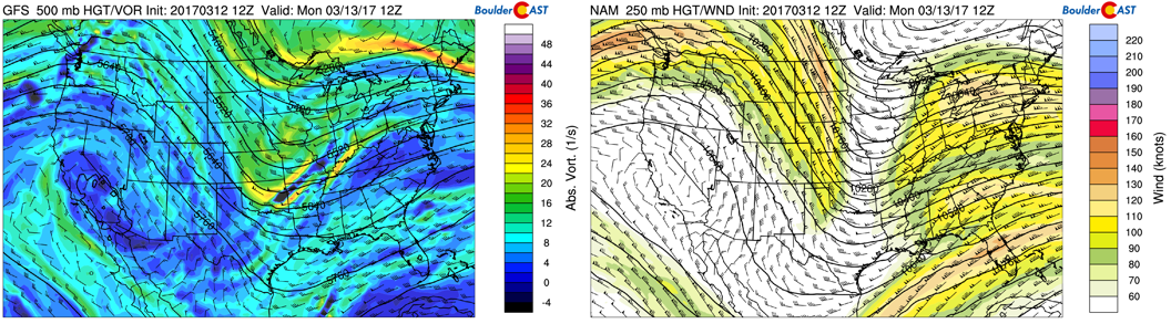
GFS 250 mb upper-level winds (left) and 500 mb absolute vorticity (right) for today
At the surface, the low pressure in the Midwest has led to weak upslope winds from a cold-frontal passage last night. This is evident below, with red arrows depicting the flow and the orange line the frontal boundary. These winds start out from the east-northeast this morning, then west-northwest winds take hold in the afternoon. We think high temperatures should reach the mid to upper 50’s, only a few degrees cooler than yesterday. Some clouds will be around with the jet overhead, but sunshine should be taking over through the day.
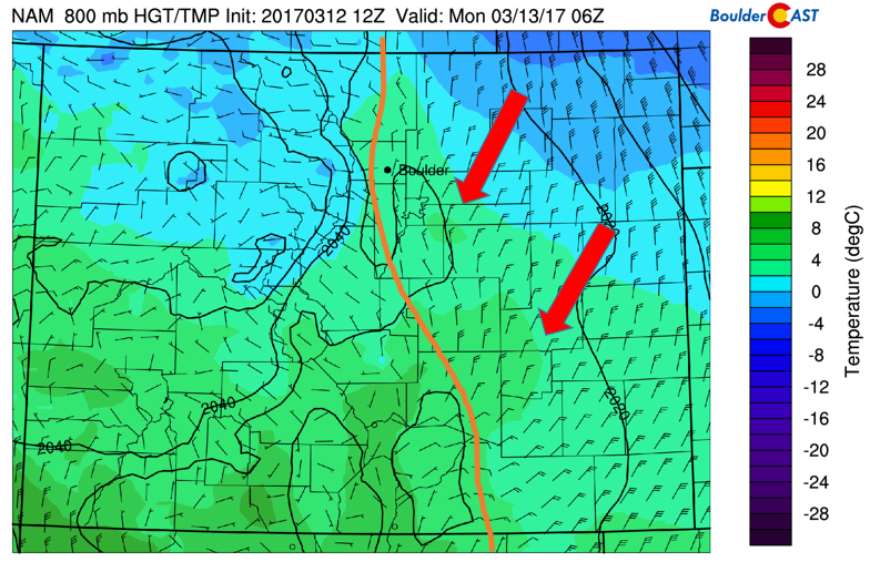
NAM 800 mb temperature and winds for this morning
Gusty Monday night / Tuesday morning
On Monday night, the jet stream shifts to our north and east. This pattern shift will briefly allow for downslope flow to ensue as a result of the pressure change in the mid and low levels. This is evident below. At ~ 10,000 feet up (700 mb; bottom left figure), winds from the west and northwest will be at 40-50 mph. At the surface, near ~ 800 mb (bottom right figure), the downslope flow is evident with tightly packed contours depicting Chinook winds. As a result, we expect gusty winds to develop again Monday night, similar to Sunday, approaching 50 mph at times. These winds will remain gusty into Tuesday morning, tapering off during the afternoon.
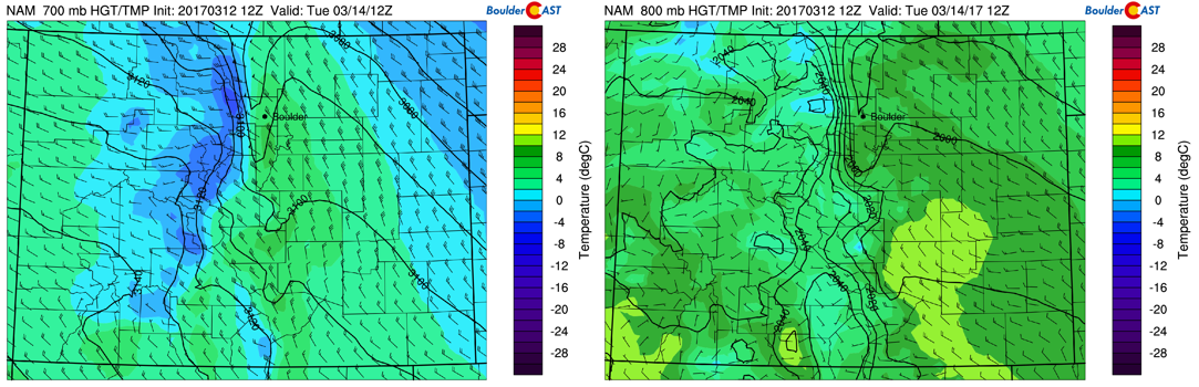
NAM 700 mb (left) and 800 mb (right) temperature and winds for Monday night / Tuesday morning
Nothing but warmth Tuesday, Wednesday, and Thursday
After a gusty start Tuesday, it’s all about warm weather to follow. The mid-level pattern shown below depicts a large dome of high pressure centered across northern Arizona. Over Colorado, we are still under west-northwest flow. However, the jet at this time has moved north and east, so expect warmer weather in the lower 70’s on Tuesday.
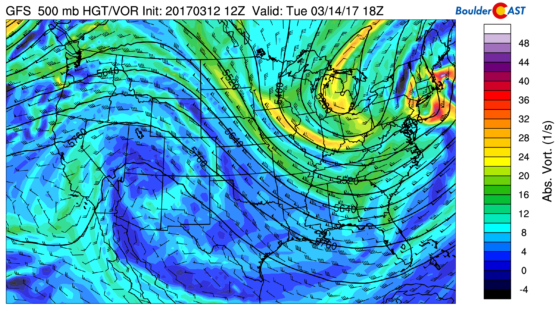
GFS 500 mb absolute vorticity for Tuesday
The warm weather continues on Wednesday and Thursday. Below shows the mid-level pattern for Wednesday:
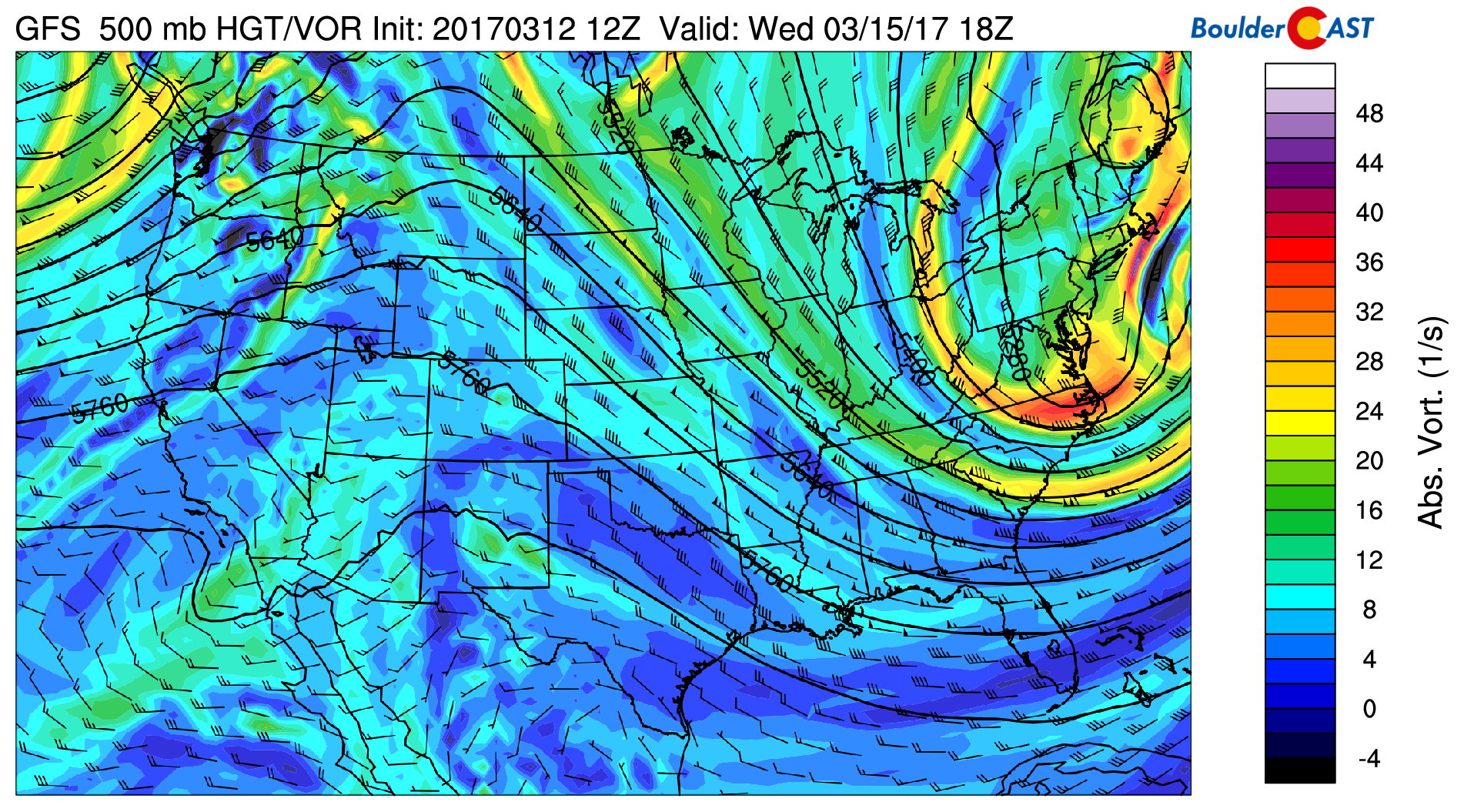
GFS 500 mb absolute vorticity map for Wednesday
and Thursday:
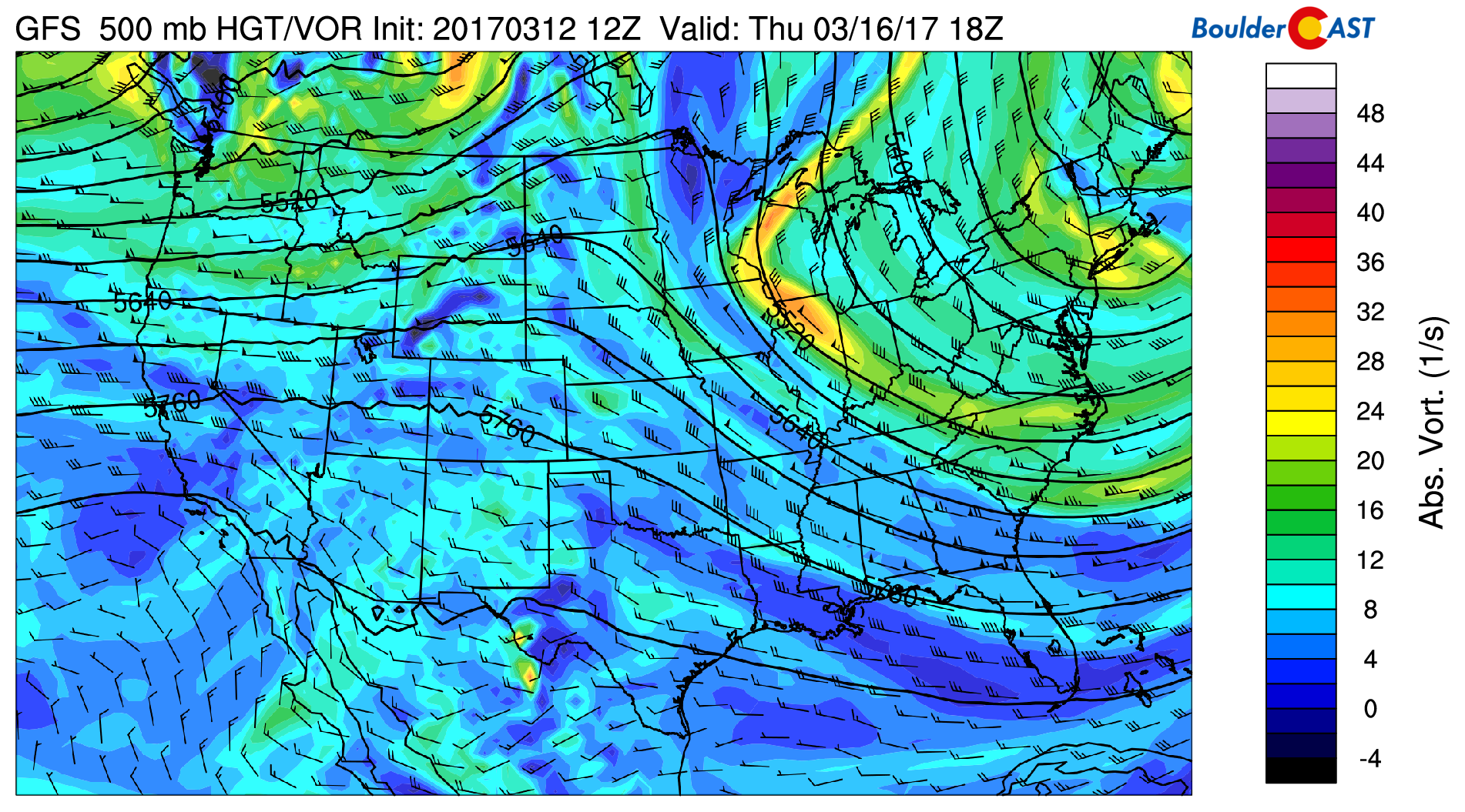
GFS 500 mb absolute vorticity map for Thursday
Not much happening except the ridge axis slowing shifting eastward to be centered across the Denver Metro on Thursday. As such, middle 70’s are likely Wednesday and Thursday…so continue to enjoy this anomalously warm weather we have had for the better part of the last two months!
Weak cold front Friday??
A few of the extended forecast models are hinting at a weak cold front sliding through late in the week. Below shows the upper-level pattern on Friday as forecasted by the GFS model. Keep in mind that we are more than four days away so the pattern is likely to change as we get closer. The map depicts a trough over the Dakotas, extending south into Nebraska and partially clipping northeastern Colorado. At the surface, northeast winds were present in this particular model forecast. What that means for our region would be a slight cool down, though only upper 60’s at most. The front won’t bring and precipitation as all forcing is well northeast of our area.
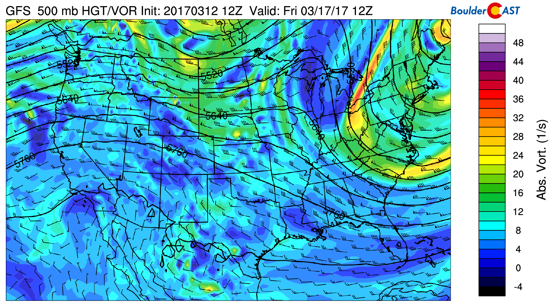
GFS 500 mb absolute vorticity map for Friday
Have a great week!
Forecast Specifics:
Monday: Mostly cloudy skies becoming partly sunny with highs in the low to middle 60’s on the Plains and near 50 in the Foothills. Gusty winds at times in the mid to late afternoon of 20 to 30 mph.
Monday night: Gusty winds increasing to 50 mph overnight from the west and northwest. Winds could approach 60 mph in the Foothills.
Tuesday: Windy conditions early on Tuesday with up to 50 mph on the Plains and possibly 60 mph in the Foothills. Winds decreasing in the afternoon with partly cloudy skies and temperatures in the lower 70’s for the Plains and lower 60’s in the Foothills.
Wednesday: Mostly sunny, warm, and beautiful with temperatures in the middle 70’s on the Plains and low 60’s in the Foothills.
Thursday: Mostly sunny and toasty. Expect middle 70’s for the Plains and middle 60’s in the Foothills.
Friday: Partly cloudy and cooler with highs in the upper 60’s for the Plains and upper 50’s in the Foothills.
High Country: Snow showers from Sunday will continue early on Monday but taper off by morning and early afternoon under partly sunny skies. Warmer and drier conditions prevail the remainder of the week, though gusty winds are possible into Wednesday. Overall, a bleak outlook for the skiers out there…
Extended: While not too exciting, the ridge of high pressure looks to remain strong through next weekend. That will keep the Plains warm and dry. There are some really minor hints that late March could turn more active, which would be nice as we could really use some precipitation. More on that though as things get closer in next week’s post!
Mon
Tue
Wed
Thu
Fri


Temperature
58
70
73
74
69


Precip Chc (Plains)
0%
0%
0%
0%
0%


